Osterholzer Heerstrasse
| Osterholzer Heerstrasse | |
|---|---|
| Street in Bremen | |
| Basic data | |
| city | Bremen |
| district | Osterholz |
| Created | 1812 |
| Cross streets | Steinmetzenweg , Kämenadenweg, Elisabeth-Selbert- Str., An der Kämenade, Osterholzer Landstr. , Schmidt-Barrien -Weg, Oyter Str., Zu Kropps Boren, Stumpesweg, Zu Aumunds Hof, Zu Wendts Hof, Zu Lachmunds Hof, Lachmundsdamm, Am Sachsenbrunnen, Ehlersdamm, Osterholzer Möhlendamm, Am Hahnenkamp, Heiligenbergstr., Hans-Bredow-Str . , Otto-Brenner- Allee, motorway exit towards Hanover |
| Buildings | Egestorff Foundation , Osterholz cemetery |
| use | |
| User groups | Cars, bikes and pedestrians |
| Road design | mostly two-lane and only partially four-lane road |
| Technical specifications | |
| Street length | 3300 meters |
The Osterholzer Heerstraße is a historic street in west-east direction in Bremen in the Osterholz district . It leads from Sebaldsbrücker Heerstraße to Oyterdamm at the Bremen-Sebaldsbrück motorway exit on the A 27 .
It is divided into the sub-areas:
- Sebaldsbrücker Heerstraße to Osterholzer Landstraße and
- Osterholzer Landstrasse to the A 27 motorway.
The cross streets were u. a. Named as Kämenadenweg and An der Kämenade after the Kämena farming family, Osterholzer Landstraße after the district, Zu Kropps Boren after small farms (Boren), Stumpesweg after the estate of the old Stumpe family, Zu Aumunds Hof after an old (17th century) farm of the Aumund family, Zu Wendts Hof after the old Wendt family farm, Zu Lachmunds Hof and Lachmundsdamm after a very old (17th century) farm of the Lachmund family, Am Sachsenbrunnen after finds from the Saxon period , Ehlersdamm after the court of the merchant Heinrich Gottlieb Ehlers, Osterholzer Möhlendamm after a windmill from 1837, Am Hahnenkamp after a field name, Heiligenbergstraße after a district of Bruchhausen-Vilsen , Hans-Bredow-Straße after the radio pioneer Hans Bredow (1879-1959); otherwise see the link to the streets.
Osterholzer Heerstraße is 3300 meters long and is one of the longest streets in Bremen.
history
Surname
The Osterholzer Heerstraße was named after the Osterholz district, first mentioned in 1181 as Osterholt (e) , and in 1246 as Hosterholte . The name indicates forest stands. In Bremen and Umzu, many military roads were built after 1800 or roads were named as military roads (see Bremen streets ).
development
Osterholz was known as a village from the 12th century. In 1181 the Archbishop of Bremen signed a treaty with Dutch settlers about the settlement in the areas "Overnigelant, Rockwinkil, Osterholt et Vurhult". Before 1350 there was the stately Kämena farm with around 60 hectares of land. The Osterholz cemetery from 1920 is located here today. The place belonged to the Goh des Hollerlandes in 1426 and was in the Oberneuland parish until 1936 . In the 14th century, the family of the mayor of Daniel von Büren owned an estate on Osterholzer Heerstraße in Tenever.
In 1812, the Osterholzer Heerstraße was paved and expanded as a military road under Napoleon . The German engineer captain Carl Ludwig Murtfeldt accompanied the construction of the highway .
They and the Osterholzer Landstrasse were the first cobbled streets and the main streets of the rural community with 443 inhabitants (1812).
Until the middle of the 19th century, the street was still characterized by the farms and estates, such as that of the family of the mayor Georg Gröning (since 1815) on Hans-Bredow-Straße . The oldest half-timbered building dates from 1755, the farm belonged to the Lachmund family. After 1882, a small park was laid out on Johann Kropp's farm and an estate was built: Today the Osterholz local office is located. From 1907 (land purchase) to 1916, the first section of the Osterholz cemetery was completed; after its expansion between 1947 and 1969, it covers 79.5 hectares, making it Bremen's largest cemetery.
1922 acquired the Cathedral parish for the establishment of the orphanage St. Peter the Stiftung St. Petri orphanage one site.
Local transport
The Bremen tram operated on Osterholzer Heerstraße from 1920 to 1952 on line 12 from Sebaldsbrück to Osterholzer Friedhof, and from 1926 to 1939 even to Osterholzer Landstraße. (For details see Sebaldsbrücker Heerstraße # public transport ).
Line 1 ( Huchting - Mahndorf train station ) has been crossing the street on Otto-Brenner-Allee / Hans-Bredow Strasse since 2012 .
In the local traffic in Bremen the bus lines 33 and 34 (Sebaldsbrück - Osterholzer Heerstraße - Osterholzer Landstraße - Oberneuland - Horn) and 37 (Sebaldsbrück - Osterholzer Heerstraße - Lachmundsdamm - Osterholzer Möhlendamm - Osterholzer Heerstraße - Heiligendammstraße) run on Osterholzer Heerstraße .
Bus routes 730 and 740 ( Verden (Aller) ) go to the surrounding area .
Buildings and facilities
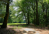
On the street there are one to three-story buildings, which are mostly residential buildings and in the central areas commercial buildings. In the eastern area there are a number of businesses.
- No. 32: Osterholz cemetery from 1916/25 according to plans by garden architect Paul Freye and architect Franz Seeck (both Berlin) and from 1947 to 1969 according to plans by horticultural director Erich Ahlers; operated by Umweltbetrieb Bremen
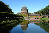
- No. 192: Egestorff Foundation , formerly the von Büren estate (owned by the von Büren councilors from 1323 to 1755) and the Oelrichs estate (owned by the Bremen councilor and merchant family Oelrichs from 1755 to 1892)
- 2-tier Classical manor house Oelrichs from around 1857
- 2-tier Old people's home from 1909 to 1912 based on plans by Werner Heyberger and Georg Karl Rohde
- Landscape park from around 1840
More buildings
- No. 31: 1-sch. Hipped roof house with a cafe
- Corner of Elisabeth-Selbert-Straße: 2-storey. Residential and commercial buildings with u. a. Seat of the Arbeiter-Samariter-Bund
- No. 69-71: 3-sch. Office building of the employment agency , Bremen-Ost branch with job center
- No. 73: 3-sch. Retirement home Haus Holter Fleet
- No. 75: 2-sch. Hipped roof house of fire station 3 of the fire brigade Bremen , as well as in the rear part of the property the THW -Ortsverband Bremen-Ost.
- No. 99: 1-gesch. House with mansard roof from the 1920s / 30s ( MSB-Maritime Survey Bureau )
- No. 100: 1- and 2-layered Office buildings of the Osterholz local authority and the Osterholz police station of the Bremen police, the Schwedenhaus day care center is located on the premises.
- No. 124: 2-sch. House of the Protestant Melanchthon parish, behind it the church from 1968 on Armsener Straße
- No. 131: 2-sch. Residential and commercial building
- No. 136: Urania cinema from 1950 to 1963 with 280 seats
- No. 158/160: American Football Platz (stadium) of the Bremen Firebirds
- No. 160: 1- and 2-layered Osterholz school, elementary school from around 1850
- No. 167: 2-sch. Post office
- No. 170: 2-sch. House with hipped roof by?
- No. 192: Egestorff Foundation, see above
- No. 194: 1- to 2-layered Center of Disability Aid Conpart and Spastikerhilfe Bremen
- No. from 203 to 223: commercial buildings
Monuments, plaques
- Craftsman's fountain probably after 1865 by Diedrich Samuel Kropp , since 1961 in the Osterholz cemetery.
See also
literature
- Herbert Black Forest : The Great Bremen Lexicon . 2nd, expanded and updated edition. In two volumes. Edition Temmen, Bremen 2003, ISBN 3-86108-693-X (first edition: 2002), supplementary volume A – Z. 2008, ISBN 978-3-86108-986-5 .
- Monika Porsch: Bremer Straßenlexikon , complete edition. Schünemann, Bremen 2003, ISBN 3-7961-1850-X .
- Gerda Engelbracht: Osterholz 1860 - 1945 : Edition Temmen, Bremen 2001, ISBN 3-86108-666-2 .
Individual evidence
Coordinates: 53 ° 3 ′ 30 ″ N , 8 ° 56 ′ 41 ″ E


