Long Row (Bremen)
| Long line | |
|---|---|
| Street in Bremen | |
| Basic data | |
| city | Bremen |
| district | Walle |
| Cross streets | Waller Ring , Rüstringer Str., Neuenburger Strasse, Wittmunder Str., Auricher Str., Starboard , An der Railing, Leerer Str., Ritter-Raschen-Str., Emder Str., Achelisweg, Am Gut Walle, Rohdenweg |
| use | |
| User groups | Cars, bikes and pedestrians |
| Road design | two lane road |
| Technical specifications | |
| Street length | 800 meters |
The Lange Reihe is a historic street in Bremen , the Walle district, the Steffensweg and Walle districts. It leads in a south-north direction from Steffensweg to Waller Heerstraße .
The cross streets were mostly named after towns and cities as Steffensweg after Stephan, as the district used to belong to the parish of St. Stephani , Waller Ring , which is connected to the Utbremer Ring and the Osterfeuerberger Ring, Rüstringer Str., Neuenburger Strasse, Wittmunder Str. , Auricher Str., Starboard and An der Railing in seafaring terms, Leerer Str., Ritter-Raschen-Strasse after the knight Christoph Ludwig Raschen , Lieutenant Colonel in Brandenburg during the Thirty Years War and Swedish diplomat, Emder Strasse, Achelisweg, Am Gut Walle, Rohdenweg; otherwise see the link to the streets.
history
Surname
The long row was named after the popular name Lange Riege .
development
The village of Walle was first mentioned in 1139 and in 1179 the Hof-Walle (northern area of the Lange Reihe) of the Lords of Walle . In 1524 the kerke Sunte Michalis tho Walle was built as Waller Church , Lange Reihe 77. In 1635 the knight Christoph Ludwig Raschen leased the Hof-Walle .
At the western end, with the construction of the free port after 1888, the new district of Westend developed. The large jute spinning and weaving mill in Bremen on Nordstrasse employed over 2000 workers around 1895 who lived here. The districts of Steffensweg (today around 4,300 inhabitants) and Westend (today around 6,400 inhabitants) were therefore predominantly densely built-up residential areas. In 1885 parts of the rural community of Walle and in 1902 the other areas were incorporated. The Lange Reihe 81 school was founded in 1929 as a lyceum. From 1947 to 1974 the Bremen University of Education was housed here.
During the Second World War , Walle was largely destroyed in 1944. Reconstruction began in 1950.
traffic
The Bremen tram touches the street with line 2 ( Gröpelingen - Sebaldsbrück ) in the northern area.
In local transport in Bremen, the bus lines 20 and 26 touch the road.
Buildings and facilities
On the street there are mostly two- to three- and a few four-story residential buildings.
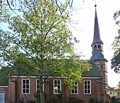
- No. 77: Evangelical Waller Church ; Built in 1524 as Kerke Sunte Michalis tho Walle , rebuilt in 1725/26, destroyed in 1942 until 1956, reconstruction according to the plans of Julius Schulte-Frohlinde
- No. 81: 4-sch. School Lange Reihe 81 from 1929 based on the design of the building authority in Bremen under the direction of chief building officer Hans Ohnesorge and based on plans by building officer Karl August Öhring and architect Johannes Ernst Windrath. The school changed from a lyceum (secondary school for girls), in 1938 to a secondary school for girls, in 1947 to the Bremen University of Education , 1974 to the upper level of the Gymnasium am Waller Ring and in 1979 to the school center of the secondary level II or school center Walle .
Notable buildings and facilities
- No. 28: 4-sch. Student residence LR 28 from 2014 with 14 apartments according to plans by Kai Daniel Hesse
- No. 38–42: 3rd closed residential complex from the 1980s
- No. 44–48: Four 3-tiered Gabled houses
- No. 69 at the corner of Ritter-Raschen-Straße 63: 3-storied. Corner house with 4-storey. gable
- No. 74-80: 2-sch. newer houses with bay windows
- No. 77: 1-sch. Buildings from after 1950 with saddle roofs by the Evangelical Parish Walle according to plans by Hermann Gildemeister .
- No. 85 to 99: 2-ply Residential houses with medium risk
- No. 102: 2-sch. Baroque style residential building of the Brücke hospice with gable projections, bay windows and balconies;
- from No. 102/112: Waller Park with Waller See next to the Waller Friedhof . In 1928 the city bought the property from the impoverished estate park owners. Garden director Paul Freye planned the Volkspark, which was later expanded.
Art objects
- No. 81: The Lüben Bank made of stone from around 1873 as a foundation of the Bremen elementary school teachers in memory of the reformer of the Bremen teacher training college August Lüben (1804–1873); the bench was set up here after 1950.
See also
literature
- Herbert Black Forest : The Great Bremen Lexicon . 2nd, updated, revised and expanded edition. Edition Temmen, Bremen 2003, ISBN 3-86108-693-X (first edition: 2002, supplementary volume A – Z. 2008, ISBN 978-3-86108-986-5 ).
- Monika Porsch: Bremer Straßenlexikon , complete edition. Schünemann, Bremen 2003, ISBN 3-7961-1850-X .
Individual evidence
- ^ Monument database of the LfD
- ^ Monument database of the LfD
- ^ In: Bremer Wohnbaupreis 2018
- ^ Peter Schulz, Peter Fischer (maps): Parks in Bremen . Bremer Marketing (Ed.), Bremen 2008.
- ^ Wiltrud Ulrike Drechsel: History in the public space. Monuments in Bremen between 1435 and 2001 . Donatverlag, Bremen 2011, pp. 20–21.
Coordinates: 53 ° 6 ′ 12 ″ N , 8 ° 46 ′ 35 ″ E


