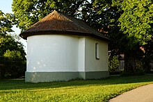
Labersricht
Labersricht is a district of the city of Neumarkt in the Upper Palatinate in the district of the same name.
history
The area of Labersricht was already settled in the Bronze Age, as corresponding grave finds prove. For example, a barrow near Labersricht contained the remains of a woman from the Middle Bronze Age with jewelry.
Former municipality of Labersricht
On July 1, 1972, the previously independent municipality of Labersricht was incorporated into Neumarkt as part of the regional reform in Bavaria . It consisted of seven places, the villages of Labersricht and Schafhof , the hamlets of Fuchsberg , Karhof , Ottosau and Wolfstein and the Wolfstein settlement on an area of 557.85 hectares . At the 1961 census, the community had 1247 inhabitants, 150 of them in the village of Labersricht.
economy
Labersricht was a strongly agrarian small and medium-sized farming community on the edge of the river Alb . The drier soil of the Franconian Alp reduced the possibility of livestock farming and tended to favor arable farming. Part- time farming started relatively late.
population
Labersricht has 116 inhabitants.
social life
The district has its own volunteer fire department .
Web links
- Labersricht in the location database of the Bayerische Landesbibliothek Online . Bavarian State Library
Individual evidence
- ↑ Gustav Fuchs, Der Königshof Altenhof - A contribution to the prehistory of the city of Neumarkt
- ↑ Ingrid Ittner, The Social Position of Women in the Bronze Age of Southern Germany , Treatises of the Natural History Society of Nuremberg. P. 232.
- ^ Wilhelm Volkert (ed.): Handbook of Bavarian offices, communities and courts 1799–1980. CH Beck'sche Verlagsbuchhandlung, Munich 1983, ISBN 3-406-09669-7 . Page 601
- ↑ Bavarian State Statistical Office (ed.): Official city directory for Bavaria, territorial status on October 1, 1964 with statistical information from the 1961 census . Issue 260 of the articles on Bavaria's statistics. Munich 1964, DNB 453660959 , Section II, Sp. 550 ( digitized version ).
- ↑ Joseph Gebhard, The agricultural structure in the district of Neumarkt in the Upper Palatinate in their spatial differentiation , messages of the Franconian Geographical Society Volume 19, 1972, p. 226 (234).
- ^ A contribution to the prehistory of the city of Neumarkt
Coordinates: 49 ° 18 ' N , 11 ° 29' E

