Lake Pend Oreille
| Lake Pend Oreille | ||
|---|---|---|

|
||
| Geographical location | Idaho (USA) | |
| Tributaries | Clark Fork , Pack River | |
| Drain | Pend Oreille River | |
| Places on the shore | Sandpoint | |
| Data | ||
| Coordinates | 48 ° 10 ′ N , 116 ° 20 ′ W | |
|
|
||
| Altitude above sea level | 630 m | |
| surface | 383 km² | |
| length | 105 km | |
| Maximum depth | 351 m | |
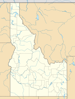
The Lake Pend Oreille is a lake in northern Idaho Panhandle . It has a length of 105 km and a water surface of 383 km².
The maximum depth of the lake is 351 m. This makes it the fifth deepest lake in the USA . The lake is fed by the Clark Fork and the Pack River . The Pend Oreille River forms the drain. The lake is surrounded by national forests and several villages. Sandpoint on the northwest bank is the largest of these.
The lake is almost entirely in Bonner County . Only the southern tip of the lake is located in Kootenai County and is part of Farragut State Park .
The forests consist of yellow pines , Douglas firs , poplars , American quivering poplars , paper birches and West American larches .
For animal population of the surrounding forests include mule deer , elk , wolf , moose , squirrel , American Black Bear , coyote and bobcat . The following birds can also be found here: bald eagles , ospreys , owls , hummingbirds , buzzards , woodpeckers , ducks and mountain hut warblers . The lake also serves as a resting place for many migratory bird species.
history
Lake Pend Oreille was formed by glaciers during the last ice age. Lake Pend Oreille is the traditional area of the Kalispell Indians. David Thompson established a North West Company trading post on the lakeshore in 1809 . It is believed that a French-Canadian fur trader who accompanied Thompson on his expedition gave the lake its name. The French word "Pend Oreille" means "earrings". Such were characteristic of the Kalispell tribe.
During the Second World War , the southern end of the lake was the second largest naval training facility in the world. It was built in response to the Japanese attack on Pearl Harbor and is now part of Farragut State Park. The lake is still used by the US Navy for research purposes (underwater sound wave research).
Web links
- Idaho State Parks - official site - Farragut
- Idaho Public TV - Lake Pend Oreille
- US Navy - Acoustic Research Detachment - Bayview, Idaho
- Global Security.org - US Navy ARD - Bayview, Idaho
- US Navy Undersea Warfare magazine - submarine stealth in Idaho
- Nav Source.org - photos of LSV-2 Cutthroat - Navy ARD - Bayview, ID
- Lake Pend Oreille Weather Buoy - US Navy
- The World's Deepest Lakes
- Idaho Scenic Byways
