Laurel (Maryland)
| Laurel | ||
|---|---|---|
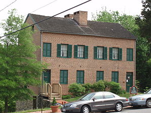
 Laurel Museum |
||
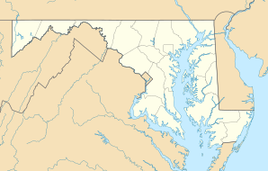
| Location in Maryland | ||
|
|
||
| Basic data | ||
| Foundation : | 1870 | |
| State : | United States | |
| State : | Maryland | |
| County : | Prince George's County | |
| Coordinates : | 39 ° 6 ′ N , 76 ° 52 ′ W | |
| Time zone : | Eastern ( UTC − 5 / −4 ) | |
| Residents : | 25,115 (as of 2010) | |
| Population density : | 2,562.8 inhabitants per km 2 | |
| Area : | 9.9 km 2 (about 4 mi 2 ) of which 9.8 km 2 (about 4 mi 2 ) is land |
|
| Height : | 50 m | |
| Postcodes : | 20707-20709, 20723-20729 | |
| Area code : | +1 240, 301 | |
| FIPS : | 24-45900 | |
| GNIS ID : | 597667 | |
| Website : | www.cityoflaurel.org | |
| Mayor : | Craig A. Moe | |
Laurel is a city in Prince George's County in the US state of Maryland , about halfway between the US capital Washington, DC and Baltimore , the largest city in Maryland.
Size and population
According to the 2010 US Census, Laurel has a population of 25,115; the city has an area of 9.9 km².
traffic
Laurel is traversed north to south by the famous US Highway 1 , which connects Key West in Florida with Fort Kent in Maine on the Canadian border. To the west is Interstate 95 , which also runs from Florida to Maine, the Laurels city limits. To the east is the Baltimore-Washington Parkway . In a west-east direction, these roads are crossed by Maryland State Highway 198 (MD 198).
economy
The Applied Physics Laboratory , which evaluates the data from the New Horizons space probe sent to Pluto , is located in Laurel .
useful information
- On May 15, 1972, George Wallace , then Governor of Alabama and Democratic Party presidential candidate , was gunned down in Laurel during a campaign rally. Wallace remained paralyzed.
Personalities
sons and daughters of the town
- Bill Green (* 1960), hammer thrower
- Andrew Maynard (born 1964), boxer
- Tiffany McCarty (born 1990), soccer player
Personalities related to the city
- Barnes Compton (1830–1898), politician; lived in Laurel since 1880
- Breckinridge Long (1881-1958), diplomat; died in Laurel
- Myla Goldberg (* 1971), author and musician; grew up in Laurel
- Greg Merson ( b.1987 ), poker player; lives in Laurel
