Prince George's County
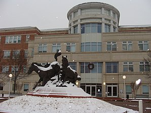
 Prince George's County Courthouse |
|
| National emblem | |
 flag |
|
| administration | |
|---|---|
| US state : | Maryland |
| Administrative headquarters : | Upper Marlboro |
| Address of the administrative headquarters: |
County Administration Building 14741 Governor Oden Bowie Drive Upper Marlboro, MD 20772-3050 |
| Foundation : | 1696 |
| Made up from: | Charles County , Calvert County |
| Area code : | 001 301 |
| Demographics | |
| Residents : | 863,420 (2010) |
| Population density : | 686.9 inhabitants / km 2 |
| geography | |
| Total area : | 1291 km² |
| Water surface : | 34 km² |
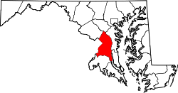
| map | |
| Website : www.princegeorgescountymd.gov | |
The Prince George's County is a county in the US state of Maryland . The county seat is Upper Marlboro .
Prince George's County is part of the metropolitan area around the US capital Washington, DC
geography
The county is located on the east bank of the Potomac River in the eastern and southern suburbs of the US capital Washington. The Potomac forms the border with Virginia . Prince George's County covers an area of 1,291 square kilometers; 34 square kilometers (2.61 percent) of this is water. It borders on the following counties and independent cities:
| Montgomery County | Howard County | |
| Washington, DC |

|
Anne Arundel County |
|
Fairfax County, Virginia , Alexandria, Virginia |
Charles County | Calvert County |
history
The county was formed in 1696 from parts of Charles and Calvert Counties. It was named after George, Prince of Denmark (1653–1708), the husband of Queen Anne of Great Britain.
In 1748, Frederick County was founded on a spun off part of Prince George's County. 1791 another part of the county was spun off for the newly established District of Columbia .
Six sites in Prince George's County have National Historic Landmark status because of their historical significance . 100 buildings and sites in the county are listed in the National Register of Historic Places (as of November 14, 2017).
Demographic data
| growth of population | |||
|---|---|---|---|
| Census | Residents | ± in% | |
| 1790 | 21,344 | - | |
| 1800 | 21,175 | -0.8% | |
| 1810 | 20,589 | -2.8% | |
| 1820 | 20,216 | -1.8% | |
| 1830 | 20,474 | 1.3% | |
| 1840 | 19,539 | -4.6% | |
| 1850 | 21,549 | 10.3% | |
| 1860 | 23,327 | 8.3% | |
| 1870 | 21,138 | -9.4% | |
| 1880 | 26,451 | 25.1% | |
| 1890 | 26,080 | -1.4% | |
| 1900 | 29,898 | 14.6% | |
| 1910 | 36,147 | 20.9% | |
| 1920 | 43,347 | 19.9% | |
| 1930 | 60,095 | 38.6% | |
| 1940 | 89,490 | 48.9% | |
| 1950 | 194.182 | 117% | |
| 1960 | 357.395 | 84.1% | |
| 1970 | 660,567 | 84.8% | |
| 1980 | 665.071 | 0.7% | |
| 1990 | 729.268 | 9.7% | |
| 2000 | 801.515 | 9.9% | |
| 2010 | 863.420 | 7.7% | |
| before 1900 1900–1990 2000 + 2010 | |||
According to the 2010 census , Prince George's County had 863,420 people in 297,937 households. The population density was 686.9 people per square kilometer.
The racial the population was composed of 19.2 percent white, 64.5 percent African American, 0.5 percent Native American, 4.1 percent Asian and other ethnic groups; 3.2 percent were descended from two or more races. Regardless of ethnicity, 14.9 percent of the population was Hispanic or Latino of any race.
Statistically, there were 2.74 people each in the 297,937 households.
24.8 percent of the population were under 18 years old, 65.7 percent were between 18 and 64 and 9.5 percent were 65 years or older. 51.8 percent of the population was female.
The median income for a household was 69,545 USD . The per capita income was $ 30,917. 7.8 percent of the population lived below the poverty line.
cities and communes
Census-designated places (CDP)
- Accokeek
- Adelphi
- Andrews Air Force Base
- Beltsville
- Brandywine
- Calverton 1
- Camp Springs
- Carmody Hills-Pepper Mill Village
- Chillum
- Clinton
- Coral Hills
- East Riverdale
- Forestville
- Fort Washington
- Friendly
- Glenn Dale
- Goddard
- Greater Landover
- Greater Upper Marlboro
- Hillandale 1
- Hillcrest Heights
- Kettering
- Counterattack
- Lake Arbor
- Landover
- Langley Park
- Lanham-Seabrook
- largo
- Marlow Heights
- Marlton
- Mitchellville
- Oxon Hill Glassmanor
- Rosaryville
- South Laurel
- Springdale
- Suitland-Silver Hill
- Temple Hills
- Walker Mill
- West Laurel
- Woodlawn
- Woodmore
1 - partially in Montgomery County
Individual evidence
- ↑ GNIS-ID: 1714670. Retrieved on February 22, 2011 (English).
- ↑ Listing of National Historic Landmarks by State: Maryland . National Park Service , accessed November 14, 2017.
- ↑ Search mask database in the National Register Information System. National Park Service , accessed November 14, 2017.
- ^ University of Virginia Library - Historical Census Browser. Retrieved September 7, 2011
- ↑ United States Census.gov.Retrieved September 7, 2011
- ↑ Extract from census.gov (2000 + 2010). Accessed April 4, 2012
- ^ US Census Bureau, State & County QuickFacts - Prince George's County. Retrieved September 8, 2011
Web links
- US Census Bureau, State & County QuickFacts - Prince George's County
- Maryland State Archives - Prince George's County
- Yahoo Image Search - Prince George's County
- www.city-data.com - Prince George's County
Coordinates: 38 ° 50 ′ N , 76 ° 51 ′ W


