Leithen Water
| Leithen Water | ||
|
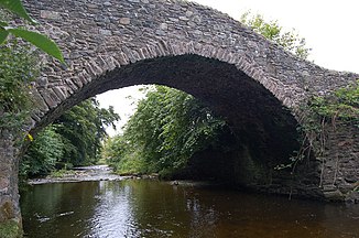
Old Bridge over the Leithen Water |
||
| Data | ||
| location | Scottish Borders , Midlothian , Scotland | |
| River system | tweed | |
| source | On the slopes of Dundreich 55 ° 43 ′ 48 ″ N , 3 ° 8 ′ 54 ″ W |
|
| Source height | 590 m ASL | |
| muzzle | in Innerleithen in the Tweed coordinates: 55 ° 36 '52 " N , 3 ° 3' 16" W 55 ° 36 '52 " N , 3 ° 3' 16" W. |
|
| Mouth height | 140 m | |
| Height difference | 450 m | |
| Bottom slope | 24 ‰ | |
| length | 19 km | |
The Leithen Water is a river in the Scottish Council Areas Midlothian and Scottish Borders .
course
The river rises at an altitude of around 590 meters on the eastern slopes of the 622 meter high Dundreich in the Moorfoot Hills in Midlothian. The Hawkster Gill Burn , which rises only a few meters to the northeast, flows unlike the Leithen Water to the northeast towards the South Esk . About 300 meters south of the source, the Leithen Water forms the border between the neighboring Council Areas Midlothian and Scottish Borders over a distance of about 800 meters, only to continue in the Scottish Borders from now on. Initially flowing mainly to the south, the Leithen Water takes a south-easterly direction after around 3.5 kilometers. About eleven kilometers down from its source, the Leithen Water flows south again and maintains this direction until it flows into the Tweed in Innerleithen . Its mouth height is about 140 meters. The Leithen Water covers a total of around 19 kilometers.
Leithen Water flows through Glentress Forest past Makeness Kipps and Bowbeat Hill and forms the valley between Dunslair Heights and Totto Hill . It also flows along the flanks of Black Law , Whitehope Law , Black Knowe , Dod Hill , Priesthope Hill and Lee Pen . It takes in various streams along its course.
The Leithen Water is a left tributary of the Tweed. The name of its mouth, Innerleithen, means "mouth of the Leithen". In the past, Leithen Water often overflowed its banks. An extraordinarily heavy flood in 1891 threatened to destroy the river valley near Innerleithen and severely damaged numerous buildings in Innerleithen.
Surroundings
Various traces of settlement can be found along its course. These are undated, The Common -called deserted village on the eastern slope of the Priest Hope Hill above the Leithen Waters and the Hill Fort Pirn Woodfort . Both facilities are listed as Scheduled Monuments .
From the confluence of the Glentress Burn , the B709 follows the course of the Leithen Waters and crosses it once. Innerleithen by crosses Galashiels to Hamilton leading A72 . With the Old Bridge built in 1701 and the Leithen Water Bridge near the golf club (crossing the B709), two listed bridges span the Leithen Water.
To the north of Innerleithen, a weir branches off from the Leithen Water into a mill channel. The facility, which dates from the 18th century, is now a listed building. Further up the river, the listed Leithen Lodge is on the left bank.
Leithen Water Bridge (crossing the B709)
Individual evidence
- ↑ a b c d e Map of the Ordnance Survey
- ↑ a b Measurement on Google Maps
- ^ Information in the Gazetteer for Scotland
- ↑ Information from the Scottish Parliament
- ↑ Listed Building - Entry . In: Historic Scotland .
- ↑ Scheduled Monument - Entry . In: Historic Scotland .
- ↑ Scheduled Monument - Entry . In: Historic Scotland .
- ↑ Listed Building - Entry . In: Historic Scotland .
- ↑ Listed Building - Entry . In: Historic Scotland .
- ↑ Listed Building - Entry . In: Historic Scotland .
- ↑ Listed Building - Entry . In: Historic Scotland .


