Lexington, Missouri
| Lexington | |
|---|---|
|
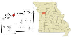
Location in Missouri
|
|
| Basic data | |
| Foundation : | 1822 |
| State : | United States |
| State : | Missouri |
| County : | Lafayette County |
| Coordinates : | 39 ° 11 ′ N , 93 ° 53 ′ W |
| Time zone : | Central ( UTC − 6 / −5 ) |
|
Inhabitants : - Metropolitan Area : |
4,453 (status: 2000) 2,067,585 (status: 2009) |
| Population density : | 494.8 inhabitants per km 2 |
| Area : | 9.5 km 2 (approx. 4 mi 2 ) of which 9.0 km 2 (approx. 3 mi 2 ) are land |
| Height : | 259 m |
| Postal code : | 64067 |
| Area code : | +1 660 |
| FIPS : | 29-41870 |
| GNIS ID : | 0720950 |
Lexington is a town in Lafayette County in the US state of Missouri with 4,453 inhabitants (2000 census). The city area is 9.5 km².
Lexington is part of the Kansas City metropolitan area .
The city's ZIP code is 64067. The city is the county seat of Lafayette County and is located on the Missouri River , approximately 75 km west of Kansas City / Missouri. Lexington is also the birthplace of Randall Garrett , a science fiction and fantasy writer.
history
The city was founded in 1822 and named after the city of Lexington , Massachusetts , where the American Revolutionary War began. A battle took place in the city from September 18-20, 1861 during the American Civil War .
All routes of the commercial and settler railroad to the west between the 1820s and the construction of the railroad after the Civil War ran along the Missouri and through Lexington.
Known residents
politics
- Thomas Peter Akers (1828–1877), Congressman (1856/57)
- John P. Campbell (1820-1888), Congressman (1848-1852)
- Thomas B. Catron (1840-1921), Senator
- Mark L. De Motte (1832-1908), Congressman
- Alexander Graves (1844–1916), Congressman (1883–1885)
- Josh Hawley (born 1979), politician
- Frank Houx (1860–1941), Governor of Wyoming
- John Telemachus Johnson (1788-1856), Congressman
- Atterson W. Rucker (1847-1924), Congressman
- Samuel Locke Sawyer (1813–1890), Congressman (1879–1881)
- Ike Skelton (1931-2013), Congressman (1977-2011)
- Hugh Campbell Wallace (1863–1931), Ambassador to France
- John Welborn (1857-1907), Congressman (1905-1907)
Entrepreneur
- James "Bud" Walton - Co-Founder of Walmart
- Sam Walton (1918–1992) - founder of the Walmart chain
