
Leysse
| Leysse | ||
 The estuary of the river |
||
| Data | ||
| Water code | FR : V1310500 | |
| location | France , Auvergne-Rhône-Alpes region | |
| River system | Rhône | |
| Drain over | Lac du Bourget → Canal de Savières → Rhône → Mediterranean | |
| source | in the municipality of Les Déserts 45 ° 38 ′ 48 ″ N , 6 ° 1 ′ 14 ″ E |
|
| Source height | approx. 1170 m | |
| muzzle | in the municipality of Le Bourget-du-Lac in the Lac du Bourget coordinates: 45 ° 39 ′ 21 ″ N , 5 ° 52 ′ 2 ″ E 45 ° 39 ′ 21 ″ N , 5 ° 52 ′ 2 ″ E |
|
| Mouth height | approx. 230 m | |
| Height difference | approx. 940 m | |
| Bottom slope | approx. 32 ‰ | |
| length | 29 km | |
| Catchment area | 306 km² | |
| Drainage at the La Motte-Servolex gauge |
MQ |
6.1 m³ / s |
| Left tributaries | Albanne , Hyère | |
| Flowing lakes | Lac du Bourget | |
| Medium-sized cities | Chambery | |
| Small towns | Saint-Alban-Leysse , La Motte-Servolex | |
The Leysse is a river in France that runs in the Savoie department in the Auvergne-Rhône-Alpes region . It rises in the Regional Natural Park of the Bauges , the Col de Plainpalais , in the municipality of Les Deserts , dehydrated in an arc from southwest to northwest, passing through the metropolitan area of Chambery and ends after 29 kilometers in the municipality of Le Bourget-du-Lac in the Lake of Bourget . The water of the Leysse then flows indirectly into the Rhône via the outlet of the lake, the Canal de Savières .
Places on the river
Web links
Commons : Leysse - collection of images, videos and audio files
Commons : Lac du Bourget - Collection of images, videos and audio files
Confluence of the Leysse with the Albanne

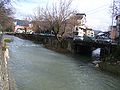
The Leysse in the urban area of Chambéry

The Leysse flows into the Lac du Bourget

Outflow of the Lac du Bourget into the Rhône


Remarks
- ↑ Source geoportail.fr (1: 32,000)
- ↑ estuary geoportail.fr (1: 16,000)
- ↑ a b c The information on the length of the river is based on the information about the Laysse at SANDRE (French), accessed on May 4, 2012, rounded to full kilometers.
- ↑ hydro.eaufrance.fr (station: V1315020 , option: Synthèse )