Light mountain
| Light mountain | ||
|---|---|---|
|
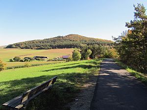
Autumn view from the Kegelspielradweg on the Lichtberg |
||
| height | 465 m above sea level NN | |
| location | District of Fulda , Hessen , Germany | |
| Mountains | Rhön ( Hessian skittles ) | |
| Coordinates | 50 ° 44 '55 " N , 9 ° 48' 46" E | |
|
|
||
| Type | extinct volcano | |
| rock | basalt | |
| Development | Forest, forest and hiking trails | |
The light mountain is 465 m above sea level. NN high, extinct volcano of the Hessian bowling game , a part of the Rhön low mountain range in Bavaria , Hesse and Thuringia ( Germany ) .
Basalt used to be mined on the Kegelberg Lichtberg .
Geographical location
The Lichtberg is located within the Fulda district . On the northern edge of the Hessian Rhön Nature Park and also in the Rhön Biosphere Reserve , its basalt cone rises 1.8 km (as the crow flies ) southeast of the core town of the Eiterfeld municipality . On its northeast flank is the Leibolz district , to the west the Leimbach district , south-west Malges and to the south the Rückersberg ( 524.7 m above sea level ).
Transport links / hiking
The state road "L 3170", which connects Eiterfeld via Leibolz and Großentaft to the southeast with Rasdorf , runs north past Lichterg, to the west runs the "L 3171", which leads from Eiterfeld via Leimbach, Betzenrod and Roßbach south to Hünfeld . From these roads and also from the district road "K 147", which branches off from the "L 3170" in Leibolz towards the south, forest, forest and hiking trails lead to the Lichtberg.
See also
literature
- Gustav Schneider: Schneider's Rhön guide. Verlag Parzeller, ISBN 3-7900-0234-8
- Topographic leisure map 1: 50,000, Rhön Nordblatt Nature Park , ISBN 3-89446-275-2

