List of architectural monuments in Aachen-Brand
The list of architectural monuments in Aachen-Brand contains the listed buildings in the area of the Aachen-Brand district in North Rhine-Westphalia (as of September 27, 2016). These architectural monuments are entered in the monuments list of the city of Aachen; The basis for the admission is the Monument Protection Act North Rhine-Westphalia (DSchG NRW).
Monuments
This partial list of the list of architectural monuments in Aachen includes, alphabetically sorted by street name, the architectural monuments in the area of the municipality of Brand, which was incorporated into Aachen in 1972 , today the Aachen district and district of Brand.
| image | designation | location | description | construction time | Registered since |
Monument number |
|---|---|---|---|---|---|---|

|
Residential houses | Am Rollefer Berg 7, 7a map |
||||

|
Residential building (parts) | Am Rollefer Berg 9 card |
||||

|
bunker | Am Rollefer Berg 19–21 map |
The bunker of the standard building type 117 was intended to accommodate a military staff in the Siegfried Line between Aachen-Königshügel u. Oberforstbach planned. In addition to the work room for commanders and adjutants, there was accommodation for the item off., Ordon.-Off., Message off., As well as 1 standby room, radio rooms, 1 storage room and 1 telephone room. Courtyard side z. T. buried, upper part d. re. Entrance is exposed. | 1938 | ||

|
Residential building | Map at Rollefer Berg 22 |
||||

|
Residential building | Bilstermühlerstraße 31 map |
||||

|
Lime kiln Bilstermühler Strasse | Bilstermühlerstraße map |
Freestanding funnel furnace made of quarry stone on a square base; 1950 shutdown, 1987 restoration | before 1900 | ||

|
Bridge over the Inde | Hall 04, hall no. 117, near Indeweg map |
||||
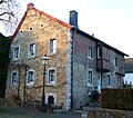
|
Residential building | Buschstrasse 4 map |
||||

|
Residential houses | Buschstrasse 20, 22 map |
||||
| "Gut Neuenhof" | Debyestrasse 52-54 map |
former water system with two-wing farm yard. Two-storey manor house with a mansard roof from the first half of the 18th century. consists of plastered brick with ashlar walls. First mentioned in 1460; originally the chimney of the bakery belonging to the estate marked a border point of the judicial districts Kornelimünster, Eilendorf and Schönforst | 15th century / 18th. Century | |||
 more pictures |
"Gut Haarhof" | Debyestrasse 110 map |
former knight seat "Haar"; from here the Haarbach flows above ground; The “ Harner Mühle ” belongs to the court and was mentioned in the 13th century (existing building plan 1646) as a grinding mill with a flapping wheel; Building used as a stable until 1996 | 17th century | ||
 more pictures |
Catholic parish church of St. Donatus | Donatusplatz map |
Successor to an old chapel from 1761; Architect: Cathedral builder Vincenz Statz | 1879-1883 | ||

|
Residential building | Eilendorfer Strasse 35 map |
||||

|
Residential building (parts) | Eilendorfer Strasse 42 map |
||||

|
Residential houses | Eilendorfer Strasse 44, 46 map |
||||

|
Residential building | Eilendorfer Strasse 65-67 map |
||||

|
Residential building (parts) | Eilendorfer Straße 66 (parts), 68 map |
||||
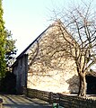
|
Residential building | Eilendorfer Strasse 70 map |
||||
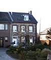
|
Residential building | Eilendorfer Strasse 79 map |
||||

|
Residential building | Eilendorfer Strasse 85 map |
||||

|
Residential houses | Eilendorfer Strasse 89, 91 map |
||||

|
Residential houses | Eilendorfer Strasse 101, 103 map |
||||

|
Residential building | Eilendorfer Strasse 106 map |
||||

|
Residential houses | Eilendorfer Strasse 111a, 113, 115 map |
||||

|
Residential building (parts) | Freunder Landstrasse 9 map |
||||
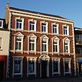
|
Residential building | Freunder Landstrasse 26 map |
||||

|
Residential building | Freunder Landstrasse 44 map |
||||

|
Residential building | Freunder Landstrasse 65 map |
||||

|
Residential building (parts) | Freunder Landstrasse 90 map |
||||

|
Residential building | Freunder Landstrasse 92 map |
||||

|
Residential building | Grachtstrasse 25 map |
||||

|
bridge | Canal road map |
||||

|
former rectory | Hochstrasse 9 map |
||||

|
former chaplain | Hochstrasse 12 map |
||||

|
School and social building | Josefsallee 6 map |
||||

|
formerly Brander train station | Karl-Kuck-Strasse 1 map |
Station on the Vennbahn , the former industrial line to Luxembourg, shut down in 1982, today a tourist restaurant | 1885 | ||

|
Funny mill | Funny route 44 map |
former copper mill (16th / 17th century); from 1803 rededicated as a cloth factory and carded yarn spinning mill; Consisting of brick courtyard, shed hall , technical building (machine room, boiler building) and office building, from 2006 to 2012 Aachen Textile Museum | 19th century |
|
|

|
Residential building (parts) | Krauthausener Strasse 1 map |
||||

|
Residential houses | Krauthausener Strasse 3, 5 map |
||||

|
Residential building | Krauthausener Strasse 15 map |
||||

|
Residential building | Krauthausener Strasse 16 map |
||||
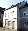
|
Residential building | Krauthausener Strasse 17 map |
1908 | |||

|
Residential houses | Krauthausener Straße 18, 18a (parts of) map |
||||

|
Residential houses | Krauthausener Strasse 20, 22 map |
||||

|
Residential building | Krauthausener Strasse 24 map |
||||

|
Residential building | Krauthausener Strasse 25 map |
||||

|
Residential building | Krauthausener Strasse 27 map |
||||

|
Residential building | Krauthausener Strasse 29 map |
||||

|
Residential building | Krauthausener Strasse 31 map |
||||

|
Residential building | Krauthausener Strasse 32 map |
1885 | |||

|
Residential houses | Krauthausener Strasse 33, 35, 37 map |
1886 (No. 33) 1885 (No. 35) | |||

|
Residential houses | Krauthausener Strasse 34, 34A map |
||||

|
Residential building | Krauthausener Strasse 39 map |
||||

|
Brand market school | Marktplatz 25–27 card |
built according to plans by the municipal building technician Josef Wieczarkowiecz | 1922/23 | ||

|
Residential houses | Münsterstrasse 104, 106 map |
||||

|
Residential houses | Münsterstrasse 115, 117, 119 map |
||||

|
Residential building | Munsterstrasse 120 map |
||||

|
Residential building | Munsterstrasse 159 map |
||||

|
Residential building | Münsterstrasse 208 map |
||||

|
Residential building | Münsterstrasse 211 map |
||||

|
Residential houses | Münsterstrasse 221 (parts), 223 map |
||||

|
Residential building (parts) | Münsterstrasse 222–224 map |
||||

|
Residential building (parts) | Munsterstrasse 257a map |
1877 | |||

|
Residential houses | Münsterstrasse 258, 260 map |
||||

|
Residential houses | Münsterstrasse 275, 277 map |
||||

|
Residential building | Munsterstrasse 276 map |
||||

|
Residential building (parts) | Munsterstrasse 284 map |
||||

|
Residential building | Münsterstrasse 285 map |
||||

|
Residential building | Munsterstrasse 288 map |
||||

|
Residential building | Münsterstrasse 295 map |
||||

|
Residential houses | Münsterstrasse 297, 299 map |
||||

|
Vincenz Chapel | Munsterstrasse map |
built to protect against earthquakes, consecrated to Vincent Ferrer ; Complete renovation and reconstruction in 1889 and 1999 | 1756 | ||

|
Residential building | Niederforstbacher Strasse 57 map |
||||

|
Residential building | Niederforstbacher Strasse 61 map |
||||

|
Residential houses | Niederforstbacher Strasse 62, 64 map |
||||

|
Residential building | Pützgasse 5 map |
1869 | |||

|
Residential building | Pützgasse 20 map |
||||

|
Residential building | Pützgasse 36 map |
||||

|
Residential building | Ringstrasse 5 | ||||

|
Residential building | Ringstrasse 7 | ||||

|
Residential building | Ringstrasse 25 | ||||

|
Residential building | Ringstrasse 31 | ||||

|
Residential building (parts) | Ringstrasse 39 | ||||

|
Residential building | Ringstrasse 41 | ||||

|
Residential houses | Ringstrasse 107, 109 map |
||||

|
Residential houses | Ringstrasse 111a, 113 map |
||||
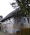
|
Residential building | Ringstrasse 117 map |
||||

|
Residential building | Ringstrasse 119 map |
||||

|
Residential building | Ringstrasse 163 map |
||||

|
Residential building | Ringstrasse 175, 179 map |
||||

|
Residential building | Rollefstrasse 54 map |
||||

|
Residential building | Rollefstrasse 64 map |
||||

|
Residential building | Schroufstrasse 56a map |
||||
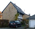
|
Residential building | Schroufstrasse 79 map |
||||
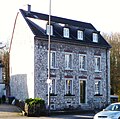
|
Residential building | Trierer Strasse 610 map |
||||

|
Residential building | Trierer Strasse 625–627 map |
||||

|
Residential building | Trierer Strasse 626 map |
||||

|
Residential building | Trierer Strasse 644 map |
||||

|
Residential building (parts) | Trierer Strasse 648 map |
||||

|
Residential building | Trierer Strasse 652–654 map |
former administrative headquarters of the Aachen district waterworks; Architect: Theodor Veil , two three-story, five-axis houses, upper floors in brick with stucco decorations and bay windows | 1923/1924 | ||

|
Residential building (parts) | Trierer Strasse 660 map |
||||

|
"Gut Weiern" | Trierer Strasse 695–699 map |
||||

|
Residential building | Trierer Strasse 702 map |
||||

|
Residential houses | Trierer Straße 711, 713, 715 (parts of) map |
||||
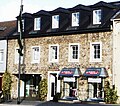
|
Residential building (parts) | Trierer Strasse 791 map |
||||

|
Residential building (parts) | Trierer Strasse 821 map |
||||
|
|
prussia. Milestone (parts) | Trier street map |
New building on the foundations of the old stone, destroyed in the 30s; He wore the Prussian eagle with the inscription "Aachen 1 Meile" | Napoleonic period / 1980 | ||

|
prussia. Quarter milestone | Trier street map |
||||

|
Station cross | Trierer Straße (before 805) map |
||||
 more pictures |
Viaduct over Rollefbachtal |
Vennbahnweg map |
6-arch quarry stone viaduct, cheeks with bluestone; Part of the former industrial line to Luxembourg | 1885 | ||

|
Residential building | Wolferskaul 2a card |
||||

|
Residential houses | Zehntstrasse 37, 39 (parts) map |
||||

|
Residential building | Zehntstrasse 43 map |
||||

|
Residential building (parts) | Zehntweg 78 card |
Web links
Commons : Architectural monuments in Aachen-Brand - Collection of images, videos and audio files
- List of monuments of the city of Aachen (PDF file; 126 kB)
- Architectural monuments on fire in the Aachen geoportal
