List of architectural monuments in Aachen-Mitte (A – H)
The list of architectural monuments in Aachen-Mitte (A – H) contains the listed buildings in the area of the Aachen-Mitte district in North Rhine-Westphalia (as of September 27, 2016). These architectural monuments are entered in the monuments list of the city of Aachen; The basis for the admission is the Monument Protection Act North Rhine-Westphalia (DSchG NRW).
Monuments
This partial list of the list of monuments in Aachen includes the monuments in Aachen-Mitte sorted alphabetically by street names from A to H. Other sub-lists exist for the street name from I to O and P to Z . There are separate partial lists for the monuments in Burtscheid , in Forst and in the Franconian Quarter .
| image | designation | location | description | construction time | Registered since |
Monument number |
|---|---|---|---|---|---|---|

|
Waldorf School | Aachener and Münchener Allee 5 map |
||||

|
former substation; converted as a rehearsal room for the Aachen Symphony Orchestra | Aachener-Münchener-Platz 2,3 map |
built by the electrical company Schuckert & Co. | 1893 | ||

|
Residential building | Adalbertsberg 6 map |
Two-storey brick house, window frames on the ground floor made of bluestone | 1763 | ||
| Residential houses (parts) | Adalbertsberg 11, 13 map |
|||||

|
Residential houses | Adalbertsberg 29, 31, 33 map |
four-story houses with late classical plaster facades and stone walls | 2nd half of the 19th century | ||

|
Residential building | Adalbertsberg 35 map |
four-storey house with a late classicist plastered facade and stone walls | 2nd half of the 19th century | ||

|
Residential building | Adalbertsberg 39 map |
three and a half storey brick house, plinth and window sills in bluestone | 2nd half of the 19th century | ||

|
Residential building | Adalbertsberg 41 map |
three and a half storey brick house, plinth and window sills in bluestone | 2nd half of the 19th century | ||

|
Residential building | Adalbertsberg 43 map |
three-and-a-half-storey brick house, plinth and window sills in bluestone, with pilasters | 2nd half of the 19th century | ||

|
Residential building | Adalbertsberg 45 card |
four-story brick house, plinth and window sills in bluestone | 2nd half of the 19th century | ||

|
Residential houses | Adalbertsteinweg 2, 4 map |
||||

|
Residential building | Adalbertsteinweg 80 map |
||||

|
Residential houses | Adalbertsteinweg 88, 90 map |
||||

|
District Court Aachen (parts) | Adalbertsteinweg 92–92a map |
Architect of the old penal institution Robert Ferdinand Cremer | 1865-1870 | ||

|
Residential houses | Adalbertsteinweg 105, 107, 109, 111, 113, 115 map |
||||

|
Residential houses | Adalbertsteinweg 152, 154 map |
||||

|
Residential houses | Adalbertsteinweg 156, 158, 160, 162 map |
||||

|
Residential houses | Adalbertsteinweg 163, 165, 167, 169, 171 map |
||||

|
Residential houses | Adalbertsteinweg 164, 166 map |
||||

|
Residential houses | Adalbertsteinweg 172, 174 map |
||||

|
Residential building (parts) | Adalbertsteinweg 175a map |
||||

|
Residential houses | Adalbertsteinweg 175, 177, 179 map |
||||

|
Residential houses | Adalbertsteinweg 178, 180, 182 map |
Architect Albert Schneiders | 1894/1985 | ||

|
Residential building | Adalbertsteinweg 181 map |
||||

|
Residential building | Adalbertsteinweg 183 map |
||||

|
Residential houses | Adalbertsteinweg 184, 186 map |
||||

|
Residential building (parts) | Adalbertsteinweg 195 map |
1889 | |||
|
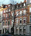
Residential houses | Adalbertsteinweg 197, 199 map |
||||

|
Residential houses | Adalbertsteinweg 201, 203, 205 map |
||||

|
Residential houses | Adalbertsteinweg 207, 209 map |
||||

|
Residential houses | Adalbertsteinweg 204, 206, 208, 210, 212, 214 map |
||||

|
Residential building (parts) | Adalbertsteinweg 211 map |
||||
|
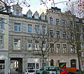
Residential houses | Adalbertsteinweg 218, 220 map |
||||

|
Residential houses | Adalbertsteinweg 222, 224, 226, 228, 230 (parts of) map |
||||

|
Residential building | Adalbertsteinweg 225 map |
||||

|
Residential building | Adalbertsteinweg 229 map |
||||

|
Residential building | Adalbertsteinweg 238 map |
||||

|
Residential building | Adalbertsteinweg 266 map |
||||
 more pictures |
East cemetery | Adalbertsteinweg map |
oldest Aachen cemetery in modern history, built at the instigation of the French municipal government | 1803 | ||

|
Bastion tower of the Aachen city wall (parts) | Adalbertstift 6 card |
1300-1350 | |||
 more pictures |
Catholic parish church St. Adalbert | Adalbertstift card |
Collegiate Church by order of Otto III. ; Consecration 1005; Re-construction in the Romanesque style at the beginning of the 19th century by Heinrich Wiethase | before 1005 | ||

|
Elevation mark of the prussia. Land survey 1895 | Adalbertstift card |
1895 | |||

|
Residential houses | Adalbertstrasse 61, 63 map |
||||

|
Residential building (parts) | Adalbertstrasse 67 map |
||||

|
Residential building | Adalbertstrasse 67a map |
||||

|
Residential building (parts) | Adalbertstrasse 70 map |
||||
 more pictures |
Parish Church of St. Sebastian | Ahornstrasse 53 map |
according to plans by the architect Alfons Leitl | 1954 | ||

|
Computer science center of the RWTH Aachen (former university of education) | Ahornstrasse 55 map |
built according to plans by Wilhelm Bertram, Elmar Lang and Hans-Günther Bierwirth as a steel frame construction with three floors and a stacked floor. Also a sports wing | 1950-1957 | 2006 | |

|
school | Ahornstrasse 60 map |
||||

|
Residential building | Alexanderstrasse 39 map |
Three-storey corner house with a two-storey bay window and a sloping corner axis, facade plastered with neo-baroque decorative shapes, mansard roof | End of 19th century | ||

|
Residential building | Alexanderstrasse 45 map |
four-storey corner house with a sloping corner axis, with a three-storey bay window raised by a turret, brick facade with plastered structure, neo-Gothic and neo-Renaissance decorative shapes | before 1895 | ||

|
Residential building | Alexanderstraße 69-71 map |
||||

|
Residential building | Alexanderstrasse 99-101 map |
||||
 more pictures |
Hotmannspief fountain | Alexanderstrasse map |
based on plans by Adam Franz Friedrich Leydel ; 1830 supplemented by fountain figures | 1825 | ||

|
Alexian Monastery Aachen (parts) | Alexian Trench 33 map |
detectable since 1334; New building according to plans by the architect Wilhelm Pauen | 1616/1928 | ||

|
Residential houses | Alexian Trench 36, 38 map |
||||

|
Remains of the first inner city wall | Alexian Trench Map |
around 1200 | |||

|
Residential building | Alsenstrasse 4 map |
1900 | |||

|
Residential houses | Alsenstrasse 5, 7, 9 map |
||||
|
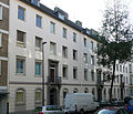
Residential houses | Alsenstrasse 6, 8, 10 map |
||||

|
Residential houses | Alsenstrasse 11, 13, 15 map |
||||

|
Residential houses | Alsenstrasse 16, 18 map |
||||

|
Residential houses | Alsenstrasse 17, 19, 21 map |
||||

|
Residential houses | Alsenstrasse 20, 22 map |
||||

|
Residential houses | Alsenstrasse 23, 25 map |
||||

|
Residential houses | Alsenstrasse 24, 26 map |
||||

|
Residential houses | Alsenstrasse 27, 29 map |
||||

|
Residential building (parts) | Alsenstrasse 28 map |
||||

|
Residential houses | Alsenstrasse 30, 32, 34 map |
||||

|
Residential houses | Alsenstrasse 33, 35 map |
||||

|
Building complex | Alter Posthof 1–5 card |
built on the foundations of the old Capuchin monastery (built in 1614, secularized in 1817), inaugurated in 1891 as the "main post office" of the Oberpostdirektion after being rebuilt, re-inaugurated in 2003 as "Kapuzinerkarree" after major renovation | before 1891 | ||

|
Building complex | Alter Posthof 7-11 card |
see before | before 1891 | ||
|
|
Hall | Old slaughterhouse map |
Transport hall of the former city slaughter and cattle yard Aachen ; built according to plans by Johannes Richter , Joseph Laurent and Karl Heuser; 70 × 15 m large and 12 m high hall in front of the slaughterhouses, spanned by 14 sickle beams; the north and south narrow gables are crowned by two corner turrets with round-arched attachments and a round-arched central gable | 1906 | ||

|
"Gut Chorusberg" | Am Chorusberg 41 card |
||||
 more pictures |
Volkssternwarte Aachen | Map at Hangeweiher 23 |
built on the initiative of the senior professor Eduard Heis | 1935 | ||
 more pictures |
Park Kaiser-Friedrich-Park | Map at the hillside pond |
according to plans of the city gardening director Weßberge | 1908-1910 | ||

|
Good Hasselholz | Am Hasselholz 8, 8a card |
Old stock from the 15th century; Extension measures to the closed square courtyard with farm building (1830), separate "tenant house" (1860) and manor house (1871) | 1830/1860/1871 | ||

|
"Neuenhof" | Am Hasselholz 15 card |
independent extension to Gut Hasselholz; former seat of the Amya family | 1618 | ||

|
"Log cabin" | Am Hasselholz 16 map |
Independent construction of the Gut Hasselholz farm complex | |||

|
Residential building | At the hill 7 card |
Residential construction houses; for climatic reasons and because of the free altitude at the time, roof tiles were all around | 1925-1928 | ||

|
Water tower | At the power supply tower 3 cards |
Part of the former municipal slaughterhouse and cattle yard ; built according to plans by Johannes Richter , Joseph Laurent and Karl Heuser; four-storey brick tower with natural stone strips on a transversely rectangular floor plan with a protruding tent roof | 1894 | ||
 more pictures |
Lavenstein (former tower of the outer city wall) | Am Lavenstein map |
two-storey round tower made of quarry stone masonry | approx. 1300-1350 | ||
|
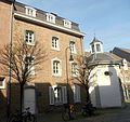
Residential building (parts) | At the Roskapellchen 1 card |
||||
 more pictures |
former "Marienkapelle", popularly called " Roskapellchen " | At the Roskapellchen card |
Attributed to Laurenz Mefferdatis (posthumously), according to Joseph Buchkremer and, in terms of architectural style, more likely to be Johann Joseph Couven (round window, a keystone) | 1758/59 | ||

|
Residential houses | To the women brothers 2 card |
||||

|
Residential houses | To the women brothers 4, 6 card |
||||

|
Residential houses | At the Junkersmühle 2, 4, 6, 8, 10, 12, 14 card |
||||

|
Residential building | At the Schanz 1 card |
||||

|
Residential houses | At the Schanz 2 map |
||||
 more pictures |
Residential houses | At the Schanz 3 map |
||||

|
Residential building (parts) | Annastraße 1, 3 map |
||||
|
|
Residential building (parts) | Annastrasse 2 map |
||||

|
Residential building | Annastraße 4–6 map |
||||

|
Residential houses | Annastraße 5, 7, 9 (parts) map |
||||

|
Residential building | Annastrasse 17 map |
||||

|
Residential building (parts) | Annastrasse 19 map |
||||

|
Residential building (parts) | Annastraße 24 map |
||||

|
Residential building | Annastrasse 25 map |
||||

|
Residential houses | Annastraße 28, 30 map |
||||

|
Residential building | Annastraße 29, 31 (parts of) map |
||||

|
Residential houses | Annastraße 32–34, 36, 38, 40 map |
||||
 more pictures |
Evangel. Anna Church | Annastrasse 33 map |
Monastery church of the Benedictine nuns ; Extension by Johann Joseph Couven | 1511; Extension in 1749 | ||

|
Rectory | Annastrasse 35 map |
||||

|
Residential houses | Annastraße 62, 64 map |
||||

|
Residential houses | Annuntiatenbach 20, 22, 24, 26, 28, 30 card |
||||

|
Residential houses | Annuntiatenbach 33–35, 37, 39 map |
||||

|
Residential houses | Annuntiatenbach 43, 45, 47 map |
||||
| Residential building | Antoniusstrasse 18 map |
|||||

|
Residential building (parts) | Antoniusstrasse 32 map |
||||

|
Residential houses | Aretzstrasse 40-48 map |
||||

|
Residential building | Aretzstrasse 50 map |
||||

|
Residential houses | Aretzstrasse 53, 55 map |
||||

|
Residential building | Aretzstrasse 56 map |
||||

|
Residential houses | Aretzstrasse 57, 59 map |
||||

|
Residential houses | Arndtstrasse 11, 13 map |
||||

|
Residential houses | Arndtstrasse 21, 23 map |
||||

|
Residential houses | Arndtstrasse 26, 28, 30 map |
||||

|
Residential building | Arndtstrasse 34 map |
||||

|
Residential building | Atherstrasse 21–23 map |
||||

|
Residential building | Augustinerbach 2a card |
Former residential and commercial building, now RWTH Aachen building | 2nd half of the 19th century | ||
|
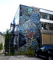
Institute for Materials Science | Augustinerbach 4 map |
built according to plans by Karl Schlüter , ceramic mosaic (northwest facade) and wooden inlay wall (foyer) by Ludwig Schaffrath | 1957 | ||
 more pictures |
Kaiser-Karls-Gymnasium | Augustinerbach 7 card |
former Jesuit school , later called "Marianum"; New building built according to plans by city architect Joseph Laurent | 1888-1903 | ||

|
Graffito "Between the Days" | Augustinerbach card |
Wall painting by Klaus Paier | 6./7. May 1983 | 3595 |
|

|
Graffito "The Great War" | Augustinerbach card |
Wall painting by Klaus Paier | 1985 | 3596 |
|

|
Residential building (parts / facade) | Augustinergasse 4–6 map |
Facade of the building, attributed to Jean-Pierre Cluysenaar , moved from Templergraben 79 at the instigation of Leo Hugot ; | around 1830 (facade) | ||

|
Residential building | Augustinergasse 32 map |
Entrance Augustinergasse next to the Kaiser-Karls-Gymnasium school yard, rear facade on Pontstraße next to Aula Carolina | |||
|
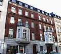
Residential houses (parts) | Aureliusstraße 1–3 map |
||||

|
Residential houses (parts) | Aureliusstrasse 5, 7 map |
||||

|
Residential building | Aureliusstrasse 9 map |
||||

|
Residential houses (parts) | Aureliusstraße 11, 13 map |
||||

|
Aachen Central Station | Bahnhofplatz 2a map |
First year in the classical , new building in the Art Nouveau built | 1843; 1905 | ||

|
Main customs office | Bahnhofplatz 3 map |
three-storey brick building with bluestone structure and hipped roof based on plans by Johann Peter Cremer ; | 1846-1849 | ||

|
Residential building | Bahnhofplatz 8 map |
||||

|
Residential building | Bahnhofplatz 9 map |
||||

|
Residential building | Bahnhofstrasse 12 map |
||||

|
Residential houses | Bahnhofstrasse 27 (parts), 29 map |
||||

|
Residential houses | Bahnhofstrasse 28, 30, 32 map |
||||

|
Residential houses | Beeckstrasse 5, 7, 9 map |
||||

|
Residential houses | Beeckstrasse 11, 13 map |
||||

|
Residential houses | Beeckstrasse 14, 16 map |
||||

|
Catholic elementary school | Beeckstrasse 17 map |
||||

|
Residential building | Beeckstrasse 22 map |
||||

|
Paul Julius Reuter College | Beeckstrasse 26 map |
1905 | |||

|
Residential houses | Beeckstrasse 27, 29 map |
||||
|
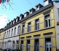
Residential houses | Beeckstrasse 32, 34 map |
||||

|
Residential houses | Beeckstrasse 33, 35 map |
No. 33 built according to plans by Georg Krämer | 1905 | ||

|
Residential building (parts) | Beeckstrasse 36 map |
||||

|
Residential building | Beeckstrasse 37 map |
||||

|
Residential building | Beginenstrasse 1 map |
||||

|
Residential houses | Beginenstrasse 4 map |
||||

|
Residential houses | Beginenstrasse 6 map |
||||

|
Residential building | Beginenstrasse 12 map |
||||

|
School Beguinage | Beginenstrasse 13–15 map |
||||

|
Residential building | Beginenstrasse 16 map |
||||

|
Residential houses | Beginenstrasse 32, 34 map |
||||
 more pictures |
Kerstenscher Pavilion | Belvedereallee 1 map |
The baroque building , built by Johann Joseph Couven , originally stood as a garden house in the city center, but was moved to the Lousberg in 1907 | Mid-18th century, new building in 1907 | ||
 more pictures |
Turret | Belvedereallee 5 map |
technical monument with elements from the 50s; Architect: Wilhelm K. Fischer; A revolving restaurant was added in the 1970s | 1956-1958 | ||

|
Obelisk on the Lousberg | Belvedereallee card |
Land survey point designed by Captaine Boucher on the initiative of Jean Joseph Tranchot | 1807 | ||

|
Park Lousberg / Salvatorberg | Belvedereallee card |
Plant based on plans by the Düsseldorf court gardener Maximilian Friedrich Weyhe | from 1815 | ||

|
Residential building | Bendelstrasse 6-8 map |
Back of the Convent of the Sisters of the Poor Child Jesus | 1844 | ||

|
Residential building (parts) | Bendelstrasse 9 map |
||||

|
Residential building | Bendelstrasse 18 map |
||||

|
Residential houses | Bergdriesch 18, 20 card |
||||

|
Residential building / restaurant | Bergdriesch 38 card |
||||

|
Residential building | Bergdriesch 38a card |
||||
|
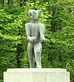
Bear of Berlin | Berliner Ring, motorway exit to A544 towards Cologne map |
New creation by Lutz Brockhaus ; The previous sculpture by Karl Bobek from 1964 was weathered; 180 cm high, thus 50 cm larger than the first version | 1998 | ||

|
Residential houses | Bischofstrasse 1, 3 map |
||||

|
Residential building | Blondelstrasse 28 map |
||||

|
Residential building | Blücherplatz 1 card |
||||

|
Residential houses | Blücherplatz 3, 5, 7 card |
||||

|
Residential houses | Blücherplatz 4, 6 card |
||||

|
Residential building | Blücherplatz 8 card |
||||

|
Residential houses | Blücherplatz 9, 11, 13 card |
||||

|
Residential building (parts) | Blücherplatz 10 card |
||||

|
Residential houses | Blücherplatz 12, 14, 16 card |
||||

|
Residential buildings | Blücherplatz 15–27 card |
former Metallwarengesellschaft mbH ; elongated, rectangular five-storey and 12-axis brick building with two attached staircases and an integrated square chimney; Architect: Joseph Havertz; Restoration and conversion at the end of the 1970s | 1913/14 | ||

|
Residential houses | Blücherplatz 18, 20, 22 card |
||||
|
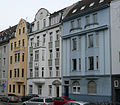
Residential houses | Blücherplatz 26, 28, 30 card |
No. 30: 1910 | |||

|
Residential houses | Blücherplatz 29, 31 card |
||||

|
Residential houses | Blücherplatz 32, 34 card |
||||
|
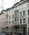
Residential houses | Blücherplatz 33, 35 card |
||||

|
Residential houses | Blücherplatz 37, 39 card |
||||

|
Residential houses | Blücherplatz 40, 42, 44 map |
||||

|
Residential houses | Blücherplatz 41 card |
||||

|
former Royal Building Trade School; today the music school of the city of Aachen | Blücherplatz card |
||||

|
former power and electricity station | Borngasse map |
built by the electrical company Schuckert & Co. | 1893 | ||

|
Residential houses | Pit pit 14, 16, 18 map |
||||

|
Residential houses | Pit pit 20, 22 card |
||||

|
Residential houses | Pit pit 30, 32 card |
||||

|
Residential building | Pit trench 36a card |
||||

|
Residential building | Boxgraben 43 card |
||||

|
Residential houses | Pit pit 44, 46, 48 card |
||||

|
Residential building | Boxgraben 52 card |
||||

|
Residential building | Boxgraben 60 card |
||||

|
Residential building | Boxgraben 63 card |
Late classicist row house owned by the cloth manufacturer Friedrich Frankenhoff, each with three floors and axes. Street front bluestone cuboid (ground floor), brick with bluestone walls and bluestone decor (upper floor). Main floor with blind balustrade and antique framing of the central window. Inside, neo-renaissance ceilings, paneling from the 1880s. | 1870 | ||

|
Residential building (parts) | Boxgraben 65 card |
||||

|
Residential building | Boxgraben 66 card |
||||

|
Residential building | Boxgraben 67 card |
||||

|
Residential building | Pit pit 74 card |
||||

|
Residential building | Boxgraben 77 card |
||||

|
Residential building | Boxgraben 80 card |
||||

|
Residential building | Boxgraben 83 card |
||||
|
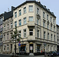
Residential houses | Pit pit 86, 88 card |
||||

|
Residential building | Boxgraben 92 card |
||||

|
Residential building | Boxgraben 98–100 card |
built on the initiative of the Aachen Association for the Promotion of Labor based on plans by Georg Frentzen and Edmund Thyssen, initially as a weaving school. Today the building houses the graphic and design department of the FH Aachen | 1891 | ||

|
Residential building | Boxgraben 122 card |
||||

|
Residential building (parts) | Boxgraben 124 card |
||||

|
Residential houses | Boxgraben 135, 137 card |
||||
|
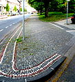
Street mosaic pavement | Pit trench card |
||||
 more pictures |
Residential building; | Brussels Ring 20–22 card |
Back of the Colynshof | |||

|
Residential building (parts) | Buchkremerstraße 1a map |
Facade of the former Hungarian baths, built by Friedrich Joseph Ark | 1861 | ||

|
Commercial building (parts) ("Aachen window") | Buchkremerstraße 2 map |
||||

|
Commercial building (parts) ("Aachen window") | Buchkremerstraße 4 map |
||||

|
Büchelpalais | Büchel 10 card |
1889 | 0686 |
||

|
Residential / commercial building | Büchel 12 card |
0650 |
|||

|
Red castle | Buchel 14 card |
0657 |
|||

|
Residential building | Büchel 16 card |
||||

|
Residential / commercial building (parts) | Büchel 32 card |
0683 |
|||

|
Residential / commercial buildings | Büchel 34, 36 card |
||||

|
"Red House" | Büchel 41 card |
in the 18th century reconstruction by Johann Joseph Couven | 18th century | ||

|
Residential houses | Burggrafenstrasse 1, 1a, 3, 5 map |
||||

|
Residential building | Burtscheider Strasse 20 map |
||||

|
Residential houses | Couvenstrasse 7 map |
||||

|
Residential houses | Couvenstrasse 9, 11, 13 map |
||||

|
Residential houses | Deliusstrasse 2 map |
||||

|
Residential houses | Deliusstrasse 4 map |
||||

|
Residential building | Deliusstrasse 5 map |
||||

|
former Delius cloth factory (parts) | Deliusstrasse 6–30 map |
four-storey brick and plaster building with a curved facade in a mixture of Gothic ornamental shapes and Art Nouveau elements on behalf of the cloth manufacturer Carl Delius ; 1982 restoration and conversion based on plans by J. Schwarze and H. Feldmann; | 1906 | ||

|
Residential building | Deliusstrasse 7 map |
||||
|
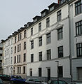
Residential houses | Dennewartstrasse 5, 7, 9 map |
||||
|
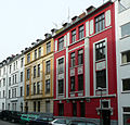
Residential houses | Dennewartstrasse 11, 13, 15 map |
||||

|
Residential houses | Dennewartstrasse 20, 22 map |
||||

|
Residential building | Dennewartstrasse 47 map |
||||

|
Good Diepenbenden | Diepenbenden 41 card |
Estate, mill; Factory for salmiak and Berlin blue ; Birthplace of Alfred Rethel | First built in 1616; New building around 1820 | ||

|
Residential houses | Domhof 1, 1a, 1b, 1c, 1d, 3 map |
||||

|
Residential houses | Domhof 2, 4, 4a, 6, 8, 10 card |
||||

|
Residential building | Düppelstrasse 1 map |
||||

|
Residential building | Düppelstrasse 3 map |
1906 | |||

|
Residential houses | Düppelstrasse 2, 4 map |
||||
|
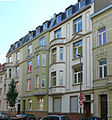
Residential houses | Düppelstrasse 6, 8, 10 map |
||||

|
Residential houses | Düppelstrasse 12, 14, 16, 18, 20 map |
||||
 more pictures |
Residential building; today municipal primary school | Düppelstrasse 19 map |
||||

|
Residential houses | Düppelstrasse 22, 24, 26, 28, 30 map |
around 1616 | |||

|
Residential building | Düppelstrasse 34 map |
||||

|
Residential houses | Düppelstrasse 38, 40, 42 map |
||||
 more pictures |
Catholic parish church of St. Corpus Christi with rectory and chaplaincy | Düppelstrasse map |
Architects: Rudolf Schwarz , Hans Schwippert and Johannes Krahn | 1930 | ||

|
"Gut Weyern" | Eberburgweg 2, 4 map |
||||

|
Student village | Eckertweg 20 map |
1953 | |||

|
Residential houses | Eifelstrasse 5, 7, 9 map |
||||

|
Residential houses | Eifelstrasse 11, 13 map |
||||

|
Residential building (parts) | Eifelstrasse 19 map |
||||

|
Residential houses | Eifelstrasse 21, 23, 25 map |
No. 21: 1905 | |||

|
Residential building | Eifelstrasse 26–28 map |
||||

|
Residential houses | Eifelstrasse 38, 40 map |
||||

|
Residential houses | Eifelstrasse 39, 41 map |
||||

|
Residential houses | Eifelstrasse 42, 44, 46 map |
||||

|
Residential houses | Eifelstrasse 43, 45 map |
||||

|
Residential houses | Eifelstrasse 47, 49, 51 map |
||||

|
Residential building (parts) | Eilfschornsteinstrasse 4 map |
||||

|
Residential houses | Eilfschornsteinstraße 6, 8, 10, 12, 14 map |
No. 14: RWTH Aachen residence | No. 14: cellar around 1800; Construction around 1850 | ||

|
Kármán Forum | Eilfschornsteinstrasse 7-15 map |
built according to plans by JP Volkamer | 1977 | ||

|
Institute for Philosophy at RWTH Aachen | Eilfschornsteinstrasse 16 map |
former girls' secondary school | 1897/1898 | ||

|
Kármán Auditorium of the RWTH Aachen (parts) | Eilfschornsteinstrasse 15 map |
||||

|
Remains of the inner city wall | Eilfschornsteinstrasse map |
parallel to the Templergraben | around 1200 | ||

|
Residential building (parts) | Eintrachtstrasse 1 card |
||||

|
Residential houses | Eintrachtstraße 2, 4–12 map |
||||
|
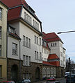
Residential building | Eintrachtstraße 3 map |
||||

|
Residential houses | Elisabethstrasse 4, 6 map |
1898 | |||
 more pictures |
Elisabeth Hall | Elisabethstrasse 8–12 map |
based on plans by city architect Joseph Laurent | 1908-1911 | ||

|
Residential building | Elisabethstrasse 14 map |
||||

|
Residential building | Elsassplatz 2 map |
||||

|
Residential building | Elsassplatz 12 map |
||||

|
Residential houses | Elsassstrasse 2a, 4 map |
||||

|
Residential houses | Elsassstrasse 8, 10 map |
||||

|
Residential building | Elsassstrasse 9 map |
||||

|
Residential building | Elsassstrasse 26 map |
||||

|
Residential building | Elsassstrasse 28 map |
||||

|
Residential houses | Elsassstraße 30, 32, 34, 36 map |
||||

|
Residential houses | Elsassstrasse 27, 29, 31 map |
||||

|
Residential houses | Elsassstrasse 35, 37, 39, 41, 43 map |
||||

|
Residential building (parts) | Elsassstrasse 38 map |
||||

|
Residential houses | Elsassstrasse 40, 42, 44, 46 map |
||||

|
Residential building (parts) | Elsassstrasse 45 map |
||||

|
Residential houses | Elsassstrasse 47, 49 map |
||||

|
Residential building | Elsassstrasse 59 map |
||||

|
Panneschopp housing estate | Elsassstraße 77-83 map |
Settlements for factory workers and Belgian military personnel | 1929/30 | ||

|
Good duck pond | Entenpfuhler Weg 11 map |
||||

|
Gut Bodenhof | Eupener Straße 30 (parts of) map |
former moated castle with two-storey manor house with central projectile and round corner towers; Mentioned in 1438; Seat of the Amya family from 1586 to 1655 ; 1655–1657 new building; Damaged in 1694 and rebuilt in 1696; 1860 The trenches are dried up and the bridge is renewed. | 17th century | ||

|
House Eich - residential house + bluestone portal + enclosure | Eupener Strasse 138 map |
Former Bishop's Konvikt, later a student home and boarding school, today the diocese association building | |||

|
Residential building | Eupener Strasse 176 map |
||||

|
Residential building | Eupener Strasse 191a map |
||||

|
Residential building | Eupener Strasse 217 map |
||||

|
Catholic parish church of St. Gregorius | Eupener Strasse 222 map |
Church building with an unusual floor plan. Architect: Stefan Leuer | 1967 | 3615 |
|

|
Residential building | Eupener Strasse 318 map |
||||

|
Residential building (parts) | Eupener Strasse 322 map |
The wrought-iron window grilles next to the entrance were relocated from the small club in Aachen in 1930 after they were torn down. | |||
 more pictures |
" Alt-Linzenshäuschen " | Eupener Strasse 378 map |
former watchtower and reporting tower of the Aachen Empire ; later forester's house; since 1999 restaurant and excursion bar | 15th century | ||

|
Residential building | Eupener Strasse 390 map |
||||

|
Residential building | Eupener Straße 403, 405, 407, 409 as well as associated. Open spaces card |
||||

|
former customs house, outer shell and associated. Open spaces | Eupener Strasse 420 map |
||||

|
Residential building | Eynattener Strasse 70 map |
||||

|
Residential building | Field 11a card |
||||

|
building | Feldstrasse 5 map |
Horse slaughterhouse of the former city slaughterhouse and cattle yard in Aachen ; built according to plans by Johannes Richter , Joseph Laurent and Karl Heuser; Brick hall with a gently sloping gable roof and six window axes; windowless narrow gables crowned with stepped gables; | 1894 | ||

|
Burghaus Classen | Spruce slope 20 map |
Architect: Friedrich Pützer | 1899/1900 | ||
 more pictures |
Grass house | Fish market 3 card |
First Aachen City Hall, foundation walls from Carolingian times; after 1656 general renovation; 1886–1889 renovation by city architect Joseph Laurent | 1267 | ||
 more pictures |
Residential building | Fish market 4 card |
former "Dreikaiserhaus"; four-storey brick building with corner turrets and bay windows in neo-Gothic style based on plans by Heinrich Dürr | 1888 | ||

|
Residential building | Fish market 6 card |
||||

|
Residential building | Fish market 7 card |
||||

|
Residential building | Fish market 8 card |
||||

|
Residential houses | Fish market 10 card |
||||

|
Residential building | Försterstrasse 1 map |
||||

|
Residential building | Försterstrasse 3 map |
||||

|
Residential building | Försterstrasse 5 map |
Architect: Arnold Königs ; two storeys, two axes, two-axis gable screen, porch of three storeys on the right side of the house, plaster facade, decor: neo-baroque | around 1906 | ||

|
Residential building | Försterstrasse 7 map |
||||

|
Residential building | Försterstrasse 8 map |
||||

|
Residential building | Försterstrasse 9 map |
||||

|
Residential building | Försterstrasse 10 map |
||||

|
Residential building | Försterstrasse 12 map |
||||

|
Residential building | Foersterstrasse 14 map |
built according to plans by Johann Sieprath | |||

|
Residential building | Foersterstrasse 18 map |
||||

|
Residential building | Försterstrasse 20 map |
||||

|
Residential houses | Försterstrasse 22, 24 map |
||||

|
Residential building | Försterstrasse 27 map |
||||

|
Residential building | Foersterstrasse 28 map |
from 1941 to 1944 Judenhaus | |||

|
Residential building | Franzstrasse 40 map |
||||

|
House of the German East | Franzstrasse 74-76 map |
||||

|
Residential building | Franzstrasse 113 map |
||||

|
Residential building (parts) | Franzstrasse 117 map |
||||
 more pictures |
Marching Gate | Franzstrasse map |
Gate of the outer city wall | 1257-1300 | ||

|
Residential building | Frère-Roger-Strasse 1 map |
||||

|
House of the Evangelical Church | Frère-Roger-Strasse 6-10 map |
||||

|
Residential building | Friedlandstrasse 2 (parts) map |
Entrance gates and fence of the former Villa Delius; Architect Georg Frentzen | 1888 | ||
 more pictures |
" Elisenbrunnen " | Friedrich-Wilhelm-Platz 13b map |
Classicist building based on plans by Johann Peter Cremer and Karl Friedrich Schinkel ; Open foyer with pillar porch; The rear part was built on the remains of the inner city wall | 1822-1827 | ||

|
Residential building | Friesenstrasse 3 map |
||||

|
Residential building | Friesenstrasse 4, 6 map |
||||

|
Residential building | Friesenstrasse 7 map |
||||

|
Residential houses | Gartenstrasse 1, 3, 5 map |
||||

|
Residential houses | Gartenstrasse 7, 9, 11 map |
||||

|
Residential houses | Gartenstrasse 2, 4 map |
||||

|
Residential building | Gartenstrasse 18 map |
||||

|
Residential houses | Gartenstrasse 32, 34 map |
||||

|
Residential houses | Gartenstrasse 40, 42, 44 map |
||||

|
Residential houses | Gartenstrasse 46, 48, 50 map |
||||

|
Residential houses | Gartenstrasse 52 map |
||||

|
Residential houses | Gasborn 21, 23, 25 map |
||||

|
Residential building | Gasborn 31 card |
||||

|
Residential houses | Gerlachstrasse 6, 8, 10 map |
||||

|
Residential houses | Gerlachstrasse 9, 11 map |
||||

|
Residential houses | Gerlachstrasse 12, 14, 16 map |
||||

|
Residential building, entrance gate and garage access gate | Giselastrasse 1 map |
||||

|
Residential building | Giselastraße 6 map |
||||

|
Residential houses | Goethestrasse 3 map |
||||
|
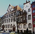
Residential houses | Goethestrasse 5-7 map |
||||

|
Residential houses | Goethestrasse 4, 6 map |
||||

|
Residential building | Goethestrasse 10 map |
1908 | |||

|
Residential building | Goethestrasse 11 map |
||||

|
Residential building | Goethestrasse 14 map |
1907 | |||

|
Residential building | Goethestrasse 18 map |
||||

|
Residential building (parts) | Goethestrasse 27–29 map |
Entrance area of the former municipal clinical institutions | |||

|
Residential houses | Gottfriedstrasse 12, 14, 16 map |
||||

|
Residential houses | Gottfriedstrasse 18, 20 map |
||||

|
Residential houses | Gottfriedstrasse 22, 24 map |
||||

|
Residential building | Gottfriedstrasse 28 map |
||||

|
Residential building | Gottfriedstrasse 30 map |
||||

|
"Johanneshof" | Grindelweg 25 map |
||||

|
Residential / commercial building | Großkölnstraße 38 map |
||||

|
Residential / commercial buildings | Großkölnstraße 74-76, 78 map |
Draft HsNr. 78 by Johann Joseph Couven | |||
 more pictures |
City Church of St. Nicholas | Großkölnstrasse map |
Erected as a monastery church of the Franciscan Minorites , completely renovated in 1951 according to the original plans | 1281 | ||

|
Splinter protection cell | Green way card |
3629 |
|||

|
Residential houses | Guaitastraße 1, 3, 5 map |
||||

|
Residential houses | Guaitastraße 2, 4, 6, 8, 10 map |
||||

|
Residential houses | Guaitastraße 14, 16, 18 map |
||||

|
Residential houses | Guaitastraße 15, 17, 19 map |
||||

|
Residential houses | Guaitastraße 20, 22-24 (parts of) map |
||||

|
Parts of the Gut Grenzhof farm complex | Gut Grenzhof 2–45 (formerly Eupener Strasse 386) map |
||||

|
Residential building | Hanbrucher Strasse 1 map |
||||

|
urban elementary school | Hanbrucher Strasse 29 map |
||||

|
Residential building | Hanbrucher Strasse 40–42 map |
1895 | |||

|
Horse farm "Gut Hanbruch" | Hanbrucher Weg 1 map |
||||

|
Residential building | Harscampstrasse 11 map |
||||

|
Residential building | Harscampstrasse 20 map |
||||

|
Residential building | Harscampstrasse 21 map |
||||

|
Residential building | Harscampstrasse 28-30 map |
||||

|
Residential houses | Harscampstrasse 34, 36 map |
||||

|
Residential houses | Harscampstrasse 35, 37 map |
||||

|
Residential building (parts) | 38-40 Harscampstrasse map |
||||

|
Residential building | Harscampstrasse 74b map |
||||

|
Residential houses | Harscampstrasse 75, 77 map |
||||

|
Residential building | Harscampstrasse 78 map |
||||

|
Residential / commercial building | Hartmannstrasse 2 map |
||||

|
Residential / commercial buildings | Hartmannstrasse 6, 8-10, 12-14 map |
||||

|
Residential / commercial buildings | Hartmannstrasse 32, 34 map |
||||

|
"Berghof" | Hasselholzer Weg 60 map |
separate part of the hamlet of Gut Hasselholz | |||

|
Residential building | Hasselholzer Weg 202 map |
||||
| Residential building | Heidweg 20 map |
|||||

|
building | Hein-Janssen-Straße 15–21 map |
||||

|
Residential houses | Heinrichsallee 8, 10 map |
||||
|
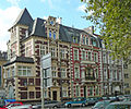
Residential houses | Heinrichsallee 9, 11, 13 map |
||||

|
Residential houses | Heinrichsallee 12, 14, 16 map |
||||

|
Residential houses | Heinrichsallee 17, 19 map |
||||

|
Residential building | Heinrichsallee 20 map |
||||

|
Residential houses | Heinrichsallee 21, 23, 25, 27, 29, 31 map |
||||

|
Residential houses | Heinrichsallee 33, 35 map |
||||

|
Residential houses | Heinrichsallee 34, 36 map |
||||

|
Residential houses | Heinrichsallee 38, 40, 42 map |
||||

|
Residential houses | Heinrichsallee 44, 46 map |
||||

|
Residential building (parts) | Heinrichsallee 47 map |
||||

|
Residential houses | Heinrichsallee 49, 51 map |
||||
|
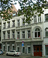
Residential houses | Heinrichsallee 50, 52 map |
||||

|
Residential houses | Heinrichsallee 60 map |
1904 | |||

|
Residential houses | Heinrichsallee 70, 72 map |
||||

|
Monument to Emperor Friedrich III | Heinrichsallee map |
Sculptor: Hugo Lederer | 1911 | ||

|
Residential houses | Heinzenstrasse 1, 3, 5, 7, 9 map |
||||

|
Residential building | Heinzenstrasse 2 map |
||||
|
|
Residential building | Heinzenstrasse 13 map |
||||

|
Residential building (parts) | Heinzenstrasse 15 map |
||||

|
former "JA Hergett cloth factory" | Heinzenstrasse 16 map |
two factory buildings and an office building in the rear part of the property as well as a side wing; Main factory building three-and-a-half-story, five-axis brick building with blue stone window sills and iron plate anchors; to the left of it three-storey and four-axle brick wing; 1895 extension buildings | 1861-1867 | ||

|
Residential building | Heinzenstrasse 17 map |
||||

|
Residential building | Heinzenstrasse 25 map |
||||
| "Bonneskuhl" | Hergenrather Weg 121 map |
|||||

|
Residential building | Hermannstrasse 4 map |
4-storey house, right 3-storey bay window with balcony. Windows and parapets with Art Nouveau decorative shapes, facade with decorative stucco. | 1903 | November 30, 1984 | 03507 |

|
Barbarossa Wall | Hirschgraben 15–31 map |
Parts of the medieval inner city wall | around 1200 | ||

|
Barbarossa Wall | Hirschgraben 43 map |
Parts of the medieval inner city wall | around 1200 | ||

|
Residential building | Höfchensweg 60 map |
||||

|
Residential building | Höfchensweg 71–73 map |
||||

|
Residential building | Höhenweg 1 map |
Residential construction houses; for climatic reasons and because of the free altitude at the time, roof tiles were all around | 1925-1928 | ||

|
Residential building | Höhenweg 21 map |
as before | 1925-1928 | ||
 more pictures |
Cathedral cellar | Yard 1 card |
Two-storey gabled house in brick and bluestone with stone half-timbered facade characteristic of Aachen under the Maas Renaissance influence as well as cross-frame windows and oculus above the door, windows and floating gable changed and supplemented in 1949/50 | 1658 | ||
 more pictures |
House to the linden tree | Yard 2 card |
three-storey brick house with bluestone windows on the first floor, e.g. Some with bluestone cross-frame windows, part of the Couven Museum since 1967 | Ground floor 17th century, upper floor 1st half of the 19th century | ||

|
Residential building | Courtyard 3 card |
three-storey brick house with bluestone walls | 1752, the upper floor 19th century | ||

|
House to the Mohren | Courtyard 4 card |
three-story building with a classical plastered facade | around 1830 | ||
 more pictures |
Residential building | Court 7 card |
former Quirinusbad, on the foundations of an old hospital, 1745 interior work by Johann Joseph Couven , further renovation in 1829 by Adam Franz Friedrich Leydel | 1745/1829 | ||

|
Residential building (parts) | Yard 9 card |
In the basement remains of the former Blasiusspital, parts of the facade from Elfschornsteinstrasse. 25 translocated | around 1200, change. in the 2nd half of the 20th century | ||

|
Residential building (parts) | Court 11 card |
Base with remains of the building from the late 12th century | End of the 12th century, new building in the 20th century | ||

|
Residential building (parts) | Court 13 card |
two-storey brick house with bluestone windows | 17. u. 18th century | ||

|
Residential building | Yard 12 card |
three-storey residential and commercial building, on the ground floor high double storey with arcade arches, upper floor with clinker plaster facade with neo-baroque and art nouveau decorative shapes, mansard roof | around 1900 | ||

|
Residential building | Hof 15-17 map |
two-story building, plastered, e.g. Some with brick and with bluestone walls | 1793 | ||

|
Residential building (parts) | Yard 20 card |
Relocated bluestone facade from Peterstraße 49 | |||

|
Residential building | Hohenstaufenallee 39 map |
1752 | |||

|
"Burned Mill" | Hohenstaufenallee 41–43 map |
1756 | |||

|
Rectory of the cath. Parish Church of the Holy Spirit | Hohenstaufenallee 44 map |
||||

|
Residential building | Hohenzollernplatz 4 map |
||||

|
Residential building | Hohenzollernplatz 5 map |
||||

|
Residential houses | Holsteinstrasse 7, 9 map |
||||

|
Residential building | Holzgraben 1–3 map |
built according to plans by Edmund Thyssen; | 19th century | ||

|
Residential houses | Horngasse 14, 16, 18 map |
||||

|
Residential building | Horngasse 15-17 map |
||||

|
Residential houses | Horngasse 20, 22, 24, 26 map |
||||

|
Residential building | Hubertusplatz 1 card |
||||

|
Residential houses | Hubertusplatz 2, 4, 6 card |
||||

|
Residential building | Hubertusstrasse 3 map |
||||

|
Residential houses | Hubertusstrasse 7, 9 map |
||||

|
Residential houses | Hubertusstrasse 13, 15 map |
||||

|
Residential building | Hubertusstrasse 19 map |
||||

|
Residential houses | Hubertusstraße 24, 26, 28, 30, 32 map |
||||

|
hotel | Hubertusstrasse 35 map |
||||

|
Residential houses | Hubertusstrasse 36, 38 map |
||||

|
Residential houses | Hubertusstrasse 39, 41 map |
||||

|
Residential building | Hubertusstrasse 40 map |
||||
|
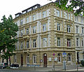
Residential building | Hubertusstrasse 43 map |
||||

|
Residential building | Hubertusstrasse 44 map |
||||

|
Residential houses | Hubertusstrasse 46, 48 map |
||||

|
Residential building | Hubertusstrasse 47 map |
||||

|
Residential building | Hubertusstrasse 50 map |
||||

|
Residential houses | Hubertusstrasse 53, 55 map |
at the end of the 19th century | |||

|
Residential building | Hubertusstrasse 54 map |
||||

|
Residential houses | Hubertusstrasse 57–59 map |
at the end of the 19th century | |||

|
Residential building | Hubertusstrasse 58 map |
at the end of the 19th century | |||

|
House Monheim | Chicken market 17 card |
built in 1663 as a Coeberghisches Stockhaus conversion to "Haus Monheim" in 1786 by Jakob Couven ; two-storey late baroque brick building, mansard roof with large mansard windows; from 1958 seat of the Couven Museum | 1786 | ||
 more pictures |
Chicken Thief Fountain | Chicken market card |
based on plans by the sculptor Hermann Joachim Pagels | 1913 |
Former monuments
| image | designation | location | description | construction time | Registered since |
Monument number |
|---|---|---|---|---|---|---|

|
Residential building | Aretzstrasse 47-51 map |
no longer under monument protection since 2011 | |||

|
Residential building | Brussels Ring 55 card |
no longer under monument protection since 2012 | |||

|
Residential building | Büchel 53 card |
no longer under monument protection since 2012 | |||

|
Residential building | Harscampstrasse 61 map |
no longer under monument protection since 2011 | |||

|
Residential building | Harscampstrasse 63 map |
no longer under monument protection since 2012 | |||

|
Residential building | Harscampstrasse 76 map |
no longer under monument protection since 2016 |
See also
- List of ground monuments in Aachen
- List of street names in Aachen-Mitte
- Relocated buildings in Aachen
- Works by Jakob Couven
- Works by Johann Joseph Couven
Web links
- List of monuments of the city of Aachen (PDF; 228 kB)
- Architectural monuments in Aachen-Mitte in the Aachen geoportal
Individual evidence
- ↑ 125 years ago, the contract for the first municipal power station on Borngasse was signed , Archive of the Month July 2017, on the website of the City Archives of Aachen
- ^ Entry on the collective building of RWTH Aachen in the database " KuLaDig " of the Rhineland Regional Association
- ↑ Detailed description in Rheinische Industriekultur .
- ^ Entry on the Institute for Biblical and Historical Theology at RWTH Aachen University in the " KuLaDig " database of the Rhineland Regional Association
- ^ Entry on the Institute for Materials Science at RWTH Aachen University in the " KuLaDig " database of the Rhineland Regional Association
- ↑ Berlin Bear (bronze) in Aachen . Announcement by the Berliner Bärenfreunde eV from December 12, 2015.
- ↑ 125 years ago, the contract for the first municipal power station on Borngasse was signed , Archive of the Month July 2017, on the website of the City Archives of Aachen
- ^ Entry on University of Applied Sciences for Design in the database " KuLaDig " of the Rhineland Regional Association
- ↑ Detailed description in Rheinische Industriekultur .
- ^ Entry on RWTH Aachen's residential building on Eilfschornsteinstrasse in the " KuLaDig " database of the Rhineland Regional Council
- ^ Entry on the Philosophical Institute of the RWTH Aachen in the database " KuLaDig " of the Rhineland Regional Association
- ↑ Detailed description in Rheinische Industriekultur .
- ↑ Detailed description in Rheinische Industriekultur .

