List of architectural monuments in Aachen-Kornelimünster
The list of architectural monuments in Aachen-Kornelimünster contains the listed buildings in the area of Aachen-Kornelimünster , Kornelimünster / Walheim district, in North Rhine-Westphalia (as of September 27, 2016). These architectural monuments are entered in the monuments list of the city of Aachen; The basis for the admission is the Monument Protection Act North Rhine-Westphalia (DSchG NRW).
Monuments
This partial list of the list of monuments in Aachen includes the monuments in alphabetical order by street name in the area of the parts of the municipality of Kornelimünster that were incorporated into Aachen in 1972 , today's Aachen district Kornelimünster.
| image | designation | location | description | construction time | Registered since |
Monument number |
|---|---|---|---|---|---|---|

|
House (parts) | Abbey garden 6 card |
Part of the former Kornelimünster Imperial Abbey ; five-wing palace complex mostly in late baroque style ; today the seat of the permanent exhibition " Art from NRW " | 1721 | ||

|
Old primary school building | Abbey garden 11–13 menu |
Architect: Peter Salm . Two-storey, eight-axis plastered school building with a rectangular floor plan with a hipped roof . Basement covered with quarry stone, rectangular window openings with stone framing. | 1937-1939 | ||

|
former. Station on the disused railway line between Aachen and Ulflingen Vennbahn . | At the station 2-4 card |
Station of the former industrial line to Luxembourg; Closed in 1984; today an excursion restaurant | before 1885 | ||
|
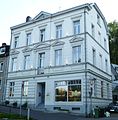
Residential houses | On the mountain 2 card |
||||

|
Residential houses | Am Berg 4, 6 card |
||||

|
Residential houses | Am Berg 8 card |
||||

|
Residential houses | Am Berg 10, 12 card |
||||

|
Residential houses | Am Berg 14, 16 map |
House no. 14 was, among other things, the clerk's apartment, a meeting place for holy masses and has been the location of a carpenter's workshop since 1912. A specially attached coach house offered Jean Joseph Tranchot space for carriage and horses for his mapping assignments in the region. | 1789 | ||

|
Residential houses | Am Berg 18 card |
||||

|
Residential houses | Am Berg 22, 24 card |
||||

|
Residential houses | On the mountain 26 card |
||||

|
Residential houses | Benediktusplatz 1–3 card |
||||

|
Residential houses | Benediktusplatz 5 map |
1888 | |||

|
Residential houses | Benediktusplatz 7, 9, map |
Restoration in 1955 | 1668 | ||

|
Residential houses | Benediktusplatz 11, 13, 15, 17 map |
No. 17 (right) is said to be the narrowest house in North Rhine-Westphalia; | |||

|
Residential houses | Benediktusplatz 19 map |
||||

|
Residential houses | Benediktusplatz 2, 4 map |
||||

|
Residential houses | Benediktusplatz 8, 10, 12, 14 map |
1876 (No. 10) 1735 (No. 12) | |||

|
Residential houses | Benediktusplatz 18, 20, 22 card |
||||

|
Residential houses | Benediktusplatz 24 map |
1625 | |||
 more pictures |
Anthony's Chapel | Breiniger Strasse 2 map |
Quarry stone chapel on the foundations of a chapel from 1718, built by Abbot Ludwig von Sickingen | 1756/57 | ||

|
Residential building (parts) | Breiniger Strasse 4 map |
||||

|
Residential houses | Breiniger Strasse 8, 10, 12 map |
||||

|
Wayside cross | Breiniger Strasse map |
Inscription (partly illegible): "Here rest the remains of the well-born wife Maria Josepha Theodora Minderjahn and her brother, the venerable Mr. Karl Bartholomäus Minderjahn. She died in 1837 on March 6th at the age of 87, the latter died on February 18th in the 84th year of his age, in the 60th year of his priesthood. Both were beautiful models of virtue and piety .... " | around 1840 | ||

|
former parish church St. Stephanus | Dorffer Strasse 2 map |
oldest building structure from the 8th century; Main church from the 15th or 17th century. | 12th century (mention) | ||

|
Residential houses | Dorffer Strasse 4, 6 map |
||||

|
"Gut Fronhof" | Fronhofer Weg 11, 13 map |
Courtyard complex made of brick and quarry stone walls | 18th century | ||

|
Bridge over Iternbach | Street Iternberg - Vennbahnweg map |
Part of the former industrial railway to Luxembourg, | 1885 | ||

|
Commercial building | Iternberg 34 map |
||||

|
Residential building | Iternberg 43 and 43a card |
||||

|
Residential building | Iternberg 45 card |
||||

|
Residential building | Iternberg 85 card |
||||

|
Residential building | Klauser Strasse 2 map |
||||

|
Residential building | Klauser Strasse 4 map |
||||

|
Residential houses | Klauser Strasse 6, 8 10 map |
||||

|
Residential building | Klauser Strasse 16 map |
||||

|
Residential building (parts) | Klauser Strasse 18 map |
||||

|
Residential building | Klauser Strasse 42 map |
||||

|
Klause (Maria im Schnee chapel) | Klauser Strasse 43 map |
Former hermitage in the Klauserwäldchen / Frankenwäldchen nature reserve | 1658 | ||

|
Residential houses (parts) | Klauser Strasse 44, 46 map |
||||

|
Residential building (parts) | Klauser Strasse 48 map |
||||

|
Residential building | Klauser Strasse 49 map |
||||

|
Residential houses | Klauser Strasse 50, 52 map |
||||
|
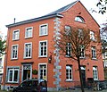
Residential houses | Korneliusmarkt 2 card |
"The Eulenspiegel" | |||
|
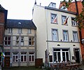
Residential houses | Korneliusmarkt 4, 6 card |
"In the courtroom" (No. 6) | |||

|
Residential building | Korneliusmarkt 3 card |
former mayor's office (1830), later school (until 1930) | |||
|
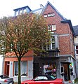
Residential houses (parts) | Korneliusmarkt 8, 10 card |
||||
|
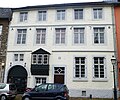
Residential houses | Korneliusmarkt 12 card |
"St. Nicholas Hospital"; Origins 12th century, the house built around 1407, the lower two floors date from 1670. To the left of this house there was a chapel, the semicircular apse of which can still be seen in the basement of the house. The chapel is said to have belonged to one of the fortified towers, Am Berg, in the early Middle Ages. | 1407/1670 | ||

|
Residential houses (parts) | Korneliusmarkt 14, 16-18 map |
"Archelei" (No. 16/18) | |||

|
Residential houses | Korneliusmarkt 22, 24, 26, 28, 30 card |
"The Big Bell" (No. 22); "The Little Bell" (No. 24); "Im Kaiser" (No. 30), cross-stock window from 1630; | 1705 (No. 26) 1614 (No. 30) | ||

|
Residential houses | Korneliusmarkt 32–34 card |
||||

|
Residential houses | Korneliusmarkt 36.38 card |
"Arche Marjohn" (No. 38) named after a former. Jewish owners | |||

|
Residential building | Korneliusmarkt 42 map |
||||

|
Residential houses | Korneliusmarkt 50, 52 card |
||||

|
Residential houses | Korneliusmarkt 54, 56 map |
"Im Stern" (No. 56) | |||
 more pictures |
Provost church of St. Cornelius | Korneliusmarkt card |
former abbey church of the Benedictines , 1804 parish church, 5-aisled church with vorw. Gothic style, 14./15. Century expanded with Romanesque elements , octagonal chapel extension in the 18th century. | 9th century | ||

|
Residential houses | Korneliusstraße 2, 4 map |
1752 (No. 2) / 1736 (No. 4) | |||

|
Residential houses | Korneliusstraße 6, 8 map |
1756 (No. 8) | |||

|
Residential houses | Korneliusstraße 10, 12-14, 16 map |
1836 (No. 12) 1826 (No. 14) | |||

|
Residential houses | Korneliusstrasse 5, 7, 9 map |
1788 (nos. 7 and 9) | |||

|
Residential houses | Korneliusstrasse 11 map |
1666 | |||

|
Residential houses | Korneliusstraße 19, 21, 23 map |
1752 (No. 19) 1741 (No. 21) | |||

|
Residential houses | Korneliusstrasse 25 map |
||||

|
Residential building | Korneliusstrasse 32 map |
||||

|
Residential houses | Korneliusstrasse 36 map |
||||
|
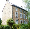
Residential houses | Korneliusstrasse 38 map |
||||

|
Residential houses | Korneliusstraße 39a, 41 map |
||||

|
Residential houses | Korneliusstraße 43-45 map |
||||

|
"Gut Lufterhof" | Lufter Weg 11, 11a, 11b map |
Square courtyard; The white, cohesive building block on the side has house no. 11-11b, today a. a. Riding school and riding school | |||

|
Residential houses | Lufter Weg 13 map |
Side wing of the "Gut Lufterhof" | |||

|
Residential building | Napoleonsberg 52 map |
||||

|
Residential houses | Napoleonsberg 68, 70 map |
||||

|
Residential building | Napoleonsberg 96 map |
||||
|
|
Factory building | Napoleonsberg 102-104 map |
1839–1970 Factory and residential building of the Abtei-Bräu Josef Schmitz KG, today an artist's workshop | |||

|
Residential building (parts) | Napoleonsberg 124 map |
||||
|
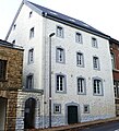
Residential building | Napoleonsberg 126 map |
||||

|
Residential houses | Napoleonsberg 132 map |
1903 | |||

|
Residential houses | Napoleonsberg 134 map |
||||

|
Residential building (parts) | Napoleonsberg 136 map |
||||
|
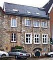
Residential building | Napoleonsberg 188 map |
||||
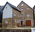
|
Residential building | Napoleonsberg 192 map |
||||

|
New Benedictine Abbey of Kornelimünster | Oberforstbacher Strasse 69b, 69c, 69d map |
built at the instigation of Dutch Benedictine monks ; served as a secondary school from 1948 to 1987; 2011/2012 complete refurbishment to a residential property | 1906 | ||

|
New Benedictine Abbey (without church) | Oberforstbacher Strasse 71 map |
Only the front and side wings without the newer church in the background count towards the listed part | 1906 | ||

|
Residential houses | Promenade 1, 3 map |
former Rohland textile factory ; Single-storey front building in quarry stone with gate passage made of bluestone. Western then a three-storey, six-axis, white muddy brick building with a later extension. Rear factory building as a three-storey white brick building, gable in 3: 9 axes (with eight-axis extension) with blue stone window sills and flat gable with a semicircular window. | 1837 | ||

|
Department gate | Promenade 2 card |
old abbot gate; Part of the former Kornelimünster Imperial Abbey | 1687 | ||

|
Residential houses | Promenade 9 card |
Part of the former Rohland textile factory ; see Promenade 1–3 | 1837 | ||

|
Residential houses | St. Gangolfsberg 2 map |
||||

|
Residential houses | St. Gangolfsberg 4, 4a, 4b map |
||||

|
Residential houses | Schildchenweg 4, 6 map |
||||
 more pictures |
Jewish Cemetery | Schildchenweg map |
possibly laid out in the 17th century, shut down in 1935 | before 1852 | ||

|
Residential building | Schulberg 18 card |
former St. Gangolf's Chapel; Gothic quarry stone building on the foundation of a previous Romanesque building; today youth meeting | 15./16. Century | ||

|
Residential houses | Steinkaulplatz 1, 3–5 card |
||||

|
Residential houses | Steinkaulplatz 7–9 card |
1701 | |||

|
Residential houses | Steinkaulplatz 4 card |
||||

|
Residential houses | Steinkaulplatz 6, 8 (parts) map |
||||

|
"Höllenloch" drainage channel | Steinkaulplatz card |
||||

|
Residential houses | Under the willows 8 card |
||||

|
Viaduct over the Iterbach valley and the Iternberg |
Vennbahnweg map |
Part of the former industrial line to Luxembourg, 5-arch quarry stone viaduct with a flight core and bluestone covers on the cheeks, closed in 1982, today a footpath and bike path | 1885 | ||

|
Residential building | Venwegener Strasse 18 map |
||||

|
Residential building | Venwegener Strasse 38 map |
||||

|
Residential building | Venwegener Straße 44-46 map |
||||

|
"Good Smart Mill" | Venwegener Strasse 60, 64 map |
||||

|
Residential building | Venwegener Strasse 70 map |
Web links
Commons : Architectural monuments in Aachen-Kornelimünster - Collection of images, videos and audio files
- List of monuments of the city of Aachen (PDF; 129 kB)
- Architectural monuments in Kornelimünster in the Aachen geoportal
