List of architectural monuments in Aachen-Mitte (I – O)
The list of architectural monuments in Aachen-Mitte (I – O) contains the listed buildings in the area of the Aachen-Mitte district in North Rhine-Westphalia (as of September 27, 2016). These architectural monuments are entered in the monuments list of the city of Aachen; The basis for the admission is the Monument Protection Act North Rhine-Westphalia (DSchG NRW).
Monuments
This partial list of the list of monuments in Aachen includes the monuments in Aachen-Mitte, sorted alphabetically by street names from I to O. Other parts lists are available for the road name of A to H , and from P to Z . There are separate partial lists for the monuments in Burtscheid , in Forst and in the Franconian Quarter .
| image | designation | location | description | construction time | Registered since |
Monument number |
|---|---|---|---|---|---|---|

|
Residential building | In Mariental 1, 3 (parts) map |
||||

|
Residential houses | In Mariental 7, 9, 11 map |
||||

|
2 bronze statues | Intzestraße in front of No. 1 card |
made by Mathias Streicher, TH-Prof. for plastic | 1916 | ||

|
Foundry Institute of the RWTH Aachen | Intzestraße 5 map |
Frame construction based on plans by Benno Schachner | 1950/1951 | ||

|
Residential building | Jakobsplatz 4 card |
||||

|
Catholic Parish Office St. Jakob | Jakobsplatz 5 card |
1888 | |||

|
Residential building (parts) | Jakobstrasse 1 map |
Designed by Johann Joseph Couven | Mid-18th century | ||

|
House "Eijene Keizer Karl" | Jakobstrasse 2 map |
built according to plans by Adam Franz Friedrich Leydel | between 1829 and 1837 | ||

|
Residential building | Jakobstrasse 3 map |
||||

|
Residential house (parts); No. 6: “To the colorful ox” ( butcher's guild house ); No. 8: "To the turret". | Jakobstrasse 4, 6, 8, 10 map |
Hs no. 6 According to plans by Johann Joseph Couven ; Hs no. 10 originally also by Couven, demolished in 1895, then rebuilt in Couven style | Mid-18th century | ||

|
Residential building | Jakobstrasse 7 map |
||||

|
Residential houses (parts) | Jakobstrasse 12, 14–16 map |
Draft HsNr. 16: Johann Joseph Couven | |||

|
Residential building "Zum Güldenen Verken"; Guild house of the Nadler | Jakobstrasse 18 map |
until 1879 part of the Chorus needle factory; from 1897 seat of the Marianneninstitut , between the brewery building and the seltzer water factory | |||

|
Convent of the Sisters of the Poor Child Jesus | Jakobstrasse 19 map |
built on the foundations of an old white woman monastery from the 13th century, passed into the possession of the order of Clara Fey in 1848; New wing according to plans by Hermann Kremers | 1956 | ||

|
Residential building | Jakobstrasse 21 map |
Part of the former monastery of the Sisters of the Poor Child Jesus | before 1848 | ||

|
Haus zum Horn (parts) | Jakobstrasse 24 map |
Part of the Chorus needle factory; In 1757 Johann Joseph Couven extended it as a management building, later the house of the builder Klausener | 1659 | ||

|
Bluestone portal | Jakobstrasse 24B map |
Passage to the former needle factory Chorus | |||
 more pictures |
Wylre's house | Jakobstrasse 35 map |
Former cloth then scratch factory ; Expansion and renovation in the 18th century by Johann Joseph Couven and Laurenz Mefferdatis , later supplemented by Jakob Couven | 1669 | ||
 more pictures |
Former monastery and parish church of St. Paul (parts) | Jakobstrasse 40 map |
former Dominican monastery church ; Late Gothic hall construction; Renaissance portal from 1705; Rebuilt in 1822 according to plans by Johann Peter Cremer and Karl Friedrich Schinkel in a classicistic style | before 1339 | ||

|
Residential building | Jakobstrasse 45 map |
||||

|
Residential building (parts) | Jakobstrasse 64 map |
||||

|
Residential houses | Jakobstrasse 76b, 76c map |
||||

|
Residential houses | Jakobstrasse 78, 80, 82 map |
1760 (No. 82) | |||

|
Residential houses | Jakobstrasse 86, 88, 90, 92, 94 map |
Draft HsNr. 88 Johann Joseph Couven | |||

|
Residential building | Jakobstrasse 93 map |
||||
 more pictures |
Residential building | Jakobstrasse 95 map |
||||

|
Residential houses | Jakobstrasse 97, 99–101, 103 map |
||||
|
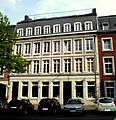
Residential houses |
Jakobstrasse 105/107 map |
three-storey brick building with mansard roof and facade in bluestone framework, ground floor in bluestone, z. Partially changed, mansard roof; contemporary interior | 1812 | ||

|
Residential houses | Jakobstrasse 109, 111 map |
||||

|
Residential building | Jakobstrasse 108–110 map |
Former Administration building of the Beissel needle factory | |||

|
Residential houses | Jakobstrasse 122, 124 map |
||||

|
Residential building | Jakobstrasse 127 map |
||||

|
building | Jakobstrasse 136–146 map |
||||

|
Residential houses | Jakobstrasse 165 map |
||||

|
Residential houses | Jakobstrasse 167b, 169 map |
||||

|
Residential building (parts) | Jakobstrasse 177–179 map |
||||

|
Residential building | Jakobstrasse 178 map |
||||

|
Residential houses | Jakobstrasse 204-206, 208 map |
208: Gabled house with cross-frame windows, now sexton's apartment | 1792 (no.206) | ||

|
Residential houses | Jakobstrasse 214–216, 218, 220, 222, 224 map |
||||

|
Residential houses | Jakobstrasse 228, 230, 232 map |
||||
 more pictures |
Strong blacksmith | Jakobstrasse map |
Fountain monument by Carl Burger | 1909 | ||
 more pictures |
Catholic parish church St. Jakob | Jakobstrasse map |
built according to plans by Heinrich Wiethase by architect Eduard Linse | 1881-1886 | ||

|
Crucifixion group at the corner of Vaalser Straße (Kalvarienberg) | Jakobstrasse map |
Sculptors: Wilhelm Pohl and Carl Esser | 1893 | ||

|
Residential building | Jesuitenstrasse 2 map |
||||

|
Residential building (parts) | Jesuitenstrasse 4 map |
||||

|
school | Jesuitenstrasse 9-11 map |
Main building of the St. Leonhard Gymnasium Aachen, built as a high school based on designs by city architect Joseph Laurent | 1890-1892 | ||

|
school | Jesuitenstrasse 18-20 map |
Main building of the Städt. Ev. Elementary school Annaschule | |||
 more pictures |
Greek Orthodox Church Archangels Michael and St. Dimitrios | Jesuit Street map |
former monastery church of the Jesuit community Aachen in the style of Rhenish mannerism ; later grain magazine. 1891/92 renewal of the facade in neo -renaissance style | 1618-1628 | ||

|
Residential houses | Johanniterstraße 3, 5, 7 map |
||||

|
Residential houses | Johanniterstraße 11, 13, 15 map |
||||

|
Residential building | Johanniterstraße 20 map |
||||

|
Residential building | Johanniterstraße 21 map |
||||

|
Residential houses | Johanniterstraße 23, 25 map |
||||

|
Residential houses | Johanniterstraße 26, 28, 30 map |
||||

|
Residential building (parts) | Johanniterstraße 27 map |
||||

|
Residential houses | Johanniterstraße 29, 31 map |
||||
| Remains of the city wall (inner city wall) | Johanniterstrasse 32–34 map |
around 1200 | ||||

|
Residential buildings | Joseph-von-Görres-Straße 1–15 map |
||||

|
Residential buildings | Joseph-von-Görres-Straße 2–14 map |
||||

|
Residential houses | Joseph-von-Görres-Strasse 50, 52, 54, 56 map |
||||

|
Residential buildings | Joseph-von-Görres-Straße 61–75 map |
||||

|
Residential buildings | Joseph-von-Görres-Straße 60–90 map |
||||
 more pictures |
Catholic parish church of St. Elisabeth | Jülicher Strasse 72a map |
built according to plans by Eduard Endler ; Profaned in 2011 | 1904-1907 | ||

|
Residential houses | Jülicher Strasse 74, 76, 78, 80, 82, 84 map |
||||

|
Residential building | Jülicher Strasse 95 map |
||||

|
Ludwig Forum for International Art (former umbrella factory) | Jülicher Strasse 97-109 map |
built according to plans by Josef Bachmann and Alexander Lürken as a reinforced concrete frame structure; two or three storeys with yellow clinker brick over red brickwork; Towering building with a rounded corner, emphasized in the horizontal by narrow parapets | 1928 | ||

|
Residential houses | Jülicher Strasse 134, 136 map |
||||

|
Residential building | Jülicher Strasse 156 map |
||||

|
Residential houses | Jülicher Strasse 162, 164 map |
||||

|
Residential building | Jülicher Strasse 182 map |
||||

|
Factory, formerly Garbe, Lahmeyer & Co. | Jülicher Strasse 191 map |
Factory complex, consisting of 3 buildings | 3618 |
||

|
Main building of the Talbot wagon factory | Jülicher Strasse 215 map |
First buildings supported by structural engineer Otto Intze , 1921–23 significant extensions to the administration building, gatehouse and other halls, architect: Gerhard Becker | 1893/94 | ||

|
Residential complex | Jülicher Strasse 224–234 map |
||||

|
facade | Jülicher Strasse 326 map |
Remnants of the "Wischer Mühle". The grain mill on the Wurm was first mentioned in a document in 1564, it was rebuilt in the middle of the 19th century and was in operation until 1962, with a steam engine last being used for support. Then the buildings fell apart, so that only the facade of the gatehouse is preserved. | Mid 19th century | ||

|
Residential building | Junkerstrasse 3a map |
||||

|
Residential building | Junkerstrasse 7 map |
||||

|
Residential houses | Junkerstraße 13, 15-17, 19 map |
||||

|
Residential houses | Junkerstrasse 23, 25, 27 map |
||||

|
Residential houses | Junkerstrasse 33, 35, 37 map |
||||

|
High bunker | Junkerstrasse 36 map |
One of the first bunkers to be completed in Aachen, planned in 1941 by the architects Frings and Maur and built in 1942. The structure of the bunker has largely remained unchanged; some shelters and some of the building services have been preserved from the original period. Rehearsal rooms have been rented out in the bunker since the 1980s, and since 1994 it has been used by the “MusikBunker eV” association. | 1942 | 3527 |
|

|
Residential houses | Junkerstrasse 39, 41 map |
||||

|
Residential houses | Junkerstrasse 43, 45 map |
||||

|
Parts of the city wall (outer city wall) | Junkerstrasse 46 map |
between 1257 and 1350 | |||

|
Residential houses | Junkerstrasse 48, 50 map |
||||

|
Residential houses | Junkerstrasse 54, 56 map |
||||

|
Residential building | Junkerstrasse 60 map |
||||

|
Residential houses | Junkerstrasse 64, 66 map |
||||
 more pictures |
Pfaff tower ; today domicile of Ripuaria Aachen | Junkerstrasse 68 map |
the only circular tower and part of the outer Aachen city wall ; | 1300-1350 | ||

|
Residential houses | Junkerstrasse 73, 75, 77 map |
||||

|
Residential houses | Junkerstraße 79, 81, 83, 85, 87 map |
||||
 more pictures |
Long tower | Junkerstrasse 101 map |
Part of the outer city wall, central watch and reporting tower | approx. 1300-1350 | ||
 more pictures |
Colynshof | Kaiser-Friedrich-Allee 69 map |
||||
 more pictures |
Triton fountain | Kaiser-Friedrich-Allee map |
built according to plans by the sculptor Carl Burger | between 1905 and 1910 | ||

|
Park | Kaiser-Friedrich-Allee map |
laid out according to plans by the city gardening director Weßberge | between 1905 and 1910 | ||

|
Residential building | Kaiserplatz 6 card |
||||
 more pictures |
Bankhaus Kapuzinergraben (parts) | Kapuzinergraben 12-14 map |
created by Georg Frentzen ; restored after World War II by Hans Königs | 1910 | ||
 more pictures |
Kapuziner-Karree (formerly the main post office) | Kapuzinergraben 19 map |
built according to plans by the Cologne post office building councilor Hirndorf along the former inner city wall, named after a Capuchin monastery that was demolished in 1817 | 1888-1900 | ||
| Parts of the Barbarossamauer (inner city wall) | Kapuzinergraben 26 map |
around 1200 | ||||

|
Residential houses | Karlsgraben 3, 5, 7, 9, 11, 13 map |
||||

|
Residential houses | Karlsgraben 35, 37, 39, 41, 43 map |
||||
|
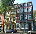
Residential houses | Karlsgraben 49, 51 map |
||||

|
"Lochnertor and coach house" | Karlsgraben 55 map |
Part of the former estate of Count Berghe von Trips ; later part of the van Houtem cloth factory and the Lochnervilla of Johann Friedrich Lochner ; Architect (attributed to): Jakob Couven or Joseph Moretti | around 1775 | ||

|
Residential houses | Karlsgraben 57, 59, 61, 63, 65 map |
||||

|
Residential houses | Kármánstrasse 7, 9, 11, 13, 15 map |
Residential buildings of the RWTH Aachen in the style of the neo-Renaissance | 1890s | ||

|
Residential building | 19 Kármánstrasse map |
Philosophical Faculty of the RWTH Aachen; originally secondary school, later Couven grammar school with sports hall, based on plans by city architect Joseph Laurent | 1893 (main building); 1897 (sports hall) | ||

|
"Karmeliterhöfe" | Kasernenstrasse 25 map |
named after the Carmelite order resident in the 19th century , former police headquarters, later seat of the administrative court until 2007; built according to the plans of the district architect Lüring as a three-wing, three-storey complex in the neo-baroque style | 1907-1910 | ||

|
City administration of Aachen |
Katschhof 1 card |
built according to plans by Gerhard Graubner ; has also housed the Center Charlemagne - New City Museum Aachen since 2014 | 1958–1962 | ||
 more pictures |
Fountain of Paradise | Katschhof 2 card |
built according to plans by Georg Frentzen | 1897 | ||

|
Aachen Cathedral Clinic | Katschhof 3 (parts) map |
Built in 1884 and rebuilt and expanded by Joseph Buchkremer between 1909 and 1911 . Stone facade with neo-Romanesque and neo-Gothic decorative shapes. In the 1980s it was completely gutted and converted into a day clinic | 1884 | ||

|
Residential houses (parts) | Kleinkölnstraße 3, 5 map |
||||

|
Residential building (parts) | Kleinkölnstraße 18 map |
former “ Londoner Hof ”, built according to plans by Laurenz Mefferdatis ; Interior work in 1740 by Johann Joseph Couven ; destroyed in WWII; Ground floor rebuilt according to old plans and salvaged components | 1713-1740 | ||

|
Residential houses | Kleinmarschierstrasse 1, 3 map |
Architect: Adam Franz Friedrich Leydel (No. 1) | around 1834 | ||

|
Residential building (parts) | Kleinmarschierstrasse 11 map |
||||

|
Residential building | Kleinmarschierstrasse 35 map |
||||

|
Residential building | Kleinmarschierstrasse 37 map |
||||

|
Residential building | Klemensstrasse 11 map |
||||

|
Residential houses (parts) | Kockerellstrasse 3 map |
||||

|
Residential building | Kockerellstrasse 4 map |
||||

|
Residential houses (parts) | Kockerellstrasse 5 map |
||||

|
Residential houses (parts) | Kockerellstrasse 7 map |
||||

|
Residential houses (parts) | Kockerellstrasse 9 map |
||||

|
Residential houses (parts) | Kockerellstrasse 13, 15, 17 map |
||||

|
Residential houses (parts) | Kockerellstrasse 19 map |
||||

|
Residential building | Kockerellstrasse 20 map |
||||

|
Residential building (parts) | Kockerellstrasse 22 map |
three-storey, four-axle house with a baroque facade based on designs by Johann Joseph Couven ; Brick building with walls made of bluestone | Mid-18th century | ||

|
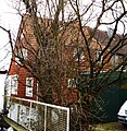
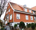
Residential building | King's Hill 2 card |
Residential construction houses; for climatic reasons and because of the free altitude at the time, roof tiles were all around | 1925-1928 | ||
|
Residential building | King's Hill 5 card |
as before | 1925-1928 | ||

|
Residential building | King's Hill 6, 8, 10, 12 card |
as before | 1925-1928 | ||

|
Residential building | King's Hill 24 card |
as before | 1925-1928 | ||
|
Residential building | King's Hill 28 card |
as before | 1925-1928 | ||

|
Residential building | Koenigstrasse 1b map |
||||

|
Residential building (parts) | Koenigstrasse 3 map |
||||

|
Residential building | Koenigstrasse 15-17 map |
||||

|
Residential building (parts) | Koenigstrasse 21a map |
||||

|
Residential building (parts) | Koenigstrasse 22 map |
former JH Kesselkaul cloth factory ; expanded several times from 1825; 1941–1944 Judenhaus | 1815 | ||

|
Residential houses | Koenigstrasse 24, 26 map |
||||

|
Residential building | Koenigstrasse 27, 29 map |
||||

|
Residential building (parts) | Koenigstrasse 28 map |
||||

|
Residential building | Koenigstrasse 30 map |
||||

|
Residential building (parts) | Koenigstrasse 31 map |
||||

|
Residential building (parts) | Koenigstrasse 34 map |
||||

|
Residential building | Koenigstrasse 44–46 map |
||||

|
Residential houses | Königstrasse 62, 64, 66, 68, 70 map |
||||

|
Residential houses (parts) | Koenigstrasse 67, 69 map |
||||

|
Residential houses | Koenigstrasse 71, 73, 73a map |
||||

|
Königstor customs house | Koenigstrasse 75 map |
former customs and guard house at the Königstor , built by Adam Franz Friedrich Leydel ; Spoilen moved to the Kaiser-Friedrich-Park entrance | 1836 | ||

|
Anti-tank traps | Brains card |
900 m long part of the west wall plus 100 m part east of the federal road; Cusp structures in reinforced concrete | 1938/39 | 3503 |
|

|
Residential building | Körbergasse 2 map |
||||

|
Residential houses | Körbergasse 3, 5 map |
1655 (No. 3) | |||

|
Residential houses | Körnerstrasse 12, 14 map |
||||
 more pictures |
Catholic Parish Church of the Holy Spirit | Körnerstrasse 20–22 map |
based on plans by Otto Bongartz | 1929/30 | ||

|
Residential building | Koernerstrasse 25 map |
||||

|
Commercial building (parts) | Komphausbadstrasse 10 map |
||||
 more pictures |
Altes Kurhaus (New Redoute) | Komphausbadstrasse 15, 17, 19 map |
built according to plans by Jakob Couven ; Front view | 1782-1786 | ||
 more pictures |
"Mail car" | Krämerstrasse map |
belonging together with "Eulenspiegel"; originally two separate houses; built after the 2nd World War by Franz Lüttgens according to old plans; two-storey, ground floor half-timbered with brick infill, upper storey cantilevered, entirely in wood | around 1657 | ||

|
"Eulenspiegel" | Krämerstrasse map |
belonging together with "Postwagen"; originally two separate houses; after the 2nd World War by Franz Lüttgens built according to old plans; three-storey brick house with hipped roof and cross-frame windows in bluestone; | around 1657 | ||

|
Residential / commercial buildings | Krämerstrasse 1, 3 map |
Conversion of HsNr. 1 Mid-18th century based on plans by Johann Joseph Couven | |||

|
Residential / commercial building (parts) | Kramerstrasse 5 map |
||||

|
Residential house (parts); "To the golden apple tree" inn | Krämerstrasse 7 map |
||||

|
Residential / commercial buildings | Krämerstrasse 8, 10, 12 map |
||||

|
Residential / commercial buildings | Krämerstrasse 14, 14a, 16 map |
||||

|
Residential / commercial building | Kramerstrasse 17 map |
||||

|
Residential / commercial building | Kramerstrasse 18 map |
||||

|
Residential / commercial buildings | Krämerstrasse 27, 29 map |
||||

|
Residential building | Krakaustraße 1 map |
||||

|
Residential building | Krakaustraße 27 map |
former " JH Kesselkaul cloth factory "; three-storey brick house with 8 axes, pilaster strips and hipped roof. 1980 Conversion and expansion of the main building, which is under monument protection, and the gateway to office and retail space on the ground floor and apartments on the upper floors | 1855 | ||

|
Residential building | Krefelder Strasse 2 map |
||||

|
Residential building | Krefelder Strasse 11 map |
||||

|
Residential building | Krefelder Strasse 21 map |
designed by Karl Henrici as his own home. Inside, the wooden fixtures (ceilings, paneling, wall cupboards) have been preserved. During construction work inside, decorative and figurative paintings were uncovered in the rooms on the mezzanine floor. | 1886 | ||

|
Residential building (parts) | Krefelder Strasse 25 map |
||||

|
Residential building | Krefelder Strasse 27 map |
by architect Arnold Königs ; four floors, three axes; The central risalit with tail gable encompasses an axis and has a bay window and balcony as decoration; Plastered facade, neo-baroque decor | 1903 | ||

|
Residential building | Krefelder Strasse 31 map |
Architect: Arnold Königs; Four floors (fifth floor renewed), 3: 6 axes, side elevation one axis each. Plastered facade, decor: neo-renaissance | 1905 | ||

|
Rectory of the Holy Cross | Kreuzherrenstrasse 1 (Pontstrasse 148) map |
Rebuilt in 1977 under the direction of Hans Heinemann | 1738 | ||

|
Residential building | Kupferstrasse 2 map |
||||

|
Residential building | Kupferstrasse 3 map |
||||

|
Residential houses | Kupferstrasse 8, 10 map |
||||

|
Residential building (parts) | Kupferstrasse 11 map |
||||

|
Residential building (parts) | Kupferstrasse 14 map |
||||

|
Residential houses | Kupferstrasse 17, 19 map |
||||

|
Residential building | Kupferstrasse 21 map |
||||

|
Residential houses | Kupferstrasse 18, 20 map |
||||

|
Residential houses | Kupferstrasse 26, 28 map |
||||

|
Altes Kurhaus (New Redoute) | Kurhausstrasse 2, 2c map |
built according to plans by Jakob Couven ; Rear view | 1782-1786 | ||
 more pictures |
Panneschopp housing estate | Leipziger Strasse 1–11 map |
Settlements for factory workers and Belgian military personnel | Weimar period | ||

|
Panneschopp housing estate | Leipziger Strasse 2-8 map |
Settlements for factory workers and Belgian military personnel | Weimar period | ||

|
Residential houses | Leydelstrasse 9, 11 map |
||||

|
Residential building (parts) | Leydelstrasse 12 map |
||||

|
Residential houses | Leydelstrasse 14, 16 map |
No. 16: Built by city architect Friedrich Joseph Ark as his own home. From 1867 until his death in 1906, the home of Laurenz Heinrich Hetjens , namesake of the Hetjens Museum in Düsseldorf. | No. 16: 1850 | ||

|
Residential houses | Leydelstrasse 15, 17, 19 map |
||||

|
Residential houses | Leydelstrasse 18, 20 map |
||||

|
Hall | Liebigstrasse map |
Calf market hall of the former city slaughterhouse and cattle yard Aachen ; built according to plans by Johannes Richter , Joseph Laurent and Karl Heuser; two-storey brick building with a flat gable roof; A three-part gable with a higher central area, which is crowned by a shell-shaped ornamental shape at the apex | 1894 | ||

|
monastery | Lindenplatz 2 map |
||||

|
Residential building | Lochnerstrasse 1 map |
||||

|
Residential building | Lochnerstrasse 2 map |
||||

|
Residential houses | Lochnerstrasse 7, 9 map |
||||

|
Residential building (parts) | Lochnerstrasse 11 map |
||||

|
Residential building | Lochnerstrasse 13 map |
||||

|
Residential houses | Lochnerstrasse 21, 23, 25, 27, 29 map |
||||

|
Residential houses | Lochnerstrasse 22 map |
||||

|
Residential houses | Lochnerstrasse 24 map |
||||

|
Residential houses | Lochnerstrasse 26 map |
||||

|
Residential houses | Lochnerstrasse 28 map |
||||

|
Residential houses | Lochnerstrasse 30 map |
||||

|
Residential houses | Lochnerstrasse 32 map |
||||

|
Residential houses | Lochnerstrasse 34 map |
||||

|
Residential building | Lochnerstrasse 45 map |
||||

|
Residential houses | Lochnerstrasse 48, 50 map |
||||

|
Residential houses | Lochnerstrasse 57, 59, 61 map |
||||

|
Residential building | Lochnerstrasse 69 map |
||||

|
Residential houses | Löhergraben 4, 6, 8 map |
||||

|
Residential houses | Löhergraben 10, 12 map |
||||

|
Residential houses | Löhergraben 14, 16 map |
||||

|
Residential houses | Löhergraben 18 map |
||||

|
Baroque factory | Löhergraben 22 (parts) map |
former Startz cloth factory (parts); today cultural center; slim, elongated rectangular storey building with baroque style elements; 1978–1981 restored under the direction of Winfried Wolks | 1821 | ||

|
Building (parts) | Lombardenstrasse 12–22 map |
Headquarters of Stawag | |||
 more pictures |
school-building | Lothringerstraße 10 map |
built by the Aachen association for the promotion of hard work as a Kaiser Wilhelm high school , used from 1973 by the vocational college for business and administration | 1886 | ||

|
Residential houses | Lothringerstraße 10a, 12, 14 map |
||||

|
Residential building | Lothringerstraße 13 map |
||||

|
Residential houses | Lothringerstraße 15, 17 map |
||||

|
Residential houses | Lothringerstraße 35, 37 map |
||||

|
Residential building | Lousbergstrasse 1 map |
||||

|
Residential building | Lousbergstrasse 4 map |
||||

|
Residential building | Lousbergstrasse 12 map |
||||

|
Residential house with monastery wall and garden chapel | Lousbergstrasse 14 map |
former Carmelite convent Aachen of the Discalced Carmelites | |||
|
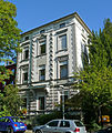
Residential building | Lousbergstrasse 16 map |
||||

|
Residential building (parts) | Lousbergstrasse 18 map |
||||

|
Residential houses | Lousbergstrasse 21, 23 map |
||||

|
Residential building | Lousbergstrasse 24 map |
||||

|
Residential building | Lousbergstrasse 26 map |
||||

|
Residential building | Lousbergstrasse 37 map |
||||

|
Residential building (parts) | Lousbergstrasse 39 map |
||||

|
Residential building | Lousbergstrasse 42b map |
||||

|
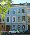
Residential houses | Lousbergstrasse 45, 47 map |
||||
|
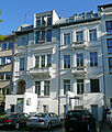
Residential building | Lousbergstrasse 51 map |
||||
|
Residential houses (parts) | Lousbergstrasse 52, 54 map |
||||

|
Residential houses | Lousbergstrasse 53, 55 map |
||||

|
Residential building | Lousbergstrasse 57 map |
||||

|
Residential building | Lousbergstrasse 59 map |
||||
|
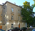
Residential building | Lousbergstrasse 61 map |
||||

|
Residential houses | Lousbergstrasse 58, 60, 62 (parts) map |
||||

|
Residential building | Lousbergstrasse 68 map |
||||

|
Residential building | Ludwigsallee 9 map |
||||

|
Residential building | Ludwigsallee 15 map |
||||

|
Residential houses | Ludwigsallee 25, 27, 29 map |
1873 | |||

|
Residential houses | Ludwigsallee 31, 33, 35 map |
||||

|
Residential building | Ludwigsallee 37 map |
||||

|
Residential building (parts) | Ludwigsallee 39 map |
||||

|
Residential houses | Ludwigsallee 39a, 39b map |
||||

|
Residential building | Ludwigaallee 43 map |
||||

|
Border wall | Ludwigsallee 43a map |
||||

|
Residential house with border wall | Ludwigsallee 45 map |
||||

|
Border wall | Ludwigsallee 47 map |
||||

|
Residential houses | Ludwigsallee 49, 51 map |
||||

|
Residential building | Ludwigsallee 53 map |
||||

|
Residential building | Ludwigsallee 55 map |
||||

|
Residential building (parts) | Ludwigsallee 57 map |
||||

|
Residential building | Ludwigsallee 59 map |
||||

|
Residential houses | Ludwigsallee 61, 63 map |
||||

|
Residential houses | Ludwigsallee 65, 67 map |
||||

|
Residential house including front garden | Ludwigsallee 69–77 map |
||||
|
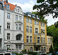
Residential houses | Ludwigsallee 99, 101 map |
former industrialist mansion, house no. 101 since 1957 used as a liaison house by the KDSt.V. Franconia Aachen | |||
 more pictures |
Marienburg Bastion ( Marienturm ) | Ludwigsallee map |
Defense tower on the old foundations of a watchtower of the outer city wall | 1300-1350 / 1512 | ||

|
Monument " Alfred von Reumont " | Ludwigsallee map |
1910 | |||

|
Street mosaic pavement and promenade | Ludwigsallee map |
||||

|
Residential houses | Lütticher Strasse 23 map |
||||

|
Residential houses | Lütticher Strasse 25 map |
||||

|
Residential houses | Lütticher Strasse 27 map |
||||

|
Residential building | Lütticher Strasse 28 map |
1841 | |||

|
Residential building | Lütticher Strasse 31 map |
||||

|
Residential building | Lütticher Strasse 35 map |
||||
 more pictures |
Jewish Cemetery | Lütticher Strasse 39 map |
In 1865 and 1878 the area was expanded to 40 m × 140 m and is still in use today | 1822 | ||

|
building | Lütticher Straße 42–56 map |
||||
|
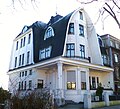
Residential building | Lütticher Strasse 139 map |
built according to plans by Krämer / Schultz | 1905 | ||

|
Residential building | Lütticher Strasse 179 map |
||||

|
Residential building | Lütticher Strasse 164 map |
||||

|
House "Haus Waldpforte" | Lütticher Strasse 240 map |
||||

|
Residential building | Lütticher Strasse 242 map |
||||

|
Residential building | Lütticher Strasse 244 map |
||||

|
Residential building | Lütticher Strasse 246 map |
||||

|
Residential building | Lütticher Strasse 248 map |
built in the homeland style . Free-standing, two-storey building with a basement made of stone masonry, flat hipped roof , white plastered facade, windows with contemporary lattice division and double folding shutters. | 1939/1940 | ||

|
"Gut Grundhaus" | Lütticher Strasse 281 map |
formerly called "Groutenhof"; first mentions around 1574 | 16th Century | ||

|
"Hochgrundhaus" | Lütticher Straße 320–322 map |
Located above the "basic house" on a formerly open viewing terrace, built by Hermann Josef Hürth as a mansion with a neo-baroque facade, central projection with turrets and portico with two columns; today the seat of a Waldorf kindergarten | 1882 | ||

|
"Gut Breitenstein" | Lütticher Strasse 569a map |
originally three-winged courtyard; The residential and utility wing were preserved. The two-storey baroque mansion made of brick with bluestone walls was given in the first half of the 19th century. a second floor with a hipped roof | First half of the 18th century | ||

|
Residential building (parts) | Lütticher Strasse 580-582 map |
||||

|
Residential building | Lütticher Strasse 586 map |
||||

|
Residential building | Lütticher Strasse 595 map |
||||

|
Residential building | Lütticher Strasse 597 map |
||||

|
Prussia. Milestone u. Prussia. Quarter milestone | Liege Street map |
||||

|
bunker | Lütticher Strasse (south Entenpfuhl) map |
Part of the west wall as part of the Aachen-Saar program; Special construction of the combat bunker standard construction type SK / 6a No. 153 with 2 m wall thickness machine gun bunker with a 6-notch dome, which is no longer available. In addition to the vestibule and the two gas locks, the bunker contains a standby room, an ammunition room, a storage room and a flanking system. The machine gun was built into the armored dome above the ammunition room. The closures do not come from the time the facility was built, but are more recent. | 1938 | ||

|
bunker | Lütticher Strasse (east of Lütticher Strasse) map |
Part of the west wall as part of the Aachen-Saar program. | 1938 | ||

|
bunker | Lütticher Straße (east of the Lütticher Straße picture) map |
Part of the west wall as part of the Aachen-Saar program. PAK bunker . Anti-tank gun installed in the southeast part behind the armored slate plate, next to the anti-tank space crew room with five beds, in front of the anti-tank space ammunition storage. The room to defend the pak driveway and the crew entrance is in front of the crew room, followed by a gas lock; The only free-standing bunker that has been preserved in its original state from the outside. | 1938 | ||
 more pictures |
Bush tunnel | Liege Street map |
Part of the Liège – Aachen railway line ; 691 m long and until 2007 the oldest railway tunnel in Germany that was still used | 1838-1843 | ||

|
Panneschopp housing estate | Lützowstrasse 1–33 map |
Settlements for factory workers and Belgian military personnel | Weimar period | ||

|
Panneschopp housing estate | Lützowstrasse 2–28 map |
Settlements for factory workers and Belgian military personnel | Weimar period | ||

|
"Gut Knipp" | Luerweg 61, 63 map |
||||

|
"Gut Ries" | Luerweg 65 map |
||||

|
"Good Caper" | Luerweg 68 map |
||||

|
"Ice mill" | Luxemburger Ring 1 card |
Part of a former watermill | 18th century | ||

|
Residential building | Mariabrunnstraße 3, 5 (parts), 7 (parts) map |
||||

|
Residential houses | Mariabrunnstrasse 16, 18 map |
||||
|
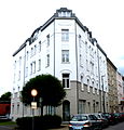
Residential building | Mariabrunnstrasse 19 map |
||||

|
Residential houses | Mariabrunnstrasse 20, 22 map |
||||

|
Residential houses | Mariabrunnstrasse 25, 27, 29 map |
||||

|
Residential houses | Mariabrunnstrasse 30, 32 map |
||||

|
Residential building (parts) | Mariahilfstraße 2b map |
||||

|
Residential houses | Mariahilfstraße 4, 6, 8 map |
||||

|
Residential building (parts) | Mariahilfstrasse 7 map |
||||

|
Residential building | Mariahilfstrasse 9 map |
||||

|
Residential houses | Mariahilfstrasse 13, 15 map |
||||

|
Residential houses | Mariahilfstrasse 17, 19 map |
||||

|
Residential houses | Mariahilfstraße 21, 23, 25 map |
||||
|
|
Residential building (parts) | Mariahilfstrasse 18 map |
||||

|
Residential houses | Mariahilfstraße 20, 22 map |
||||
|
|
Residential building (parts) | Mariahilfstrasse 27 map |
||||

|
Residential houses | Mariahilfstraße 29, 31, 33, 35 map |
||||

|
Residential building | Maria-Theresia-Allee 28 map |
||||

|
Residential building | Maria-Theresia-Allee 257 map |
||||

|
Residential building | Maria-Theresia-Allee 271 map |
||||

|
Building (parts) | Market 14-20 card |
||||

|
Residential / commercial building (parts) | Market 22 card |
||||

|
"To the golden unicorn" inn | Market 33 card |
||||

|
Guest house / residential building (parts) | Market 35 card |
||||

|
"Goldener Schwan" inn | Market 37 card |
||||
 more pictures |
Aachen City Hall | Markt 38–40 card |
built on the foundations of the Carolingian Aula regia of the Aachen Imperial Palatinate | 1349 | 0002 |
|
 more pictures |
Löwenstein House (City Administration) | Market 39 card |
1478 inhabited by Ida von Löwenstein; Old guild house, structural unit with the house "Zum Wolf"; 1905 clad with neo-Gothic plaster; 1970s extensive renovation work under the leadership of Leo Hugot and the facade-like condition restored; Baroque bluestone portal moved from the former Marienbongard monastery | 1344/45 | ||

|
Residential / commercial building | Market 42 card |
||||

|
House of Brussels residential / commercial building (Karls-Apotheke) |
Market 43 card |
built by Johann Joseph Couven on the foundations of the old "Schöffenhaus Brussels", later called "Zum wilden Mann". | 14th century / 1748 (new building) | ||

|
Residential / commercial building (parts) | Market 52 card |
||||
 more pictures |
Market fountain | Market card |
Bronze bowl based on designs by Johann Joseph Couven , cast by Franz and Peter von Trier | before 1620/1734 | ||

|
Residential houses | Martin-Luther-Strasse 4 map |
||||

|
Residential houses | Martin-Luther-Strasse 6 map |
||||

|
Residential houses | Martin-Luther-Strasse 8 map |
||||

|
Residential houses | Martin-Luther-Strasse 10, 12 map |
1891 (No. 10) | |||

|
Residential building | Matthiashofstraße 2 map |
||||

|
Residential building | Matthiashofstrasse 8 map |
||||

|
Residential building | Matthiashofstraße 19 map |
||||

|
Residential building | Matthiashofstraße 26 map |
1880 | |||

|
Office and administration building | Matthiashofstraße 28-30 map |
former "Heinrich Croon coffee roastery"; two-and-a-half-story and seven-axis brick building with a basement based on plans by Edmund Thyssen; Extension in 1907/08 | 1880 | ||

|
Residential houses | Mauerstraße 1a, 1 map |
||||

|
Residential building | Mauerstrasse 3 map |
||||

|
Residential building | Mauerstrasse 4 map |
||||

|
Residential building | Mauerstrasse 6 map |
||||

|
Residential building | Mauerstrasse 9 map |
||||

|
Residential building | Mauerstrasse 11 map |
||||

|
Residential building | Mauerstrasse 13 map |
||||

|
Residential building | Mauerstrasse 15 map |
||||

|
Residential building | Mauerstrasse 16 map |
||||

|
Residential building (parts) | Mauerstrasse 17 map |
||||

|
Residential building | Mauerstrasse 18 map |
||||

|
Residential building | Mauerstrasse 19 map |
||||

|
Residential building | Mauerstrasse 20 map |
||||

|
Residential building | Mauerstrasse 22 map |
||||

|
Residential building | Mauerstrasse 24 map |
||||

|
Residential building | Mauerstrasse 26 map |
||||

|
Residential building | Mauerstrasse 35 map |
||||

|
Residential building | Mauerstrasse 37 map |
||||

|
Residential building (parts) | Mauerstrasse 40 map |
||||

|
Residential building | Mauerstrasse 42 map |
||||

|
Residential building | Mauerstrasse 44 map |
||||

|
Residential building | Mauerstrasse 46 map |
||||

|
Residential building | Mauerstrasse 48 map |
||||

|
Residential building | Mauerstrasse 50 map |
||||

|
Residential building (parts) | Mauerstrasse 52 map |
||||

|
Residential building | Mauerstrasse 54 map |
||||

|
Residential building | Mauerstrasse 58 map |
||||

|
Residential building | Mauerstrasse 60 map |
||||

|
Residential building (parts) | Mauerstrasse 75 map |
Side wing of the former Delius cloth factory ; Four-storey brick and plaster building with a curved facade in a mixture of neo-Gothic decorative shapes and Art Nouveau elements on behalf of the cloth manufacturer Carl Delius 1982 restoration according to plans by Schwarze & Feldmann and conversion | 1906 | ||

|
Residential and commercial building | Mauerstrasse 110 map |
||||

|
Residential building | Maxstrasse 2 map |
||||

|
Residential houses | Maxstrasse 8, 10 map |
||||

|
Residential houses | Maxstrasse 12, 14, 16, 18 map |
||||

|
Residential houses | Maxstrasse 13, 15 map |
||||

|
Residential building | Mefferdatisstrasse 1–3 map |
||||
 more pictures |
Residential houses; former fish hall W. Frohn | Mefferdatisstrasse 4-6, 8 map |
Architects H. Verhein / Georg Krämer | 1906 | ||
| Wall fountain | Melatener Strasse 13 map |
|||||

|
"Institute for High Frequency and Telecommunications" | Melatener Strasse 23 map |
Architect: Karl Schlüter (State Building Administration) | |||

|
"Villa Königshügel" | Melatener Strasse 31 map |
built for the entrepreneurial couple Lammertz; Architect Carl Sieben ; today guest house of the RWTH Aachen | 1913/14 | ||

|
"Piccolino" day nursery run by the Aachen Student Union | Melatener Strasse 39 map |
former garden pavilion of Villa Lammertz | |||

|
Hall | Metzgerstrasse 60 map |
Calf slaughterhouse of the former city slaughterhouse and cattle yard in Aachen ; built according to plans by Johannes Richter , Joseph Laurent and Karl Heuser; Brick hall with flat gable roof; Emphasized central axis with a gable top in neo-renaissance forms and an inscription stone with indication of the hall function | 1894 | ||

|
office building | Metzgerstrasse 61 map |
Former management building of the former city slaughter and cattle yard; built according to plans by Johannes Richter, Joseph Laurent and Karl Heuser; two-storey brick building with half mansard roof; The structure of the facade is characterized by house stone elements and artistically forged wall anchors in the neo-renaissance style | 1894 | ||

|
Hall | Metzgerstrasse 62 map |
Beef slaughterhouse of the former city slaughterhouse and cattle yard; built according to plans by Johannes Richter, Joseph Laurent and Karl Heuser; Brick hall with flat gable roof; Emphasized central axis with a gable top in neo-renaissance forms and an inscription stone with indication of the hall function | 1894 | ||

|
building | Metzgerstrasse 65 map |
Show office of the former municipal slaughterhouse and cattle yard; built according to plans by the town planning officer Kirchbauer | 1928 | ||

|
Hall | Metzgerstrasse 66 map |
Pig slaughterhouse of the former city slaughterhouse and cattle yard; built according to plans by Johannes Richter, Joseph Laurent and Karl Heuser; Brick hall with a flat gable roof | 1894 | ||

|
building | Metzgerstrasse 69 map |
Kuttlerei of the former city slaughterhouse and cattle yard; built according to plans by Johannes Richter, Joseph Laurent and Karl Heuser; arranged at the gable to the square with three-axis narrow sides and elevated central axis; Elevated middle part of the gable with large lunette windows (bricked up) and flat gable roof | 1894 | ||

|
Wall | Metzgerstrasse map |
Wall of the former municipal slaughterhouse and cattle yard; built according to plans by the town planning officer Kirchbauer | 1928 | ||

|
Clock tower / meat collection hall | Metzgerstrasse map |
Part of the former municipal slaughterhouse and cattle yard; Built according to plans by the town planning officer Kirchbauer; Hall with nine reinforced concrete arch girders and orthogonally proportioned brick exterior walls as well as a cement shell roof on purlins ; Four-and-a-half-story tower with elevated tower corner area | 1926-1930 | ||

|
Sports and company buildings | Minoritenstrasse 7 map |
former transformer station of the city power supply; Architect Philipp Kerz; after 1977 it was partly used as a sports hall and a new substation | 1925 | ||

|
Residential building | Minoritenstrasse 8 map |
||||

|
Residential houses | Mörgensstrasse 4, 6 map |
||||

|
Residential building | Mörgensstrasse 5 map |
Former town house of the Moirke family, later part of the Nellessen cloth factory and now part of the Alexianer Hospital ; built according to plans by Johann Joseph Couven | Mid-18th century | ||

|
Residential houses (parts) | Mörgensstrasse 11, 13 map |
||||

|
Residential houses | Mörgensstrasse 14, 16 map |
||||

|
Residential houses | Mörgensstrasse 15, 17 map |
||||

|
Chimney of the former cloth factory C. Nellessen, JM Sohn | Mörgensstrasse 24 map |
General renovation after the Second World War by René von Schöfer | 1825-1830 | ||

|
Residential houses (parts) | Monheimsallee 6 map |
||||

|
Residential houses (parts) | Monheimsallee 8, 10 map |
||||

|
Residential houses | Monheimsallee 12, 14, 16 map |
||||
|
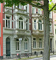
Residential houses | Monheimsallee 13, 15 map |
||||

|
Residential houses | Monheimsallee 21, 23 map |
||||

|
Residential building | Monheimsallee 25 map |
||||

|
Residential houses | Monheimsallee 35, 37 map |
||||
 more pictures |
New Kurhaus Aachen | Monheimsallee 44 map |
has housed the Aachen casino since 1976 | |||
 more pictures |
Quellenhof and Kurmittelhaus | Monheimsallee 52 map |
built according to plans by the Munich architects Karl Stöhr and Theodor Fischer | 1914-1916 | ||

|
Residential building | Monheimsallee 54 map |
||||

|
Residential building | Monheimsallee 58 map |
||||

|
Residential building | Monheimsallee 60 map |
||||

|
Residential building | Monheimsallee 62 map |
1898 | |||

|
Residential building (parts) | Monheimsallee 75 map |
||||

|
Residential building | Monheimsallee 77 map |
||||

|
Residential building | Monheimsallee 81 map |
||||

|
Residential houses | Monheimsallee 85, 87 map |
||||

|
Residential houses | Monheimsallee 91, 93 map |
||||
 more pictures |
kiosk | Monheimsallee map |
single-storey plastered building in expressionistic forms, roof with pyramid-shaped, slate-covered top and surrounding brickwork railing; originally built as a transformer house; Architect Philipp Kerz; later used as a kiosk, since 1989 as a storage room. Restored in 1988 and 2017 | 1925 | ||

|
David Hansemann memorial | Monheimsallee map |
Monument to merchant and banker David Hansemann | 1888 | ||

|
Lenné monument | Monheimsallee map |
Memorial to garden artist and landscape architect Peter Joseph Lenné | |||
 more pictures |
Park of the Kurpark Aachen | Monheimsallee map |
Part of the city garden of Aachen | 1880 | ||

|
Farwick Park | Monheimsallee map |
Part of the Aachen city garden, acquired and laid out to compensate for the construction of the Quellenhof | 1926/27 | ||
 more pictures |
Park of the former Protestant cemetery Güldenplan | Monheimsallee map |
Used as a cemetery until 1889, since 1945 part of the Aachen city garden | 1605 | ||

|
promenade | Monheimsallee map |
Built in 1870, greening plan designed by Peter Joseph Lenné, but only implemented 20 years later | 1870-1890 | ||

|
Residential building | Morillenhang 1 card |
||||

|
Residential houses | Mostardstrasse 15, 17, 19 (parts of) map |
||||

|
Residential houses (parts) | Mostardstrasse 20, 22 map |
||||
 more pictures |
Catholic parish church of St. Foillan | Münsterplatz 1 map |
Rebuilding according to old plans | 1482; after 1888 | ||

|
Residential building | Münsterplatz 2 map |
||||

|
Residential building (parts) | Münsterplatz 6 map |
||||

|
Building Sparkasse Aachen (parts) | Münsterplatz 7-9 card |
Architect Wilhelm Kirchbauer ; three-storey building with wide gables and arcades on the ground floor | 1914-15 | ||

|
Residential houses | Münsterplatz 10, 11 map |
||||

|
Residential houses | Münsterplatz 12, 13 map |
||||

|
Residential houses | Münsterplatz 14–15 card |
||||

|
Residential building (parts) | Münsterplatz 16 map |
||||

|
Residential houses | Münsterplatz 18, 19 map |
No. 19: built according to plans by Johann Joseph Couven | Mid 18th century (No. 19) 1899 (No. 18) | ||
|
|
Residential building (parts) | Münsterplatz 20 map |
built according to plans by Johann Joseph Couven | Mid-18th century | ||

|
Residential building | Münsterplatz 27 map |
||||

|
Residential building (parts) | Münsterplatz 28 map |
||||
 more pictures |
Dom | Munsterplatz map |
Okotogon 8th century; Choir hall between 1355 and 1414; Side chapels and westwork in the 18th century. | from 8th century | 0001 |
|
 more pictures |
Vinzenzbrunnen on the Münsterplatz | Munsterplatz map |
built to designs by Friedrich Joseph Ark ; Sculpture work: Wilhelm Josef Wings and Gottfried Götting | 1847 | ||

|
Wayside shrine | Muffeter Weg map |
||||
 more pictures |
"House Monheim" | Muffeter Weg 3 (parts) map |
originally built as "Haus Marienhöhe" by architect Hermann Joseph Hürth for the manufacturer Leonard Monheim ; Extensively rebuilt in 1913; formerly Faculty of Electrical Engineering and Information Technology at RWTH Aachen | 1873-1875 | ||

|
Residential building | Muffeter Weg 21 map |
||||

|
Residential houses | Muffeter Weg 36, 38, 40, 42 map |
Residential construction houses; clad all around with roof tiles for climatic reasons and because of the free altitude at the time | 1925-1928 | ||

|
Residential houses | New port 2c, 2d | ||||

|
Bluestone portal | New gate 3-7 card |
||||

|
Residential building (parts) | Neupforte 4 card |
||||

|
Residential building | New gate 6 card |
||||

|
Residential houses (parts) | Neupforte 10, 12 card |
||||

|
Residential building | Neupforte 14 card |
||||

|
Residential building (parts) | Neupforte 16 card |
||||

|
Residential houses | Neupforte 18, 20, 22, 24, 26 map |
Houses 24 and 26 built according to plans by Johann Joseph Couven | |||

|
Residential building | Nikolausstrasse 17 map |
||||

|
Residential building | Nizzaallee 2 map |
Art Nouveau villa, built for Otto von Pelser-Berensberg by architect Carl Sieben ; Corporation house of the VDSt Aachen-Breslau II | 1910 | ||

|
Residential building | Nizzaallee 4 map |
Art Nouveau villa, built for Otto von Pelser-Berensberg by architect Carl Sieben; Corporation house of the KDSt.V. Marchia | 1910 | ||

|
Residential houses | Nizzaallee 45, 47, 47a map |
||||

|
Residential houses | Nizzaallee 49, 51 map |
||||

|
Residential houses | Nizzaallee 59, 61, 63 map |
||||

|
Residential houses | Nizzaallee 65, 67, 69 map |
||||

|
Residential building (parts) | Nizzaallee 75 map |
||||

|
Residential building | Nizzaallee 77 map |
||||

|
Residential houses | Nizzaallee 79, 81 map |
||||

|
Residential houses | Nizzaallee 83, 85 map |
||||

|
Residential building (parts) | Nizzaallee 87 map |
||||

|
Residential houses | Noppiusstraße 1, 3 map |
||||

|
Residential building | Noppiusstrasse 7 map |
||||

|
Residential houses | Noppiusstraße 11, 13, 15 map |
||||

|
Residential houses | Noppiusstraße 12, 14 map |
||||

|
Residential building | Noppiusstrasse 19 map |
||||

|
Residential building | Noppiusstrasse 24 map |
||||

|
Residential building | Oberstrasse 1 (/ Steinkaulstrasse 36) map |
||||

|
Restaurant / residential building | Ottostraße 6 map |
||||

|
Residential houses | Ottostraße 9, 11 map |
||||

|
Residential houses | Ottostraße 18, 20 map |
||||

|
Residential building (parts) | Ottostraße 19 map |
||||

|
Residential building | Ottostraße 21 map |
||||

|
Residential building | Ottostraße 22 map |
||||

|
Residential building (parts) | Ottostraße 23 map |
||||

|
Residential building | Ottostraße 27 map |
||||

|
Residential building (parts) | Ottostraße 28 map |
||||

|
Residential houses | Ottostraße 32, 34 map |
||||

|
Residential houses | Ottostraße 46, 46a map |
||||

|
Residential building | Ottostrasse 49 map |
||||

|
former cloth factory Wilhelm Peters & Co. | Ottostraße 50-62 map |
four-storey brick building with a hipped roof, built in four double axes with pilaster strips | Mid 19th century | ||

|
Residential houses | Ottostraße 51 map |
||||

|
Residential building | Ottostraße 57 map |
||||

|
Residential building | Ottostraße 63 map |
||||

|
Residential houses | Ottostraße 69, 71 map |
||||

|
Residential houses | Ottostraße 73, 75 map |
||||

|
Residential building | Ottostraße 78 map |
||||

|
Residential houses | Ottostraße 80, 82 map |
||||

|
Residential building | Ottostrasse 79 map |
||||

|
Residential building (parts) | Ottostraße 84 map |
||||

|
Residential building | Ottostraße 88–90 map |
former M. Marx cloth factory; around 1887 conversion to a residential complex by Gerhard Rehm ; The six-axis factory building resulted in two three-storey three-window houses, facade in the neo-renaissance style, further conversions followed, later including the former studio of Erich von den Driesch | around 1870 | ||

|
Residential building | Ottostrasse 92 |
Former monuments
| image | designation | location | description | construction time | Registered since |
Monument number |
|---|---|---|---|---|---|---|

|
Residential building | Lütticher Strasse 599 map |
no longer under monument protection since 2011 | |||

|
Residential building | Martin-Luther-Strasse 11 map |
no longer under monument protection since 2016 | |||

|
Residential building | Ottostrasse 81 map |
no longer under monument protection since 2011 |
See also
- List of ground monuments in Aachen
- List of street names in Aachen-Mitte
- Relocated buildings in Aachen
- Works by Jakob Couven
- Works by Johann Joseph Couven
Web links
- List of monuments of the city of Aachen (PDF; 129 kB)
- Architectural monuments in Aachen-Mitte in the Aachen geoportal
Individual evidence
- ↑ Entry on the foundry institute of the RWTH Aachen in the database " KuLaDig " of the Rhineland Regional Association
- ↑ Detailed description in Rheinische Industriekultur .
- ↑ Detailed description in Rheinische Industriekultur .
- ^ Hochbunker Junkerstraße .
- ↑ Detailed description in Rheinische Industriekultur .
- ↑ Entry on residential buildings of RWTH Aachen University in Kármánstraße in the database " KuLaDig " of the Rhineland Regional Association
- ^ Entry on the former Couven-Gymnasium and Couvenhalle in the database " KuLaDig " of the Rhineland Regional Association
- ↑ Detailed description in Rheinische Industriekultur .
- ↑ The old Aachen residential building. Arnold 1930.
- ↑ My friend Hetjens. Publication of the Hetjens Museum, accessed on May 6, 2014.
- ↑ Detailed description in Rheinische Industriekultur .
- ↑ Bunker in the city forest near Entenpfuhl .
- ↑ Detailed description in Rheinische Industriekultur .
- ↑ Detailed description in Rheinische Industriekultur .
- ↑ Entry on the Institute for Electrical Telecommunications and High Frequency Technology at RWTH Aachen University in the " KuLaDig " database of the Rhineland Regional Council
- ↑ Entry on the guesthouse Königshügel of RWTH Aachen in the database " KuLaDig " of the Rhineland Regional Association
- ^ Entry on the RWTH Aachen day nursery in the " KuLaDig " database of the Rhineland Regional Association
- ↑ Detailed description in Rheinische Industriekultur .
- ↑ Detailed description in Rheinische Industriekultur .
- ^ Entry on the Institute for Materials in Electrical Engineering at RWTH Aachen University in the " KuLaDig " database of the Rhineland Regional Council
