List of architectural monuments in Aachen-Mitte (P – Z)
The list of architectural monuments in Aachen-Mitte (P – Z) contains the listed buildings in the area of the Aachen-Mitte district in North Rhine-Westphalia (as of September 27, 2016). These architectural monuments are entered in the monuments list of the city of Aachen; The basis for the admission is the Monument Protection Act North Rhine-Westphalia (DSchG NRW).
Monuments
This partial list of the list of monuments in Aachen includes the monuments in Aachen-Mitte sorted alphabetically according to street names from P to Z. Other parts lists are available for the road name of A to H and I to O . There are separate partial lists for the monuments in Burtscheid , in Forst and in the Franconian Quarter .
| image | designation | location | description | construction time | Registered since |
Monument number |
|---|---|---|---|---|---|---|

|
Residential building | Pass road 1 map |
||||

|
Residential building | Pass road 10 map |
||||

|
Residential houses | Pass road 14, 16 map |
||||

|
Residential houses | Pass road 18, 20, 22 map |
||||

|
Residential building | Pass road 25-27 map |
former " Froebel seminar"; 2-storey villa-like complex with mansard roofs, corner turrets, blind gables; plastered, base with sandstone facing, ashlar structure, historicizing, mostly neo-baroque decorative motifs; Architect: Georg Frentzen | |||

|
Residential building | Pass road 78 map |
||||
|
|
"Good clay cool" | Pass road 106, 108, 108a, 108b, 108c map |
The “Lehmkühlchen” estate is noted on a map from 1770. The complex consists of two building blocks, which are cut diagonally towards the pass road with classical gables. The house where Aachen was born and another business enterprise are housed in the right wing, while the left part now houses four single-family houses. | |||

|
Lattice bridge in the city garden of Aachen | Pass road map |
||||

|
Congress memorial in the city garden of Aachen | Pass road map |
||||

|
Stadtgarten / Kurgarten park | Pass road map |
Part of the Aachen city garden | 1880 | ||

|
Farwickpark park | Pass road map |
Part of the Aachen city garden, acquired and laid out to compensate for the construction of the Quellenhof | 1926/27 | ||

|
Park, former Protestant cemetery; " Güldenplan cemetery " | Pass road map |
since 1945 part of the Aachen City Garden, Aachen's oldest evangelical cemetery, used as a cemetery until 1889 | 17th century | ||

|
Residential houses | Paulusstrasse 1, 3 | ||||

|
Residential houses | Paulusstrasse 2, 4 map |
||||

|
Residential building | Paulusstrasse 19 map |
||||
 more pictures |
Catholic parish church of St. Peter | Peterskirchhof map |
built according to plans by Laurenz Mefferdatis | 1748/49 | ||

|
Residential building | Pippinstrasse 1 map |
built according to plans by Carl Sieben and Arnold Königs ; three storeys, five axes, colossal pilasters emphasizing the central axes. Ground floor: ashlar, otherwise plastered facade divided into ashlar, decor: neoclassicism | 1912 | ||

|
"Herffs-Erb" | Pommerotter Weg 15 map |
||||

|
Residential building | Pontdriesch 9 card |
||||

|
Residential houses | Pontdriesch 15, 17 map |
||||

|
Residential building (parts) | Pontdriesch 21 card |
||||

|
Residential building | Pontdriesch 23 map |
||||

|
Restaurant / residential building | Pontstrasse 2 map |
||||

|
Residential / commercial building | Pontstrasse 4 map |
||||

|
Residential building | Pontstrasse 5 / Augustinergasse 32 map |
||||

|
Residential / commercial building | Pontstrasse 6 map |
||||
 more pictures |
St. Katharina, monastery church of the Augustinian Canons ; today Aula Carolina | Pontstrasse 7 map |
1663 | |||

|
Residential / commercial building | Pontstrasse 8 map |
||||

|
Residential / commercial building | Pontstrasse 11 map |
||||
 more pictures |
Great House of Aachen (newspaper museum) | Pontstrasse 13 map |
built by Heinrich Dollart ; 1828 converted into a girls' school by Adam Franz Friedrich Leydel ; 1851–54 new conversion to police headquarters by Friedrich Joseph Ark | 1495 | ||

|
Residential houses | Pontstrasse 19, 21 map |
||||

|
Residential / commercial building | Pontstrasse 22 map |
||||

|
Restaurant / residential building | Pontstrasse 23 map |
||||

|
Residential / commercial building (parts) | Pontstrasse 24 map |
||||

|
Residential / commercial building | Pontstrasse 26 map |
||||

|
Residential / commercial building | Pontstrasse 28 map |
||||

|
Residential / commercial building | Pontstrasse 29–37 map |
||||

|
Residential / commercial buildings | Pontstrasse 30, 32 map |
||||

|
Paier wall painting | Pontstrasse 39 map |
Graffiti by Klaus Paier at the back entrance of Café Kittel | |||
|
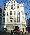
building | Pontstrasse 40–42 map |
||||

|
Building (parts) | Pontstrasse 41 map |
known as the Humboldt House of the RWTH Aachen; Part of the Carmelite Convent | 1660 | ||
 more pictures |
Theresien Church | Pontstrasse 41 map |
built according to plans by Laurenz Mefferdatis ; Part of the Carmelite Convent | 1739-1745 | ||

|
Residential / commercial building | Pontstrasse 46 map |
||||

|
RWTH building | Pontstrasse 51–53 map |
Former Aachen pawnshop with a Lombard hall attached to the rear , built according to plans by Laurenz Mefferdatis , owner of RWTH Aachen University since 1962 | around 1705 | ||

|
Residential / commercial building | Pontstrasse 60 map |
||||

|
Residential / commercial buildings | Pontstrasse 62, 64 map |
||||

|
Residential / commercial building | Pontstrasse 66-68 map |
||||

|
"Magellan" Inn (parts) | Pontstrasse 78 map |
former Teutonic Order Commander St. Aegidius ; Of the new building, which included the Aegidius Chapel from the first half of the 14th century, only parts of the surrounding wall are preserved | 14th / 17th century | ||

|
Restaurant / residential building | Pontstrasse 100 map |
||||

|
Residential building (parts) | Pontstrasse 117 map |
Paul Julius Reuter founded his news office here in 1850 | |||

|
Restaurant / residential building | Pontstrasse 121 map |
||||

|
Restaurant / residential building | Pontstrasse 123 map |
||||

|
Residential / commercial buildings | Pontstrasse 125, 127 map |
||||

|
Rectory of the Holy Cross | Pontstrasse 148 / Kreuzherrenstrasse 1 map |
Rebuilt in 1977 under the direction of Hans Heinemann | 1738 | ||

|
Residential building | Pontstrasse 151 map |
||||

|
Restaurant / residential building | Pontstrasse 154 map |
||||

|
Restaurant / residential building | Pontstrasse 156–158 map |
||||
|
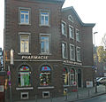
Residential / commercial building | Pontstrasse 157 map |
||||

|
Residential building | Pontstrasse 182 map |
Current use: Mexican restaurant ("TOMS TACOS"), preserved vaulted cellar and preserved, restored front building, modern extension on the ground floor at the rear | |||
 more pictures |
Parish Church of the Holy Cross | Pontstrasse map |
Church of the Order of the Holy Cross ; New building in early Gothic style based on plans by Joseph Buchkremer | 1363-1372; New building 1898–1902 | ||
 more pictures |
Ponttor | Ponttor card |
1300-1350 | |||

|
Residential houses | Preusweg 1, 3 map |
||||

|
Residential houses | Preusweg 5 map |
||||

|
Residential houses | Preusweg 36, 38 map |
two-storey, freestanding, plastered house in Bauhaus style with flat roof | 1933 | ||

|
Residential building | Preusweg 40 map |
two-storey, freestanding, plastered house in Bauhaus style with flat roof | 1933 | ||

|
Residential houses | Preusweg 42, 44 map |
two-storey, freestanding, plastered house in Bauhaus style with flat roof | 1933 | ||

|
Residential building | Preusweg 46 map |
two-storey, freestanding, plastered house in Bauhaus style with flat roof | 1933 | ||

|
Residential building | Preusweg 68 map |
||||

|
Residential building | Preusweg 111 map |
||||

|
"Forsthaus Adamshäuschen" | Preusweg 129 map |
||||

|
Bilal mosque | Professor – Pirlet – Straße 20 map |
1964-1966 | |||

|
Residential houses | Promenadenstrasse 25, 27, 29 (parts of) map |
||||

|
Residential houses (parts) | Promenadenstraße 34 (parts), 36 (parts), 38 map |
||||

|
Residential building | Promenadenstrasse 35 map |
||||

|
Residential houses | Promenadenstrasse 40, 42, 44 map |
||||

|
Residential houses | Promenadenstrasse 46, 48 map |
||||

|
Residential building | Promenadenstrasse 41 map |
||||

|
Residential building (parts) | Rehmplatz 7 card |
||||

|
Residential building | Rehmplatz 9 card |
||||

|
Residential building | Rehmplatz 16 card |
||||

|
Marian column | Rehmplatz card |
Aachen's first religious monument, design by city architect Joseph Laurent , executed in sandstone by sculptor Wilhelm Pohl | 1887 | ||

|
Residential houses | Reihstrasse 4, 6 map |
||||

|
Residential buildings | Reimanstrasse 2–12 map |
||||

|
Residential houses | Reimanstrasse 14 map |
||||

|
Residential houses | Reimanstrasse 16, 18 map |
No. 18: 1887 | |||

|
Residential building | Reimanstrasse 19 map |
||||

|
Residential houses | Reimanstrasse 20, 22 map |
||||

|
Residential building | Reimanstrasse 23 map |
||||

|
Residential houses | Reimanstrasse 24, 26 map |
||||

|
Residential building (parts) | Reimanstrasse 25 map |
||||

|
Residential houses | Racecourse 1 card |
||||

|
Residential houses | Racecourse 3 card |
||||

|
Residential houses | Racecourse 5, 7 card |
||||

|
Residential houses | Rethelstrasse 4 | ||||

|
Residential houses | Rethelstrasse 6 | ||||

|
building | Ritter-Chorus-Straße 1–3 card |
||||
 more pictures |
Parts of the Aachen Cathedral Singing School | Ritter-Chorus-Straße 5 card |
1960 | |||

|
Residential houses | Robensstrasse 36, 38, 40, 42 map |
||||

|
Residential houses | Robensstrasse 46, 48 map |
||||

|
Residential houses | Robensstrasse 50 map |
||||

|
Residential houses | Robensstrasse 52, 54, 56 map |
1926 (No. 52); 1907 (No. 54) | |||

|
Residential houses | Robensstrasse 57, 59 map |
||||

|
Residential building (parts) | Robensstrasse 58 map |
||||

|
Residential houses | Robensstrasse 61, 63 map |
||||

|
Residential houses | Robensstrasse 67 (parts), 69 map |
||||

|
Residential building | Rochusstrasse 1 map |
||||

|
Residential building | Rochusstrasse 20 map |
||||

|
Residential houses | Rochusstrasse 21, 23, 25 map |
built according to plans by Arnold Königs ; No. 21: four floors, three axes, plastered facade, decor: neo-baroque. No. 23: four floors, two axes. Risalit in the broader right axis: bay window over two floors with balcony, gable. Plastered facade, decor: neo-Gothic; House where Hans Königs was born | around 1900 | ||

|
Residential building | Rochusstrasse 25 map |
||||

|
Residential houses | Rochusstrasse 26, 28 map |
Architect: Arnold Königs; four floors, three axes. Bay windows and / or balconies each encompass two axes. Plastered facade, decor: Neo-Baroque and Art Nouveau. | 1900-1905 | ||

|
Residential building (parts) | Rochusstrasse 30 map |
Architect: Arnold Königs; four floors, three axes. Bay windows and / or balconies each encompass two axes. Plastered facade, decor: Neo-Baroque and Art Nouveau. | 1905 | ||

|
Residential building | Rochusstrasse 31 map |
1898 | |||

|
Residential building | Rochusstrasse 33 map |
||||

|
Residential building | Rochusstrasse 37 map |
||||

|
Residential building | Rochusstrasse 39 map |
||||

|
Residential building | Rochusstrasse 41 map |
||||

|
Residential building (parts) | Rochusstrasse 43 map |
||||

|
Residential building | Rochusstrasse 44 map |
||||

|
Residential building | Rochusstrasse 45 map |
||||

|
Residential building (parts) | Rochusstrasse 46 map |
||||

|
Residential building | Rochusstrasse 47 map |
||||

|
Residential building | Rochusstrasse 48 map |
Architect: Arnold Königs; Four floors, 5: 3 axes, corner axis sloping with a bay window over two floors and a balcony. Mansard roof, clinker plaster facade, decor: neo-renaissance and neo-baroque. | around 1903 | ||

|
Residential building (parts) | Rochusstrasse 49 map |
||||

|
Residential building | Rochusstrasse 51 map |
||||

|
Residential building | Rochusstrasse 53 map |
||||

|
Residential building | Rochusstrasse 55 map |
||||

|
Residential houses | Rochusstrasse 57 map |
||||

|
Residential building | Rochusstrasse 63 map |
||||

|
Residential building | Römerstrasse 9 |
|
|||
 more pictures |
Administrative building of the city of Aachen | Römerstrasse 10 map |
“ House Border Guard ”; Steel frame construction 1925 by Emil Fahrenkamp on behalf of Rudolf Lochner ; Completed in 1930 by Jacob Koerfer | 1925-1930 | ||

|
Residential building (parts) | Römerstrasse 19 | ||||

|
Residential houses | Römerstrasse 25, 27 | ||||

|
Residential building | Römerstrasse 35 | ||||

|
Residential building | Roermonder Strasse 2 map |
||||

|
Residential building (parts) | Roermonder Strasse 27 map |
||||

|
Residential building | Roermonder Strasse 94 (parts of) map |
||||

|
Residential building | Rolandstrasse 1 map |
||||

|
Residential building | Rolandstrasse 6 map |
||||

|
Residential houses | Rolandstrasse 10a map |
||||

|
Residential houses | Rolandstrasse 12, 14 | ||||

|
Residential houses | Rolandstrasse 16 | ||||

|
Residential houses | Rolandstrasse 18, 20, 22 map |
||||

|
Residential building | Rolandstrasse 28 map |
Architect Albert Schneiders | 1910-1912 | ||

|
Residential building | Rolandstrasse 30, 32, 34 map |
Architect Albert Schneiders | 1910-1912 | ||

|
Residential building | Rolandstrasse 36, 38, 40 map |
||||

|
Residential building | Rolandstrasse 42 map |
||||

|
Residential building | Ronheider Weg 10 map |
||||

|
Residential building | Ronheider Weg 16 map |
||||

|
"Gut Martelenberg" | Ronheider Weg 77 map |
||||

|
Residential building | Rosstrasse 1–3 map |
||||

|
Residential building | Rosstrasse 7 map |
||||

|
Residential building (parts) | Rosstrasse 9 map |
||||

|
north-east. Rear building, south-west. Rear building and bridge former needle factory | Rosstrasse 11–13 (parts of) map |
former needle factory Josef Zimmermann GmbH ; Hs no. 11 built according to plans by Johann Joseph Couven | Middle of the 18th century (No. 11), around 1820 (No. 13) | ||

|
Residential houses | Rosstrasse 19, 21, 23, 25 map |
||||

|
Residential houses | Rosstrasse 27 map |
||||

|
Residential houses | Rosstrasse 29 map |
||||

|
Residential houses | Rosstrasse 31, 33, 35 map |
Portal HsNr. 33 built according to plans by Johann Joseph Couven | |||

|
Residential houses | Rosstrasse 37, 39 map |
||||

|
Residential building (parts) | Rosstrasse 41 map |
former seat of the J. Fellinger & Sons dye works; | 1734 | ||

|
Residential building | Rosstrasse 59 map |
||||

|
Residential building (parts) | Rosstrasse 61 map |
||||

|
Residential building | I. Rote-Haag-Weg 38 map |
||||
 more pictures |
Aachen Forest Stadium | I. Rote-Haag-Weg 68 map |
||||

|
"Gut Waldhausen" | I. Rote-Haag-Weg 70 (parts) map |
Originally consisting of two parallel wings, the estate was expanded from 1947 to 1950 to form a three-wing complex. Two-storey, seven-axle residential building with the historic utility wing made of brick with bluestone walls. | 1799 | ||

|
Residential building | II. Rote-Haag-Weg 28 map |
||||

|
Residential building | Rudolfstrasse 41 map |
||||

|
Residential building | Rudolfstrasse 77 map |
||||

|
Residential houses | Rütscherstraße 40, 42 map |
||||

|
Residential houses | Rütscherstraße 66, 68 map |
||||

|
Residential building (parts) | Rütscherstraße 72 map |
||||

|
Residential houses | Rütscherstraße 84, 86, 88 map |
||||

|
"Gut Berg" | Rütscherstraße 224 map |
built on much older foundations than a white muddy two-storey house, extended in the 19th century | 1811 | ||

|
"Good Oak" | Rütscherstraße 257 map |
built on much older foundations than a three-wing brick courtyard | 18th / 19th century | ||

|
school | Saarstrasse 66 map |
||||

|
Residential houses | Saarstrasse 78, 80-82 map |
||||

|
Residential building | Saarstrasse 86 map |
||||

|
Residential building | Saarstrasse 88 map |
||||

|
Residential building | Saarstrasse 90 map |
||||

|
Residential building | Saarstrasse 98 map |
||||

|
Residential houses | Saarstrasse 100, 102 map |
||||
 more pictures |
Monastery church of the oblates ; donated by Ludwig the Pious | Salvatorberg 1 map |
re-Romanesque restored by city architect Joseph Laurent | 9th century; New building 1883–1885 | ||

|
School building VHS Aachen | Sandkaulbach 13–15 map |
1889 | |||

|
Chamber of Crafts Aachen | Sandkaulbach 17-21 map |
||||

|
Residential / commercial building | Sandkaulstrasse 46 map |
||||

|
Residential building | Sandkaulstrasse 53 map |
Architect: Arnold Königs; four-storey three-axle house with a two-storey central bay window, a balcony and a plastered facade | 1905 | ||

|
Residential / commercial building | Sandkaulstrasse 60 map |
||||
|
|
Residential building (parts) | Sandkaulstrasse 63 map |
Street-side facade and street-side roof | |||

|
Residential building | Sandkaulstrasse 66-68 map |
||||

|
Residential building | Sandkaulstrasse 67 map |
||||
 more pictures |
Catholic parish church St. Josef ; Holy Sepulcher | St. Josefs-Platz map |
1894-1898 | |||

|
Residential houses | Disk Road 12-14 map |
||||

|
Administration building | Disk Road 16 map |
||||

|
High bunker | Disk road map |
Three-storey high bunker with flat roof as a reinforced concrete construction in solid construction. Architect: Wilhelm Schmitz-Gilles, made by Derichs & Konertz with prisoners of war of the Building Battalion 35. It was subordinate to the Office for Civil Protection and was in operation until 1989 | 1941-1943 | ||

|
Residential building | Schildstrasse 7 map |
||||

|
Residential houses | Schildstrasse 11, 13 map |
||||

|
Residential houses (parts) | Schildstrasse 12, 14 map |
||||

|
Residential building | Schildstrasse 18 map |
||||

|
Residential building | Schildstrasse 25 map |
||||

|
Residential houses | Schillerstraße 63, 65, 67, 69, 71 map |
1908 | |||

|
Reiff Museum including Rococo portal in room R229 | Schinkelstrasse 1–3 map |
built as a testamentary legacy from Franz Reiff | between 1902–1905 | ||

|
Rogowski Institute | Schinkelstrasse 2, 4-6 map |
Architect: Erwin Knopp in the New Objectivity style. Three-story longitudinal wing with a basement in eight axes, main entrance with a staircase in front and cantilevered rain protection. Two-storey transverse wing in three axes, plastered masonry, flat roof. Original fittings inside: rear entrance door, vestibule and staircase dividing doors on the basement, staircase dividing doors on the ground floor and tiled handrail in the stairwell. | 1925-1929 | ||

|
Residential building | Schmiedstrasse 2 map |
||||

|
Residential building | Schmiedstrasse 6 | ||||

|
Residential building | Schmiedstrasse 9 | ||||

|
Residential building | Schützenstrasse 2 map |
||||

|
Residential houses | Schützenstrasse 12, 14 map |
||||

|
Residential building (parts) | Schützenstraße 17 (parts), 19 map |
||||

|
Residential building | Schützenstrasse 23 map |
||||

|
Residential building | Schumacherstrasse 1 map |
||||

|
Residential building | Schumacherstraße 6 (parts of) map |
||||

|
Residential building (parts) | Schumacherstrasse 7 map |
||||

|
Residential building | Schumacherstrasse 8 map |
||||
|
|
Residential building | Schumacherstrasse 9 map |
||||

|
Residential houses | Sedanstrasse 1, 3, 5, 7 map |
||||

|
Residential houses | Sedanstrasse 9, 11 map |
||||

|
Residential houses | Sedanstrasse 13, 15, 17, 19 map |
||||

|
Residential houses | Sedanstrasse 16, 18 map |
||||

|
Residential houses | Sedanstrasse 23, 25, 27 map |
||||

|
Residential houses | Sedanstrasse 24, 26, 28 map |
||||

|
Residential houses | Sedanstrasse 32, 34, 36 map |
||||
|
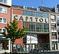
Capitol cinema | Rope trench 8 card |
||||

|
Residential building | Seilgraben 16-18 map |
||||

|
Residential building (parts) | Rope trench 32 card |
New building in couven style; During the construction of the rear building, parts of the former Fey house, which was destroyed in 1944, were relocated. | 1949 | ||

|
Ramp and grille | Seilgraben, next to No. 34 card |
Entrance area of the former "House Fey" | |||

|
Residential buildings | Sigmundstrasse 9–17 map |
||||

|
Residential buildings | Sigmundstrasse 22-24 map |
||||

|
"Gut Muffet" | Simpelvelder Straße 48 map |
restored three-winged, white-washed former courtyard complex; Modifications in the 20th century by Fritz Eller | 18./19. Century | ||

|
Residential houses | Soerser Weg 24, 26 map |
||||

|
Residential building (parts) | Spitzgäßchen 2 card |
"Zur Mark" house with pointed gable and bluestone framework; Fully restored in 1954 | 1656 | ||

|
Congressional Memorial |
City garden Aachen map |
Designed by Johann Peter Cremer in 1822 ; Elaborated by Schinkel / Cremers in 1837 ; Continued in 1839 by Friedrich Joseph Ark . | 1822, 1837, 1839 | ||

|
Residential building | Steinkaulstrasse 11 map |
||||

|
Residential building (parts) | Steinkaulstrasse 13 map |
||||
|
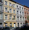
Residential houses | Steinkaulstrasse 15, 17 map |
||||

|
Residential houses | Steinkaulstrasse 19, 21, 23 map |
||||

|
Residential houses (parts) | Steinkaulstrasse 16 (1), 16 (2), 16 (3) map |
||||

|
Residential building | Steinkaulstrasse 27 map |
||||

|
Residential building; Mies van der Rohe's birthplace | Steinkaulstrasse 29 map |
||||

|
Residential houses | Steinkaulstrasse 31, 33 map |
||||

|
Residential building | Steinkaulstrasse 35 map |
||||

|
Residential building | Steinkaulstrasse 36 / Oberstr. 1 card |
||||

|
Residential building (parts) | Steinkaulstrasse 37 map |
||||

|
Residential houses | Steinkaulstrasse 40, 42 map |
||||

|
Residential building | Steinkaulstrasse 41 map |
||||

|
Residential building (parts) | Steinkaulstrasse 44 map |
||||

|
Residential building | Steinkaulstrasse 52 map |
||||
| Signal box | Signal box R2 Aachen West | |||||
| Signal box | Signal box R3 Aachen West | |||||

|
Residential building | Stephanstrasse 1 map |
||||

|
Residential houses | Stephanstraße 2 (parts), 2a, 4 map |
||||

|
Residential building | Stephanstrasse 8 map |
||||

|
Residential houses | Stephanstraße 9, 11, 13 map |
||||
 more pictures |
Building Aachener eye clinic | Stephanstraße 16-20 map |
Architect Eduard Linse | 1887/88 | ||

|
Residential houses | Stephanstrasse 17, 19, 21 map |
||||

|
Residential houses | Stephanstraße 22, 24–26 map |
||||

|
Residential building | Stephanstrasse 25 map |
||||

|
Residential building | Stephanstrasse 37 map |
||||

|
Residential building | Stephanstrasse 40 map |
||||

|
Part of the Panneschopp housing estate | Steubenstrasse 1–11 map |
Settlements for factory workers and Belgian military personnel | Weimar period | ||

|
Part of the Panneschopp housing estate | Steubenstrasse 2–12 map |
Settlements for factory workers and Belgian military personnel | Weimar period | ||

|
Residential houses | Stiftstrasse 2, 4 map |
||||

|
Residential building (parts) | Stolberger Strasse 32 map |
||||

|
Residential houses | Stolberger Strasse 58, 60, 62 map |
||||

|
Residential houses | Stolberger Strasse 64, 66, 68, 70 map |
||||

|
Part of the Panneschopp housing estate | Stolberger Strasse 72-80 | Settlements for factory workers and Belgian military personnel | Weimar period | ||

|
"Gut Panneschopp" | Stolberger Strasse 102 map |
||||

|
Main fire station | Stolberger Strasse 155 map |
Functional building in the style of Beton brut with visible concrete elements and beams, architect: Rudolf Steinbach . Refurbished 2015–2017. | 1961 | ||

|
Residential building | Stolberger Strasse 253 map |
||||

|
Residential building | Stolberger Strasse 257a map |
||||

|
Residential building (parts) | Stolberger Strasse 259 map |
||||

|
Residential houses | Stolberger Strasse 271, 273, 275 map |
||||

|
Residential building | Stolberger Strasse 277 map |
||||

|
Residential building | Stolberger Strasse 283 map |
||||

|
Residential houses | Stromgasse 15, 17 map |
||||

|
Residential houses | Stromgasse 19, 21 map |
||||

|
Residential building (parts) | Stromgasse 36 map |
||||

|
Residential building (parts) | Stromgasse 41 map |
||||

|
Residential building | Stromgasse 45 map |
||||

|
Residential building | Stromgasse 52 map |
||||

|
Residential building | Südstrasse 2 | 3-storey in 3 axes, facade plastered with neo-renaissance and neo-baroque
Ornamental shapes, the upper floor divided by a half-column arrangement or a pilaster arrangement, balcony basket removed on the 1st floor |
1876 | ||

|
Residential building | Südstrasse 2a map |
3-storey in 3 axes, central balcony on the 1st floor, facade plastered with late-classical decorative shapes, mansard roof, ground floor changed by installing a shop | 1896/97 | ||

|
Residential building | Südstrasse 4 map |
3-storey in 3 axes, 1-axis central projectile with balcony on the 1st floor, facade plastered with late classicist decorative shapes, ground floor partially changed, mansard roof | 1875 | ||

|
Residential building (parts) | Südstrasse 5 map |
4-storey in 3 axes, clinker plaster facade, white muddy with neo-renaissance decorative shapes, on the 1st floor central balcony with renewed parapet, ground floor partially redesigned by installing a shop | 1896/97 | ||

|
Residential houses | Südstrasse 11, 13, 15, 17 map |
4-storey in 3 axes, the facade plastered with neo-renaissance decorative shapes (no. 11 and 13) or neo-baroque (no. 15. and 17), ground floor changed. No. 13: central balcony on 1st floor removed; No. 15: Central balcony on the 1st floor with renewed balcony parapet | 1896-1999 | ||

|
Residential building | Südstrasse 27 map |
4-storey corner house facing Beethovenstrasse in 3: 5 axes with a sloping corner axis, the balconies of which are removed on the 1st and 2nd floors, plastered facades, emphasized by risalits, with Neo-Renaissance decorative shapes | 1900 | ||

|
Residential houses | Südstrasse 29, 31 map |
3-storey in 2 axes, clinker-plaster facade with neo-renaissance and neo-baroque decorative shapes, on the right axis widened, gabled and provided with a bay window with balcony | 1900 | ||

|
Residential building | Südstrasse 39 map |
4-storey in 3 axes, central balcony on 2nd floor, central balcony removed on 1st floor, facade plastered with neo-baroque decorative shapes, ground floor changed | 1899 | ||

|
Residential building | Südstrasse 43 map |
4-storey in 4 axes, a 3-storey bay window in front of the broad central axes, the facade plastered and decorated with decorative shapes from the period after the Art Nouveau, mansard roof | 1914 | ||

|
Residential building | Südstrasse 44 map |
4-storey in 4 axes with 2-storey and 2-axis central bay, balcony, facade plastered with decorative shapes from the Art Nouveau period, mansard roof, rubble stone base | 1914 | ||

|
Residential building | Südstrasse 46 map |
4-storey in 3 axes, on the left a 2-axis, 3-storey bay window, facade plastered with decorative shapes from the period after the Art Nouveau, ground floor changed, mansard roof | 1912 | ||

|
Residential houses | Südstrasse 47 map |
No. 47: 4-storey in 4 axes, the two outer axes accentuated like a risalit, gabled and provided with a bay on the 1st floor, facade plastered with Art Nouveau decorative shapes, two original shop fittings on the ground floor; No. 49 | 1906 | ||

|
Residential building | Südstrasse 48 map |
1903 | |||

|
Residential building | Südstrasse 49 map |
4-storey in 3 axes, on the gabled central axis a 2-storey bay window with balcony (renewed parapet), facade plastered with decorative forms from the Art Nouveau period, a shop fitting on the ground floor, mansard roof | 1906 | ||

|
Residential houses | Südstrasse 50, 52 map |
4-storey in 3 axes, on the 1st floor a 1-storey central bay window with balcony, the facade plastered with decorative forms of the neo-baroque | 1901 | ||

|
Residential building | Südstrasse 54 map |
4-storey in three axes, the broad central axis with a 2-storey bay window with balcony, the facade plastered with decorative shapes from the period after Art Nouveau,
Mansard roof with a gabled roof bay over the central axis, ground floor changed |
1914 | ||

|
Residential houses | Suermondtplatz 2, 3 (parts) map |
||||

|
Residential building | Süsterfeldstrasse 81 map |
Priest house of the monastery of the Good Shepherd ; Architect Hermann Joseph Huerth | 1886/87 | ||

|
Residential building | Map of Süsterfeldstrasse 99 |
Pupil's house and laundry of the Good Shepherd Monastery; Architect Hermann Joseph Huerth | 1886/87 | ||
 more pictures |
Building Gut Kalkofen | Talbotstrasse 33-35, 37 map |
four-wing moated castle ; Conversion from 1750 to 1753 by Johann Joseph Couven into a pleasure palace ; after a major fire in 1943, simplified restoration. | 1305; 1750-1753 | ||

|
building | Talstrasse 1–29 | ||||

|
Residential houses (parts) | Templergraben 4, 6, 8 map |
||||

|
Residential houses | Templergraben 10, 12, 14 map |
||||

|
Residential building | Templergraben 15a map |
||||

|
Residential houses | Templergraben 18, 20 map |
||||

|
Residential houses (parts) | Templergraben 19, 21, 23, 25 map |
||||

|
Residential houses | Templergraben 33, 35, 37, 39a, 41, 43, 45, 47, 49, 51 map |
||||

|
Residential houses (parts) | Templergraben 38, 40 map |
||||

|
Hotel Restaurant | Templergraben 42 map |
||||

|
Main building of the RWTH Aachen | Templergraben 55 map |
built according to plans by Robert Ferdinand Cremer ; a few months later expansion by August von Kaven and 1938–1940 by Otto Gruber | 1865-1870 | ||

|
Brick building of the RWTH Aachen (parts) | Templergraben 86 map |
built according to plans by Friedrich Joseph Ark as a brick construction for the cloth factory " Marx & Auerbach "; In 1956 it was converted into an institute and administration building | 1861-1864 | ||

|
Parts of the inner Aachen city wall | Templar moat behind 92 map |
around 1200 | |||

|
Residential / commercial building | Theaterplatz 7 card |
||||

|
Residential / commercial building (parts) | Theaterplatz 10–12 card |
Telecommunications office | 1891 | ||
 more pictures |
Administration building | Theaterplatz 14 card |
three-storey and 13-axis classicist building according to plans by Johann Peter Cremer , tympanum by Helmuth Schepp 1953, seat of the Aachen district government from 1827 to 1972, in the meantime seat of the Gestapo from 1933 to 1945 , today u. a. Location of the RWTH Aachen archive | 1827 | ||
 more pictures |
Theater Aachen | Theaterplatz 19 card |
Classicist building according to plans by Johann Peter Cremer, with the support of Karl Friedrich Schinkel (Giebelfeld); Remodeling 1900/1901 by Heinrich Seeling | 1825 | ||

|
Banking house Suermondt |
Theaterstrasse 9 (parts of) map |
Three-storey, six-axle bank building designed by Robert Suermondt , architect Eduard Linse , today the management building of an insurance company | 1900 | ||

|
Residential / commercial building (parts) | Theaterstrasse 17 map |
three-and-a-half-story, six - axis neo-renaissance building with ashlar facade, erected by Max Hasak as a Reichsbank building; In the 1990s, based on plans by Bernhard Paul, it was converted into a café-palace with Viennese flair | 1888 | ||

|
Residential / commercial building (parts) | Theaterstrasse 22 map |
||||
|
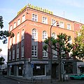
Residential / commercial building | Theaterstrasse 24–28 map |
built by Dederichs as a publishing house for "The Political Daily" | 1928 | ||

|
Residential / commercial buildings (parts) | Theaterstrasse 31, 33 map |
||||

|
Residential / commercial building | Theaterstrasse 46 map |
||||

|
Residential / commercial building (parts) | Theaterstrasse 47 map |
||||

|
Residential / commercial buildings | Theaterstrasse 49, 51 map |
||||

|
Residential / commercial building | Theaterstrasse 55 map |
||||

|
Residential and commercial buildings; No. 67: " House Matthéy " |
Theaterstrasse 65, 67, 69 map |
House Matthéy built according to plans by Adam Franz Friedrich Leydel | 1834 | ||

|
Residential / commercial building | Theaterstrasse 75 map |
||||

|
Residential / commercial building | Theaterstrasse 83 map |
||||

|
Residential / commercial building | Theaterstrasse 86 map |
||||

|
Residential / commercial building (parts) | Theaterstrasse 88 map |
||||
| Street mosaic pavement | Theaterstrasse map |
|||||

|
Residential building | Theresienstraße 4 | ||||

|
Residential building | Theresienstraße 9 map |
||||

|
Residential building | Theresienstraße 13 | ||||

|
Residential building | Theresienstraße 19 map |
||||
|
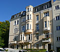
Residential houses | Theresienstraße 22, 24, 26 map |
||||

|
Residential houses | Thomashofstraße 9, 11, 13 map |
||||

|
Residential houses | Thomashofstrasse 15, 17 map |
||||

|
Residential houses | Thomashofstrasse 19, 21 map |
||||

|
Residential houses | Thomashofstraße 23, 25, 27 map |
||||

|
Residential building | Thomashofstrasse 31 map |
||||

|
Residential houses | Thomashofstrasse 54, 56 map |
||||

|
Residential houses | Thomashofstrasse 60 map |
||||

|
"Gut Tönnesrath" | Tönnesrather Weg 16–18 map |
previously insignificant clay frame construction; New building based on plans by Ludwig Schönegeld as a square courtyard; Alfred Rethel's birthplace | 1810-1818 | ||

|
Parish home of St. Paul | Trichtergasse 3 card |
||||

|
Residential houses | Trichtergasse 4, 6, 8 card |
||||

|
Residential houses | Trichtergasse 16, 18, 20 map |
||||

|
Residential building (parts) | Turmstrasse 180 map |
||||

|
Remise | Turmstrasse 184 map |
||||

|
Residential houses | Hungary road 2, 4, 6 map |
||||

|
Residential houses | Hungary road 10 map |
||||

|
“ Maria im Tann ” - House of youth professional aid | Unterer Backertsweg 6 card |
Built according to plans by city architect Joseph Laurent as a convalescent home for men and women, then a home for children and young people | 1906-1909 | ||

|
“Maria im Tann” - center for child, youth and family aid | Unterer Backertsweg 7 map |
Built according to plans by city architect Joseph Laurent as a convalescent home for men and women; Children's and youth home | 1906-1909 | ||

|
Rectory of St. Foillan | Ursulinerstraße 1 map |
||||

|
Residential houses | Ursulinerstraße 21 (parts), 23, 25 map |
||||

|
Residential building | Vaalser Strasse 1–3 map |
||||

|
Residential building (parts) | Vaalser Strasse 5 map |
||||

|
Residential houses | Vaalser Strasse 7, 9 map |
||||

|
Residential building (parts) | Vaalser Strasse 8 map |
||||

|
Residential building | Vaalser Strasse 13 map |
||||

|
Residential building | Vaalser Strasse 15 map |
||||

|
building | Vaalser Strasse 37–43 map |
||||

|
Residential building (parts) | Vaalser Strasse 47 map |
||||

|
Residential building | Vaalser Strasse 51 map |
||||

|
Residential houses | Vaalser Strasse 53, 55 map |
||||

|
Residential building | Vaalser Strasse 70 map |
||||

|
Residential houses | Vaalser Strasse 78, 80, 82, 84 map |
||||

|
Residential houses | Vaalser Strasse 92, 94, 96, 98, 100 map |
||||

|
Residential houses | Vaalser Strasse 97, 99 map |
||||

|
Residential houses | Vaalser Strasse 110, 112 map |
||||

|
Residential houses | Vaalser Strasse 111, 111a map |
||||

|
Residential building | Vaalser Strasse 117 map |
||||

|
Residential houses | Vaalser Strasse 118, 120 map |
||||

|
Residential houses | Vaalser Strasse 119a, 121, 121a, 123 map |
||||

|
Residential houses | Vaalser Strasse 122 map |
||||

|
Residential houses | Vaalser Strasse 146, 148 map |
||||

|
Residential houses | Vaalser Strasse 154 (parts), 156, 158, 160 (parts) map |
||||

|
Residential building | Vaalser Strasse 157 map |
||||

|
Residential houses | Vaalser Strasse 164 map |
||||
|
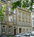
Residential houses | Veltmanplatz 12, 13 card |
||||

|
Residential building | Veltmanplatz 17 map |
8: 7: 6-axis, 3½-storey corner house with a diamond frieze under the eaves of the hipped roof. Architect: Radermacher. two-storey bay window on the side facing Veltmanplatz with an exit above it in the direction of Hermannstrasse and three-storey bay window facing the planned but not completed Sachsenstrasse. The roof extension was changed after war damage, and the entrance area with marble cladding also dates from the reconstruction period. | 1937 | 3548 |
|

|
Residential building | Vereinsstrasse 9 map |
||||

|
Residential building | Vereinsstrasse 10 map |
||||

|
Residential building | Vereinsstrasse 19 map |
||||

|
Residential building | Wallstrasse 9 map |
||||

|
Residential building | Wallstrasse 23 map |
||||

|
Residential houses | Wallstrasse 46, 48, 50 map |
||||

|
Residential building | Wallstrasse 55 map |
||||

|
Residential building | Wallstrasse 59 map |
||||

|
building | Weberstrasse 34-42 | ||||

|
Residential houses | Weberstrasse 37, 39 map |
||||

|
Residential building | Wespienstraße 2 map |
||||

|
Residential building | Wespienstraße 26 map |
||||

|
Residential houses | Wespienstraße 27, 29 map |
||||

|
Residential building | Wespienstraße 32 map |
||||

|
Residential building | Wilhelmstrasse 2 map |
||||

|
Residential building | Wilhelmstrasse 12 map |
||||

|
Residential houses | Wilhelmstrasse 14, 16 map |
||||

|
Villa Cassalette | Wilhelmstrasse 18 map |
Three-storey city villa in five axes, architect Eduard Linse ; 1900/01 Extension by a rear two-storey, five-axis part of the building including skylight halls according to plans by city master builder Joseph Laurent ; Sandstone stone facade in the style of a Venetian Renaissance palazzo; high basement floor with gate entrance, two upper floors above in the left axis with horizontal parapets and a central balcony on the first floor < | 1883-1888 | ||

|
Residential building | Wilhelmstrasse 17 map |
||||

|
Residential houses | Wilhelmstrasse 24 map |
||||
|
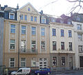
Residential houses | Wilhelmstrasse 27, 29 map |
||||

|
Residential building | Wilhelmstrasse 31 | ||||

|
Residential houses | Wilhelmstrasse 33, 35 | ||||

|
Residential building (parts) | Wilhelmstrasse 34 map |
Street-side facade (except 4th floor), entrance and staircase | |||

|
Residential building | Wilhelmstrasse 41 map |
||||

|
Residential houses | Wilhelmstrasse 60, 62 map |
||||

|
Residential houses | Wilhelmstrasse 61–63, 65, 67 map |
||||

|
Residential building | Wilhelmstrasse 68 map |
||||

|
Residential houses | Wilhelmstrasse 71, 73 | ||||

|
Residential houses (parts) | Wilhelmstrasse 75, 77 map |
||||

|
Residential houses | Wilhelmstrasse 78, 80 | ||||

|
Residential building | Wilhelmstrasse 79 | ||||

|
Residential building (parts) | Wilhelmstrasse 82 | ||||

|
Residential building | Wilhelmstrasse 86 map |
||||

|
Residential houses | Wilhelmstrasse 87, 89, 91 map |
||||

|
Residential building | Wirichsbongardstrasse 10 map |
||||
|
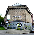
High bunker | Wittekindstrasse 1 map |
Three-storey bunker on a pentagonal floor plan. Built according to a design by the financial construction office and served as an emergency shelter until 1948. Now used as a music bunker | 1941-1943 | ||

|
Mining building of the RWTH Aachen | Wüllnerstrasse 2 map |
built by government architect Mennicke and district building inspector Morit, figure reliefs by Karl Krauss | 1894-1897 | ||

|
Textbook collection of the RWTH Aachen University Library and the Institute for Statistics | Wüllnerstrasse 3 map |
built according to plans by Karl Henrici ; white puddled building with sandstone elements | 1898-1900 | ||

|
Audimax of the RWTH Aachen | Wüllnerstrasse 9 map |
erected as a steel frame construction on a former railway site according to plans by the senior government and building officer Karl Schlüter ; Combination of traditionalist gravity with great transparency | 1954 |
Former monuments
| image | designation | location | description | construction time | Registered since |
Monument number |
|---|---|---|---|---|---|---|

|
Residential commercial building | Pontstrasse 48 map |
no longer under monument protection since 2016 | |||

|
Residential building (parts) | Reihstraße 16 map |
no longer under monument protection since 2016 |
See also
- List of ground monuments in Aachen
- List of street names in Aachen-Mitte
- Relocated buildings in Aachen
- Works by Jakob Couven
- Works by Johann Joseph Couven
Web links
- List of monuments of the city of Aachen (PDF; 129 kB)
- Architectural monuments in Aachen-Mitte in the Aachen geoportal
- Walter Holtzhausen / Jochen Richart: Südstrasse and the Reumontviertel ; Pp. 109-137
Individual evidence
- ^ Entry on Red House Aachen in the " KuLaDig " database of the Rhineland Regional Association
- ^ Entry on Lombard Hall in the database " KuLaDig " of the Rhineland Regional Association
- ↑ Description of the high bunker Scheibenstraße ( memento of the original from March 4, 2016 in the Internet Archive ) Info: The archive link has been inserted automatically and has not yet been checked. Please check the original and archive link according to the instructions and then remove this notice.
- ^ Entry on Reiff Museum in the " KuLaDig " database of the Rhineland Regional Association
- ↑ Entry on Rogowski Institute of RWTH Aachen in the database " KuLaDig " of the Rhineland Regional Association
- ^ Bunker Wittekindstrasse
- ↑ Entry on the mining building of RWTH Aachen in the database " KuLaDig " of the Rhineland Regional Association
- ^ Entry on the old library of RWTH Aachen University in the " KuLaDig " database of the Rhineland Regional Association
- ↑ Entry on Large Lecture Hall Building of RWTH Aachen in the database " KuLaDig " of the Rhineland Regional Association
