List of architectural monuments in Freisen
In the list of architectural monuments in Freisen , all architectural monuments of the Saarland municipality of Freisen and its districts are listed. The basis is the publication of the state monument list in the Saarland official gazette of December 22, 2004 as well as the inventory list and the current list of monuments of the state monument authority Saar.
Asweiler
| location | designation | description | image |
|---|---|---|---|
| Husselstrasse 9 location |
farm | Built in 1884 |
Freisen
| location | designation | description | image |
|---|---|---|---|
| Remigiusstraße, before cath. Parish church location |
War memorial | ||
| Remigiusstrasse location |
Catholic Church of St. Remigius | St. Remigius was built in 1753 as a baroque hall church. In 1953 the nave was expanded to include a transept and a choir . The interior is accessed via the simple arched portal with walls in the west tower. The stepped front wall with ribbons of round windows leads to the choir with a three-sided end and large round windows. |

|
Grügelborn
| location | designation | description | image |
|---|---|---|---|
| In the triangle, no. No. |
Wayside cross | 1905 | |
| Steinbachstrasse 2 location |
Farmhouse | 1798 |
Main hamlet
| location | designation | description | image |
|---|---|---|---|
| Oberkircher Strasse location |
Railway bridge, 1938 | Already in the middle of the 19th century there were plans for a railway line through the Ostertal , but it was not until 1937 that the National Socialist Gauleiter for Rhineland-Palatinate decided to build the line. The basalt stone bridges of the region are characteristic of the railway. The low railway bridge in Haupersweiler has three full arches and half on each side. It was put into service with the opening of the last section of the railway line in 1938. |

|
| Oberkircher Straße (opposite No. 11) |
Wayside cross | 18th century | |
| Oberkircher Strasse 13 location |
Farmhouse | First half of the 19th century |
Oberkirchen
| location | designation | description | image |
|---|---|---|---|
| Dreieckstraße / corner Rembrandtstraße location |
Wayside cross | Last quarter of the 18th century | |
| Gartenstrasse location |
Railway underpass | Erected in 1936 as part of | |
| Hauptstrasse 26 location |
school | The eaves, two-storey sandstone building was erected in 1882. It has two corner projections - one with two and one without window axes. A sill cornice connects the windows on the upper floor, an eaves cornice in the middle part continues into the Resalite. | |
| Matzenbergstrasse location |
Tower of the cath. Parish church of St. Katharina , late Gothic baptismal font, figurative furnishings | The hall church was built around 1760 and expanded to the east in 1956/57. The oldest part is the late Gothic west tower with a flat pointed arch portal in which the year 1414 can be found. The quarry stone tower was easily placed in the nave. It is divided by two circumferential cornices. Some of the furnishings are also listed, including some figures from the 19th century and the late Gothic baptismal font. |

|
| Museum Street location |
Railway underpass | Erected in 1936. | |
| Talbrückstrasse location |
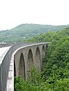
Oberkirchen Viaduct , 1936 (individual monument) | The railway bridge was built in 1935/36 in 16 months by the construction company Polensky & Zöllner with basalt stones. The bridge is 275 m long and has 12 arches on 11 pillars. In 1969/1970 the Westrichbahn was closed due to lack of profitability and the rails were dismantled. The bridge has been part of the Fritz Wunderlich hiking trail since 1993. |

|
Reitscheid
| location | designation | description | image |
|---|---|---|---|
| Grügelborner Straße 3 location |
Farmhouse | Built in 1862 |
Black earths
| location | designation | description | image |
|---|---|---|---|
| In the break 3 layer |
Farmhouse | The older business section dates from 1858, the residential building from 1894. |
Web links
Commons : Architectural monuments in Freisen - Collection of images, videos and audio files
- List of monuments of the Saarland: List of monuments in the district of St. Wendel (PDF file; 16.81 MB)