List of architectural monuments in Eldetal
In the list of architectural monuments in Eldetal , all listed buildings in the municipality of Eldetal (Mecklenburg-Western Pomerania) are listed. The basis is the publication of the list of monuments of the Müritz district as of April 2010.
Architectural monuments according to districts
Below
| ID | location | designation | description | image |
|---|---|---|---|---|
| 69 |
Dorfstrasse 17 (map) |
former manor complex with manor house, | ||
| 69 |
Dorfstrasse 17 (map) |
Servants' House and | ||
| 69 |
Dorfstrasse 18 (map) |
Residential building with | ||
| 69 |
Dorfstrasse 18 | barn | ||
| 69 |
Dorfstrasse 14 (map) |
Torhaus (former cartwright) | ||
| 69 |
cowshed | |||
| 69 |
Village street | Cobblestone street (roundabout) to the estate | ||
| 70 |
(Road to Wittstock) | Cobblestone road to Wittstock | ||
| 71 |
Village street | VdN memorial stone |
Grabow
| ID | location | designation | description | image |
|---|---|---|---|---|
| 146 |
Dorfstrasse 6 | barn | ||
| 148 |
Dorfstrasse 14 | Old school | ||
| 149 |
Dorfstrasse 17 | 1. Farm buildings | ||
| 149 |
Dorfstrasse 17 | 2. Farm buildings | ||
| 149 |
Dorfstrasse 17 | 3. Farm buildings | ||
| 150 |
Dorfstrasse 18 | Farmhouse with | ||
| 150 |
Dorfstrasse 18 | Stall and | ||
| 150 |
Dorfstrasse 18 | barn | ||
| 151 |
Dorfstrasse 19 | Residential building | ||
| 152 |
Dorfstrasse 24 | Residential building with | ||
| 152 |
Dorfstrasse 24 | Stall and | ||
| 152 |
Dorfstrasse 24 | Bakehouse | ||
| 154 |
Dorfstrasse 26 | Residential building | ||
| 154 |
Dorfstrasse 27 | barn | ||
| 155 |
Dorfstrasse 28 | Residential and commercial building | ||
| 156 |
graveyard | Cemetery wall with | ||
| 156 |
graveyard | several portal pillars | ||
| 157 |
graveyard | Memorial stone for concentration camp victims | ||
| 158 |
Dorfstrasse (map) |
Church with |
 |
|
| 158 |
Village street | Field stone wall | ||
| 159 |
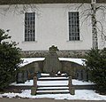
Church arsenal | War memorial 1914/1918 |
 |
|
| 160 |
Exit to Below (map) |
Death march memorial stone and |
 |
|
| 160 |
Before the grass | VdN memorial stone |
Evchensruh
| location | Official name | description | image |
|---|---|---|---|
| . Grabower Strasse 7 | Barn / residential building |
|
Massow
| location | Official name | description | image |
|---|---|---|---|
| Freyensteiner Strasse | Cobblestone road from Massow to Freyenstein |
|
|
| Freyensteiner Strasse | VdN memorial plaque |
|
|
| . Freyensteiner Strasse 17 | Residential building |
|
|
| . graveyard | Grave complex for 4 German soldiers ( World War II ) |
|
|
| . Courtyard 17 (?) | Church with churchyard wall | Neo-Romanesque village church Massow from 1842 made of field and brick with polygonal choir ; square Tower tower; Sandstone font from the 16th century |

|
| . Yard 18 | Manor complex with manor house and park | 2-fold, 13-axis. Plastered building from 1860 with mezzanine , today (2015) nursing home; Good of the families von Flotow , von Below , von Lücken , von Pahlen , von Weltzien , von Rohr , von der Lanken, von Preen and again von Lücken. |

|
| . Courtyard 6/7 | Blacksmith shop and house |
|
|
| . Yard 13 | Distillery (?) |
|
|
| Ruin of the barn with 2 connecting corridors to the distillery and Kastanienallee |
|
Neuhof
| ID | location | designation | description | image |
|---|---|---|---|---|
|
|
Neuhof 1 (map) |
Residential building former dairy with servants' house and former stable |
 |
Wredenhagen
| ID | location | designation | description | image |
|---|---|---|---|---|
|
|
Am Burgberg 1 (map) |
Fortress with gatehouse and Amthaus = Forsthaus and Manor House (school) and castle wall and brick house and fountain and remains of the basement home and paving (historical) and paved access road to the castle and the remains of the park |
 |
|
|
|
Am Burgberg 12 | distillery | ||
|
|
Am Burgberg 15 (map) |
Stable = falconry (formerly cattle stable) | ||
|
|
At the Forsthof 1 | Barn of the forester's yard and surrounding wall | ||
|
|
at the church | War memorial 1914/18 |
 |
|
|
|
at the state / district border, road to Wittstock (L24) | Milestone national border | ||
|
|
at the state / district border, road to Wittstock (L24) | Milestone national border | ||
|
|
Dorfstrasse 11 | milestone | ||
|
|
Dorfstrasse 37 (map) |
Rectory | ||
|
|
Dorfstrasse 37 (map) |
Rectory | ||
|
|
Dorfstrasse 52 (map) |
church |
 |
|
|
|
Dorfstrasse 69 (map) |
Residential and commercial building |
 |
|
|
|
Dorfstrasse 70 (map) |
Residential house with wall |
 |
|
|
|
Dorfstrasse 75 (map) |
Residential building |
 |
|
|
|
Dorfstrasse 85 (map) |
Residential house, street facade | ||
|
|
Dorfstraße 105 (Diekstrat 2) (map) |
Residential building |
 |
|
|
|
Dorfstrasse 108 (Diekstrat 5) (map) |
Residential building |
 |
|
|
|
Fledderborg | Forest monument | ||
|
|
Röbeler Chaussee 23 | Residential building |
Zepkow
| ID | location | designation | description | image |
|---|---|---|---|---|
|
|
Dorfstrasse 30 (map) |
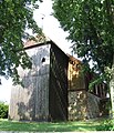
church | Village church from the 19th century as a brick building on an old field stone base (13th century) and with a wooden tower from 1775. |
 |
|
|
Dorfstrasse 30 | War memorial 1914–1918 | ||
|
|
Dorfstrasse 36 (map) |
Residential house with hall extension and stable and storage | ||
|
|
Dorfstrasse 64/65 (map) |
Residential building | ||
|
|
Dorfstrasse 73/74 (map) |
Residential house with barn (fire station), wall and former forge | ||
|
|
Dorfstrasse 78 (map) |
Residential building | ||
|
|
Dorfstrasse 81/82 (map) |
Residential building | ||
|
|
Cemetery (map) |
Cemetery portal with field stone wall |
source
- List of monuments of the district of Müritz according to community membership, status 04.2010 (pages only partially accessible in the course of the district reform 2011 and the conversion of the website)
Web links
Commons : Architectural monuments in Eldetal - Collection of images, videos and audio files
- History and illustrations of Wredenhagen Castle , accessed March 21, 2018
- Reconstruction drawing of Wredenhagen Castle by Wolfgang Braun , accessed on March 21, 2018