List of cultural monuments in Tauberbischofsheim-Distelhausen
|
List of cultural monuments in Tauberbischofsheim :
City of Tauberbischofsheim by street name: A • B • D • E • F • G • H • I • K • L • M • O • R • S • T • U • V • W • Z) Other districts: Dienstadt • Distelhausen • Dittigheim • Dittwar • Hochhausen • Impfingen |
The list of cultural monuments in Tauberbischofsheim- Distelhausen lists the cultural monuments of the Tauberbischofsheim district of Distelhausen . This list is a partial list of the list of cultural monuments in Tauberbischofsheim . The basis for this list is the list of architectural and art monuments published by the Stuttgart Regional Council as of February 15, 2012.
This list is not legally binding. Legally binding information is only available on request from the Lower Monument Protection Authority of the city of Tauberbischofsheim.
Cultural monuments in Distelhausen
Architectural, art and cultural monuments in Distelhausen with the village of Distelhausen ( ⊙ ) and the residential area at the Distelhausen train station ( ⊙ ):
![]() Map with all coordinates of the cultural monuments in the district of Distelhausen: OSM
Map with all coordinates of the cultural monuments in the district of Distelhausen: OSM
| image | designation | location | Dating | description |
|---|---|---|---|---|
 |
Wayside shrine | Altenberg (Gewann) (Reg. No. 0-5679) (Map) |
Wayside shrine, Kreuzschlepper from 1817, with inscription. Location at Gewann Altenberg between Kützberg, Forst and Lange Steige. Protected according to § 2 DSchG
|
|
 |
Memorial stone | Altenberg (Gewann) (Reg. No. 0-5679) (Map) |
1985 | Memorial stone for the land consolidation Distelhausen-Gerlachsheim in 1985. Location at Gewann Altenberg between Kützberg, Forst and Lange Steige.
|
| Wayside shrine | Am Käpelle 2 (map) |
Wayside shrine, directly above the Distelhäuser Brewery
|
||
 |
statue | Bergstrasse 1 (map) |
Mary statue on a house wall.
|
|
 |
archway | Bergstrasse 4 (map) |
Historic archway with decorated corner stone.
|
|
 |
Virgin Mary statue | Bundesstrasse 20 (map) |
Virgin Mary statue with baby Jesus in a showcase on a plinth on a house wall
|
|
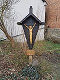 |
Wooden cross | Bundesstrasse 20-24 (map) |
Wooden cross with the corpus of Christ, on the roadside between the houses at Bundesstrasse 20 and 24
|
|
| Farmhouse | Bundesstrasse 21 (Flst.Nr. 0-266) (map) |
Farmhouse, on a narrow part of the main road in the village Protected according to § 2 DSchG
|
||
 |
Virgin Mary statue | Bundesstrasse 30 (map) |
Virgin Mary statue with baby Jesus on a plinth on a house wall
|
|
 |
Jesus statue | Bundesstrasse 34 (map) |
Statue of Jesus in a showcase on a base on a house wall
|
|
 |
Virgin Mary statue | Bundesstrasse 34 (map) |
Statue of the Virgin Mary, at the corner of the Bundesstraße (K 2814) -Bergstraße junction
|
|
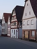 |
Residential building | Bundesstrasse 39 (Flst.Nr. 0-16) (map) |
Residential building. Historic half-timbered house. Protected according to § 2 DSchG
|
|
| Courtyard gate | Bundesstrasse 43 (behind) (control no. 0-15) (map) |
Courtyard gate Protected according to § 28 DSchG
|
||
| Residential building | Bundesstraße 45 (Flst.Nr.0-14) (map) |
Residential building Protected according to § 2 DSchG
|
||
 |
Courtyard gate | Bundesstrasse 45-47 (map) |
Historic, covered courtyard gate. Protected according to § 28 DSchG
|
|
| Wayside shrine | Bundesstrasse 50 (near) (map) |
Wayside shrine Protected according to § 2 DSchG
|
||
| barn | Bundesstraße 51a (Flst.Nr. 0-2) (map) |
Barn Protected according to § 2 DSchG
|
||
 More pictures |
Half-timbered barn | Bundesstrasse 53 (map) |
Half-timbered barn, gate posts, farm museum with around 5,000 exhibits from rural life
|
|
| Wayside shrine | Bundesstrasse 53 (near) (map) |
Wayside shrine, in front of the farm museum
|
||
| Wayside shrine | Bundesstrasse 61 (bei) (Flst.Nr. 0-84) (map) |
1609 | Wayside shrine with crucifixion group from 1609. Protected according to § 2 DSchG
|
|
 |
crossroads | Eichelberg (map) |
Way cross with the body of Christ, above Distelhausen on the Eichelberg
|
|
| Wayside shrine | Flurstrasse (Flst. No. 0-5180) |
1832 | Wayside shrine with Pietà, ins. 1832 Protected according to § 2 DSchG
|
|
 More pictures |
Sable lock | Flurstrasse 2 (map) |
1840 | Zobelschloss (also New Castle ), built in 1840, historic half-timbered building, former summer residence of the von Zobel family, used as a gardening and agricultural school in the 20th century, has housed the district media center of the Main-Tauber district since 2003
|
 More pictures |
Weather cross | District boundary (Tauberbischofsheim - Lauda-Königshofen) (map) |
1714 | The weather cross. From 1714; Erected as an "eternal memory" of a major storm damage; Its pedestal formed the boundary stone to the districts of five old communities (Oberlauda, Lauda, Distelhausen, Dittigheim and Dittwar), whose coats of arms are shown on it. After the regional reform in Baden-Württemberg, some of the neighboring old communities are only districts and Dittigheim is no longer a direct neighbor.
|
| crossroads | Grünsfelder Straße (Flst.Nr. 0-5358) / Bundesstraße 53 (near) (map) |
Crossroads, at an intersection, at the beginning of Grünsfelder Straße (referred to as L 512 after the end of town), after it branches off from the main road in town (in front of the farm museum) Protected according to § 2 DSchG
|
||
 More pictures |
Brewhouse | Grünsfelder Strasse (map) |
Brewhouse of the Distelhäuser Brewery with old copper brew kettles, visible through a pane of glass from Grünsfelder Straße, partially illuminated at night.
|
|
 |
Wayside shrine | K 2814 (Distelhausen – Dittigheim) (map) |
Wayside shrine, by the roadside, near the Taubertal bridge over the A 81
|
|
 |
Wayside shrine | L 512 (Distelhausen – Grünsfeld) (map) |
Wayside shrine with a depiction of the crucifixion, on a farm road right next to the L 512, after leaving the village in the direction of Grünsfeld
|
|
 |
Metal cross | L 512 (Distelhausen – Grünsfeld) (map) |
Metal cross on a farm road right next to the L 512, after leaving the village in the direction of Grünsfeld
|
|
 |
crossroads | L 512 (Distelhausen – Grünsfeld) (map) |
Crossroads on a farm road, right next to a bridge over the L 512 in the direction of Grünsfeld. The wayside cross is located on the boundary of Distelhausen and Grünsfeld.
|
|
 |
Wayside shrine | Münchenberg (Gewann) (Flst.Nr. 0-6033) (Map) |
1881 | Stock image with Pietà 1881, at a crossroads, Gemarkung München Berg, slightly above the rail tracks of the rail Tauber managed according to § 2 DSchG
|
| Wayside shrine | Schloßstraße (Flst. No. 0-5274) (map) |
18th century | Wayside shrine with sculptural crucifixion group, 18th century. Protected according to § 2 DSchG
|
|
| Rectory | Wolfgangstraße 1 (Flst. No. 0-111) (map) |
1787 | Catholic parsonage with parish barn and enclosure (totality). Protected according to § 2 DSchG
|
|
 |
Cross with corpus | Wolfgangstraße 1 (near) (Flst.Nr. 0-141) (map) |
19th century | Cross with corpus, red sandstone, 19th century, in front of the Markusheim. Protected according to § 2 DSchG
|
| Cross with corpus | Wolfgangstrasse 1 (near) (Flst.Nr. 0-111) |
around 1500 | Cross with corpus, around 1500. Protected according to § 2 DSchG
|
|
 More pictures |
St. Mark | Wolfgangstraße 2 (Flst. No. 0-142) (map) |
1731-1738 | Catholic parish church St. Markus, built 1731–1738 according to plans from the school of Balthasar Neumann, altars by Benedikt Schlecht (1744), Gothic sculptures of the Pieta and St. Wolfgang Protected according to § 28 DSchG
|
 |
statue | Wolfgangstraße 2 (Flst. No. 0-142) (map) |
The left of three statues on the western outside of St. Mark's Church.
|
|
 |
statue | Wolfgangstraße 2 (Flst. No. 0-142) (map) |
The middle of three statues on the western outside of St. Mark's Church.
|
|
 |
statue | Wolfgangstraße 2 (Flst. No. 0-142) (map) |
The right of three statues on the western outside of St. Mark's Church.
|
|
| Residential building | Wolfgangstraße 3 (Flst. No. 0-113) (map) |
Residential building Protected according to § 2 DSchG
|
||
| Construction details | Wolfgangstraße 5 (Flst. No. 0-115) (map) |
Construction details Protected according to § 2 DSchG
|
||
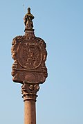 |
Wayside shrine | Wolfgangstrasse 5 (in front of) (Flst.Nr. 0-141) (map) |
1721 | Wayside shrine, so-called Marian column, with double image: Immaculata and Descent from the Cross from 1721 (in front of Wolfgangstrasse 5, opposite Wolfgangstrasse 9) Protected according to § 28 DSchG
|
 |
Abendantz Castle | Wolfgangstrasse 8 (Flst. No. 0-247–248, 0-250) (map) |
1758 | So-called. Abendanz'scher Herrenhof. Also: Schloss Abendantz. Mansion. Built in 1758 according to the inscription. Today used as a fire station. Protected according to § 28 DSchG
|
 |
Goalposts | Wolfgangstraße 8 (Flst. No. 0-247) (map) |
1758 | Historic gate posts, from 1758, entrance area of Schloss Abendantz. Protected according to § 28 DSchG
|
 |
Courtyard | Wolfgangstraße 9 (Flst. No. 0-139) (map) |
Half-timbered house. Part of a courtyard system (entity). Protected according to § 2 DSchG
|
|
 |
archway | Wolfgangstraße 9 (Flst. No. 0-139) (map) |
1582 | Historic archway, from 1582. Part of a courtyard complex (entity) Protected according to § 2 DSchG
|
 |
House Madonna | Wolfgangstraße 11 (Flst. No. 0-156) (map) |
Mary statue on a house wall. Protected according to § 2 DSchG
|
|
 |
Goalposts | Wolfgangstrasse 11 (map) |
Historic goal posts.
|
|
 |
Virgin Mary statue | Wolfgangstrasse 13 (map) |
Mary statue on a house wall.
|
|
 |
Pieta | Wolfgangstrasse 15 (map) |
Pieta, on a plinth on a house wall.
|
|
| Wayside shrine | Wolfgangstrasse 17 (Flst. No. 0-152) (map) |
1810 | Wayside shrine with plastic Pietà, ins. 1810, at the house at Wolfgangstrasse 17 on the roadside. Protected according to § 2 DSchG
|
|
 |
Tauber Bridge | Wolfgangstrasse (Flst. No. 0-5886) (map) |
Historic arch bridge over the Tauber. The State Monuments Office included the Tauber Bridge in the list of cultural monuments in 1988. During a renovation in the 2010s, the old arches were preserved and another arch was added so that a larger amount of water can flow through in the event of a flood. The alternative of building a new bridge was rejected by the state of Baden-Württemberg for reasons of monument preservation. Protected according to § 2 DSchG
|
|
 |
Wayside shrine | Wolfgangstrasse (map) |
1741 | Wayside shrine, from 1741. That year a citizen of Distelhausen drowned in the Tauber. This wayside shrine was erected to commemorate and honor God.
|
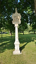 |
Wayside shrine | Wolfgangstrasse (Flst. No. 0-5988) (map) |
around 1700 | Wayside shrine bearing a cross, around 1700, at a fork in the road (left towards Wolggang chapel, right towards Dittigheim) Protected according to § 2 DSchG
|
 |
Cemetery with chapel | Wolfgangstraße 27 (Flst. No. 0-5935, 0-5956, 0-5959) (map) |
15-19 Century | Distelhausen cemetery with chapel (St. Wolfgang chapel and Abendanz sarcophagus, § 28 each), enclosing wall, gate, stations of the cross and historical tombs (totality). Protected according to § 28 DSchG
|
 More pictures |
St. Wolfgang Chapel | Wolfgangstraße 27 (Flst. No. 0-5959) (map) |
15th century | St. Wolfgang Chapel, at the Distelhausen cemetery, donated in the 15th century, since 1472 the scene of the St. Wolfgang ride. Part of the whole cemetery. Protected according to § 28 DSchG
|
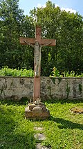 |
Cemetery cross | Wolfgangstraße 27 (Flst. No. 0-5959) (map) |
Stone cross, in the Distelhausen cemetery. Part of the whole cemetery. Protected according to § 28 DSchG
|
|
 |
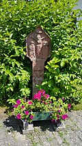
Wayside shrine | Wolfgangstrasse 27 (map) |
Wayside shrine. Part of the whole cemetery. Protected according to § 28 DSchG
|
|
 |
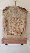
Wayside shrine | Wolfgangstrasse 27 (map) |
Wayside shrine. Part of the whole cemetery. Protected according to § 28 DSchG
|
|
 |
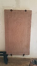
Stone tablet | Wolfgangstrasse 27 (map) |
Stone tablet, in the Wolfgang chapel. Part of the whole cemetery. Protected according to § 28 DSchG
|
|
 |
Stone tablet | Wolfgangstrasse 27 (map) |
Stone tablet, in the Wolfgang chapel. Part of the whole cemetery. Protected according to § 28 DSchG
|
|
 More pictures |
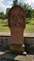
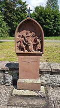
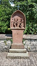
Way of the Cross in the cemetery wall | Wolfgangstraße 27 (Flst. No. 0-5956, 0-5959) (map) |
Way of the Cross in the cemetery wall, comprising fourteen stations; The Way of the Cross begins on the side of the Wall in the direction of Distelhausen and leads to the Wolfgang Chapel. Part of the whole cemetery. Protected according to § 28 DSchG
|
|
 More pictures |
1st station of the cross | Wolfgangstraße 27 (Flst. No. 0-5956, 0-5959) (map) |
Stations of the Cross 01/14 (Distelhausen) of the fourteen stations of the Cross in the cemetery wall. Inscription among other things "I. Jesus is condemned by Pilate" (...). Protected according to § 28 DSchG
|
|
 More pictures |
2nd station of the cross | Wolfgangstraße 27 (Flst. No. 0-5956, 0-5959) (map) |
Stations of the Cross 02/14 (Distelhausen) of the fourteen stations of the Cross in the cemetery wall. Inscription: "II. Jesus takes the heavy cross on his shoulders". Protected according to § 28 DSchG
|
|
 More pictures |
3rd station of the cross | Wolfgangstraße 27 (Flst. No. 0-5956, 0-5959) (map) |
Stations of the Cross 03/14 (Distelhausen) of the fourteen stations of the Cross in the cemetery wall. Inscription: "III. Jesus falls for the first time under the cross". Protected according to § 28 DSchG
|
|
 More pictures |
4th station of the cross | Wolfgangstraße 27 (Flst. No. 0-5959) (map) |
Stations of the Cross 04/14 (Distelhausen) of the fourteen stations of the Cross in the cemetery wall. Inscription: "IV. Jesus meets his holy mother". Protected according to § 28 DSchG
|
|
 More pictures |
5th station of the cross | Wolfgangstraße 27 (Flst. No. 0-5959) (map) |
Stations of the Cross 05/14 (Distelhausen) of the fourteen stations of the Cross in the cemetery wall. Inscription: "V. Simon helps Jesus carry the cross". Protected according to § 28 DSchG
|
|
 More pictures |
6. Stations of the Cross | Wolfgangstraße 27 (Flst. No. 0-5959) (map) |
Station of the Cross 06/14 (Distelhausen) of the fourteen stations of the Cross in the cemetery wall. Inscription: "VI. Veronica gives Jesus the handkerchief". Protected according to § 28 DSchG
|
|
 More pictures |
7th station of the cross | Wolfgangstraße 27 (Flst. No. 0-5959) (map) |
Stations of the Cross 07/14 (Distelhausen) of the fourteen stations of the Cross in the cemetery wall. Inscription: "VII. Jesus falls the second time under the cross". Protected according to § 28 DSchG
|
|
 More pictures |
8. Station of the Cross | Wolfgangstraße 27 (Flst. No. 0-5959) (map) |
Stations of the Cross 08/14 (Distelhausen) of the fourteen stations of the Cross in the cemetery wall. Inscription: "VIII. Jesus meets the weeping daughters of Jerusalem". Protected according to § 28 DSchG
|
|
 More pictures |
9. Stations of the Cross | Wolfgangstraße 27 (Flst. No. 0-5959) (map) |
Station of the Cross 09/14 (Distelhausen) of the fourteen stations of the Cross in the cemetery wall. Inscription: "IX. Jesus falls the third time under the cross". Protected according to § 28 DSchG
|
|
 More pictures |
10th station of the cross | Wolfgangstraße 27 (Flst. No. 0-5959) (map) |
Kreuzwegstation 10/14 (Distelhausen) of the fourteen stations of the Kreuzweg in the cemetery wall. Inscription: "X. Jesus is stripped of his clothes". Protected according to § 28 DSchG
|
|
 More pictures |
11. Stations of the Cross | Wolfgangstraße 27 (Flst. No. 0-5959) (map) |
Stations of the Cross 11/14 (Distelhausen) of the fourteen stations of the Cross in the cemetery wall. Inscription: "XI. Jesus is nailed to the cross". Protected according to § 28 DSchG
|
|
 More pictures |
12. Stations of the Cross | Wolfgangstraße 27 (Flst. No. 0-5959) (map) |
Station of the Cross 12/14 (Distelhausen) of the fourteen stations of the Cross in the cemetery wall. Inscription: "XII. Jesus dies on the cross". Protected according to § 28 DSchG
|
|
 More pictures |
13. Stations of the Cross | Wolfgangstraße 27 (Flst. No. 0-5959) (map) |
Station of the Cross 13/14 (Distelhausen) of the fourteen stations of the Cross in the cemetery wall. Inscription: "XIII. Jesus is taken down from the cross". Protected according to § 28 DSchG
|
|
 More pictures |
14. Station of the Cross | Wolfgangstraße 27 (Flst. No. 0-5959) (map) |
Stations of the Cross 14/14 (Distelhausen) of the fourteen stations of the Cross in the cemetery wall. Inscription: "XIV. Jesus is laid in the grave". Protected according to § 28 DSchG
|
|
 |
Section and station building | Wolfgangstrasse 29 (Flst. No. 0-6009–6010, 06010/1, 0-6169, 0-6300) (map) |
Railway line of the Badische Taubertlbahn on the district of Distelhausen with underground structures and dams as well as stations and ancillary buildings, here: "Section and station building", stop with platform and shelters. Part of the entity "Badische Taubertalbahn". Protected according to § 2 DSchG
|
|
 |
Stone cross | Wolfgangstrasse 29 (map) |
Stone cross at a crossroads in front of the Distelhausen train station
|
|
| Residential building | Zobelweg 2 (district no. 0-256) (map) |
Residential building Protected according to § 2 DSchG
|
||
| House and barn | Zum Brünnle 1 (Flst.Nr. 0-112, 0-5466, 0-5484) (map) |
Barn from 1724 or 1728 with the initials IB and the cellars under the house and barn (entity). Protected according to § 2 DSchG
|
||
 |
Well room | Zum Brünnle 15 (Flst.Nr. 0-5478-5479) (map) |
Well room. Half-timbered house. Protected according to § 28 DSchG
|
|
 |
Virgin Mary statue and mural | Zum Brünnle 17 (map) |
Virgin Mary statue with baby Jesus on a pedestal on a house wall; next to it a larger mural
|
|
 |
Pietà with cross | Zum Brünnle 25 (at the building) (Flst.Nr. 0-5531) (map) |
Pietà with a cross on a plinth on a house wall Protected according to § 2 DSchG
|
literature
- Adolf von Oechelhäuser : The art monuments of the Grand Duchy of Baden. Volume 4: District of Mosbach. Second division: Tauberbischofsheim district. Freiburg im Breisgau 1898, pp. 16-19 (Distelhausen).
Web links
Remarks
- ↑ This list may not correspond to the current status of the official list of monuments. This can be viewed by the responsible authorities. Therefore, the presence or absence of a structure or ensemble on this list does not guarantee that it is or is not a registered monument at the present time. The State Office for Monument Preservation Baden-Württemberg provides binding information .
Individual evidence
- ↑ Farm Museum: Welcome to the Distelhausen Farm Museum . online at www.bauernhofmuseum-distelhausen.de. Retrieved January 15, 2018.
- ↑ LEO-BW.de: Farm Museum Bertold Hollerbach . Online at www.leo-bw.de. Retrieved December 5, 2018.
- ^ Fränkische Nachrichten: One lock, many functions . Article dated August 18, 2010.
- ↑ Fränkische Nachrichten: 300 years of the Wetterkreuz: Star march from the neighboring communities of Oberlauda, Lauda, Distelhausen, Dittigheim and Dittwar as well as Heckfeld: The response exceeded all expectations . September 16, 2014. online at www.fnweb.de. Retrieved December 29, 2014.
- ↑ Heimat- und Kulturverein Dittwar e. V .: The weather cross . Online at www.hkvdittwar.de. Retrieved May 16, 2015.
- ↑ LEO-BW.de: rectory (Wolfgangstraße 1, Tauberbischofsheim) . Online at www.leo-bw.de. Retrieved December 5, 2018.
- ↑ LEO-BW.de: Parish (Wolfgangstraße 2, Tauberbischofsheim) . Online at www.leo-bw.de. Retrieved December 5, 2018.
- ↑ Pastoral care unit Tauberbischofsheim: Markuskirche Distelhausen . Online at www.kath-kirche-tbb.de. Retrieved January 15, 2018.
- ^ Franconian wine country: Catholic parish church St. Markus . Online at www.fraenkisches-weinland.de. Retrieved January 15, 2018.
- ^ Boller building: Tauber bridge in Distelhausen . 2016. Online at www.boller-bau.de. Retrieved January 27, 2018.
- ↑ a b c d e f g h LEO-BW.de: https://www.leo-bw.de/web/guest/detail-gis/-/Detail/details/DOKUMENT/lad_denkmale/102619468/Friedhof+Wolfgangstra % C3% 9Fe + 27 + Tauberbischofsheim . Online at www.leo-bw.de. Retrieved December 5, 2018.
- ^ City of Tauberbischofsheim: Tauberbischofsheim cemetery system. Cemeteries in Tauberbischofsheim and communities . Online at www.tauberbischofsheim.de. Retrieved December 5, 2018.
