List of cultural monuments in Tauberbischofsheim-Stadt
|
List of cultural monuments in Tauberbischofsheim :
City of Tauberbischofsheim by street name: A • B • D • E • F • G • H • I • K • L • M • O • R • S • T • U • V • W • Z) Other districts: Dienstadt • Distelhausen • Dittigheim • Dittwar • Hochhausen • Impfingen |
In the list of cultural monuments in Tauberbischofsheim-Stadt , the cultural monuments of the core city of Tauberbischofsheim are listed. This list is a partial list of the list of cultural monuments in Tauberbischofsheim . The basis for this list is the list of architectural and art monuments published by the Stuttgart Regional Council as of February 15, 2012.
This list is not legally binding. Legally binding information is only available on request from the Lower Monument Protection Authority of the city of Tauberbischofsheim.
Cultural monuments in the Tauberbischofsheim city area
Architecture, art and cultural monuments in the central city Tauberbischofsheim with the old town Tauberbischofsheim ( ⊙ ), the risen living quarters Tauberbischofsheim above the Tauber bridge ( ⊙ ) and to the king Straße ( ⊙ ), the living quarters station Dittwar ( ⊙ ) Former Kurmainz Barracks at Laurentiusberg ( ⊙ ) and industrial park A 81 ( ⊙ ):
![]() Map with all the coordinates of the cultural monuments in the area around the core town of Tauberbischofsheim: OSM | WikiMap
Map with all the coordinates of the cultural monuments in the area around the core town of Tauberbischofsheim: OSM | WikiMap
A.
| image | designation | location | Dating | description |
|---|---|---|---|---|
 More pictures |
cross | Albert-Schweitzer-Strasse 6 (map) |
1870 | Cross, from 1870, stop at the corridor procession
|
 More pictures |
Atonement Cross | Albert-Schweitzer-Strasse (map) |
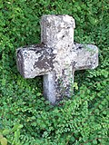
16th century | Atonement cross Tauberbischofsheim V, approx. 16th century, originally outside the development, today inside in Albert-Schweitzer-Straße (Alte Würzburger Straße). See the list of murder and atonement crosses in Tauberbischofsheim .
|
 More pictures |
Württemberg war memorial | Albert-Schweitzer-Strasse 18 (map) |
1866/67 | Württemberg war memorial, after the battle at Tauberbischofsheim in the summer of 1866, the memorial was erected exactly one year later for the fallen Württemberg soldiers at the gates of the city; today it is on the edge of Albert-Schweitzer-Strasse
|
 More pictures |
Wayside shrine | Albert-Schweitzer-Strasse 31-33 (map) |
Wayside shrine
|
|
 More pictures |
Träumeles wayside shrine | Albert-Schweitzer-Strasse 37 (map) |
Träubelesbildstock, on the forecourt of the Tauberbischofsheim hospital . This wayside shrine originally stood on the military training area of the Prinz Eugen barracks in Külsheim. When this area was created, the local farmers were quartered. One of them moved to Impfingen and brought this wayside shrine, which was at his property, to the town of Tauberbischofsheim.
|
|
 More pictures |
Pietà | Albert-Schweitzer-Strasse (map) |
Pietà, on the side of the road above the Tauberbischofsheim hospital
|
|
 More pictures |
Wayside shrine | Old Würzburger Strasse (Tauberbischofsheim – Großrinderfeld) (map) |
Wayside shrine after Albert-Schweitzer-Straße, on the local connection route in the direction of Großrinderfeld
|
|
 More pictures |
Wayside shrine | Old Würzburger Strasse (Tauberbischofsheim – Großrinderfeld) (map) |
Wayside shrine after Albert-Schweitzer-Straße, on the local connecting route in the direction of Großrinderfeld (Alte Würzburger Straße)
|
|
 More pictures |
Klingler Cross | Old Würzburger Strasse (Tauberbischofsheim – Großrinderfeld) (map) |
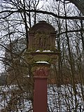
1590 | Klinglerkreuz, Elisabeth Klinglerin, 1590, after Albert-Schweitzer-Strasse, on the local connecting route in the direction of Großrinderfeld (Alte Würzburger Strasse)
|
 |
Wayside shrine | Old Würzburger Strasse (Tauberbischofsheim – Großrinderfeld) (map) |
Wayside shrine with the inscription Ecce homo on Alte Würzburger Strasse from Tauberbischofsheim towards Großrinderfeld.
|
|
 More pictures |
Station building | Am Dittwarer Bahnhof 2 (map) |
Station building on the former Tauberbischofsheim - Dittwar station - Königheim railway line
|
|
 More pictures |
Mary's shrine | Am Dittwarer Bahnhof 2 (map) |
Mary's shrine at the Dittwar train station
|
|
 |
Wayside shrine | Am Heimbergsflur 11 (map) |
Wayside shrine
|
|
 |
Double shrine | Anton-Schwan-Strasse (map) |
Double picture cane at the end of Anton-Schwan-Straße (between the hospital and the Heimberg building). The double picture cane is located on a footpath between Albert-Schweitzer-Straße and Am Heimbergsflur.
|
B.
| image | designation | location | Dating | description |
|---|---|---|---|---|
 More pictures |
synagogue | Bachgasse 9 (map) |
1720-1740 | Location of the former synagogue of the Jewish community of Tauberbischofsheim with a noticeably high entrance area.
|
| barn | Bachgasse 16 (map) |
1674-1675 | Gable-independent barn construction. Erected 1674–1675. Two aisles and four zones divided in the direction of the ridge. Entrance in the left ship. The same structure is repeated in the roof. The load-bearing roof structure is formed by a lying chair construction in combination with standing chair stands. With a few exceptions, all woodworks are made of oak. The barn stands parallel to the mill canal.
|
|
| Residential building | Badgasse 8 (map) |
1482 | House, first phase of construction 1482
|
|
 More pictures |
Tauberbischofsheim station | Bahnhofstrasse 16-18 (map) |
1865-1868 | Tauberbischofsheim station, built 1865–1868 (factual entirety). A technical school for social education has been housed in the building since 2007. See also: Other parts of the whole of the station with goods shed, signal box and toilet block (Bahnhofstrasse 17, 22, Hochhäuser Strasse 1)
|
| Bahnhofstrasse 17 | Part of the whole station
|
|||
| Part of the whole station | Bahnhofstrasse 22 | Part of the whole station
|
D.
| image | designation | location | Dating | description |
|---|---|---|---|---|
 More pictures |
Old city gate, so-called jewelry gate | Dittigheimer Strasse 1–4 (map) |
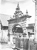
So-called. Ornamental Gate in front of the Upper City Gate. Historic city gate of Tauberbischofsheim at the Halbigsmühle (roller mill). Part of the urban fortification Tauberbischofsheim : Former. City gate (Dittigheimer Straße 4). See also: Remnants of the city wall with round tower (Fischgässchen).
|
|
 More pictures |
Crucifixion group | Dr.-Burger-Strasse 1 (map) |
1792 | Crucifixion group, from 1792, from the former Leonhardikapelle, in Dr.-Burger-Strasse (at the tax office) at the confluence with Albert-Schweitzer-Strasse
|
| graveyard | Dr.-Ulrich-Strasse 2 (map) |
1856 | Christl. Cemetery, cemetery cross, prisoner of war memorial, Jewish cemetery (aggregate). Access above the cemetery (Dr.-Ulrich-Straße 2), see also the access on the street below the cemetery (Hochhäuser Straße 1)
|
|
| Crucifixion group | Dr.-Ulrich-Strasse 2 (map) |
1616 | Crucifixion group at the cemetery building, inscribed 1616; next to it there is a crucifixion group in the middle of the cemetery from 1857
|
E.
| image | designation | location | Dating | description |
|---|---|---|---|---|
 |
Wayside shrine | Edelberg (Flst.Nr. 0-3310) (map) |
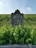
Wayside shrine depicting Pietà
|
|
| Residential and commercial building | Eichstrasse 3 (Flst. No. 0-996) (map) |
Residential and commercial building Protected according to § 2 DSchG
|
F.
| image | designation | location | Dating | description |
|---|---|---|---|---|
 More pictures |
Hunger Tower, city fortifications | Fischgässchen (map) |
Late Middle Ages | Remains of the city wall with the hunger tower ; Parts of the urban fortification Tauberbischofsheim : Remnants of the city wall with round tower (Fischgässchen). See also: Former City gate (Dittigheimer Straße 4).
|
 |
Atonement Cross | Forest ground | 14./15. Century | Atonement Cross Tauberbischofsheim VIII, approx. End of 14./15. Century, northeast of the city to the right of the path in "Forstgrund"; The “Forstbuckel” begins above the cross (to the left of the old Würzburger Strasse). See the list of murder and atonement crosses in Tauberbischofsheim .
|
| Residential building | Frauenstrasse 29 (map) |
1481 | Two-storey, gable-independent building with partly massive ground floor zone and above (now exposed) half-timbering. Vaulted crawl space and a later beam cellar with a mezzanine above. 1481 first construction phase. Further construction phases 1561, 1600-1690, 1720-1790 and 1800-1830. Soot-blackened rafter roof with standing roof truss. The house is on the north side of the street not far from the market square.
|
|
 More pictures |
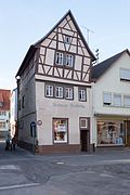
Half-timbered house | Frauenstrasse 38 (map) |
Half-timbered house
|
G
| image | designation | location | Dating | description |
|---|---|---|---|---|
 |
Vocational School Madonna | Gartenstrasse 1 (map) |
1775 | Marian column from 1775, wayside shrine, so-called vocational school Madonna, a statue of the Virgin Mary with baby Jesus, was once in the meadow at the intersection of Dr.-Ulrich-Strasse and Rammingerstrasse, in front of the vocational schools of the Tauberbischofsheim commercial school and the Tauberbischofsheim commercial school . The statue of the Virgin Mary was originally set into a vineyard wall near a sawmill on Königheimer Strasse . After that, the location changed for many years to the meadow in front of the vocational schools at Dr.-Ulrich-Straße 1 and the name Berufsschul-Madonna was born. Today the statue is in the district office of the Main-Tauber district at Gartenstrasse 1 .
|
| Stucco ceiling | Gartenstrasse 1 | 18th century | Interiors with stucco ceilings
|
|
| Lintel | Grabenweg 18 (map) |
1732 | Lintel from 1732. This was part of the old school building near the St. Martin church . Due to the new construction of the town church in 1909, the old schoolhouse was torn down and its lintel was reused when a new house was built at Grabenweg 18.
|
H
| image | designation | location | Dating | description |
|---|---|---|---|---|
 More pictures |
Favorite house | Hauptstrasse 21 (map) |
1628 | Half-timbered house, built in 1628, birthplace of Jacobus Gallus von Holach, wooden panels on the facade refer to the Melusin sagas of the Taubertal
|
 More pictures |
Mackert's house | Hauptstrasse 31 (map) |
1744-1746 | Mackertsches Haus, built from 1744 to 1746, a monument to the baroque wine trading era
|
 More pictures |
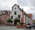
monastery | Hauptstrasse 33, 35 (map) |
16.-18. Century | Former Franciscan monastery (aggregate).
|
 More pictures |
Rincker house | Hauptstrasse 40 (map) |
1678 | Rincker-Haus, half-timbered house, from 1786 to 1823 the seat of the Kurmainzischen hospital administrator Rincker
|
 More pictures |
Mary figure | Hauptstrasse 48 (map) |
1730 | Figure of Mary, from 1730
|
 More pictures |
Sandstone figure | Hauptstrasse 49 (map) |
1736 | Sandstone figure, from 1736, inscription: "Zum Rießen 1736"
|
 More pictures |
Badischer Hof | Hauptstrasse 70 (map) |
1733 | Badischer Hof, from 1733, Baroque period, built in 1733 as the aristocratic court of the knight Anton Phillip von Fleischmann, later served as the grand ducal post stable master's office in Baden, the oldest hotel in Tauberbischofsheim, around 1811 it received its current name, in 1894 a hall with large arched windows was added, the exterior is true to the original receive
|
| Historic house | Hauptstrasse 71 (map) |
1866 | Former residential and commercial building, other monument from 1866
|
|
 More pictures |
Maria-Hilf chapel | Hauptstrasse 73 (map) |
1700 | Maria-Hilf-Chapel, first half of the 18th century, built in 1700 from private funds, Roman Catholic baroque church, the front is characterized by a curved gable and the columned portal with a blown gable
|
 |
Wayside shrine | Hochhäuser Strasse 1 (map) |
1669 | Wayside shrine, from 1669
|
| Part of the whole station | Skyscrapers Street 1 | Part of the whole station (see also: Bahnhofstrasse).
|
||
 More pictures |
graveyard | Hochhäuser Strasse 1 (map) |
1856 | Tauberbischofsheim Cemetery, 1856, entity, high-rise buildings at 1 (below) and Dr.-Ulrich-Straße 2 (above)
|
 More pictures |
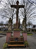
Crucifixion group | Hochhäuser Strasse 1 (map) |
1857 | Crucifixion group in the cemetery There is also a crucifixion group from 1616 on the cemetery building (see: Dr.-Ulrich-Straße 2)
|
 More pictures |
Mary's Grotto | Hochhäuser Strasse 1 (map) |
Mariengrotte in the cemetery
|
|
 More pictures |
War memorial | Hochhäuser Strasse 1 (map) |
War memorial in the Tauberbischofsheim cemetery
|
|
 More pictures |
War memorials | Hochhäuser Strasse 1 (map) |
War memorials in the Tauberbischofsheim cemetery
|
|
 More pictures |
War memorials | Hochhäuser Strasse 1 (map) |
War memorials in the Tauberbischofsheim cemetery
|
|
 More pictures |
War memorial cross | Hochhäuser Strasse 1 (map) |
War memorial cross in the Tauberbischofsheim cemetery
|
|
 More pictures |
War memorials | Hochhäuser Strasse 1 (map) |
War memorials in the Tauberbischofsheim cemetery The middle cross was erected for a Nassau NCO who was wounded in the battle near Gerchsheim and later died in Tauberbischofsheim.
|
|
 More pictures |
War memorials | Hochhäuser Strasse 1 (map) |
War memorials in the Tauberbischofsheim cemetery
|
|
 More pictures |
Tauberbischofsheim Jewish cemetery | Hochhäuser Strasse 1 (map) |
1875 | Jewish cemetery Tauberbischofsheim, 1875 by the Jewish community Tauberbischofsheim built
|
 |
Wayside shrine | Hochhäuser Strasse 8 (map) |
Wayside shrine
|
I.
| image | designation | location | Dating | description |
|---|---|---|---|---|
 |
Wayside shrine | Im Berg (Gewann) (Flst.Nr. 0-6824) K 2816 (an) (Dienstadt – Tauberbischofsheim) (map) |
Wayside shrine Protected according to § 2 DSchG
|
|
 |
Stone cross | Im Berg (Gewann) (Flst.Nr. 0-6847) K 2816 (an) (Dienstadt – Tauberbischofsheim) (map) |
approx. 16./17. Century | Stone cross. Atonement Cross Tauberbischofsheim VII, approx. 16./17. Century, on the county road from Tauberbischofsheim to Dienstadt; shortly after the atonement cross the Dienstädter district begins. See the list of murder and atonement crosses in Tauberbischofsheim . Protected according to § 2 DSchG
|
K
| image | designation | location | Dating | description |
|---|---|---|---|---|
 More pictures |
St. Boniface | Kapellenstrasse 4 (map) |
1964-1967 | Catholic parish church St. Bonifatius, built 1964–1967 according to plans by Erwin van Aaken, glass windows by Emil Wachter, bronze fittings (tabernacle, cross, Madonna, Bonifatius, Lioba, Stations of the Cross) by Lukas Gastl, organ by Hubert Sandtner (2005)
|
| Rectory | Kirchweg 3 (map) |
Rectory. Part of the totality of ev. Parish church and rectory.
|
||
 More pictures |
Christ Church | Kirchweg 4 (map) |
1894-1895 | Christ Church, built between 1894 and 1895, Protestant town church. Part of the totality of ev. Parish church and rectory.
|
 More pictures |
St. Lioba Church | Klostergasse 1 (map) |
1650 | St. Lioba Church, built in 1650, completed after further changes in Baroque style in 1753, formerly St. Chapel consecrated to Elisabeth, later served as the former monastery church of the Franciscan monastery of Tauberbischofsheim, which was dissolved in 1823
|
 More pictures |
Building with archway and wall decorations | Klostergasse 3 | 14th century | Former hospital for the poor, emerged from the monastery hospital, first mentioned in a document in the 14th century; Archway from 1605, artistic wall decorations
|
 More pictures |
Building inscription | Klostergasse 10 | 1619 | Building inscription, from 1619, building inscription "1619 WI" with professional identification of the rope makers in Tauberbischofsheim, WI are the initials of the rope maker Wolff Jacob, the grandfather of Gallus Jacob.
|
 More pictures |
Stone gate | Klostergasse 13 (map) |
Stone gate
|
|
 More pictures |
Wayside shrine | Königheimer Strasse 8 (map) |
Wayside shrine in Königheimer Strasse. 14 Holy Helpers.
|
|
 More pictures |
Wayside shrine | Koenigheimer Strasse | Wayside shrine in Königheimer Strasse
|
|
 More pictures |
Wayside shrine | Koenigheimer Strasse 32 (map) |
Wayside shrine in front of a residential building on Königheimer Strasse. Spöhr accident shrine.
|
|
 More pictures |
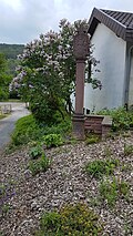
Wayside shrine | Koenigheimer Strasse 69 (map) |
1997 | Wayside shrine with a Pietà and a cross on top, at the corner of a crossroads, roughly in the middle of Königheimer Straße. Inscription on the base: "Former location on Külsheimer Straße (LGB. NR. 7077). New production on behalf of the Herbert and Helena Baumann TBB 1997."
|
 More pictures |
Wayside shrine | Koenigheimer Strasse | Wayside shrine in Königheimer Strasse
|
L.
| image | designation | location | Dating | description |
|---|---|---|---|---|
 |
Wayside shrine | L 578 (card) |
Wayside shrine, located on the L 578, near the Laurentiusberg.
|
|
 More pictures |
Laurentius Chapel | Laurentiusberg (map) |
1702/1723 | Laurentiuskapelle (formerly called St. Lorenzikapelle ), 1702, inaugurated on August 10, 1723.
|
 More pictures |
Atonement Cross | Laurentiusberg (map) |
16th century | Atonement Cross Tauberbischofsheim I, approx. 16th century, one of three late medieval atonement crosses next to the Laurentius Chapel. See the list of murder and atonement crosses in Tauberbischofsheim .
|
 More pictures |
Atonement Cross | Laurentiusberg (map) |
15./16. Century | Atonement Cross Tauberbischofsheim II, approx. 15./16. Century, one of three late medieval atonement crosses next to the Laurentiuskapelle. See the list of murder and atonement crosses in Tauberbischofsheim .
|
 More pictures |
Atonement Cross | Laurentiusberg (map) |
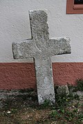
16./17. Century | Atonement Cross Tauberbischofsheim III, approx. 16./17. Century, one of three late medieval atonement crosses next to the Laurentiuskapelle. See the list of murder and atonement crosses in Tauberbischofsheim .
|
 More pictures |
Friedrichs-Höhe | Laurentiusberg (map) |
1863 | Völkerschlachtdenkmal, from 1863, so-called "Friedrichs-Höhe", monument to the Völkerschlacht von Leipzig, stone column, was erected by the city of Tauberbischofsheim in 1863 - on the 50th anniversary of the Völkerschlacht bei Leipzig. See inscription on the base.
|
 More pictures |
Wayside shrine | Laurentiusbergstrasse 16 (map) |
1578 | Depiction of the crucifixion from 1578, in the area of the Protestant kindergarten. formerly on the old Laurentiusbergstrasse
|
 More pictures |
Wayside shrine | Laurentiusbergstrasse 37 (map) |
Wayside shrine.
|
M.
| image | designation | location | Dating | description |
|---|---|---|---|---|
 More pictures |
Rehhof | Marktplatz 6 (map) |
1702 | Rehhof, a rocky entrance gate from 1702, the house coat of arms of the "Rehe-Hoff" is visible, probably one of the first seven courtyards in Tauberbischofsheim
|
 More pictures |
town hall | Marktplatz 8 (map) |
1865-1867 | Town hall, built from 1865 to 1867 in neo-Gothic style
|
 |
Plaque | Marktplatz 8 (map) |
1933-1945 | Memorial plaque in the town hall for “the Jewish fellow citizens expelled and murdered by injustice and tyranny” in the city from 1933 to 1945
|
 |
Stone cross | Marktplatz 8 (map) |
Stone cross, in front of the town hall on the market square
|
|
 |
Thurn and Taxis Post Office | Marketplace 9/10 (map) |
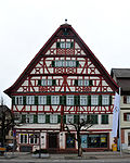
1550 | Thurn- und Taxissche Post, half-timbered house, half-timbered lower floors from 1550, created in 1602 as a large half-timbered house by adding a gable, the Alte Post building originally consisted of two small houses
|
 |
Star pharmacy and De la Roche house | Marktplatz 13 (map) |
1613 | Star pharmacy and de la Roche house, half-timbered houses, star pharmacy built from 1613, De la Roche house built from 1670
|
| Residential building | Martinsgasse 1 (map) |
16th century | Other monument from the 16th century
|
|
 |
Atonement Cross | Moosichwald (map) |
15-17 Century | Atonement Cross Tauberbischofsheim IX, approx. 15./17. Century, east of the city on the northern edge of the Moosichwald. See the list of murder and atonement crosses in Tauberbischofsheim .
|
O
| image | designation | location | Dating | description |
|---|---|---|---|---|
| Half-timbered house | Obere Gasse (map) |
Half-timbered house in the middle of this narrow alley between St.-Lioba-Straße and Ringstraße.
|
||
 More pictures |
Upper Sprait Chapel | Upper Sprait (Gewann) (Flst.Nr. 0-6957) (Map) |
1754 | Upper Sprait Chapel, marked in 1754, in the Upper Sprait estate. Protected according to § 2 DSchG
|
R.
| image | designation | location | Dating | description |
|---|---|---|---|---|
 |
Wayside shrine | Cycle path (Tauberbischofsheim – Dittwar) (map) |
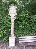
Wayside shrine, on the bike path from Tauberbischofsheim to Dittwar, at the level of the Dittwar train station
|
S.
| image | designation | location | Dating | description |
|---|---|---|---|---|
| Part of the castle complex | Schloßplatz 3 (map) |
13-19 Century | Part of the castle complex (totality), see also: Schloßplatz 7
|
|
| Part of the castle complex | Schloßplatz 4 (map) |
13-19 Century | Part of the castle complex (totality), see also: Schloßplatz 7
|
|
| Part of the castle complex | Schloßplatz 5 (map) |
13-19 Century | Part of the castle complex (totality), see also: Schloßplatz 7
|
|
 More pictures |
Electoral Mainz Castle | Schlossplatz 7 (map) |
13th century | Kurmainzisches Schloss, originating as a medieval town castle from the 13th century, of which the keep (tower tower) is still preserved today, replaced in the 16th century by the Kurmainzische Schloss, former seat of the archbishopric officials of the Mainz spa state, today houses the Tauber Franconian landscape museum castle complex (Entity), barn (§ 2)
|
 More pictures |
Türmersturm | Schlossplatz 7 (map) |
1270 | Türmersturm, construction started in 1270, former keep of the medieval town castle from the 13th century, landmark of the town of Tauberbischofsheim
|
 More pictures |
Elementary school | Schlossplatz 8 (map) |
1907-1908 | Former municipal elementary school, today elementary school at the castle.
|
 More pictures |
Frankoniahaus | Schmiederstrasse 19 (map) |
Frankoniahaus, used today by the Franconian News
|
|
| jail | Schmiederstrasse 20 (map) |
1854-1855 | Former District office prison with surrounding wall (totality).
|
|
| Former tax office | Schmiederstrasse 21 (map) |
1886-1937 | Former "Combined settlement and district forestry" with extension wing. Miscellaneous monument. Serves today as one of several administrative buildings of the district office of the Main-Tauber district. Protected according to §. DSchG
|
|
 More pictures |
Local court Tauberbischofsheim | Schmiederstrasse 22 (map) |
1875-1876 | District Court, 1875–1876 re.
|
| hospital | Schmiederstrasse 25 (map) |
1865-1866 | Former municipal hospital with garden and surrounding wall (totality).
|
|
 More pictures |
Peterskapelle | Schmiederstrasse 28 / Museumsstrasse (map) |
1180 | Peterskapelle (also called the chapel in front of the gate in old documents), built in 1180, the oldest sacred building in the city of Tauberbischofsheim, from Romanesque times, from around 1400 on the cemetery chapel in the Petersfriedhof up to the construction of today's cemetery across from the railway line in 1853, un-vaulted hall with retracted Rectangular choir, which opens into the nave in a wide and compact arch, preserved altar group inside the church with three early baroque altars from the 17th century, choir with stucco ceiling from 1624, rich fittings from the Renaissance period
|
 More pictures |
Churchyard | Schmiederstrasse 28 / Museumsstrasse (map) |
16. – 19. Century | St. Peters Cemetery
|
 More pictures |
Half-timbered house | Sonnenplatz 1 (map) |
1550 | Half-timbered house, from 1550
|
 More pictures |
Gorres House | Sonnenplatz 2 (map) |
1902 | Görres House, built in Art Nouveau style from 1902, a previous owner who was distantly related to the political writer Josef von Görres placed a bust of this writer in a niche in the house, originally a statue of the Virgin Mary
|
 More pictures |
Sonnenplatz pharmacy | Sonnenplatz 4 (map) |
1730 | Sonnenplatz pharmacy, built in 1730, Baroque period, expanded in Empire style in 1810 with a magnificent interior made of dark cherry heartwood, a pharmacy museum since 2006.
|
| Wayside shrine | Sprait | Wayside shrine, on the Sprait (towards Dienstadt)
|
||
 More pictures |
St. Martin | St. Lioba Square 1 (map) |
1910-1914 | Catholic parish church of St. Martin, built 1910–1914 according to plans by Ludwig Maier, high altar by Thomas Buscher (1916), Marienaltar by Niklaus Weckmann / Hans Schäufelein (1517), Madonna by Hans Multscher (1480), organ by Claudius F. Winterhalter ( 1989)
|
| Mount of Olives | St.-Lioba-Platz 1 (near) (map) |
Mount of Olives scene
|
||
| Lioba fountain | St.-Lioba-Platz 1 (near) (map) |
Lioba fountain. St. Lioba fountain with statue of St. Lioba von Tauberbischofsheim .
|
||
 More pictures |
Sebastianus Chapel | St.-Lioba-Platz 4, Kirchgäßchen (map) |
1474 | Sebastianus Chapel, built in 1474, double chapel, former cemetery chapel, with a stone sculpture of the Last Judgment at the entrance to the basement, the ossuary (ossuary); Plaques on both sides tell of the construction of the chapel; City memorial for the dead of both wars and the post-war period; on the upper floor a chapel of the former Sebastianus Brotherhood; late Gothic, renovated church interior, glass pictures of the life of Lioba von Tauberbischofsheim (city saint), created according to designs by the painter Feuerstein; Located at St.-Lioba-Platz 4 between Kirchgäßchen and Martinsgasse
|
| Residential building | St. Lioba Square 5 (map) |
18th century | Residential house with courtyard wall and gate (totality).
|
|
 More pictures |
Half-timbered house | St. Lioba Street 24 (map) |
Historic half-timbered house
|
|
 More pictures |
Half-timbered house | 29 St. Lioba Street (map) |
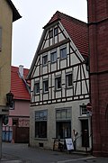
19th century | Half-timbered house. Residential and commercial building. Miscellaneous monument. Second half of the 19th century
|
 More pictures |
Way of the Cross | Stammbergweg (map) |
1772 | Way of the Cross, from 1772, with seven stations for the seven sorrows of Mary, follows on from the prophecy of Simeon; The veneration of the Sorrows of Mary arose in the Middle Ages; The seven sorrows of Mary are each symbolized by swords
|
 More pictures |
1st station of the cross | Stammbergweg (map) |
1772 | Station of the Cross 1/7 (Tauberbischofsheim) of the seven stations of the Cross to the Stammberg Chapel. Depiction of one of the so-called "Seven Sorrows of Mary".
|
 More pictures |
2nd station of the cross | Stammbergweg (map) |
1772 | Station of the Cross 2/7 (Tauberbischofsheim) of the seven stations of the Cross to the Stammberg Chapel. Depiction of one of the so-called "Seven Sorrows of Mary".
|
 More pictures |
3rd station of the cross | Stammbergweg (map) |
1772 | Way of the Cross station 3/7 (Tauberbischofsheim) of the seven stations of the Way of the Cross to the Stammberg Chapel. Depiction of one of the so-called "Seven Sorrows of Mary".
|
 More pictures |
4th station of the cross | Stammbergweg (map) |
1772 | Stations of the Cross 4/7 (Tauberbischofsheim) of the seven stations of the Cross to the Stammberg Chapel. Depiction of one of the so-called "Seven Sorrows of Mary".
|
 More pictures |
5th station of the cross | Stammbergweg (map) |
1772 | Stations of the Cross 5/7 (Tauberbischofsheim) of the seven stations of the Cross to the Stammberg Chapel. Depiction of one of the so-called "Seven Sorrows of Mary".
|
 More pictures |
6. Stations of the Cross | Stammbergweg (map) |
1772 | Stations of the Cross 6/7 (Tauberbischofsheim) of the seven stations of the Cross to the Stammberg Chapel. Depiction of one of the so-called "Seven Sorrows of Mary".
|
 More pictures |
7th station of the cross | Stammbergweg (map) |
1772 | Stations of the Cross 7/7 (Tauberbischofsheim) of the seven stations of the Cross to the Stammberg Chapel. Depiction of one of the so-called "Seven Sorrows of Mary".
|
 More pictures |
Pietà representation | Stammbergweg (map) |
Pietà representation, located on the Way of the Cross shortly after the Hotel St. Michael on the right side of the road
|
|
 More pictures |
crossroads | Stammbergweg (map) |
1867 | Way cross, from 1867, located on the way of the cross from the Hotel St. Michael to the Stammberg chapel on the right side of the path
|
 More pictures |
Wayside shrine | Stammbergweg (map) |
1559 | Wayside shrine, from 1559, just before the Stammberg chapel on the left side of the path
|
 More pictures |
Wayside shrine | Stammbergweg (map) |
1643 | Wayside shrine, from 1643, just before the Stammberg chapel on the right side of the path
|
 More pictures |
Stammbergkapelle | Stammbergweg (map) |
1773 | Stammbergkapelle (also called Maria-Pain-Chapel), located outside the city on the Stammberg from which it is named; also called the Way of the Cross Chapel
|
 More pictures |
Pietà | Stammbergweg (map) |
1773 | Pietà, located about 15 meters to the left of the Stammberg chapel
|
 More pictures |
Field chapel on the Stammberg | Stammbergweg (map) |
Field chapel on the Stammberg (Brehmbachtal, at the beginning of the Appental valley)
|
|
 |
Wayside shrine | Stammberg (map) |
Wayside shrine. Depiction of Mary with baby Jesus
|
|
 |
Memorial stone | Stammberg (map) |
Memorial stone in the bird sanctuary on Stammberg
|
|
 |
cross | Stammberg (map) |
Wooden cross with the corpus of Christ in the forest on Stammberg
|
|
 |
Landmarks | Stammberg (map) |
Several boundary stones with the Tauberbischofsheim coat of arms on the Stammberg, including at the Fuhrmannsloch
|
|
 More pictures |
Archbishop's Convict for Boys | Stammbergweg 1 (map) |
1890-1891 | Main building of the former Archbishop's St. Michael Boys' Convict, from 1890–1891, with decorated windows and stone figures; The Archbishop's Knabenkonvikt was a predecessor of the Matthias Grünewald Gymnasium , now the Hotel St. Michael
|
 More pictures |
House chapel in the Hotel St. Michael | Stammbergweg 1 (map) |
1891 | House chapel in the Hotel St. Michael, from 1891, chapel in the former Archbishop's Knabenkonvikt , a predecessor school of the Matthias-Grünewald-Gymnasium , today in the Hotel St. Michael, with richly decorated windows from 1891
|
 More pictures |
Sacred Heart Chapel | Stammbergweg 1 (map) |
Sacred Heart Chapel with organ
|
|
| statue | Stammbergweg 1 (map) |
Statue in front of the Hotel St. Michael
|
||
| statue | Stammbergweg 1 (map) |
Statue at the front of the St. Michael Hotel
|
||
| Wayside shrine | Stammbergweg 1 | Pietà and scallop representation, at the former Konvikt
|
||
 |
statue | Struwepfad 1 (map) |
Wall portrait: statue in wall niche. At the house on the corner of Struwepfad / St.-Lioba-Platz.
|
T
| image | designation | location | Dating | description |
|---|---|---|---|---|
 |
Wayside shrine | Fir forest (map) |
Wayside shrine on the edge of the fir forest near the Leintalsgraben near Panzerstraße.
|
|
 |
Memorial stone | Fir forest (map) |
Memorial stone in the fir forest at Silberbrünnle near Leintalsgraben.
|
U
| image | designation | location | Dating | description |
|---|---|---|---|---|
| cornerstone | Lower alley | 1592 | Eckstein, which is reminiscent of a historical building. Corner of Frauenstrasse-Untere Gasse with the year 1592. The abbreviation “GD” belongs to the rich cathedral chapter factor Georg Dillmann.
|
|
| cornerstone | Lower alley | 1591 | Eckstein, which is reminiscent of a historical building. Year 1591. As with another corner stone also with the name Georg Dillmann.
|
|
 More pictures |
Lower Sprait Chapel | Lower Sprait (Won) (Map) |
16th century | Lower Sprait Chapel. (also field chapel on the Sprait), on the Sprait at the place of execution, at the end of the Schützenweg. Protected according to § 2 DSchG
|
 |
Atonement Cross | Lower Sprait (Gewann) (Reg. No. 0-7067) (Map) |
Atonement Cross | Atonement Cross Tauberbischofsheim IV, approx. 16./17. Century, so-called "Richtplatzkreuz" (the former place of execution was nearby; the stone cross is located after the end of the Schützenweg in the Gewann Unterer Sprait). See the list of murder and atonement crosses in Tauberbischofsheim . Protected according to § 2 DSchG
|
V
| image | designation | location | Dating | description |
|---|---|---|---|---|
 |
Fallen memorial | Vitryallee (Flst.Nr. 0-1241 / 4) in the green area (map) |
1914-1918 | Fallen memorial or war memorial, at the beginning of Vitryallee on a meadow in front of the Tauber Bridge Protected according to § 2 DSchG
|
 |
crossroads | Vitryallee 7 (Flst.Nr. 0-1241 / 5) (map) |
1843 | Stone cross, from 1843 Protected according to § 2 DSchG
|
 More pictures |
Rector's Chapel | Vorderer Heimberg (map) |
1626 | So-called. Rector's Chapel, built by Kaspar Liebler and Jacob Trefs from 1626 according to the column inscription. The name Rektorskapelle probably comes from a custom of a former school principal to sing songs of the Mother of God with his students at this point. Located today at the top of the Gewanns Vorderer Heimberg, near the Hammberg district. The rector's chapel used to be at a different location near the Tauberbischofsheim hospital. The Hammbergsteig leads from Albert-Schweitzer Straße to the Rector's Chapel on the edge of the forest on Hammberg.
|
W.
| image | designation | location | Dating | description |
|---|---|---|---|---|
 |
Stone cross | Wellenberg (Gewann) (Flst.Nr. 0-428) L 504 (an) (Tauberbischofsheim – Külsheim) (map) |
16./.17. Century | Stone cross. Atonement Cross Tauberbischofsheim VI, approx. 16./17. Century, about a kilometer west of the city, right on the road towards Külsheim, above a small retaining wall. See the list of murder and atonement crosses in Tauberbischofsheim . Protected according to § 2 DSchG
|
| Wayside shrine | Wertheimer Straße (Flst. No. 4932) Impfinger Grund (Gewann) (map) |
Wayside shrine. Stefan's Pietà. Protected according to § 2 DSchG
|
||
 More pictures |
Wayside shrine | Wieselberg (Flst. No. 0-8428) Wiesenbach (Gewann) near Dittwar train station (map) |
1608 | So-called. "Metzger-Bildstock" or "Metzgerbild" from 1608, on the old way to Gissigheim, near Dittwarer train station. Crucifixion Depiction. Depiction of the activity of the butcher leading a calf. Accompanied by a dog. Possibly a butcher's thanks for being able to pass this mountainous route without physical harm. Protected according to § 2 DSchG
|
| Historic house | Würzburger Strasse 1 (map) |
Historic house
|
Z
| image | designation | location | Dating | description |
|---|---|---|---|---|
| Niche with house Madonna | Zehntgasse 1 (tax no. 0-585) (map) |
Niche with house Madonna (on the building) Protected according to § 2 DSchG
|
||
 More pictures |
Residential building | Kennel 2 (Flst.Nr. 0-622 / 1) (map) |
1559 | Residential house, with heraldic plaque and statue, from 1559. Protected according to § 28 DSchG
|
 More pictures |
Heraldic panel | Kennel 2 (Flst.Nr. 0-622 / 1) (map) |
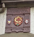
1559 | Coats of arms of the cathedral provost factor Julius Zehender (center), his first wife Margaretha Denerin (left), his second wife Catharina Pfrundschigin (Pfreundschick, right). Part of the memorial at Zwinger 2 (residential building). Protected according to § 28 DSchG
|
 More pictures |
statue | Kennel 2 (Flst.Nr. 0-622 / 1) (map) |
Virgin Mary statue with baby Jesus on a corner of the house. Part of the memorial at Zwinger 2 (residential building). Protected according to § 28 DSchG
|
|
| Wayside shrine | Room place | 1626 | Wayside shrine from 1626, Drei Lilien, on the former Konvikt (today: Hotel St. Michael), on the former Zimmerplatz
|
See also
- List of street names in Tauberbischofsheim , where many of the cultural monuments are located
literature
- Adolf von Oechelhäuser : The art monuments of the Grand Duchy of Baden. Volume 4: District of Mosbach. Second division: Tauberbischofsheim district. Freiburg im Breisgau 1898, pp. 151-207 (Tauberbischofsheim).
- Hugo Stang, Anton Ullrich, Wilhelm Ogiermann, Josef Kiefer, August Haun: Tauberbischofsheim. From the history of an old official town . Self-published by the city administration, Tauberbischofsheim 1955 (chronicle without the period 1600 to 1800).
- Franz Gehrig , Hermann Müller: Tauberbischofsheim . Association of Tauberfränkische Heimatfreunde e. V., Tauberbischofsheim 1997 (focus of the chronicle: 1600 to 1900).
Web links
Remarks
- ↑ This list may not correspond to the current status of the official list of monuments. This can be viewed by the responsible authorities. Therefore, the presence or absence of a structure or ensemble on this list does not guarantee that it is or is not a registered monument at the present time. The State Office for Monument Preservation Baden-Württemberg provides binding information .
Individual evidence
- ↑ a b c d e f g h i j k l m n o p q r s t u v w x y z aa ab ac ad ae af Jürgen Wohlfarth: wayside shrines . Online at www.büscheme.de. Retrieved January 15, 2018.
- ↑ a b c d e f g h i Sven Gerth: Tauberbischofsheim . Online at www.suehnekreuz.de. Retrieved January 15, 2018.
- ^ Information from Franz Kuhngamberger, Heimatverein Impfingen, January 9, 2018.
- ^ Bauforschung-BW.de: Barn in Tauberbischofsheim .
- ^ Bauforschung-BW.de: House in Tauberbischofsheim .
- ↑ a b c d LEO-BW.de: Bahnhof (Bahnhofstrasse 17, 22, Hochhäuser Strasse 1, Tauberbischofsheim) . Online at www.leo-bw.de. Retrieved June 19, 2018.
- ↑ a b my homepage - city wall. In: xn--bscheme-n2a.de. Retrieved August 25, 2020 .
- ↑ a b LEO-BW.de: City fortifications (Dittigheimer Straße 4 (near), Fischgässchen, Tauberbischofsheim) . Online at www.leo-bw.de. Retrieved June 19, 2018.
- ↑ LEO-BW.de: Cemetery (Dr. Ulrich-Straße 2, Tauberbischofsheim) . Online at www.leo-bw.de. Retrieved December 5, 2018.
- ^ City of Tauberbischofsheim: Tauberbischofsheim cemetery system. Cemeteries in Tauberbischofsheim and communities . Online at www.tauberbischofsheim.de. Retrieved December 5, 2018.
- ↑ a b LEO-BW.de: Crucifixion Group (Dr.-Ulrich-Straße 2, Tauberbischofsheim) . Online at www.leo-bw.de. Retrieved December 5, 2018.
- ↑ a b c d e f g h i j k LEO-BW.de: Friedhof (Dr.-Ulrich-Straße 2, Tauberbischofsheim). Totality. . Online at www.leo-bw.de. Retrieved June 19, 2018.
- ^ Bauforschung-BW.de: House in Tauberbischofsheim .
- ↑ LEO-BW.de: Mariensäule (Gartenstrasse 1, Tauberbischofsheim) . Online at www.leo-bw.de. Retrieved December 5, 2018.
- ↑ LEO-BW.de: Stucco ceiling (Gartenstrasse 1, Tauberbischofsheim) . Online at www.leo-bw.de. Retrieved December 5, 2018.
- ^ Jürgen Wohlfarth: Grabenweg, Taubst . Online at www.büscheme.de. Retrieved June 13, 2018.
- ↑ Bauforschung-BW.de: Lieblerhaus .
- ↑ LEO-BW.de: Franciscan Tauberbischofsheim . Online at www.leo-bw.de. Retrieved December 5, 2018.
- ↑ LEO-BW.de: Kloster (Hauptstrasse 33, 35, Tauberbischofsheim) . Online at www.leo-bw.de. Retrieved December 5, 2018.
- ↑ LEO-BW.de: residential and commercial building (main road 71, Tauberbischofsheim) . Online at www.leo-bw.de. Retrieved December 5, 2018.
- ↑ LEO-BW.de: Chapel (Hauptstrasse 73, Tauberbischofsheim) . Online at www.leo-bw.de. Retrieved December 5, 2018.
- ^ Catholic parish of Tauberbischofsheim: Bonifatiuskirche . Online at www.kath-kirche-tbb.de. Retrieved January 15, 2018.
- ↑ a b Parish Church Kirchweg 3 4 Tauberbischofsheim - detail page - LEO-BW. In: leo-bw.de. Retrieved August 25, 2020 .
- ↑ LEO-BW.de: Chapel (Laurentiusbergstraße 20, Tauberbischofsheim) . Online at www.leo-bw.de. Retrieved December 5, 2018.
- ↑ LEO-BW.de: Town Hall (Marktplatz 8, Tauberbischofsheim) . Online at www.leo-bw.de. Retrieved December 5, 2018.
- ↑ LEO-BW.de: House (Martinsgasse 1, Tauberbischofsheim) . Online at www.leo-bw.de. Retrieved December 5, 2018.
- ^ Jürgen Wohlfarth: Obere Gasse . Online at www.büscheme.de. Retrieved June 13, 2018.
- ↑ LEO-BW.de: Chapel (Tauberbischofsheim), description: Obere Spraitkapelle . Online at www.leo-bw.de. Retrieved June 19, 2018.
- ↑ a b c d LEO-BW.de: former Kurmainzisches Schloss (Schloßplatz 3, 4, 5, 7, Tauberbischofsheim) . Online at www.leo-bw.de. Retrieved December 5, 2018.
- ↑ LEO-BW.de: Tauberfränkisches Landschaftsmuseum . Online at www.leo-bw.de. Retrieved December 5, 2018.
- ↑ LEO-BW.de: elementary school (Schloßplatz 8, Tauberbischofsheim) . Online at www.leo-bw.de. Retrieved December 5, 2018.
- ↑ LEO-BW.de: prison (Schmieder Straße 20, Tauberbischofsheim) . Online at www.leo-bw.de. Retrieved December 5, 2018.
- ↑ LEO-BW.de: Tax Office (Schmiederstraße 21, Tauberbischofsheim) . Online at www.leo-bw.de. Retrieved December 5, 2018.
- ↑ LEO-BW.de: District Court (Schmiederstraße 22, Tauberbischofsheim) . Online at www.leo-bw.de. Retrieved December 5, 2018.
- ↑ LEO-BW.de: Spital (Schmiederstraße 25, Tauberbischofsheim) . Online at www.leo-bw.de. Retrieved December 5, 2018.
- ↑ LEO-BW.de: Chapel (Schmiederstraße 28, Tauberbischofsheim) . Online at www.leo-bw.de. Retrieved December 5, 2018.
- ↑ LEO-BW.de: Kirchhof (Schmiederstraße 28, Tauberbischofsheim) . Online at www.leo-bw.de. Retrieved December 5, 2018.
- ↑ LEO-BW.de: Kath. Stadtkirche (St.-Lioba-Platz 1, Tauberbischofsheim) . Online at www.leo-bw.de. Retrieved December 5, 2018.
- ↑ Basic information about the church in the Church Guide St. Martin . (PDF; 447.7 kB). Online at www.kath-kirche-tbb.de. Retrieved January 15, 2018.
- ↑ LEO-BW.de: Ölberg (St.-Lioba-Platz 1 (near), Tauberbischofsheim) . Online at www.leo-bw.de. Retrieved December 5, 2018.
- ↑ LEO-BW.de: cath. Sebastian's Chapel (St.-Lioba-Platz 4, Tauberbischofsheim) . Online at www.leo-bw.de. Retrieved December 5, 2018.
- ↑ LEO-BW.de: residential building (St.-Lioba-Platz 5, Tauberbischofsheim) . Online at www.leo-bw.de. Retrieved December 5, 2018.
- ↑ LEO-BW.de: residential and commercial building (St.-Lioba-Straße 29, Tauberbischofsheim) . Online at www.leo-bw.de. Retrieved December 5, 2018.
- ↑ a b LEO-BW.de: Chapel (Stammbergweg, Tauberbischofsheim) . Online at www.leo-bw.de. Retrieved December 5, 2018.
- ↑ LEO-BW.de: Konvikt (Stammbergweg 1, Tauberbischofsheim) . Online at www.leo-bw.de. Retrieved December 5, 2018.
- ↑ a b Jürgen Wohlfarth: Untere Gasse . Online at www.büscheme.de. Retrieved June 13, 2018.
- ↑ LEO-BW.de: Chapel (Tauberbischofsheim), description: Lower Spraitkapelle. . Online at www.leo-bw.de. Retrieved June 19, 2018.
- ↑ LEO-BW.de: Chapel (Tauberbischofsheim) . Online at www.leo-bw.de. Retrieved December 5, 2018.
- ↑ a b c Jürgen Wohlfarth: Zwinger . Online at www.büscheme.de. Retrieved June 13, 2018.
