List of cultural monuments in Tauberbischofsheim-Hochhausen
|
List of cultural monuments in Tauberbischofsheim :
City of Tauberbischofsheim by street name: A • B • D • E • F • G • H • I • K • L • M • O • R • S • T • U • V • W • Z) Other districts: Dienstadt • Distelhausen • Dittigheim • Dittwar • Hochhausen • Impfingen |
The list of cultural monuments in Tauberbischofsheim- Hochhausen lists the cultural monuments of the Tauberbischofsheim district of Hochhausen . This list is a partial list of the list of cultural monuments in Tauberbischofsheim . The basis for this list is the list of architectural and art monuments published by the Stuttgart Regional Council as of February 15, 2012.
This list is not legally binding. Legally binding information is only available on request from the Lower Monument Protection Authority of the city of Tauberbischofsheim.
Cultural monuments in Hochhausen
Architectural, art and cultural monuments in Hochhausen ( ⊙ ):
![]() Map with all coordinates of the cultural monuments in the district of Hochhausen: OSM
Map with all coordinates of the cultural monuments in the district of Hochhausen: OSM
| image | designation | location | Dating | description |
|---|---|---|---|---|
 |
Wayside shrine | Alte Steige (Flst.Nr. 0-7000) Brunnenflur-Steig (Gewann) (map) |
Wayside shrine, on the old path above a new building area. Protected according to § 28 DSchG
|
|
 |
Wayside shrine | At the railway (Flst. No. 0-118), Schulzengasse (map) |
Wayside shrine (in the green area), with a representation of the “Marienkrönung”, from 1818, on the right side of the road, at the confluence with Schulzengasse at the street An der Eisenbahn (in a green area opposite the cemetery). Protected according to § 2 DSchG
|
|
 More pictures |
Station building | At the railway 6 (Flst.Nr. 0-1290, 0-1290 / 2) (map) |
Station building, bus stop with platform and bus shelter. Part of the entity "Badische Taubertalbahn", railway line of the Badische Taubertalbahn on the Hochhausen district with underground structures and dams as well as stations with ancillary buildings, here: route section as well as station reception building and bridge at km 11.433. Protected according to § 2 DSchG
|
|
 |
War memorial | At the railway 6 (opposite) (Flst.Nr. 0-1382 / 1) (map) |
1870/71 | War memorial for the fallen soldiers of the Franco-German War 1870/71, (on the station forecourt) at Hochhausen station. Protected according to § 2 DSchG
|
 |
Wayside shrine | At the railway 28 (in front of) (Flst.Nr. 0-1329) (map) |
17./18. Century | St. Francis wayside shrine, from the 17th / 18th centuries Century. Protected according to § 2 DSchG
|
 More pictures |
Jewish cemetery in Hochhausen | At the Setz (Flst.Nr. 0-4878) (map) |
1876/77 | Jewish cemetery in Hochhausen, since 1876/77. With cemetery wall. Protected according to § 2 DSchG
|
 More pictures |
Sculpture | Bildhäuslein (Gewann) (Flst.Nr. 0-1388 / 3) K 2880 (an) (confluence with Rathausstrasse) (map) |
around 1900 | Wegkapelle or street chapel, so-called "Bildhäusle", around 1900 (from the 20th century); is located at the entrance to Hochhausen (coming from Werbach), inside the curve of the K 2880, at the confluence with Rathausstrasse. Protected according to § 2 DSchG
|
 |
Wayside shrine | Brühl (Gewann) (Flst.Nr. 0-9096 / 1) (map) |
Wayside shrine. 14 helpers. Protected according to § 2 DSchG
|
|
 |
Signpost | Dahlenflur-Gützenberg (Gewann) (Flst.Nr. 0-3250) (map) |
Signpost. Won Dahlenflur-Gützenberg. Part of the entity "Three Signposts". The other two signposts are in the "Drei Bilder" area and on the corner of "Eiersheimer Weg" -An der Eisenbahn. Protected according to § 2 DSchG
|
|
 More pictures |
Atonement Cross | Dahlenflur-Kreuz (Gewann), Großholz (Flst.Nr. 0-7789) (map) |
14./15. Century | Atonement Cross, approx. 14./15. Century, Won Dahlenflur-Kreuz, on the western edge of the forest of the "Großholz"; The broken arm of the cross is said to have been cut off out of anger by an injured farmer who had injured his right arm. See the list of murder and atonement crosses in Tauberbischofsheim . Protected according to § 2 DSchG
|
 |
Wayside shrine | Dahlenflur-Kalten Bild (Gewann) K 2880 (Hochhausen – Uissigheim) (Flst.Nr. 0-4128) (map) |
1592 | Wayside shrine, depiction of the crucifixion, on the road between Hochhausen and Uissigheim, on the edge of the large wood. According to the inscription from 1592. Protected according to § 2 DSchG
|
 |
Signpost | Three Pictures (Won) (Reg. No. 0-6050) (Card) |
Signpost. Won three pictures. Part of the entity "Three Signposts". The other two signposts are in the "Dahlenflur-Gützenberg" area and at the corner of "Eiersheimer Weg" -An der Eisenbahn. Protected according to § 2 DSchG
|
|
 |
Signpost | Eiersheimer Weg (Flst. No. 0-9501) (map) |
Signpost. At the corner of Eiersheimer Weg-An der Eisenbahn. Part of the entity "Three Signposts". The other two signposts are in the "Dahlenflur-Gützenberg" and "Drei Bilder" trays. Protected according to § 2 DSchG
|
|
 |
Wayside shrine | Eiersheimer Weg (Flst. No. 0-5018) (map) |
1920 | Wayside shrine, from 1920, for the happy return from the First World War, on Eiersheimer Weg on the edge of a curve. Protected according to § 2 DSchG
|
 |
Wayside shrine | Eiersheimer Weg (Flst. No. 0-5018) (map) |
1763 | Wayside shrine, in the form of a stone cross, from 1763, wayside cross on Eiersheimer Weg an der Setz. Protected according to § 2 DSchG
|
 More pictures |
Käppele | Eiersheimer Weg Hecke (Gewann) (Flst.Nr. 0-4574) (map) |
1752 | Field chapel, so-called "Käppele", located between Hochhausen and Eiersheim on the wayside. Protected according to § 28 DSchG
|
 More pictures |
Holy Blood Chapel | Eiersheimer Weg 60 Eiersheimer Weg (Gewann) (Flst.Nr. 0-5689 / 1) (map) |
Heilig-Blut-Kapelle , also field chapel , with a portrait of the blood miracle of Walldürn with the inscription “To honor God and the Holy Blood”. Protected according to § 28 DSchG
|
|
 |
Wayside shrine | Frog Puddle (Gewann) (Flst.Nr. 0-9309) (Map) |
Wayside shrine Protected according to § 2 DSchG
|
|
 |
Prohibition stone | Skyscrapers Street An der Brücke (Gewann) (Flst.Nr. 0-1383 / 1) (map) |
19th century | Verbotsstein (near the Tauberbrücke), 19th century, is to the right of the bridge approach when coming from Hochhausen. The so-called "prohibition stone" is a kind of stone "traffic sign" on the Tauber Bridge between Hochhausen and Werbach. Inscription: "Walking next to each other is prohibited with a fine of 3 marks." Protected according to § 2 DSchG
|
 More pictures |
Historic Tauber Bridge | Skyscrapers Street An der Brücke (Gewann) K 2880 (Hochhausen – Werbach) (Flst.Nr. 0-223) (map) |
18th century | Historic Tauber Bridge (§ 28) with Nepomuk figure (material entity), early 18th century, between Hochhausen and Werbach, badly damaged in a flood in 1733, scene of the battle near Werbach during the German War as part of the Main campaign on July 24, 1866. Protected according to § 28 DSchG
|
 More pictures |
Nepomuk statue | Skyscrapers Street An der Brücke (Gewann) K 2880 (Hochhausen – Werbach) (Flst.Nr. 0-223) (map) |
1765 | Nepomuk statue, from 1765, on the historic Tauber Bridge, between Hochhausen and Werbach. Part of the Tauberbrücke. Protected according to § 28 DSchG
|
 |
Wayside shrine | Im Stickelgarten 1 (near) (Flst.Nr. 0-7026) (map) |
Wayside shrine Protected according to § 28 DSchG
|
|
 More pictures |
Joseph Chapel | K 2880 (Hochhausen – Uissigheim) Landstrasse 1 (Flst.Nr. 0-3545 / 1) (map) |
1891 | Catholic Josefskapelle from 1891 with altar and Trinity shrine outside (material entity), on the road between Hochhausen and Uissigheim. In the Maisenbachtal (at the intersection Gamburg-Hochhausen / Eiersheim). The Josefskapelle was built by Josef Freund in 1891. He was the former owner of the Maisenbacher Mühle in the Uissigheim district. Protected according to § 2 DSchG
|
 |
Wayside shrine | K 2880 (Hochhausen – Uissigheim) Landstrasse 1 (Flst.Nr. 0-3545 / 1) (map) |
1842 | Wayside shrine with inscription and depiction of the Holy Trinity, right next to the Josefskapelle in Maisenbachtal (at the intersection of Gamburg-Hochhausen / Eiersheim). Signed in 1842, part of the Josefskapelle. Protected according to § 2 DSchG
|
 |
Wayside shrine | Landstrasse, Taubertal Cycle Path (Flst.Nr.0-1383, 0-1383 / 5) (map) |
1779 | Wayside shrine, from 1779.
|
 |
Wayside shrine | Vallunga, Outer Vallunga (Gewann) (Flst.Nr. 0-7128) (map) |
Wayside shrine with a representation of Jesus carrying the cross.
|
|
 |
Mill components | Mühlenwörth 5 (Flst.Nr.0-218) (map) |
Components of the former mill. Protected according to § 2 DSchG
|
|
 |
Residential building | Mühlenwörth 7 (Flst.Nr. 0-194) (map) |
Residential house of a former homestead and remains of the courtyard wall with shell niche and archway (entity). Protected according to § 2 DSchG
|
|
 |
Residential building | Mühlenwörth 8 (Flst.Nr. 0-208) (map) |
Residential building Protected according to § 2 DSchG
|
|
| Residential building | Neue Gasse 9 (Flst.Nr. 0-110) (map) |
Residential building with pedestrian gate and house Madonna (totality). Protected according to § 2 DSchG
|
||
| Wayside shrine | Obere Beund Ortsetter (Gewann) (Reg. No. 0-120 / 7) |
Wayside shrine Protected according to § 2 DSchG
|
||
 |
graveyard | Upper Beund 2 (Flst.Nr. 0-1288-1290) (map) |
16th century | Hochhausen cemetery with cemetery wall and cemetery chapel (Section 28) (entity). Inside there are some interesting tombstones and other small monuments. Protected according to § 28 DSchG
|
 |
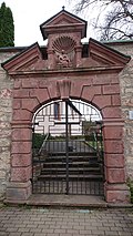
Renaissance portal | Upper Beund 2 (Flst.Nr. 0-1289) (map) |
16th century | Renaissance portal, Hochhausen cemetery. Part of the whole cemetery. Protected according to § 28 DSchG
|
 |
Cemetery cross | Upper Beund 2 (Flst.Nr. 0-1289) (map) |
16th century | Cross in the Hochhausen cemetery. Part of the whole cemetery. Protected according to § 28 DSchG
|
 More pictures |
Cemetery chapel | Upper Beund 2 (Flst.Nr. 0-1289) (map) |
1585 | Cemetery chapel, from 1585, contains epitaphs and valuable wooden sculptures that are worth seeing (fourteen helpers, pieta). Part of the whole cemetery. Protected according to § 28 DSchG
|
 |
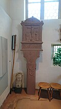
Wayside shrine | Upper Beund 2 (Flst.Nr. 0-1289) (map) |
1572 | Wayside shrine in the cemetery chapel. Depiction of the crucifixion with accompanying figures. Part of the whole cemetery. Protected according to § 28 DSchG
|
 |
Schürer Memorial | Upper Beund 2 (Flst.Nr. 0-1289) (map) |
1607 | Schürer monument, from 1607, on the back of the cemetery chapel from 1585. Part of the cemetery as a whole. Protected according to § 28 DSchG
|
 |
Wayside shrine | Upper Beund 2 (Flst.Nr. 0-1289) (map) |
Wayside shrine in the cemetery wall. Part of the whole cemetery. Protected according to § 28 DSchG
|
|
 |
Oldenburg monument | Upper Beund 2 (Flst.Nr. 0-1289) (map) |
War memorial for the fallen soldiers of the Oldenburg Regiment in the battle near Werbach . Part of the whole cemetery. Protected according to § 28 DSchG
|
|
 |
War memorial | Upper Beund 2 (Flst.Nr. 0-1289) (map) |
War memorial for the skyscrapers that fell in World War I , at the cemetery. Part of the whole cemetery. Protected according to § 28 DSchG
|
|
 |
War memorial | Upper Beund 2 (Flst.Nr. 0-1289) (map) |
War memorial for the skyscrapers that fell in World War II , at the cemetery. Part of the whole cemetery. Protected according to § 28 DSchG
|
|
 More pictures |
St. Pancras | Pfarrgasse 2 (district no. 0-141) (map) |
1329/1960 | Catholic parish church St. Pankratius, Gothic tower from 1329, new church building in 1960, glass windows by Franz Dewald. Protected according to § 28 DSchG
|
 |
Crucifixion group | Pfarrgasse 2 (opposite) (Flst. No. 0-141) (map) |
Crucifixion group Protected according to § 2 DSchG
|
|
 |
Wayside shrine | Rathausstraße 18 (near) (Flst.Nr. 0-240) (map) |
Wayside shrine Protected according to § 2 DSchG
|
|
 |
Cross tug | Rote Steig (Gewann), K 2880 (an) (Flst.Nr. 0-7825) (map) |
Cross tractor Protected according to § 2 DSchG
|
|
 |
synagogue | Schmiedegasse ("Judengässchen") (map) |
Former synagogue of the Jewish community in Hochhausen .
|
|
| Furnace stone | Schmiedegasse 4 (Flst. No. 0-41) (map) |
Ofenstein (at the outbuilding). Protected according to § 2 DSchG
|
||
 |
Courtyard | Schulgasse 1 (Flst. No. 0-138, 0-140) (map) |
16. – 19. Century | So-called. Courtyard house. Protected according to § 28 DSchG
|
 |
House Madonna | Schulgasse 10 (Flst. No. 0-149) (map) |
House Madonna (on the building) including housing (totality). Protected according to § 2 DSchG
|
|
 |
Wayside shrine | Schulgasse 34 (Flst. No. 0-183) (map) |
Wayside shrine Protected according to § 2 DSchG
|
|
 |
Wayside shrine | Schulzengasse 1 (in front of), Mühlenwörth (Flst. No. 0-216) (map) |
Wayside shrine, on the corner of Schulzengasse and Mühlenwörth. Protected according to § 2 DSchG
|
|
 |
Basement | Schulzengasse 5 (register no. 0-213) (map) |
Basement of an economic building. Protected according to § 2 DSchG
|
|
 |
Gasthaus "Zum Lamm" | Schulzengasse 6 (Flst. No. 0-99) (map) |
Gasthaus "Zum Lamm" Protected according to § 2 DSchG
|
|
 |
Nepomuk figure | Schulzengasse 6 (near) (control no. 0-99) (map) |
Nepomuk figure Protected according to § 28 DSchG
|
|
| Inscription stone | Schulzengasse 7 (tax no. 0-211) (map) |
Inscription stone (on the outbuilding) Protected according to § 2 DSchG
|
||
 |
Courtyard | Schulzengasse 12 (tax no. 0-104) (map) |
Courtyard area (entity). Protected according to § 2 DSchG
|
|
 |
Remnants of the village wall | To Upper Gate 2 (map) |
Village wall, remains of a former village wall, between the street Zum Oberen Tor and the Schutzengelgasse .
|
|
 |
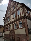
Inn | To Upper Gate 4 (Flst.Nr.0-124-125) (map) |
1612 | Gasthof "Zum Engel" (§ 28) with barn building and bowling alley (totality). Half-timbered house, from 1612. General Tilly is said to have stayed here in 1631 during the Thirty Years' War. Protected according to § 28 DSchG
|
| Relief plate | To Upper Gate 5 (map) |
Relief plate Protected according to § 2 DSchG
|
||
 |
Courtyard | To Upper Gate 6 (Flst.Nr. 0-126-127) (map) |
Courtyard area (entity). Protected according to § 2 DSchG
|
literature
- Adolf von Oechelhäuser : The art monuments of the Grand Duchy of Baden. Volume 4: District of Mosbach. Second division: Tauberbischofsheim district. Freiburg im Breisgau 1898, pp. 51-53 (Hochhausen).
Web links
Remarks
- ↑ This list may not correspond to the current status of the official list of monuments. This can be viewed by the responsible authorities. Therefore, the presence or absence of a structure or ensemble on this list does not guarantee that it is or is not a registered monument at the present time. The State Office for Monument Preservation Baden-Württemberg provides binding information .
Individual evidence
- ^ Jüdischer Friedhof Hochhausen ( Memento of the original from April 11, 2016 in the Internet Archive ) Info: The archive link was automatically inserted and not yet checked. Please check the original and archive link according to the instructions and then remove this notice. at the central archive for research into the history of Jews in Germany .
- ^ Jewish cemetery in Hochhausen near Alemannia Judaica
- ↑ LEO-BW.de : Wegkapelle (Tauberbischofsheim). Retrieved June 19, 2018.
- ^ Sven Gerth: Hochhausen. Portal Sühnekreuz.de. Retrieved January 15, 2018.
- ↑ LEO-BW.de: Feldkapelle (Eiersheimer Weg 60, Tauberbischofsheim). Retrieved December 5, 2018.
- ↑ a b LEO-BW.de: St. Josephskapelle (Landstrasse 1, Tauberbischofsheim). Retrieved December 5, 2018.
- ↑ a b c d e f g h i j LEO-BW.de: Friedhof (Obere Beund 2, Tauberbischofsheim). Retrieved December 5, 2018.
- ^ City of Tauberbischofsheim: Tauberbischofsheim cemetery system. Cemeteries in Tauberbischofsheim and communities. Retrieved December 5, 2018.
- ↑ LEO-BW.de: Catholic parish church (Pfarrgasse 2, Tauberbischofsheim). Retrieved December 5, 2018.
- ^ Pastoral care unit Tauberbischofsheim: Pankratiuskirche Hochhausen. Retrieved January 15, 2018.
- ↑ LEO-BW.de: so-called courtyard house (Schulgasse 1, Tauberbischofsheim). Retrieved December 5, 2018.
