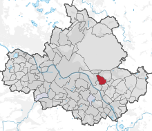
List of streets and squares in Rochwitz
The list of streets and squares in Rochwitz describes the street system in the Dresden district of Rochwitz with the corresponding historical references. Are listed roads in the territory of the district are Rochwitz.
The most important streets in the Rochwitz district are Krügerstraße, Roseggerstraße, Wachbergstraße and Grundstraße. There are no federal motorways or federal highways in the Rochwitz district of Dresden.
Legend
The following table gives an overview of the streets and squares in the district as well as some related information. In detail these are:
- Name / Location: Current designation of the street or the place as well as under 'Location' a coordinate link via which the street or the place can be displayed on various map services. The geoposition indicates approximately the middle of the street.
- Length / dimensions in meters: The length information contained in the overview are overview values rounded up or down according to mathematical rules , which were determined in Google Earth with the local scale. They are more for comparison purposes and, if official values are known, are exchanged and marked separately. For squares, the dimensions are shown in the form a × b. The addition “in the district” or “in the district” indicates how long the street is within the city / district, provided it runs through several city / districts.
- Name origin: origin or reference of the name.
- Year of naming: Time at which the street was given its current name (if known).
- Notes: Further information on nearby institutions, the history of the street, historical names, monuments, etc.
- Image: Photo of the street.
Street directory
| Name / location |
Length / dimensions |
Origin of name |
Year of designation |
Remarks | image |
|---|---|---|---|---|---|
| Altrochwitz location |
155 m | Old village center of Rochwitz | Parts of Pappritzer and Wachwitzer Strasse were included | ||
| At the Wachwitzer Höhenpark location |
215 m | 1946 | |||
| Amselsteg location |
370 m | The name goes back to a forest path | 1911 | There are some allotments here | |
| Anzengruberweg location |
105 m | 1937 | |||
| At the height of the situation |
250 m | 1953 | The street was originally called Princess Luisa Street | ||
| Beskid road location |
420 m | The name is reminiscent of a mountain range in the border area between Poland and the Czech Republic | 2004 | ||
| Bühlauer Strasse location |
85 m | 1907 | The street was originally called Mittelstrasse | ||
| Gönnsdorfer Strasse location |
435 m | 1926 | Was initially called Schönfelder Strasse | ||
| Grundstrasse location |
665 m (within Rochwitz) | 1926 | Used to link several mills together | ||
| Hutbergstrasse location |
295 m (within Rochwitz) | The name comes from the 311 meter high Hutberg | 1938 | ||
| Carpathian Road location |
1160 m | 1925 | The old route was previously called Mittelweg | ||
| Kruger Street location |
1140 m (within Rochwitz) | The coin engraver Reinhard Krüger owned a summer house at Krügerstrasse 22 . | There is a memorial stone to King Albert on the corner of Krügerstrasse and Tännichtstrasse | ||
| Kottmarstrasse location |
145 m | 1967 | |||
| Lauschestraße location |
50 m | It is named after a mountain near Zittau | 1967 | ||
| Malschendorfer Strasse location |
340 m | After the small town of Malsch village in Schönfeld highlands named | 1936 | ||
| Toboggan run location |
880 m (within Rochwitz) | Used to be a toboggan run | |||
| Roseggerstrasse location |
430 m | In memory of the Austrian writer Peter Rosegger | |||
| Scharfensteinstrasse location |
220 m | It bears the name of a mountain peak in Saxon Switzerland | 1967 | ||
| Tännichtstrasse location |
1110 m | Reminiscent of the Rochwitz Tännicht, which was partially cleared in the 19th century. | |||
| Valtenbergstrasse location |
105 m | The name comes from a mountain of the same name in Upper Lusatia | 1967 | Initially it was called Kamerunstrasse | |
| Wachbergstrasse location |
890 m | Formerly mountain or main road | |||
| Weißer-Hirsch-Strasse location |
610 m | The original name was Waldparkstraße | |||
| Zweibrüderweg location |
170 m | Should remember the first two settlers |
Web links
- Lars Herrmann: Streets and squares in Rochwitz


