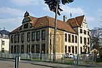
List of streets and squares in Stetzsch
The list of streets and squares in Stetzsch describes the street system in the Dresden district of Stetzsch with the corresponding historical references. Are listed roads in the territory of the district are Stetzsch. Cultural monuments in the district of Stetzsch are listed in the list of cultural monuments in Stetzsch .
Stetzsch is part of the statistical district of Briesnitz , which in turn belongs to the Cotta district of the Saxon state capital Dresden.
Legend
The following table gives an overview of the streets and squares in the district as well as some related information. In detail these are:
- Name / Location: Current designation of the street or the place as well as under 'Location' a coordinate link via which the street or the place can be displayed on various map services. The geoposition indicates approximately the middle of the street.
- Length / dimensions in meters: The length information contained in the overview are overview values rounded up or down according to mathematical rules , which were determined in Google Earth with the local scale. They are more for comparison purposes and, if official values are known, are exchanged and marked separately. For squares, the dimensions are shown in the form a × b. The addition “in the district” or “in the district” indicates how long the street is within the city / district, provided it runs through several city / districts.
- Name origin: origin or reference of the name.
- Year of naming: Time at which the street was given its current name (if known).
- Notes: Further information on nearby institutions, the history of the street, historical names, monuments, etc.
- Image: Photo of the street.
Street directory
| Name / location |
Length / dimensions |
Origin of name |
Year of designation |
Remarks | image |
|---|---|---|---|---|---|
| Alsenstrasse location |
130 m | Was named after the island of Als in the Little Belt | 1926 |

|
|
| Altstetzsch location |
250 m | Comes from the village square of the former farming village | 1926 | Formerly called Gustav-Merbitz-Platz |

|
| At the urn field location |
615 m | At that time there was an urn grove on the area | 1926 | Was previously called Schulstrasse |

|
| Brabschützer Strasse location |
230 m | Was after nahgelegenen district Brabschütz named | 1925 | For a short time it was called Grünweg | |
| Groyne road location |
125 m | Name is reminiscent of the fortification of the banks of the Elbe by means of groynes and dams | 1926 | ||
| Flensburger Strasse location |
1740 m (in the district) |
Comes from the city of Flensburg in Schleswig-Holstein | 1926 | Created by merging the former Gohliser and Kemnitzer Straße |

|
| Gustav-Merbitz-Straße location |
290 m | Was named after Gustav Merbitz | 1926 | Formerly called Bismarckstrasse | |
| Meißner Landstrasse location |
1520 m (in the district) |
The name originated from the nearby city of Meissen | 1926 | Signed as |

|
| Miltitzer Strasse location |
185 m | Bears the name after the small town of Miltitz near Meissen | 1926 | Was previously called Florastraße | |
| Podemusstrasse location |
200 m | Named after the Podemus district | 1926 | Formerly called Lindenstrasse | |
| Sea gardens location |
160 m | In the past, the area was often flooded | 1924 | This is the lowest point in the Dresden city area |

|
| Wildbergstrasse location |
45 m | Was named after the place Wildberg near Meissen | 1926 | Was called Bahnstraße in 1905 | |
| To the shelter location |
485 m | There is an animal shelter on the street | 1994 | There is also a pet cemetery nearby |
Web links
- Streets in Stetzsch. Retrieved January 1, 2019 .

