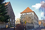
List of streets and squares in Kaitz

The list of streets and squares in Kaitz describes the street system in the Dresden district of Kaitz with the corresponding historical references. Are listed roads in the territory of the district are Kaitz. Cultural monuments in the Kaitz district are listed in the list of cultural monuments in Kaitz .
Kaitz belongs to the statistical district of Kleinpestitz / Mockritz , which in turn is assigned to the Plauen district of the Saxon state capital Dresden. The most important street in the district is the A 17 ( Europastraße 55 ) in its section between the Coschützer Tunnel - the eastern tunnel portal is in the west of the district - and the Dresden-Südvorstadt junction. On the latter, south and just outside the Kaitzer Flur in Nöthnitz , the motorway meets the federal highway 170 , which bypasses the Kaitz location to the west under the name Innsbrucker Straße. There are a total of twelve named streets and squares in Kaitz, which are listed in the following list.
Legend
The following table gives an overview of the streets and squares in the district as well as some related information. In detail these are:
- Name / Location: Current designation of the street or the place as well as under 'Location' a coordinate link via which the street or the place can be displayed on various map services. The geoposition indicates approximately the middle of the street.
- Length / dimensions in meters: The length information contained in the overview are overview values rounded up or down according to mathematical rules , which were determined in Google Earth with the local scale. They are more for comparison purposes and, if official values are known, are exchanged and marked separately. For squares, the dimensions are shown in the form a × b. The addition “in the district” or “in the district” indicates how long the street is within the city / district, provided it runs through several city / districts.
- Name origin: origin or reference of the name.
- Year of naming: Time at which the street was given its current name (if known).
- Notes: Further information on nearby institutions, the history of the street, historical names, monuments, etc.
- Image: Photo of the street.
Street directory
| Name / location | Length / dimensions | Origin of name | Year of designation | Remarks | image |
|---|---|---|---|---|---|
| Achtbeeteweg location |
Field name eight beds | The Achtbeeteweg is the old connection route from Coschütz to Kaitz. | |||
| Altkaitz location |
Old village center of Kaitz | Altkaitz originated as a round hamlet . | |||
| Bannewitzer Strasse location |
Bannewitz , neighboring municipality to the south | The Bannewitzer Straße goes back on a footpath that led straight through the valley of the Kaitzbach and was thus an abbreviation for the arch of the Possendorfer Straße. | |||
| Boderitzer Strasse location |
Boderitz , neighboring district of Bannewitz to the southwest | The Boderitzer Straße connects Kaitz with the eastern neighboring district of Mockritz . It used to be called Leichenweg, as the residents of Kaitz brought their dead to the cemetery at the Leubnitz Church on this way . | |||
| Franzweg location |
Max Franz (1860–1916), landowner and councilor of Kaitz | The Franzweg is a short dead end north of the village center Altkaitz. | |||
| Innsbrucker Strasse location |
innsbruck | 1925 | The Innsbruckerstraße arose as a bypass to relieve the Possendorfer road. | ||
| Kaitzer vineyard location |
local vineyard | The northern slopes of the Kaitzbach valley were used for viticulture until 1887; Kaitzer Weinberg Street was laid out after 1900. | |||
| Kaitzgrund location |
Kaitzbach valley | Kaitzgrund is the name of the valley above Kaitz and the footpath that runs through it. | |||
| Central web location |
The middle bridge leads along the Kaitzbach from Altkaitz to Altmockritz. | ||||
| Possendorfer Strasse location |
Possendorf , part of the southern neighboring community of Bannewitz | The Possendorfer road is part of the old highway from Dresden to Possendorf, which led to the laying on the Innsbruckerstraße 1925 directly through Kaitz. | |||
| Stuttgarter Strasse location |
Stuttgart | The Stuttgarter Strasse was to develop the business park Coschütz / Gittersee . | |||
| Zschaukegraben location |
Name of the water body Zschauke / Zschaukegraben | The Zschauke, also called the Zschaukegraben, is a tributary of the Kaitzbach . |
Web links
- Themed city map of Dresden.
- Lars Herrmann: Streets and squares in Kaitz. In: dresdner-stadtteile.de.
Individual evidence
- ^ Streets and squares in Coschütz
- ^ Kaitz in the Digital Historical Directory of Saxony
- ↑ Kaitzbachtal


