List of listed objects in Petronell-Carnuntum
The list of listed objects in Petronell-Carnuntum contains the 21 listed , immovable objects of the Lower Austrian market town of Petronell-Carnuntum .
Monuments
| photo | monument | Location | description | Metadata |
|---|---|---|---|---|

|
Auxiliary Fort Carnuntum ObjectID : 129338 |
Burgfeld location KG: Petronell |
The fort built entirely in stone on the western edge of the camp city could accommodate a cavalry unit of 500 men. The wall was reinforced with rectangular, internally attached intermediate and trapezoidal corner towers and also surrounded by a ditch. Corner and intermediate towers did not protrude beyond the line of the wall. Only the rectangular side towers of the camp gates clearly stood out from the fence. The top of the wall could be walked on on a rampart made of earth. The south-east corner was fastened with wooden planks that lay on pillars attached to the fort wall. The Praetorial Front was oriented towards the banks of the Danube and aligned in the same way as the legionary camp. The storage area was 3.65 hectares. Inside buildings, barracks, the military hospital, the officers' houses, the command building and the fort bath are known. When the modern housing estate was built, not the entire fort was destroyed. A modern overbuilding could be prevented in the area of the fort baths as well as in two sections of the southern and eastern wall. |
ObjektID : 129338 Status : Notification Status of the BDA list: 2020-02-29 Name: Auxiliarkastell Carnuntum GstNr .: 319/1; 319/4; 327/12; 327/13; 330/9; 330/30; 330/31; 330/32; 330/33; 330/34; 330/35; 331/52 |

|
Schüttkasten (stately) ObjectID : 11542 |
Gutshof 11 location KG: Petronell |
Monumental four-storey building from 1774 with a tiled hipped roof and profiled stone windows. According to an inscription from 1774, it was built on Roman remains and with Roman bricks. |
ObjectID : 11542 Status : Notification Status of the BDA list: 2020-02-29 Name: Schüttkasten (manorial) GstNr .: 146/3 |

|
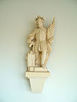
Figure St. Florian ObjectID : 11550 |
Hauptstrasse 2 KG location : Petronell |
ObjectID : 11550 Status: § 2a Status of the BDA list: 2020-02-29 Name: Figur hl. Florian GstNr .: 88/20 |
|

|
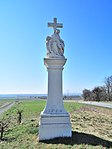
Shrine Object ID: 11545 |
next to Hauptstrasse 20, KG location : Petronell |
ObjectID : 11545 Status: § 2a Status of the BDA list: 2020-02-29 Name: Bildstock GstNr .: 1022/1 |
|

|
Figures of two toll men ObjectID : 77334 |
Hauptstrasse 47 + 54 KG location : Petronell |
Two stone gate figures on part of the wall, marked 1731. |
ObjectID : 77334 Status : Notification Status of the BDA list: 2020-02-29 Name: Figures of two Mautmännchen GstNr .: 41; 21 Petronell toll men |

|
Residential house at the Mautmandln ObjektID : 11537 |
Hauptstrasse 49 KG location : Petronell |
The house at the Mautmandln is a baroque gable- independent house from the 2nd quarter of the 18th century. |
ObjectID : 11537 Status : Notification Status of the BDA list: 2020-02-29 Name: Residential house at the Mautmandln GstNr .: 23 |

|
Catholic parish church hl. Petronella ObjectID : 11486 |
Kirchengasse 37 KG location : Petronell |
Romanesque hall church in the northeast of the village, surrounded by the medieval cemetery wall. Three-part structure consisting of a nave, choir and mighty west tower. South side chapel from the end of the 14th century and the sound floor of the church tower from the end of the 17th century. |
ObjectID : 11486 Status: § 2a Status of the BDA list: 2020-02-29 Name: Catholic parish church hl. Petronella GstNr .: 1 parish church hl. Petronella |

|
Abensperg-Traun Castle ObjectID : 11541 |
Castle 1, 3 Location KG: Petronell |
An early baroque, four-wing complex, which was built from 1660 under Ernst III. from Abensperg and Traun was expanded. |
ObjectID : 11541 Status : Notification Status of the BDA list: 2020-02-29 Name: Abensperg-Traun Castle GstNr .: 156/1; 154/1; 154/2; 155; 156/2; 157; 159/3; 154/3; 884/3; 159/1; 159/2; 159/4; 159/5 Petronell Castle |

|
War memorial ObjectID : 11532 |
Location KG: Petronell |
War memorial on the north-western gable wall of the parish church with a relief from 1920 |
ObjectID : 11532 Status: § 2a Status of the BDA list: 2020-02-29 Name: War memorial GstNr .: 1 |

|
Christian cemetery ObjectID : 11534 |
Location KG: Petronell |
Surrounds the parish church, expanded to the east in the 20th century. Medieval enclosure wall. |
ObjectID : 11534 Status: § 2a Status of the BDA list: 2020-02-29 Name: Friedhof christlich GstNr .: 1 |

|
Shrine Object ID: 11536 |
Location KG: Petronell |
ObjectID : 11536 Status: § 2a Status of the BDA list: 2020-02-29 Name: wayside shrine GstNr .: 25/2 |
|

|
Plague / Trinity Column ObjectID : 11538 |
Location KG: Petronell |
The plague monument in Petronell, donated by Otto Ehrenreich von Abensperg and Traun in 1698/1699 and executed by Ferdinand Groß, is a three-sided baroque column with a high base, a comprehensive balustrade and a crowning trinity group . Four statues stand on the base: Maria Immaculata , Johannes Nepomuk , St. Borromeo and St. Ulrich . |
ObjectID : 11538 Status: § 2a Status of the BDA list: 2020-02-29 Name: Pest- / Dreifaltigkeitssäule GstNr .: 1012/4 |

|
Chapel of St. Anna ObjectID : 11543 |
Location KG: Petronell |
High, north-facing central building with a cross-shaped floor plan, built in 1744 in the west of the village. |
ObjectID : 11543 Status: § 2a Status of the BDA list: 2020-02-29 Name: Chapel hl. Anna GstNr .: 96 |

|
Figure shrine Object ID: 11548 |
Location KG: Petronell |
ObjectID : 11548 Status: § 2a Status of the BDA list: 2020-02-29 Name: Figure picture stick GstNr .: 558/2 |
|

|
Other small monuments ObjectID : 11485 |
Location KG: Petronell |
ObjectID : 11485 Status: § 2a Status of the BDA list: 2020-02-29 Name: Other small monuments GstNr .: 1094/2 |
|

|
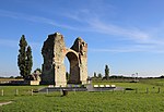
Heidentor ObjectID : 20254 |
Heidentoräcker location KG: Petronell |
The ancient quadrifrons is the symbol of the Petronell-Carnuntum region. The building originally stood on four massive, square pillars, which were connected by a cross barrel vault . Its area was 16.2 × 16.2 m, the 4.35 m wide pillars were at a distance of 5.83 m from each other. They extend beyond the vault zone and carried a horizontal parapet over the entablature . It was probably erected as a victory monument under Emperor Constantius II (337-361). Its two western pillars and an arched vault have been preserved to this day. The statue base in the center was reconstructed between 1998 and 2003, and the remains of the wall were restored and preserved. |
ObjectID : 20254 Status: § 2a Status of the BDA list: 2020-02-29 Name: Heidentor GstNr .: 777 Heidentor (Carnuntum) |

|
Tiergarten wall and spoilage ObjectID : 11533 |
Tiergarten location KG: Petronell |
ObjektID : 11533 Status : Notification Status of the BDA list: 2020-02-29 Name: Tiergartenmauer (spolien) GstNr .: 846/1; 846/2; 846/3; 846/4; 865; 885; 882 |
|

|
Civil City West ObjectID : 130306 since 2014 |
Tiergarten, Gstettenbreiten, Auen KG location : Petronell |
During the reign of Claudius , a civilian settlement was built parallel to a wood and earth warehouse with an attached camp village. At the beginning of the 2nd century, around 50,000 people were already living there. Since the beginning of the 2nd century AD it was the administrative center of the Roman province of (Upper) Pannonia . It is one of the most important and most extensively researched ancient archaeological sites in Austria . Its east-west extension was about 2 kilometers, that from north to south about 1.5 kilometers. In the west their area extended to about 1.5 kilometers west of today's Petronell-Carnuntum in the direction of the Wildungsmauer, corridor Gstettenbreite. In the north it was limited by the steep slope of the Danube with its poorly accessible alluvial forests and its tributaries. In the south, the development extended roughly to the current bypass on Bundesstraße 9 (Amphitheater II).
Note: large area, coordinates refer to one of the lots |
ObjectID : 130306 Status : Notification Status of the BDA list: 2020-02-29 Name: Civil City West GstNr .: 142/1; 148/3; 153/1; 153/3; 158/1; 846/1; 846/2; 846/3; 846/4; 848; 849; 851; 852; 853/1; 853/2; 853/3; 853/4; 854/1; 855; 856; 857; 858; 859; 860; 861; 862; 863; 864/1; 864/2; 864/3; 864/4; 864/5; 864/6; 864/7; 864/8; 865; 866/1; 866/2; 882; 883/1; 883/2; 141/2; 141/11; 141/12; 141/13; 141/14; 141/15; 843; 853/5; 854/4 Open air museum Petronell |

|
Western suburb of Carnuntum ObjectID : 131208 since 2018 |
Location KG: Petronell |
ObjectID : 131208 Status : Notification Status of the BDA list: 2020-02-29 Name: Western suburb of Carnuntum GstNr .: 867/1; 868 |
|

|
Round Chapel St. John the Baptist ObjectID : 11544 |
Location KG: Petronell |
The Romanesque sacred building, built around 1200, has been used as the Abensperg-Traun family crypt (Petronell line) since the 18th century . |
ObjectID : 11544 Status : Notification Status of the BDA list: 2020-02-29 Name: Round chapel hl. John the Baptist GstNr .: 89 Petronell Round Chapel |

|
Kuruzzenschanze since 2020 |
Location KG: Petronell |
The fortification (earth wall with palisades and small forts) was built in 1703/04 and operated until the end of the 18th century. The wall was supposed to support the imperial troops of the Habsburgs in the fight against the Kuruzzen - rural rebels from Hungary in the wake of the uprising of Franz II. Rákóczi (1704–1711) - and to block the access from Hungary to Vienna. |
ObjectID: missing! Status: Notification Status of the BDA list: 2020-02-29 Name: Kuruzzenschanze GstNr .: 487/1; 487/2; 488; 486/1; 486/2; 486/3; 483; 484/2; 482/1; 482/2; 1082; 466; 1083; 1084; 1119; 481; 485 Kuruzzenschanze, Austria |
Web links
Commons : Listed Objects in Petronell-Carnuntum - Collection of images, videos and audio files
- Petronell-Carnuntum. In: Lower Austria 3D. Retrieved on November 5, 2017 (3D representation of selected buildings and monuments).
Individual evidence
- ↑ a b Lower Austria - immovable and archaeological monuments under monument protection. (PDF), ( CSV ). Federal Monuments Office , as of February 14, 2020.
- ↑ Werner Jobst 1983, pp. 75–81.
- ↑ Trinity Column. In: marterl.at. Retrieved March 10, 2020 .
- ↑ Trinity Column. In: petronell.at. Retrieved March 10, 2020 .
- ↑ Hensler: State of Lower Austria supports the renovation of the Holy Trinity Column in Petronell Carnuntum. Press release of the ÖVP Lower Austria. In: ots.at. September 13, 2009, accessed March 10, 2020 .
- ↑ § 2a Monument Protection Act in the legal information system of the Republic of Austria .