List of listed objects in Scheibbs
The list of listed objects in Scheibbs contains the 59 listed , immovable objects of the Lower Austrian municipality of Scheibbs .
Monuments
| photo | monument | Location | description | Metadata |
|---|---|---|---|---|

|
Shrine Object ID: 20623 |
Am Türkenschuß location KG: Brandstatt |
Statue from around 1683, top with ball-crowned stone tent roof. |
ObjectID : 20623 Status: § 2a Status of the BDA list: 2020-02-29 Name: Bildstock GstNr .: 1031/3 |

|
Road bridge, Saffenbrücke ObjectID : 29009 |
Location KG: Brandstatt |
Conglomerate square construction with arched arches from 1876. The bridge over the Erlauf connects the two cadastral communities Brandstatt and Scheibbsbach a good 2 kilometers north-northwest of the city center. |
ObjectID : 29009 Status: § 2a Status of the BDA list: 2020-02-29 Name: Straßebrücke, Saffenbrücke GstNr .: 1402/3 |

|
Entire complex of castle and former pottery works Neubruck ObjectID : 130131 since 2014 |
Neubruck 1, 2 Location KG: Fürteben |
Note: A small part is located in the municipality of Sankt Anton an der Jeßnitz |
ObjektID : 130131 Status : Notification Status of the BDA list: 2020-02-29 Name : Entire castle and former Töpperwerk Neubruck GstNr .: .74 / 1; .74 / 3; .74 / 5; 803; 804/1; 804/3; 881; .109; .72; 792; 798/1 Neubruck Castle and former pottery factory |

|
Access tunnel 52 ObjectID : 129525 since 2012 |
Location KG: Fürteben |
Access tunnel 52 is part of Vienna's second high spring water pipeline . This 183-kilometer-long water supply pipeline for the city of Vienna was built at the instigation of Karl Lueger and, after a ten-year construction period, opened on December 2, 1910 as the 2nd Kaiser-Franz-Josef Spring Pipeline . |
ObjectID : 129525 Status : Notification Status of the BDA list: 2020-02-29 Name: Access tunnel 52 GstNr .: 844/1 |
|
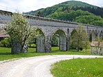
Lueger aqueduct ObjectID : 129526 since 2012 |
Location KG: Fürteben |
The Lueger aqueduct bridges the Jessnitz valley in the Neubruck district of Scheibbs. With a length of 271 meters and a height of 22 meters, it is the longest aqueduct of Vienna's second high spring water pipeline . The 14 arch positions have a span of 10 to 30 m. The Lueger aqueduct connects the community of Scheibbs and the cadastral communities of St. Anton an der Jeßnitz and Gärtenberg in the community of St. Anton an der Jeßnitz. |
ObjectID : 129526 Status : Notification Status of the BDA list: 2020-02-29 Name: Luegeraquädukt GstNr .: 804/1; 866 |

|
Wayside shrine ObjectID: 59 |
at Dreimärkterstraße 18, KG location : Fürteben |
Tuscan pedestal pillar with top without panel and stone onion hood, 2nd half of the 17th century |
ObjectID: 59 Status: Notification Status of the BDA list: 2020-02-29 Name: wayside shrine GstNr .: 762/6 |

|
Töpperkapelle St. Apostle Andrew ObjectID: 54 |
Location KG: Fürteben |
Neighboring ocher / classicist central dome, originally built as a burial chapel in 1831–1834. |
ObjectID: 54 Status: Notification Status of the BDA list: 2020-02-29 Name: Töpperkapelle hl. Apostle Andreas GstNr .: .74 / 5 Neubruck Castle and former pottery |

|
Ginningbach aqueduct ObjectID : 129543 since 2012 |
Location KG: Ginning |
The second Viennese spring water pipeline is a 183 km long drinking water supply pipeline for the city of Vienna . It was built at the instigation of Karl Lueger and, after a ten-year construction period, opened on December 2, 1910 as the 2nd Kaiser-Franz-Josef Spring Pipeline . The Ginningbach aqueduct connects the cadastral communities of Ginning and Scheibbs . |
ObjectID : 129543 Status : Notification Status of the BDA list: 2020-02-29 Name: Ginningbachaquädukt GstNr .: 60/6 |

|
Entry tower 55 ObjectID : 129544 since 2012 |
Location KG: Ginning |
The second Viennese spring water pipeline is a 183 km long drinking water supply pipeline for the city of Vienna . It was built at the instigation of Karl Lueger and, after a ten-year construction period, opened on December 2, 1910 as the 2nd Kaiser-Franz-Josef Spring Pipeline . |
ObjectID : 129544 Status : Notification Status of the BDA list: 2020-02-29 Name: Entry tower 55 GstNr .: 60/6 |

|
Water reservoir ObjectID : 20630 |
Reithgraben location KG: Ginning |
A water reservoir of the community of Scheibbs and not the II. Vienna high spring water pipeline |
ObjectID : 20630 Status: § 2a Status of the BDA list: 2020-02-29 Name: Wasserreservoir GstNr .: 601/1 |

|
Urlinger-Warte am Blassenstein-Berg ObjectID: 63 |
Location KG: Ginning |
The Urlinger-Warte is an unsuspected observation tower built in 1903 with a round bay window under a pointed helmet on the 844 m high Blassenstein . |
ObjectID: 63 Status: Notification Status of the BDA list: 2020-02-29 Name: Urlinger-Warte am Blassenstein-Berg GstNr .: 208 Urlinger-Warte |

|
Hochbruckaqueduct ObjectID : 129539 since 2012 |
KG location : Neustift near Scheibbs |
The second Viennese spring water pipeline is a 183 km long drinking water supply pipeline for the city of Vienna . It was built at the instigation of Karl Lueger and, after a ten-year construction period, opened on December 2, 1910 as the 2nd Kaiser-Franz-Josef Spring Pipeline . |
ObjectID : 129539 Status : Notification Status of the BDA list: 2020-02-29 Name: Hochbruckaquädukt GstNr .: 17/1 |

|
Entry tower 54, Lehenhof canal bridge ObjectID : 129540 since 2012 |
For location see description KG: Neustift bei Scheibbs |
The two protected structures of the second Viennese spring water pipeline are the entrance tower 54 ( Lage ) and the Lehenhof canal bridge ( Lage ). |
ObjectID : 129540 Status : Notification Status of the BDA list: 2020-02-29 Name: Einsteigurm 54, Kanalbrücke Lehenhof GstNr .: 17/1; 79 |

|
Wertheim Chapel ObjectID: 58 |
opposite Dreimärkterstraße 13 KG location : Neustift near Scheibbs |
A neo-Gothic conglomerate block building with wrought iron lattice and pointed arched groin vault, built in 1863. |
ObjectID: 58 Status: Notification Status of the BDA list: 2020-02-29 Name: Wertheimkapelle GstNr .: .81 |

|
Villa, so-called Schloss Lehenhof, ObjectID: 62 |
Hochbruck 6 KG location : Neustift near Scheibbs |
Three-sided, two-storey building with a hipped roof, built 1835–1845 as Villa Almasy on a terrace above the valley. The facade was later changed in a neoclassical style. Children's home since 1939. |
ObjectID: 62 Status: § 2a Status of the BDA list: 2020-02-29 Name: Villa, so-called Schloss Lehenhof GstNr .: .68 Schloss Lehenhof, Scheibbs |

|
Strudenbrücke ObjectID : 60 |
KG location : Neustift near Scheibbs |
The barrel-arched quarry stone building with wrought-iron pointed arches between stone pillars was built in 1836 by master mason Sebastian Sturm and was originally called Kaiser-Ferdinand-Brücke. |
ObjectID: 60 Status: § 2a Status of the BDA list: 2020-02-29 Name: Strudenbrücke GstNr .: 512/1 |

|
Wayside shrine ObjectID: 61 |
KG location : Neustift near Scheibbs |
A Tuscan pedestal pillar from the second half of the 17th century with a panel-free top and a stone onion cap. |
ObjectID: 61 Status: Notification Status of the BDA list: 2020-02-29 Name: wayside shrine GstNr .: 95/3 |

|
Ginningbach aqueduct ObjectID : 129542 |
KG location : Scheibbs |
The second Viennese spring water pipeline is a 183 km long drinking water supply pipeline for the city of Vienna . It was built at the instigation of Karl Lueger and, after a ten-year construction period, opened on December 2, 1910 as the 2nd Kaiser-Franz-Josef Spring Pipeline . |
ObjectID : 129542 Status : Notification Status of the BDA list: 2020-02-29 Name: Ginningbachaqueduct GstNr .: 28/1 |

|
Schöllgraben canal bridge ObjectID : 129541 since 2012 |
KG location : Scheibbs |
The second Viennese spring water pipeline is a 183 km long drinking water supply pipeline for the city of Vienna . It was built at the instigation of Karl Lueger and, after a ten-year construction period, opened on December 2, 1910 as the 2nd Kaiser-Franz-Josef Spring Pipeline . |
ObjectID : 129541 Status : Notification Status of the BDA list: 2020-02-29 Name: Canal Bridge Schöllgraben GstNr .: 1/19; 1/16; 5/11 |

|
Road Bridge, K. Höfinger Bridge ObjectID : 20626 |
Bahnhofstrasse location KG: Scheibbs |
Arched iron framework and arched quarry stone ramp, built in 1881. Named after the businessman Ignaz Höfinger, who was mayor of Scheibbs in the middle of the 19th century. |
ObjectID : 20626 Status: § 2a Status of the BDA list: 2020-02-29 Name: Straßenbrücke, K. Höfinger-Brücke GstNr .: 209/1 |

|
Former Zwingerturm ObjektID : 17610 |
Burgerhofstrasse 2 KG location : Scheibbs |
ObjectID : 17610 Status : Notification Status of the BDA list: 2020-02-29 Name: Former Zwingerturm GstNr .: .300 |
|

|
Scheibbs Hospital ObjectID : 17620 |
Eisenwurzenstraße 26 KG location : Scheibbs |
ObjectID : 17620 Status : Notification Status of the BDA list: 2020-02-29 Name: Hospital Scheibbs GstNr .: 459 |
|

|
Road bridge, Töpper bridge ObjectID : 20627 |
at Erlafpromenade 30 KG location : Scheibbs |
Arched iron framework, built in 1897. |
ObjectID : 20627 Status: § 2a Status of the BDA list: 2020-02-29 Name: Straßenbrücke, Töpper-Brücke GstNr .: 209/1 |

|
Road bridge, so-called Roman bridge ObjectID: 20625 |
at Erlafstrasse 3, KG location : Scheibbs |
Quarry stone arched under a barrel over a rocky island, built in 1554 by Valentin Staudinger on an old river crossing. Stone parapets replaced by iron railings around 1870. |
ObjectID: 20625 Status: § 2a Status of the BDA list: 2020-02-29 Name: Road bridge, so-called Römerbrücke GstNr .: 209/1 Römerbrücke Scheibbs |
|
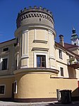
Defense tower ObjectID : 17613 |
Gaminger Straße 21 KG location : Scheibbs |
ObjectID : 17613 Status : Notification Status of the BDA list: 2020-02-29 Name: Defense tower GstNr .: .62 |
|

|
Residential building, former citizen hospital ObjectID: 1443 |
Gaminger Strasse 33 KG location : Scheibbs |
Three-story house with a hipped roof. In the core around 1600, Biedermeier facade. |
ObjectID: 1443 Status: § 2a Status of the BDA list: 2020-02-29 Name: Residential building, former Bürgerspital GstNr .: .81; 389 |

|
Former Cemetery with Töpper mausoleum ObjectID : 20620 |
Belt location KG: Scheibbs |
Cemetery: laid out at the beginning of the belt in 1575, abandoned in 1968. Töpper mausoleum: neo-Gothic house installation from 1880. |
ObjectID : 20620 Status: § 2a Status of the BDA list: 2020-02-29 Name: Former Cemetery with Töpper mausoleum GstNr .: 51 |

|
Flecknertor ObjectID : 17609 |
Belt 8 Location KG: Scheibbs |
Three-storey, deep rectangular gate tower from the 4th quarter of the 15th century between the city wall extensions. |
ObjectID : 17609 Status : Notification Status of the BDA list: 2020-02-29 Name: Flecknertor GstNr .: 113/3 |
|
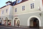
Bürgerhaus ObjektID: 1445 |
Hauptstrasse 14 KG location : Scheibbs |
Two-storey town house, the core from the 16th and 17th centuries. |
ObjectID: 1445 Status: Notification Status of the BDA list: 2020-02-29 Name: Bürgerhaus GstNr .: .49 / 2; .49 / 1 |
|
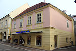
Bürgerhaus ObjektID : 126713 |
Hauptstrasse 17 KG location : Scheibbs |
One-pillar room on the ground floor with groin vaults above a Tuscan column around 1600. Upper floor facade from the 3rd quarter of the 19th century. |
ObjectID : 126713 Status : Notification Status of the BDA list: 2020-02-29 Name: Bürgerhaus GstNr .: 127 |

|
Bürgerhaus ObjektID: 1450 |
Hauptstrasse 26 KG location : Scheibbs |
Two-storey corner building, in the core late medieval. |
ObjectID: 1450 Status: Notification Status of the BDA list: 2020-02-29 Name: Bürgerhaus GstNr .: .56 |

|
Bürgerhaus ObjektID: 1451 |
Hauptstrasse 27 KG location : Scheibbs |
Two-storey building with a round corner bay window, the core is late Gothic and early modern. |
ObjectID: 1451 Status: Notification Status of the BDA list: 2020-02-29 Name: Bürgerhaus GstNr .: .16 |

|
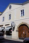
Former Handelsherrenhaus Töpper ObjektID : 20602 |
Hauptstrasse 29 KG location : Scheibbs |
Three-storey gable-crowned building. The substance is late Gothic-early modern, Biedermeier gable facade from the 1st half of the 19th century. Today the location of the traditional Reschinsky confectionery . |
ObjectID : 20602 Status : Notification Status of the BDA list: 2020-02-29 Name: Former Handelsherrenhaus Töpper GstNr .: .15 |
|
First Scheibbser Poststation ObjectID : 20603 |
Hauptstrasse 31 KG location : Scheibbs |
Two-storey building with a Biedermeier-classicist facade. From 1836 to 1907 it housed the first Scheibbs post office. |
ObjectID : 20603 Status : Notification Status of the BDA list: 2020-02-29 Name: Erste Scheibbser Poststation GstNr .: .14 |

|
Bürgerhaus ObjektID : 20606 |
Hauptstrasse 43 KG location : Scheibbs |
Two-storey building with a crooked roof, the core is late Gothic. |
ObjectID : 20606 Status : Notification Status of the BDA list: 2020-02-29 Name: Bürgerhaus GstNr .: .63 |

|
Capuchin Church and former Capuchin Monastery ObjectID : 17619 |
Kapuzinerplatz KG location : Scheibbs |
Early baroque complex, built 1678–1684 north of the city walls. The Capuchin Church is a north-facing hall building. |
ObjektID : 17619 Status: § 2a Status of the BDA list: 2020-02-29 Name: Kapuzinerkirche and former Capuchin monastery GstNr .: .33; .34 St. Barbara Monastery Church (Scheibbs) |

|
Wayside shrine, plague cross ObjectID : 20622 |
Kreuzgasse / Klassenstrasse Location KG: Scheibbs |
1644 built tabernacle shrine with beveled pillars, wrought iron grille and stone tent roof. |
ObjectID : 20622 Status: § 2a Status of the BDA list: 2020-02-29 Name: wayside shrine, Pestkreuz GstNr .: 461 |

|
Scheibbs power plant (power house with mechanical equipment) ObjektID : 29240 |
Mühlhof 4 location KG: Scheibbs |
Factory building on the banks of the Erlauf, built 1904–1905. |
ObjectID : 29240 Status : Notification Status of the BDA list: 2020-02-29 Name: Kraftwerk Scheibbs (power house with mechanical equipment) GstNr .: .38 / 3 |

|
Pedestrian bridge, sand footbridge ObjectID : 20628 |
Prof. Schuh-Gasse KG location : Scheibbs |
Iron framework over central pillars in ashlar masonry, built in 1883. |
ObjectID : 20628 Status: § 2a Status of the BDA list: 2020-02-29 Name: Pedestrian Bridge, Sandsteg GstNr .: 209/1 Sandsteg, Scheibbs |
|
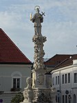
Johannes Nepomuk Column ObjectID : 20616 |
Rathausplatz KG location : Scheibbs |
Cloud column with a statue of St. John Nepomuk above a richly decorated base. |
ObjectID : 20616 Status: § 2a Status of the BDA list: 2020-02-29 Name: Johannes Nepomuk column GstNr .: 197/1 Johannes Nepomuk column Scheibbs |

|
Kaiser-Franz-Joseph-Brunnen ObjectID : 20617 |
Rathausplatz KG location : Scheibbs |
Erected in 1898 on the town hall square by Scheibbs. In an octagonal high basin a squat column with lion masks, above a round bowl with a neo-Gothic pinnacle. |
ObjectID : 20617 Status: § 2a Status of the BDA list: 2020-02-29 Name: Kaiser-Franz-Joseph-Brunnen GstNr .: 197/1 |

|
Former Grave digger's house, Mount of Olives ObjectID : 17616 |
Rathausplatz KG location : Scheibbs |
Former grave digger's house northwest of the parish church: two-storey with a pent roof. On the left, a Mount of Olives canopy from the 18th century, glazed in the third quarter of the 19th century. |
ObjectID : 17616 Status: § 2a Status of the BDA list: 2020-02-29 Name: Former Grave digger house, Ölberg GstNr .: .72 Grave digger house with Ölberg, Scheibbs |

|
Town hall ObjectID : 20609 |
Rathausplatz 1 KG location : Scheibbs |
Basically comes from the 16th century; Modifications in 1850 (Biedermeier facade) and 1992. |
ObjectID : 20609 Status: § 2a Status of the BDA list: 2020-02-29 Name: Rathaus GstNr .: .11 |
|
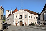
Scheibbs Castle m. Ring wall, keep u. 2 round towers, district authority ObjektID : 20612 |
Rathausplatz 5 KG location : Scheibbs |
In essence, it is a medieval four-wing complex, expanded around 1600, around an approximately square courtyard with two diagonally arranged towers. The castle stands a little higher in the south-east of the old town and today houses the Scheibbs district administration. |
ObjectID : 20612 Status : Notification Status of the BDA list: 2020-02-29 Name: Schloss Scheibbs m. Ring wall, keep u. 2 round towers, district administration GstNr .: .1; 147/1 Scheibbs Castle |

|
Catholic parish church hl. Maria Magdalena ObjectID: 17614 |
Rathausplatz 6 KG location : Scheibbs |
Late Gothic hall church with changed exterior to early Baroque in an elevated position on the south front of the Rathausplatz. The tower, which was originally presented to the northern front, was integrated by later additions. |
ObjectID: 17614 Status: § 2a Status of the BDA list: 2020-02-29 Name: Catholic parish church hl. Maria Magdalena GstNr .: .73 Parish Church of St. Magdalena (Scheibbs) |

|
Parsonage Object ID: 17617 |
Rathausplatz 7 KG location : Scheibbs |
Two-storey, hook-shaped building west of the church with a Gothic core, connected to it by a Schwibbogen passage. |
ObjectID : 17617 Status: § 2a Status of the BDA list: 2020-02-29 Name: Pfarrhof GstNr .: .74 |

|
Residential house, Stöckl ObjectID : 17618 |
Rathausplatz 7 KG location : Scheibbs |
ObjectID : 17618 Status: § 2a Status of the BDA list: 2020-02-29 Name: Wohnhaus, Stöckl GstNr .: .74 |
|

|
Former Hofrichterhaus, Gamingerhof ObjectID : 20613 |
Rathausplatz 8 KG location : Scheibbs |
Between Kartäusergasse and Abt-Berthold-Dietmayer-Gasse, somewhat receding, built in 1651 with a hipped roof and an irregular axis sequence. |
ObjectID : 20613 Status: § 2a Status of the BDA list: 2020-02-29 Name: Former Hofrichterhaus, Gamingerhof GstNr .: .71 |

|
Bürgerhaus, former charity building ObjektID : 20614 |
Rathausplatz 9 KG location : Scheibbs |
From the construction of the 16th century, corbels on the three-storey rear front. Facade around 1960. |
ObjectID : 20614 Status: § 2a Status of the BDA list: 2020-02-29 Name: Bürgerhaus, former Benefiziatenhaus GstNr .: .70 / 1 |

|
Bürgerhaus, so-called Upper House ObjectID : 20615 |
Rathausplatz 10 KG location : Scheibbs |
Building merged from two Renaissance houses. On the upper floor two round bay windows, windows with restored sgraffito frames. Since 1991 the building has housed the Scheibbs shooting target museum . |
ObjectID : 20615 Status: § 2a Status of the BDA list: 2020-02-29 Name: Bürgerhaus, so-called Oberhaus GstNr .: .69 Bücherei Scheibbs |

|
Burgerhof or Schüdttor, Schöllgrabenturm ObjectID : 17612 |
Schöllgraben 1 location KG: Scheibbs |
Four-storey tower with a hipped roof in the southwest of the city fortifications, probably a product of a granary from 1430. |
ObjectID : 17612 Status : Notification Status of the BDA list: 2020-02-29 Name: Burgerhof- or Schüdttor, Schöllgrabenturm GstNr .: .89 |

|
Gasthaus Schwarzer Elefant ObjectID : 20618 |
Schulgasse 13 KG location : Scheibbs |
Former inn. Two-storey with hipped roof, the core around 1600. At the corner of the town hall square, a statuette of Maria Immaculata in a stuccoed niche. |
ObjectID : 20618 Status: § 2a Status of the BDA list: 2020-02-29 Name: Gasthaus Schwarzer Elefant GstNr .: 142/1 |

|
Residential building ObjectID : 20619 |
Schulgasse 22 KG location : Scheibbs |
ObjectID : 20619 Status: § 2a Status of the BDA list: 2020-02-29 Name: Wohnhaus GstNr .: .10 / 1 |
|

|
Powder Tower ObjectID: 17607 |
KG location : Scheibbs |
Square tower with a tent roof and slits from the late 15th century. |
ObjectID: 17607 Status: § 2a Status of the BDA list: 2020-02-29 Name: Pulverturm GstNr .: .117 |

|
Schöllgraben Tower ObjectID : 17611 |
KG location : Scheibbs |
ObjectID : 17611 Status : Notification Status of the BDA list: 2020-02-29 Name: Schöllgraben Turm GstNr .: .299 |
|

|
Glass Tower ObjectID : 17608 |
KG location : Scheibbs |
Round tower with a flat conical roof and slits from the late 15th century. |
ObjectID: 17608 Status: Notification Status of the BDA list: 2020-02-29 Name: Glaxturm GstNr .: .115 / 2; 135/5 |

|
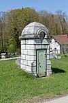
Road bridge, Saffenbrücke ObjectID : 20631 |
KG location : Scheibbsbach |
The Saffenbrücke over the Erlauf connects the two cadastral communities Brandstatt (see there) and Scheibbsbach. |
ObjectID : 20631 Status: § 2a Status of the BDA list: 2020-02-29 Name: Straßenbrücke, Saffenbrücke GstNr .: 1330 |
|
Entry tower 56 ObjectID : 129545 |
KG location : Scheibbsbach |
The second Viennese spring water pipeline is a 183 km long drinking water supply pipeline for the city of Vienna . It was built at the instigation of Karl Lueger and, after a ten-year construction period, opened on December 2, 1910 as the 2nd Kaiser-Franz-Josef Spring Pipeline . |
ObjectID : 129545 Status : Notification Status of the BDA list: 2020-02-29 Name: Entry tower 56 GstNr .: 955 |

|
Leysbach aqueduct ObjectID : 129548 since 2012 |
KG location : Scheibbsbach |
The second Viennese spring water pipeline is a 183 km long drinking water supply pipeline for the city of Vienna . It was built at the instigation of Karl Lueger and, after a ten-year construction period, opened on December 2, 1910 as the 2nd Kaiser-Franz-Josef Spring Pipeline . The Leysbach aqueduct of Vienna's second high spring water pipeline connects the communities of Scheibbs and St. Georgen an der Leys . |
ObjectID : 129548 Status : Notification Status of the BDA list: 2020-02-29 Name: Leysbachaquädukt GstNr .: 1332/2; 1111 |
Web links
Commons : Listed objects in Scheibbs - collection of pictures, videos and audio files
Individual evidence
- ↑ a b Lower Austria - immovable and archaeological monuments under monument protection. (PDF), ( CSV ). Federal Monuments Office , as of February 14, 2020.
- ↑ tiscover.com: ERLEBNISWEG - Vienna high spring water pipeline - St. Anton ad Jeßnitz ; Retrieved Nov. 26, 2012
- ↑ Lehrerweb: water supply / buildings ; Retrieved Nov. 26, 2012
- ↑ according to Lower Austria Atlas; 1771 according to BDA does not exist
- ↑ § 2a Monument Protection Act in the legal information system of the Republic of Austria .
