List of technical monuments in the Leipzig district
The list of technical monuments in the Leipzig district contains the technical monuments in the Leipzig district .
This list is a partial list of the list of cultural monuments in Saxony .
Legend
- Image: shows a picture of the cultural monument and, if applicable, a link to further photos of the cultural monument in the Wikimedia Commons media archive
- Designation: Name, designation or the type of cultural monument
-
Location: If available, street name and house number of the cultural monument; The list is basically sorted according to this address. The map link leads to various map displays and gives the coordinates of the cultural monument.
- Map view to set coordinates. In this map view, cultural monuments are shown without coordinates with a red marker and can be placed on the map. Cultural monuments without a picture are marked with a blue marker, cultural monuments with a picture are marked with a green marker.
- Dating: indicates the year of completion or the date of the first mention or the period of construction
- Description: structural and historical details of the cultural monument, preferably the monument properties
-
ID: is awarded by the State Office for the Preservation of Monuments in Saxony. It clearly identifies the cultural monument. The link leads to a PDF document from the State Office for the Preservation of Monuments in Saxony, which summarizes the information on the monument, contains a map sketch and often a detailed description. For former cultural monuments sometimes no ID is given, if one is given, this is the former ID. The corresponding link leads to an empty document at the state office. The following icon can also be found in the ID column
 ; this leads to information on this cultural monument at Wikidata .
Bad Lausick, city
| image | designation | location | Dating | description | ID |
|---|---|---|---|---|---|
| Former sawmill, with house and barn | (Map) | around 1800 (sawmill) | old location Reichersdorf, residential building a plastered building with a high crooked hip roof, historically significant and defining the local image |
08972167
|
|
| Mühlenwerke Uhlig & Weiske (formerly) | (Map) | 1913 (flour mill) | Mill building, courtyard paving and gate system; four-storey reinforced concrete building, characteristic large mill, architect: Emil Franz Hänsel, Leipzig, significance in terms of local history, economic history and technological history |
08972087
|
|
 More pictures |
Bad Lausick train station; Railway line Leipzig - Geithain; Borna - Großbothen (cross railway) | (Map) | 1887 (passenger station); 1887, later redesigned (station); 1950s (sales pavilion) | Railway station with reception building, two tunnel roofs and a platform roof, next to it on the forecourt a pavilion, ancillary building with side wall and gate pillars, goods shed on the railway site and paving on the goods shed; Railway lines Leipzig – Geithain and Borna – Großbothen (cross line), significance in terms of local history and transport history |
08972123
|
| Road bridge | (Map) | around 1800 (road bridge) | Road bridge; Quarry stone, old location Reichersdorf, significance in terms of traffic history |
08972168
|
|
| Road bridge over the Heinersdorfer Bach | around 1800 (road bridge) | old location Reichersdorf, significance in terms of traffic history |
08972165
|
||
 More pictures |
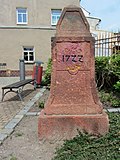
Saxon post mile pillars (totality) | (Map) | marked 1722 (quarter milestone) | Post mileage column; Quarter milestone, significance in terms of traffic history |
08967094
|
| Gas supply company with civil servants' residence | (Map) | around 1905 (gas works) | Gas supply company (No. 21a), associated civil servants' residence (No. 21); Wilhelminian-style clinker buildings, of local importance |
08972144
|
|
 More pictures |
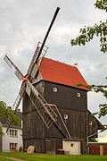
Ballendorfer post mill | (Map) | marked 1835 (post mill) | Post mill with mill technology; Original mill from 1835 with completely preserved mill technology, characterizing the townscape and of significance in terms of technology history, rarity |
08972181
|
 More pictures |
Saxon post mile pillars (totality) | (Map) | marked 1722 (full mile column) | Post mileage column; Full-mile column, of importance in terms of traffic and regional history |
08972185
|
 More pictures |
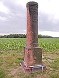
Totality of the Royal Saxon Triangulation ("European degree measurement in the Kingdom of Saxony"); Station 108 Ballendorf | (Map) | marked 1875 (triangulation column) | Triangulation column; Second order station, significant testimony to geodesy of the 19th century, of significance in terms of surveying history |
08972184
|
 More pictures |
Royal Saxon milestones (totality) | (Map) | 2nd half of the 19th century (whole milestone) | Milestone; Whole milestone, significant in terms of traffic history |
08972182
|
| Mühlgut Beucha | (Map) | 18th century (mill); marked 1827 (stable house) | Mill property with residential house (formerly mill), side building (residential stable house), barn, former bakery, shed and gate as well as mill ditch; Buildings partly in half-timbered construction, side buildings with triple windows in the gable, large courtyard of local historical importance as a mill site, location on the village pond with an elaborate design, of architectural and local significance |
08972235
|
|
| Milestone | 19th century (milestone) | Sandstone with lettering, of importance in terms of traffic history |
08972207
|
||
| Milestone | 19th century (milestone) | of importance in terms of traffic history |
08972206
|
||
| Milestone | around 1900 (kilometer stone) | of importance in terms of traffic history |
08972205
|
||
| Milestone | 19th century (milestone) | of importance in terms of traffic history |
09259831
|
||
 More pictures |
Ebersbach post mill | (Map) | marked 1859 (post mill) | Post mill with mill technology; Mill technology preserved and functional, significance in terms of local history and technology history |
09257023
|
| Railway bridge; Railway line Borna - Großbothen (cross line) | (Map) | 1920–1937 (railway bridge) | Railway bridge; Railway line Borna – Großbothen (cross line), kilometers 23, 45, early example of a concrete railway bridge, significant in terms of traffic history |
08972066
|
|
| Milestone | 2nd half of the 19th century (kilometer stone) | of importance in terms of traffic history |
09259843
|
||
| Royal Saxon milestones (totality); later milestone | (Map) | 1st half of the 19th century (milestone) | Milestone; Station station reworked to the kilometer stone, with remnants of kilometer indications, of importance in terms of traffic history |
08972203
|
|
 More pictures |
Royal Saxon milestones (totality) | (Map) | 2nd half of the 19th century (station stone) | Milestone; Station stone, of importance in terms of traffic history |
08972196
|
| Royal Saxon milestones (totality) | (Map) | 2nd half of the 19th century (milestone) | Milestone; of importance in terms of traffic history |
08972140
|
|
 More pictures |
Saxon post mile pillars (totality) | (Map) | designated 1722 (half mile column); 1981 (copy) | Post mileage column; Copy of a half-mile column, of significance in terms of traffic history |
08972250
|
| Waystone | (Map) | 19th century (road stone) | Rochlitzer Porphyrtuff, of historical importance |
08973889 |
Belgershain
| image | designation | location | Dating | description | ID |
|---|---|---|---|---|---|
| Signal box; Railway line from Leipzig to Geithain | (Map) | around 1932 (signal box) | Signal box; Railway line Leipzig – Geithain, plastered building with clinker brick structure, in the style of modernism, as an example of high-quality utility buildings of the railway of architectural and technical historical importance, in a largely authentic and original appearance |
08965888
|
|
| Water house | (Map) | around 1920 (waterworks) | Water house; Elevated tank for storing water, still in operation, significance in terms of technology and supply history |
08965987
|
|
| Residential house of a mill estate | (Map) | 18th century (miller's house) | Ground floor clay, upper floor half-timbered, intact old half-timbered construction, former windmill location (mill demolished in the 1980s), of architectural and local significance |
08965991 |
Bennewitz
| image | designation | location | Dating | description | ID |
|---|---|---|---|---|---|
 |
Waystone | Altenbach Hauptstraße (corner Schulweg, junction to Leulitz) (map) |
19th century (road stone) | Sandstone with an inscription, evidence of the traffic-technical development of the rural area of traffic-historical importance. |
08974198
|
 |
Railway bridge | Bennewitz Bahnhofstraße (behind No. 17 and in continuation Leulitzer Straße) (map) |
1897 (railway bridge) | Stone arch bridge on the Leipzig – Dresden line, of significance in terms of railway and architectural history |
08970571
|
 More pictures |
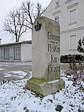
Royal Saxon milestones (totality) | (Map) | 2nd half of the 19th century (milestone); around 1900 (kilometer stone) | Milestone; Whole milestone reworked into a milestone with an inscription, of significance in terms of traffic history |
08974044
|
 |
Canitz hydropower plant | (Map) | around 1925 (canal) | Hydropower plant with boundary walls and control room as well as power plant canal; one of two preserved run-of-river power plants in the Mulde catchment area, evidence of the electrification of the Leipzig region in the 1920s, large, cubic plastered building with a landscape-shaping effect, of importance in terms of supply history |
09306006
|
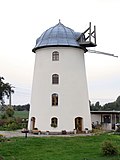 More pictures |
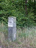
Grubnitz Dutch mill | (Map) | marked 1768 (mill) | Tower Dutchman; oldest Turmholländer windmill in Saxony, of technical significance |
08973874
|
 |
Waystone | Leulitz (in extension of Wurzener Straße, intersection between Altenbach, Bennewitz and Leulitz) (map) |
19th century (road stone) | Sandstone with an inscription, of importance in terms of traffic history |
08974183
|
 |
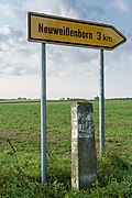
Road bridge | Rothersdorf Zum Planitzwald (map) |
1st half of the 19th century (road bridge) | Stone arch bridge with quarry stone struts over a brook (branch of the Mulde, no name), of importance in terms of traffic history |
08974193
|
 |
Waystone | Rothersdorf Zum Planitzwald (corner of Grimmaische Strasse) (map) |
19th century (road stone) | Sandstone with an inscription, of importance in terms of traffic history |
08974049 |
Böhlen, city
| image | designation | location | Dating | description | ID |
|---|---|---|---|---|---|
| Gaschwitz locomotive station | (Map) | around 1900 (engine shed) | Locomotive shed with adjoining functional building and remains of the track system; Evidence of traffic history, belonging to Gaschwitz station, which in the past played an important role for regional rail traffic since 1870 as a stop on the Leipzig – Altenburg line, which was opened in 1842, and especially as an important marshalling yard for goods traffic, of importance in terms of traffic history and technology |
08970722 |
Borna, city
| image | designation | location | Dating | description | ID |
|---|---|---|---|---|---|
 More pictures |
Borna train station | (Map) | 1904 (reception building) | Entrance building of the Borna train station; Richly structured clinker brick building with porphyry tufa elements, designed in the forms of the outgoing historicism with Art Nouveau echoes, significance in terms of local history, building history and transport history |
09258656
|
| Harmonium factory O. Lindholm | (Map) | 1911 (factory building) | Factory building with an annex on the courtyard side and a chimney; Appealingly designed plastered building in the spirit of the reform style around 1910/15, side elevations with tail gables, pilaster strips, courtyard-side production wing with horizontal clinker brick structure, testimony to the formerly important instrument making in Borna, importance for local history, science and building history |
09258531
|
|
 More pictures |
Saxon post mile pillars (totality) | (Map) | marked 1722 (half-mile column) | Post mileage column; partial copy of a half-mile column, significance in terms of traffic history |
09258978
|
 |
Briquette factory Witznitz (totality) | (Map) | 1912 (machine house); 1942 (new boiler house); 1950s (steam press); 1912 (administration building); 1912 (press house) | Individual features of the Witznitz briquette factory: Administration building (No. 1), Kaue (No. 7), workshop complex (No. 14), New boiler house (No. 19) with chimney (No. 20), machine house (No. 24), wet service ( No. 22), including the machines installed in this property and stored in the workshop building (two-roller crusher, roller grate, hammer mill), drying service (No. 27) with a tube dryer, press house with a steam press from ZEMAG Zeitz, cold store I (No. 28) and control center (transformer station) (see also material list -Obj. 09303564, same address); predominantly uniformly designed clinker buildings, occasionally with structural elements in artificial stone or plaster, administrative building plastered construction in the reform style around 1910/15, significant evidence of industrial architecture and the lignite industry, which is extremely important for the region, significance in terms of building history, regional history, technical history and landscape design |
09257286
|
| Briquette factory Witznitz (totality) | (Map) | 1912–1913 (coal and steel industry) | Entity Briquette Factory Witznitz, consisting of administration building (No. 1), Kaue (No. 7), workshop complex (No. 14), new boiler house (No. 19) with chimney (No. 20), machine house (No. 24), wet service (No. 22) including the machines installed in this property and stored in the workshop building (two-roll crusher, roller grate, hammer mill), drying service (No. 27) with a tube dryer, press house with a steam press from ZEMAG Zeitz, cold store I (No. 28) and transformer station (all at the same time individual monuments, see also individual monuments list -Obj. 09257286, same address); Uniformly designed factory from the late Art Nouveau era with clinker brick facades well preserved in detail, significant industrial architecture and important evidence of the lignite industry, which is extremely important for the region, characteristic landscape brand at the gates of the city of Borna, significance in terms of technical history, regional history, building history and landscape design |
09303564
|
|
| Mill | (Map) | around 1840 (miller's house) | Home of the former water mill; Plastered construction in the simple form typical of the time, natural stone elements, buildings of local historical importance with good architectural training around 1840 |
09257316
|
|
| Briquette factory Neukirchen (totality); cult dance factory | (Map) | 1887 (E-Zentrale); 1912–1913 wet and dry service (lignite refining); around 1890 (administration building); 1939 (mine house); 1939 (wall and ceiling painting) | Individual features of the whole of the Neukirchen briquette factory: wet service, dry service with press house underneath (no.4, 5), electrical center (machine house) (no.2), colliery house (no.1), servants' apartments and administration (no.3) and steam storage locomotive Meiningen type, briquette press and excavator bucket wheel (see also general document obj 09303318, same address); The only briquette factory from the main period of the Borna district with industrial architecture of the construction time still completely preserved, a factory of great technical-historical and high scientific documentary value as the starting point for mining in the Borna district (before it advanced further north), as a dominant feature of the landscape that is of outstanding importance and due to its nature structural design of monumental effect |
09255952
|
|
 |
Briquette factory Neukirchen (totality); cult dance factory | (Map) | 1887 (lignite refining); around 1890 (briquette shed) | Material entirety of the Neukirchen briquette factory, with the individual monuments: wet service, dry service with press house underneath (no. 4, 5, today used as an event location and for commercial purposes), electrical center (machine house) (no.2, today restaurant), colliery (no . 1, today sports studio), servants' apartments and administration (no. 3, today office use) as well as steam storage locomotive type Meiningen, briquette press and excavator bucket wheel (see also individual monument list obj 09255952, same address) and the aggregate parts chimney, magazine and briquette stacking shed; The only briquette factory from the main period of the Borna mining area with still completely preserved industrial architecture of the construction time, a factory of great technical historical and scientific documentary value as the starting point for mining in the Borna mining area (before it advanced further north), as a dominant feature of the landscape of outstanding importance and due to its structural design Design of monumental effect |
09303318
|
 More pictures |
Wyhra watermill | (Map) | around 1780 (mill); 1865 (mill technology) | Mühlgut, consisting of a former miller's house, mill building with fully preserved technical equipment, a barn, a silo (storage barn), an outbuilding, courtyard paving, gate and mill ditch with weir; Four-sided complex, predominantly half-timbered buildings, some with porphyry tufa elements, miller's house, massive plastered building, mill complex in a beautiful scenic location with original complete technical equipment from the middle of the 19th century, significance in terms of local history, technology history and the landscape |
09259029
|
 More pictures |
Zedtlitz Castle Mill | (Map) | around 1900 (mill); around 1900 (Müllerwohnhaus) | Residential house, mill building (with parts of the technical equipment) and enclosure; representatively designed plaster and clinker brick buildings in late historical forms, distinctive layout with a defining impact on the townscape, importance in terms of local history, building history and technology history |
09258928 |
Borsdorf
| image | designation | location | Dating | description | ID |
|---|---|---|---|---|---|
 More pictures |
Borsdorf train station | Bahnhofstrasse 16 (map) |
1881 (train station) | Entrance building of the Borsdorf train station; Last testimony of the station of the important junction of the Leipzig – Dresden and Borsdorf – Coswig railway lines, opened in 1881, the line has been in existence since 1837, imposing three-part clinker brick structure with natural stone structures, the track side of the single-storey central structure in wood construction, significance for local history, architectural history and traffic history |
09256826
|
 More pictures |
Waterworks with water tower | Leipziger Strasse 59; 61 (map) |
1929 (water tower); 1903 (boiler and machine house); 1903 (administration building) | Waterworks with water tower, keeper's house (No. 59), machine house (No. 61) and filter basin; Caretaker's house and machine house clinker buildings in late historical design, water tower plastered construction in expressive design language, landscape-defining ensemble, of architectural and local significance, as evidence of the water supply of technical history |
09259027
|
 |
Road bridge over the Parthe | Zweenfurth Hirschfelder Strasse (map) |
marked 1864 (road bridge) | three-arched, quarry stone and brick masonry, significance in terms of building history and traffic history |
09259448 |
Brandis, town
| image | designation | location | Dating | description | ID |
|---|---|---|---|---|---|
 More pictures |
Beucha train station | Beucha Albert-Kuntz-Strasse 62 (map) |
1898 (train station); 1872 (reception building); 1930 (um); 1960 (around) | Train station consisting of a reception building with ticket machine, toilet block, three signal boxes (some with technical equipment), railway barrier and wing signaling system; Beucha – Trebsen line (BT 6386) as a branch line for goods and passenger traffic, especially for the regional stone industry (Beucha granite porphyry), important in terms of location and traffic history, ticket machine of the GDR era of technological and social history |
08974955
|
 More pictures |
Water tower | Beucha Kirchberg 17 (next to) (map) |
1911–1913 (water tower) | Water tower; A technical monument that characterizes the townscape, with its passage at the same time forms access to the churchyard, of importance in terms of supply and local history |
08974961
|
 More pictures |
Beucha windmill | Beucha Kleinsteinberger Strasse 9 (map) |
1837 (mill) | Windmill; Turmholländer, characterizing the townscape, of importance in terms of local history |
08974974
|
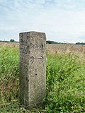 |
Waystone | Beucha Zweenfurther Straße (corner to Straße Hasenheide) (map) |
around 1900 (Wegestein) | Granite stele with inscription, meaning of transport history |
08974962
|
 |
Brandis Railway Station; Beucha – Trebsen railway line | Brandis Am Bahnhof 1; 2 (card) |
1898 (train station); 1898 (farm building); 1898 (railway maintenance office) | Station with reception building, farm building and railway maintenance office; Route BT 6823, brick buildings from the Wilhelminian era, of local and railway history |
08974953
|
 |
Waldpolenz military airfield (formerly) | Polenz (east of Brandis, west of Leulitz and Zeititz, north of Polenz) (map) |
1934/35 (airport); around 1935 (bunker); 1934-1936 (barracks) | Former military airport and barracks Accommodation for officers and crew, three hangars, tower, flying school, bunker; Military buildings in the style of the 1930s, test site of Junkers Flugzeug- und Motorenwerke AG Dessau, flying school, 1945 to 1992 use by Soviet aviation forces, then landing area for general aviation, closed since 2005, extensive demolition work in 2014/15, from structural, local and military-historical meaning |
08974905 |
Colditz, city
| image | designation | location | Dating | description | ID |
|---|---|---|---|---|---|
 |
Baderberg Bridge | Colditz Baderberg (map) |
Early 19th century (road bridge) | Baderberg Bridge and street paving; single-arch bridge over the former Mühlgraben, small granite pavement, of local and transport historical importance |
08973046 |
 |
Storage building | Colditz Bahnhofstrasse 21, 23 (map) |
1930 (memory) | Traditionally shaped plastered building with plastered structures, characterizing the street scene, of importance in terms of local development |
08973088 |
 More pictures |
Muldentalbahn (aggregate) | Colditz Bahnhofstrasse 29 (map) |
1875 (passenger station); 1875 (entity component); 1901 (signal box) | Objective aggregate component of the aggregate Muldentalbahn, section Colditz, OT Colditz with the individual monuments flood bridge (see individual monuments list -obj. 08973107), railway bridge (see individual monuments list -obj. 08973104) as well as the aggregate part Colditz train station (see also object population list -obj. 09306181); Totality with all railway systems, including track systems with substructure and superstructure, route kilometers, telecommunications and signal systems, railway stations including all functional buildings, guard houses, bridges and culverts in the communities of Glauchau, Stadt (OT Glauchau, Kleinbernsdorf, Reinholdshain), Limbach-Oberfrohna, Stadt (OT Wolkenburg-Kaufungen), Remse (OT Remse), Waldenburg (OT Niederwinkel, Oberwinkel, Waldenburg), Lunzenau, city (OT Lunzenau, Cossen, Rochsburg), Penig, city (OT Markersdorf, Penig, America, Arnsdorf, Thierbach, Zinnberg), Rochlitz, Stadt (OT Penna, Rochlitz), Seelitz (OT Fischheim, Seelitz, Biesern, Steudten), Colditz (OT Colditz, Lastau, Möseln, Sermuth, Zschetzsch), Grimma, Stadt (OT Großbothen), for industrial development of the Muldental important and landscape-forming standard-gauge railway, economic history, railway history, landscape shaping and regional history of importance |
09306180 |
| Cardboard factory owl | Colditz (map) |
1894 (paper and cardboard factory part); 1896 (turbine house); 1896 (weir) | Main building and turbine building with weir system of a cardboard factory; Typical factory building of late historicism, clinker masonry over substructures in quarry stone, three-field flap weir, technical monument with a landscape-defining location on the Zwickauer Mulde, of regional and industrial historical importance |
08973456 |
|
 |
Muldentalbahn (totality); Flood bridge | Colditz Furtweg (map) |
1934 (railway bridge) | Individual features in the above-mentioned aggregate: Railway bridge with railway embankment and tracks; (See subject list -obj. 09306181), arched bridge in quarry stone masonry, km 45, 540, belonging to the railway line Glauchau – Wurzen (Muldentalbahn), significant in terms of traffic history |
08973107 |
 More pictures |
Former Service building (two parts of the building) of the waterworks | Colditz Lastauer Strasse 3 (map) |
inscribed 1897 (Brunnenhaus); 19th century (administration building) | Simple plastered building with porphyry tufa elements, extension part in the traditional forms of the 1920s, evidence of the water supply in the past, location that characterizes the street scene on the outskirts of Colditz, significance in terms of local history and technology |
08973150 |
 More pictures |
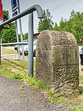
Two milestones | Colditz Leipziger Strasse (map) |
around 1900 (kilometer stone) | Sandstone, important in terms of traffic history |
08973149 |
| Colditzer stoneware factory Gottschald & Co. (formerly) | Colditz (map) |
1889 (ceramic industry) | Production systems for heavy ceramics: eight single chamber furnaces, two chimneys, sump basins and machines; Last testimony to the extensive and important ceramics industry in Colditz, importance in terms of local and technical history, technical equipment a rarity |
08966042 |
|
 |
Colditz Brewery | Colditz (map) |
Early 19th century, older in core (brewery) | Brewery in closed development, with rear building; Plastered building, high roof with two continuous dormer windows, an important part of the historical market development, of local and technological history as well as architectural and urban development importance |
08973132 |
 |
Amtsmühle (formerly); Schlobach's mill | Colditz Haingasse 5 (map) |
around 1905 (storage building) | Storage building; Plastered facade with plaster and clinker brick structures, of importance in terms of local development and industrial history |
08973045 |
 |
Calico factory v. CG Schwägrichen (formerly) | Colditz Nicolaistraße 8 (map) |
1775, reconstruction in 1842 (part of the textile industry) | Textile factory building; Originally a calico factory and the largest artificial bleaching facility in Saxony, temporarily used as a hospital by the French in 1813 and serving Napoleon as a one-time overnight stay (May 5, 1813), school since 1842, of architectural, local, regional and economic significance |
08973116 |
 |
Muldentalbahn (totality); Railway bridge | Colditz Rochlitzer Strasse (map) |
1875 (bridge) | Individual monument in the above-mentioned entity: railway bridge; (See population list -Obj. 09306181), solid wall girder bridge at km 48, 458 of the Glauchau – Wurzen line (Muldentalbahn), of importance in terms of railway history |
08973104 |
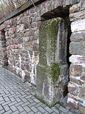 |
Royal Saxon milestones (totality) | Colditz Rochlitzer Strasse (map) |
1st half of the 19th century (milestone) | Milestone; Sandstone, significance in terms of traffic history |
08973102 |
 More pictures |
Gutter mill | (Map) | around 1900 (hall extension with living and business section) | Barn and hall of a former mill property; Swiss-style hall, half-timbered and timber construction, upper part of the barn boarded up, porch with clock tower in the local style, of importance in terms of local history and building history |
08970829 |
 More pictures |
Transformer station | Lastau Dorfstraße 34 (in front) (map) |
around 1920 (transformer station) | Pagoda type, of importance in terms of supply and technology |
08973211 |
 |
Muldentalbahn (aggregate) | Lastau Muldenaue 15 (map) |
1875 (passenger station); around 1880 (railway keeper's house) | Objective aggregate component of the aggregate Muldentalbahn, subsection Colditz, OT Lastau with the aggregate parts railway keeper's house and Lastau station (see also aggregate list -obj. 09306181); Totality with all railway systems, including track systems with substructure and superstructure, route mileage, telecommunication and signaling systems, railway stations including all functional buildings, guard houses, bridges and culverts in the communities of Glauchau, city (OT Glauchau), Limbach-Oberfrohna, city (OT Wolkenburg- Kaufungen), Remse (OT Remse), Waldenburg (OT Niederwinkel, Oberwinkel), Lunzenau, Stadt (OT Lunzenau, Cossen, Rochsburg), Penig, Stadt (OT Penig, America, Arnsdorf, Thierbach, Zinnberg), Rochlitz, Stadt (OT Rochlitz), Seelitz (OT Seelitz, Biesern), Colditz (OT Colditz, Lastau, Möseln, Sermuth, Zschetzsch), Grimma, Stadt (OT Großbothen), important for the industrial development of the Muldental and shaping the landscape, normal gauge railway, economic history, railway history, landscape design as well of regional historical importance |
09306161 |
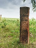 |
Waystone | Sermuth (map) |
19th century (road stone) | Porphyrtuff stele, inscriptions, important in terms of traffic history |
08974455 |
 |
Transformer station | Leisenau (map) |
around 1920 (transformer station) | Pagoda type, testimony to the development of the energy supply, of technical significance |
08974478 |
 More pictures |
Saxon post mile pillars (totality) | Leisenau (map) |
marked 1722 (quarter milestone, probably a copy) | Post mileage column; Quarter milestone, significance in terms of traffic history |
08974914 |
 More pictures |
Water tower | Leisenau (map) |
1947 (water tower) | Water tower; Mainly made of quarry stone in the monumentalizing forms of the 1940s, significance in terms of building history and technology history |
08974476 |
 |
Muldentalbahn (totality); Zwickauer Mulde railway bridge | (Map) | 1875 (railway bridge) | Individual monument in the above-mentioned entity: railway bridge; (see material list -obj. 09306181), km 45, 456 of the railway line Glauchau-Wurzen (Muldentalbahn), built as a solid wall girder in rivet construction, renewed in 1938, extends to the district of Lastau, Flst. 293/3, railway history, traffic history and technology history of importance |
09306162 |
| Muldentalbahn (aggregate) | (Map) | 1875 (aggregate component) | Material component of the material population Muldentalbahn, section Colditz, Möseln with the individual monuments Eisenbahnbrücke Zwickauer Mulde (see individual monuments list -obj. 09306162), railway bridge (see individual monuments -obj. 08973207, see also material list -obj. 09306181); Totality with all railway systems, including track systems with substructure and superstructure, route kilometers, telecommunications and signal systems, railway stations including all functional buildings, guard houses, bridges and culverts in the communities of Glauchau, Stadt (OT Glauchau, Kleinbernsdorf, Reinholdshain), Limbach-Oberfrohna, Stadt (OT Wolkenburg-Kaufungen), Remse (OT Remse), Waldenburg (OT Niederwinkel, Oberwinkel, Waldenburg), Lunzenau, city (OT Lunzenau, Cossen, Rochsburg), Penig, city (OT Markersdorf, Penig, America, Arnsdorf, Thierbach, Zinnberg), Rochlitz, Stadt (OT Penna, Rochlitz), Seelitz (OT Fischheim, Seelitz, Biesern, Steudten), Colditz (OT Colditz, Lastau, Möseln, Sermuth, Zschetzsch), Grimma, Stadt (OT Großbothen), for industrial development of the Muldental important and landscape-forming standard-gauge railway, economic history, railway history, landscape shaping and regional history of importance |
09306197 |
|
 |
Arch bridge over the Schwarzbach | Möseln (map) |
1877 (railway bridge); 1877 (road bridge) | Road and railway bridge, railway line Glauchau – Wurzen (Muldentalbahn), brick and natural stone masonry, significance in terms of transport history |
08973207 |
 |
Road bridge over the Mulde | Podelwitz (map) |
1894–1895 (bridge) | Landscaping importance, good architectural training, of importance in terms of building history, traffic history and technology history |
08970870
|
| Lack of laundry | Schönbach Untere Dorfstrasse 16 (map) |
Early 20th century (lack of laundry) | in the house of a farm, economic and historical importance |
08974487 |
|
 |
Muldentalbahn (totality); Leitenbach bridge | Sermuth (map) |
1875 (road bridge) | Individual monument in the above-mentioned entity: road bridge; (See population list -obj. 09306181), at km 53, 065 of the railway line Glauchau – Wurzen (Muldentalbahn), north of the old location of Kötteritzsch, originally built for double-track operation, of traffic history |
08974454 |
| Muldentalbahn (aggregate) | Sermuth (map) |
1875 (railway embankment) | Material component of the material population Muldentalbahn, section Colditz, OT Sermuth with the individual monument bridge Leitenbach Mulde (see individual monument list -obj. 08974454, see also material list -obj. 09306181); Totality with all railway systems, including track systems with substructure and superstructure, route kilometers, telecommunications and signal systems, railway stations including all functional buildings, guard houses, bridges and culverts in the communities of Glauchau, Stadt (OT Glauchau, Kleinbernsdorf, Reinholdshain), Limbach-Oberfrohna, Stadt (OT Wolkenburg-Kaufungen), Remse (OT Remse), Waldenburg (OT Niederwinkel, Oberwinkel, Waldenburg), Lunzenau, city (OT Lunzenau, Cossen, Rochsburg), Penig, city (OT Markersdorf, Penig, America, Arnsdorf, Thierbach, Zinnberg), Rochlitz, Stadt (OT Penna, Rochlitz), Seelitz (OT Fischheim, Seelitz, Biesern, Steudten), Colditz (OT Colditz, Lastau, Möseln, Sermuth, Zschetzsch), Grimma, Stadt (OT Großbothen), for industrial development of the Muldental important and landscape-forming standard-gauge railway, economic history, railway history, landscape shaping and regional history of importance |
09306199 |
|
 More pictures |
Muldentalbahn (totality); Borsdorf - Coswig railway line; Kiessen Viaduct | Kasten (card) |
1866–1867, later reshaped (viaduct) | Individual monument in the above-mentioned entity: railway bridge over the Mulde; (see population list -obj. 09306181), see also the municipality of Grimma, eastern part of the bridge district of Köten (see obj. 08974507), western part of the bridge, district of Sermuth, of significance in terms of traffic history |
09305773 |
| Waystone | Schkopau (map) |
around 1820 (Wegestein) | of importance in terms of traffic history |
08970553 |
|
 More pictures |
Royal Saxon milestones (totality) | Skoplau Colditzer Landstrasse (map) |
2nd half of the 19th century (milestone); 2nd half of the 19th century (milestone) | Milestone; Half-mile stone, also used as a boundary stone, marks the boundary between Leisnig and Colditz, a rare combination of functions, offset, of significance in terms of traffic and regional history |
08970831 |
 More pictures |
Royal Saxon milestones (totality) | Skoplau Colditzer Landstrasse (map) |
2nd half of the 19th century (milestone) | Milestone; Route marker stone, whole milestone, without lettering and crown, not at the original location, of importance in terms of traffic history |
08970529 |
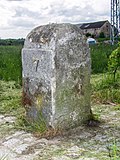 |
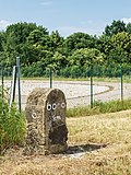
Milestone | Skoplau (map) |
around 1890 (kilometer stone) | Route marker stone with inscription, sandstone, important in terms of traffic history |
08970127 |
 |
Milestone | Skoplau Leisniger Landstrasse (map) |
around 1890 (kilometer stone) | Route marker, important in terms of traffic history |
08970886 |
 |
Milestone | Terpitzsch Hauptstraße 014 (in front) (map) |
late 19th century | Sandstone, important in terms of traffic history.
marked: 15 15,000 km 16 |
08970823 |
 |
Hydraulic ram | Zschetzsch (map) |
around 1900 (pump) | Hydraulic ram; Water lifting device, technical monument of the water supply, of local historical importance |
08974453 |
 |
Sawmill, with technical equipment | Zschetzsch Sermuther Strasse (map) |
1st half of the 20th century (technical equipment) | Plastered construction, of importance in terms of technology history |
08974913 |
 |
Muldentalbahn (totality); Gatekeeper house | Zschetzsch Sermuther Strasse 14 (map) |
1875 (gatekeeper house) | Individual monuments in the above-mentioned aggregate: Railway keeper's house with ancillary building; (See the list of subject matters -obj. 09306181), largely originally preserved caretaker's house at km 52.4 of the Glauchau – Wurzen railway line (Muldentalbahn), of significance in terms of railway and traffic history |
09306164 |
| Muldentalbahn (aggregate) | (Map) | 1875 (railway body) | Objective aggregate component of the aggregate Muldentalbahn, section Colditz, OT Zschetzsch with the individual monument Bahnwärterhaus (see individual monument list -obj. 09306164, see also material list -obj. 09306181); Totality with all railway systems, including track systems with substructure and superstructure, route kilometers, telecommunications and signal systems, railway stations including all functional buildings, guard houses, bridges and culverts in the communities of Glauchau, Stadt (OT Glauchau, Kleinbernsdorf, Reinholdshain), Limbach-Oberfrohna, Stadt (OT Wolkenburg-Kaufungen), Remse (OT Remse), Waldenburg (OT Niederwinkel, Oberwinkel, Waldenburg), Lunzenau, city (OT Lunzenau, Cossen, Rochsburg), Penig, city (OT Markersdorf, Penig, America, Arnsdorf, Thierbach, Zinnberg), Rochlitz, Stadt (OT Penna, Rochlitz), Seelitz (OT Fischheim, Seelitz, Biesern, Steudten), Colditz (OT Colditz, Lastau, Möseln, Sermuth, Zschetzsch), Grimma, Stadt (OT Großbothen), for industrial development of the Muldental important and landscape-forming standard-gauge railway, economic history, railway history, landscape shaping and regional history of importance |
09306200 |
|
 |
Transformer station | Zschirla Zschirlaer Dorfstrasse (map) |
around 1920 (transformer station) | Pagoda type, testimony to the development of the energy supply, significance in terms of regional and technical history |
08971169 |
Elstertrebnitz
| image | designation | location | Dating | description | ID |
|---|---|---|---|---|---|
| Lard grinder | (Map) | marked 1796 (Mühle); around 1780 (stable house); around 1880 (stable house); around 1900 (enclosure); around 1880 (barn) | Two side buildings (residential stable houses), residential building, mill building (with preserved mill technology), two barns, gate entrance, courtyard paving and enclosure of a mill property; old location Elstertrebnitz, great mill system with many original details from different epochs, mostly half-timbered buildings, of importance in terms of building history, local history and technology |
09258482
|
|
| Transformer house | (Map) | around 1920 (transformer station) | old location Tannewitz, pagoda type, of technical significance |
09258481
|
|
| Mill Greitschütz | (Map) | designated 1716 (mill); marked 1854 (Mühle); denotes 1880 (mill); 1912 (generator) | Mill property with a small industrial mill with technical equipment, two residential houses, farm buildings, weir system, courtyard paving, gate entrance and enclosure; old location Greitschütz, mostly plastered solid buildings, a building with a half-timbered upper floor, large mill system with original components from different epochs, of technical and local significance |
09258414
|
|
 |
Royal Saxon milestones (totality) | (Map) | after 1858 (milestone) | Milestone; old location Oderwitz, Saxon half-mile stone as a border crossing stone, object of traffic-historical importance |
09258412
|
 |
Prussian milestone | (Map) | Mid-19th century (milestone ‹Prussian›) | Milestone; Prussian half-mile stone (so-called Big Bell), old location Oderwitz, formerly Beersdorf (Saxony-Anhalt), of importance for the history of traffic |
09304830
|
 More pictures |
Iron mill | (Map) | 1915 (Eisenmühle); around 1910 (grain mill); around 1900 (Wehr); Commissioning in 1895 (hydroelectric power station); 1914 (turbine house) | Mill property with iron mill, grain mill, turbine house, outbuildings and weir system; old location Oderwitz, plastered solid buildings, the only preserved iron mill in Germany in the rubbing process, mill location documented since the 12th century, 1915 to 1992/93 production plant for iron powder for various (including medical and metallurgical) purposes, of great importance in terms of technology history |
09257123 |
Frohburg, city
| image | designation | location | Dating | description | ID |
|---|---|---|---|---|---|
 |
Mill Benndorf | (Map) | around 1692 (mill); Rebuild around 1927 (mill) | Former mill; Watermill built on a mill moat that has now silted up, no technical equipment available, Renaissance building with a steep pitched roof, coats of arms on the courtyard side, including a seat niche portal, explain architectural significance, in the agricultural region the mill was of local historical importance, today a residential building |
08971353
|
| House of the mill | (Map) | 19th century (miller's house) | Structurally and historically of importance, half-timbered building, residential building of a former water mill |
08971898
|
|
 |
Transformer house | (Map) | around 1925 (transformer station) | Pagoda type, testimony to the development of the energy supply in the region, of technical significance |
09305257
|
| Frauendorfer mill | (Map) | marked 1778 (older in core) | Former mill (with mill technology in the grinding room); From a structural and technical point of view of importance, mill building with richly designed half-timbered upper floor and directly connected grinding room, porphyry tuff portal with mill mark in the keystone, former water mill |
08970140
|
|
| Hermsdorfer mill | (Map) | marked 1828 (mill) | Former mill yard consisting of house and stable; Former watermill for the agricultural region of local historical importance, the house with half-timbered upper floor and the adjoining stable building with porphyry tufa are of architectural importance, the mill has been out of operation since 1960, no technology has been preserved |
08971308
|
|
| Born mill | (Map) | in the core 1681 (mill); marked 1787 (stable house); around 1810 (mill) | Mill and outbuildings on an angular floor plan; Former cutting, grinding and tilling mills, all buildings with half-timbered upper floors, in an attractive urban situation at the entrance to the old town, mill building characterized by wide street gables, of local history |
08970530
|
|
 More pictures |
Saxon post mile pillars (totality) | (Map) | marked 1727 (post distance column) | Post mileage column; Copy of a distance column, important in terms of traffic history |
08971329
|
| Frohburg station | (Map) | 1872 (train station) | Reception building (with two ceramic reliefs); Type construction of the Leipzig – Chemnitz line, which was expanded around 1872, two ceramic reliefs by Feuerriegel on the reception building, of local, architectural and transport historical importance |
08971273
|
|
 |
Castle and manor Frohburg (material entity); Castle brewery | (Map) | 18th century (brewery); 1734 Dendro warehouse building II (brewery); 1740 Dendro residential building (brewery) | Individual monument belonging to the Frohburg Castle and Manor: Former castle brewery (see Florian-Geyer-Straße-Object 08970429); Elongated two-storey building with a high pitched roof and dormers, a defining part of the old castle district |
08970795
|
| Castle and manor Frohburg (material entity); Castle mill | (Map) | 19th century, later reshaped (mill); Late 16th century (coat of arms) | Individual features of the entity of the castle and manor Frohburg: Castle mill and coat of arms of Christof and Catarina von Creuz above the entrance of the castle mill (see entity document Obj. 08970429); Former watermill, of local importance |
08970618
|
|
| Castle and manor Frohburg (material entity); Old paint | (Map) | inscribed 1682 (dyeing) | Individual monument belonging to the Frohburg palace and manor: former dye works and blueprinting (see composite document Obj. 08970429); Stately renaissance building on the castle pond in the line of sight of the castle, seat niche portal with fittings ornament and angel's head on the keystone, formative construction of the castle district, important evidence of the regionally important blueprint, of architectural, art-historical and local significance |
08970545
|
|
 More pictures |
Hopfgarten station; Leipzig – Geithain railway line | (Map) | 1887 (reception building) | Reception building; Belonging to the Leipzig – Geithain railway line, built as a stop in 1887, train station in 1905, stopping point since 1987, of significance in terms of traffic, building history and local history, simple plastered construction from the early days |
09259367
|
| Former village smithy | (Map) | around 1830 (forge) | Socially and historically significant and characterizing the village image next to the church on the village green |
08971863
|
|
 |
Breunsdorfer post mill | (Map) | around 1850 (mill) | Post mill; Implemented by Breunsdorf, restored in 1993, now on a hill at the south-western end of the village, of technical significance |
09257314
|
| Water tower | (Map) | 1962 (water tower) | Water tower; Concrete construction, significance in terms of technology history, building history and landscape design |
09300669 |
Geithain, city
| image | designation | location | Dating | description | ID |
|---|---|---|---|---|---|
 |
Royal Saxon milestones (totality) | (Map) | around 1858 (milestone) | Milestone; Junction stone, distance stone at the Bad Lausick – Rochlitz – Colditz junction, of significance in terms of traffic history |
08971136
|
 |
Royal Saxon milestones (totality) | (Map) | around 1856 (milestone) | Milestone; Copy of a station stone, distance stone, of importance in terms of traffic and surveying history |
08970917
|
 |
Saxon post mile pillars (totality) | (Map) | marked 1727 (post distance column) | Post mileage column; Distance column, of importance in terms of regional and transport history |
08970916
|
| Reed mill | (Map) | marked 1769 (mill building); marked 1811 (Müllerwohnhaus); marked 1755 (archway); marked 1926 (barn) | Mill building (with mill technology), stable house, side building, barn and archway of a mill property; old location Altdorf, buildings predominantly with half-timbered upper storey, segmental arch portals in porphyry tuff, decorated keystone in the archway, of importance in terms of building history, local history and technology history |
08970925
|
|
 More pictures |
Barometer house | (Map) | around 1912 (barometer house) | technological historical monument |
08970884
|
 |
Saxon post mile pillars (totality) | (Map) | marked 1727 (post distance column) | Post mileage column; Distance column, of importance in terms of regional and transport history |
08971075
|
 |
Royal Saxon milestones (totality) | (Map) | around 1856 (Stationsstein) | Milestone; Station stone, distance stone, significant in terms of traffic history |
08971047
|
 More pictures |
Geithain railway station; Leipzig – Geithain railway line | (Map) | 1870–1871 (reception building); 1920s (signal box) | Railway station with reception building (address: Eisenbahnstraße 2), goods handling, storage building and signal box (address: Eisenbahnstraße 2a); Belonging to the Leipzig – Geithain railway line, predominantly Wilhelminian-style buildings, timber-framed storage buildings, the 1920s-style signal box of architectural significance, of local and transport history |
08971030
|
| Substructure with combustion chambers of a lime ring kiln | (Map) | 1868 (lime kiln) | as a Saxon prototype of the so-called Hoffmann ring furnace of outstanding importance in terms of technology history, besides a larger and thus probably a little later built brick ring furnace in Großtreben the only circular ring furnace preserved in Saxony, also of rarity throughout Germany |
08970924
|
|
 |
Lime and brick kiln | (Map) | 1869–1885 (brick kiln); 1878 (chimney) | Remainder of a multi-chamber furnace for lime and brick kilns, with chimney; In terms of development, marks the intermediate stage from the two-chamber furnace to the ring furnace, of significance in terms of technology |
08971045
|
 |
Niedergräfenhain viaduct | (Map) | 1868–1872 (viaduct) | Railway viaduct on the Neukieritzsch – Chemnitz line; twelve-arched bridge in natural stone, of importance in terms of traffic and technology |
08971089
|
| Syhra Mill | (Map) | 18th century (mill) | Former mill, consisting of a miller's house and barn; Plastered building with a mansard roof, baroque-looking residential building that defines the townscape, building complex with architectural, technical and local historical significance |
08971034
|
|
 |
Mill | (Map) | around 1860 (mill) | Industrial building dominating the site from the late 19th century, of importance in terms of local history and technology |
08971091 |
Grimma, city
| image | designation | location | Dating | description | ID |
|---|---|---|---|---|---|
 |
Saxon post mile pillars (totality) | Bernbruch (map) |
marked 1722 (quarter milestone); 1930 copy (quarter milestone) | Post mileage column; Quarter milestone, important in terms of traffic history |
09256963
|
 |
Cannewitz Brewery | (Map) | 1887–1889 (brewery) | Brewery; consisting of two buildings, of local historical importance |
08973640
|
 |
Totality of the Royal Saxon Triangulation ("European degree measurement in the Kingdom of Saxony"); Station 107 Deditzhöhe | (Map) | marked 1873 (triangulation column) | Triangulation column; Second order station, significant testimony to geodesy of the 19th century, of significance in terms of surveying history |
08973536
|
| Teichmühlbrücke | Döben (map) |
around 1800 (road bridge) | Road bridge over the Teichmühlgraben; Arch bridge made of quarry stone masonry, part of the Teichmühle ensemble, local evidence of transport history |
08966629
|
|
| Hennigs Mill; Hofmann Mill | Förstgen (map) |
Mid 19th century (side building); 1st half of the 20th century (mill technology) | Side building of a mill property and mill technology in the neighboring mill building; old location Förstgen, mill plastered solid construction, side building upper floor half-timbered, of importance in terms of building history and technology history |
08974512
|
|
 More pictures |
So-called. Goat farm; Fremdiswalde windmill | Fremdiswalde (map) |
around 1850, location older (mill) | Tower Dutchman with extensions; Built around 1850, the location is older, and is of importance in terms of local history and technology |
08973530
|
| Golzermühle | (Map) | 1838, older in the core (Müllerwohnhaus) | Mill property consisting of a house and two mill buildings, with a memorial plaque; Former watermill, later also used as an inn, a mill with a significant local history, with a distinctive effect on the street, and of importance in terms of technology |
08973863
|
|
| Golzern paper mill; Schroedersche paper factory (formerly) | (Map) | 1862 (main building); End of the 19th century (extensions); marked 1910 (new calender hall building); 1927-1928 (turbine house) | Paper mill consisting of three connected production buildings grouped around a courtyard, another production building on the other side of the street (building with technical equipment), remains of the track system, hydropower plant and turbine house; Factory that emerged from a mill plot, stately facility mainly from the end of the 19th century, important paper mill in Saxony, together with the Cameroon workers' settlement in Bahren, it is of local historical value, due to the various structural constructions also of importance in terms of building history and technology |
08973548
|
|
| Marker stone | Göttwitz (map) |
around 1915 (kilometer stone) | Inscription, of importance in terms of local history and traffic history |
08974239
|
|
| City forest | (Map) | 1870–1910 (forest park); 1902 (Alberthalle); 1895 (Stolledenkmal); marked 1888 (Köhler monument); around 1907 (round arch bridge) | Forest park (garden monument) with pavilion Alberthalle, Stolledenkmal, Köhler monument, stone table, arched bridge, marker stones and route of the former Muldentalbahn (with passages and retaining walls); Park with a network of paths, woody trees and equipment, characteristic representative of a new type of public green space that emerged in the second half of the 19th century, important testimony to the development of the town, of importance in terms of gardening, local history and landscape design |
08966280
|
|
 More pictures |
Upper Grimma station | Bahnhofstrasse 2; 2a (card) |
1866 (passenger station) | Railway station with reception building (No. 2), platform roofing and paving and water station (No. 2a); Reception building in neo-Gothic design by Eduard Heuchler (Freiberg), of significance in terms of technology history, traffic history, local history and local development history |
08966633
|
| Old Forge; Maschinenbau-Aktiengesellschaft Golzern-Grimma (formerly) | (Map) | 1913 (factory building) | Workshop with rear annex; large factory hall made of red clinker bricks with skylight, factory building that defines the street scene, significance in terms of industrial history |
08966647
|
|
| Old turning shop; Maschinenbau-Aktiengesellschaft Golzern-Grimma (formerly) | (Map) | 1899 (factory building) | Factory building; Gründerzeit clinker construction, of industrial historical importance |
08966646
|
|
| Neumühle | Grimma (map) |
around 1890 (mill) | Mill building and gate entrance to the mill property; old location Böhlen, landscape-defining building, factory mill building on the banks of the Mulde as well as two clinker pillars with sandstone cover of the driveway, document of the local and industrial history |
08966769
|
|
 More pictures |
Suspension bridge | (Map) | 1924-1925 (bridge); 1949 (reconstruction of the bridge after being blown up); marked 1925 (bridge keeper's house) | Pedestrian bridge over the Mulde and town-side bridge house; With 80 m, the largest span of a suspension bridge in East Germany, of importance in terms of technology history, the history of local development and the appearance of the town |
08966676
|
 |
Lace factory Birkigt & Co. (formerly) | (Map) | 1907 (factory building); 1907 (boiler house); marked 1954 (high water mark) | Textile factory with production building (with attached workshop), boiler house, remains of the chimney, gatekeeper and office building and high water mark; Founded in 1907, production of woven and knitted lace and lace fabrics until 1990, built on the Grimma – Wurzen railway line, evidence of the industrial settlement in Grimma, of technical and local significance |
08966584
|
 More pictures |
Pöppelmann Bridge; Old Muldenbrücke | (Map) | marked 1716–1719 (bridge) | Road bridge over the Mulde; Remarkable stone arch bridge, the building built by Matthias Daniel Pöppelmann, the master builder of the Dresden Zwinger, on behalf of the electorate with artistic, historical and traffic significance, baroque bridge construction of rarity |
08966583
|
 More pictures |
Large mill | Large mill 4; 4a (card) |
marked 1725 (baroque mill, rye mill, no. 4); later revision marked 1867 (Mühle, no. 4); 1865, later reshaped (Kleine Mühle, Weizenmühle); 1924, today's wheat mill (industrial mill); 1892–1894 (stable building, no. 4a) | Mill system consisting of the facade of the rye mill (old mill, No. 4) and stable / shed building (No. 4a) on the Mühlenhof, the wheat mill (No. 4) on an island on the Mulde, the mill ditch with weir, and the turbine house with two turbines; Mill complex as the oldest known mill in Saxony (first mentioned in 1170), impressive urban development and landscape-defining ensemble with regional historical and scientific documentary value, rye mill, baroque building from 1725 called the Great Mill, several times rebuilt and expanded, facade of the rye mill is the last testimony to the baroque mill building, the wheat mill Typical small industrial mill around 1900 with industrial historical significance, stable / shed an elongated clinker brick building (around 1895) provides an indication of the supraregional importance of the mill, 1996 cessation of the production of flour and animal feed, large mill forms together with the miller's house with outbuildings and staff residence (Obj. 08966737) and the Obermüllerhaus (Obj. 08966739) an urban ensemble of high quality and a complexity that has become rare in Saxony |
08966738
|
 |
Railway line Borsdorf - Coswig | Husarenstrasse - (map) |
probably 1866 (railway bridge) | Railway bridge over Husarenstrasse; Road tunnel under the Borsdorf – Coswig railway line, of significance in terms of railway and transport history |
08966657
|
| Walther-Werke, Plant I (formerly) | (Map) | around 1928 (factory building) | Production building, gatehouse, fence and gate post of a factory; Mighty factory construction of the electrotechnical works of Ferdinand Walther, building in the gable position to the street, gate pillars with original lamps, impressive production building, of industrial and local historical importance |
08966687
|
|
 |
Case factory Reinhold Kühn (formerly) | Klosterstrasse 7 (map) |
marked 1927 (textile industry) | Multi-part factory of a case factory, former school; Rare example of a production building in the old town, convincing architecture in the local style, significant location on the Mulde and near the castle, factory used to be a primary and secondary school, significance in terms of urban planning, industrial history and local history |
08966263
|
| Transformer house | Grimma (map) |
1912 (transformer station) | high-quality massive station, probably built in 1912 by Landkraftwerke Leipzig Aktiengesellschaft with its headquarters in Kulkwitz, very early evidence of the electrification of the region, of importance in terms of technology and development |
08966735
|
|
 More pictures |
Saxon post mile pillars (totality) | (Map) | designated 1723 (post distance column); 1997 copy set up (post distance column) | Post mileage column; Copy of a distance column, important in terms of traffic history |
09304979
|
| Mustard and vinegar factory (formerly) | (Map) | marked 1894 (residential building) | Residential house in open development (Leipziger Straße 17), factory building with chimney (Straße des Friedens 2) and fencing of the property; Residential and factory property, Wilhelminian style building with clinker brick facades, scientific and documentary value, residential building at a not insignificant intersection, of importance in terms of building history, industrial history and urban planning |
08966721
|
|
| Road bridge | Grimma (map) |
marked 1876 (road bridge) | Arched bridge over the former Glauchau – Wurzen railway line (Muldentalbahn), natural stone bridge, of historical importance |
08966589
|
|
| Brickworks Schmidt (former) | (Map) | before 1900 (brick kiln) | Remains of the ring kiln of a former brickworks; Rare technical history testimony in the Muldental, of local importance |
08966572
|
|
 More pictures |
Lower Grimma station; Railway line Glauchau - Wurzen (Muldentalbahn) | Nerchauer Strasse 1a; 2 (card) |
1877 (passenger station) | Railway station with reception building (No. 1a) and goods shed (No. 2); Plastered buildings typical of the time, formerly part of the Glauchau – Wurzen line (Muldentalbahn), evidence of railway and industrial history |
08966586
|
| Grimma slaughterhouse | (Map) | 1898–1899, later partially changed (slaughterhouse) | Former slaughterhouse, consisting of an administration building, residential building, cold storage, machine and boiler house, slaughterhouse, tripe washing and fertilizer hall, stables for small and large cattle and parts of the enclosure (building for open bank and horse slaughterhouse and pigsty building no monuments); Partly old locality Hohnstädt, rare example of a small town slaughterhouse from the late 19th century that has been preserved in its entirety, importance for local and technical history |
08966297
|
|
| Transformer house, neighboring house, fencing and paving of the forecourt | Grimma (map) |
1912 (transformer station); 1927 (residential building); 1924 (enclosure) | urban ensemble, interesting in terms of local history and technology |
08966596
|
|
| Mustard and vinegar factory (formerly) | (Map) | marked 1894 (residential building) | Residential house in open development (Leipziger Straße 17), factory building with chimney (Straße des Friedens 2) and fencing of the property; Residential and factory property, Wilhelminian-style building with clinker brick facades, scientifically documentary value, residential building at a not insignificant crossroads, of importance in terms of building history, industrial history and urban planning |
08966721
|
|
| Grimma gasworks | (Map) | around 1890 (administration building) | Former administrative building of a gas works, with enclosure; Structured building made of unplastered brickwork, document of the municipal utility, of local importance |
08966999
|
|
 |
Water tower | Hohnstädt (map) |
1913 (water tower) | Water tower; old location Hohnstädt, building dominating the site, of technical and local importance |
08966751
|
| Transformer house | Grimma (map) |
1912 (transformer station) | high-quality massive station, probably built in 1912 by Landkraftwerke Leipzig Aktiengesellschaft based in Kulkwitz, very early evidence of the electrification of Saxon communities, of importance in terms of technology and local development |
08966302
|
|
 |
Royal Saxon milestones (totality) | Grimma (map) |
2nd half of the 19th century (milestone) | Milestone; old location of Hohnstädt, former location of Burgberg, half mile stone, of importance in terms of traffic history |
08966294
|
| Transformer house | Großbardau (map) |
around 1920 (transformer station) | Pyramid-shaped roof structure, of importance in terms of technology and site development |
09256923
|
|
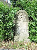 |
Royal Saxon milestones (totality) | Großbardau (map) |
2nd half of the 19th century (half milestone) | Milestone; of importance in terms of traffic history |
09256915
|
 |
Royal Saxon milestones (totality) | Großbardau (map) |
2nd half of the 19th century (half milestone) | Milestone; of importance in terms of traffic history |
09256913
|
| Obermühle | Großbardau (map) |
marked 1738, later modifications (mill) | Mill building, pigeon tower and side building of a mill property; Former water mill, evidence of a mill from the 18th century, of local and technological importance |
09256936
|
|
 |
Gasthof Großbothen; Müller's dance palace (formerly) | (Map) | 1837 (inn); around 1925 remodeling (inn); 1910 (ballroom); 1926 (disco ball with spotlight) | Gasthaus with a hall at the rear (both buildings with historical furnishings); Plastered building with Art Deco jewelery, a striking tower-like central projection, hall with partly historicizing, partly Art Nouveau decoration and swinging floor as well as "Light of 1000 Stars" (forerunner of the disco ball) from 1926, unique furnishings, the original swinging parquet in the hall technical monument, inn from local and architectural significance, supra-regional memorable and rarity value |
08974416
|
 More pictures |
Milestone | Großbothen (map) |
3rd third of the 19th century (kilometer stone) | of importance in terms of traffic history |
08974414
|
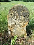 |
Milestone | Großbothen (map) |
3rd third of the 19th century (kilometer stone) | of importance in terms of traffic history |
08974495
|
| Waystone | Großbothen (map) |
19th century (road stone) | square porphyry tufa stele with weathered inscription, meaning of transport history |
08974430
|
|
| Railway line Borsdorf - Coswig | Großbothen (map) |
1st half of the 20th century (railway bridge) | Railway bridge over Kleinbothener Strasse; Bridge on the Borsdorf – Coswig line, of significance in terms of traffic history |
08974456
|
|
 More pictures |
Muldentalbahn (aggregate) | Großbothen (map) |
1875 (railway embankment) | Objective aggregate component of the aggregate Muldentalbahn, section Grimma, OT Großbothen with the individual monument Großbothen railway station (see individual monument list -obj. 08974457, see also aggregate list -obj. 09306181); Totality with all railway systems, including track systems with substructure and superstructure, route kilometers, telecommunications and signal systems, railway stations including all functional buildings, guard houses, bridges and culverts in the communities of Glauchau, Stadt (OT Glauchau, Kleinbernsdorf, Reinholdshain), Limbach-Oberfrohna, Stadt (OT Wolkenburg-Kaufungen), Remse (OT Remse), Waldenburg (OT Niederwinkel, Oberwinkel, Waldenburg), Lunzenau, city (OT Lunzenau, Cossen, Rochsburg), Penig, city (OT Markersdorf, Penig, America, Arnsdorf, Thierbach, Zinnberg), Rochlitz, Stadt (OT Penna, Rochlitz), Seelitz (OT Fischheim, Seelitz, Biesern, Steudten), Colditz (OT Colditz, Lastau, Möseln, Sermuth, Zschetzsch), Grimma, Stadt (OT Großbothen), for industrial development of the Muldental important and landscape-forming standard-gauge railway, economic history, railway history, landscape shaping and regional history of importance |
09306201
|
| Großbothen railway station; Muldentalbahn (totality); Railway lines Borsdorf - Coswig; Cross railway Großbothen - Borna | Großbothen (map) |
1869 (reception building); 1937 (signal box); 1899, later changed (signal box) | Individual features in the above-mentioned aggregate: signal box W4 (address: Kleinbothener Straße), signal box W2 (address: Zum Bahnhof), former reception building (address: Colditzer Landstraße 7) and the tracks of the Großbothen train station; (See subject list -obj. 09306181), facilities of the railway lines Borsdorf – Coswig, Glauchau – Wurzen (Muldentalbahn) and the cross line Großbothen – Borna, signal box W4 with technical equipment, first reception building from 1869, important traffic junction of the Leipziger Land, historical traffic and railway history from meaning |
08974457
|
|
| Waystone | Großbothen (map) |
19th century (road stone) | Porphyrtuff stele, square floor plan, weathered inscription, significance in terms of traffic history |
08974458
|
|
 More pictures |
Höfgen watermill | Höfgener Dorfstrasse 8 (map) |
Mentioned in a document in 1721 (mill) | Mill building (with annex, water wheel and oven), today a museum; Half-timbered building, significance for local history and the history of technology, popular education and the townscape, an important part of the cultural landscape |
08966528
|
 More pictures |
Monument smithy Höfgen | Kaditzsch (map) |
1st half of the 18th century (stable house); 18th century (small house); inscribed 1806 (Torhaus); 1809 (barn) | Four-sided courtyard with gatehouse, barn, small residential house and large residential stable house, courtyard paving, enclosure walls, water trough in the courtyard and converted old blacksmith's workshop; Stately farm in a corner location that is important for the village appearance, half-timbered buildings, street-side building with a gate passage marked 1806, drive-through barn from 1809, small residential house and large residential stable house with visible framework (18th century), water trough made of Rochlitz porphyry tuff, remarkable tool equipment in a blacksmith's workshop, scientific-documentary Value, importance for popular education, of importance in terms of building history, local history and the appearance of the town |
08966542
|
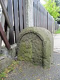
| Weighing house with weighing device | Kaditzsch (map) |
2nd half of the 20th century (Waagehaus) | Commercial building rarely located in such a central location, of significance in terms of technology history |
08966544
|
|
 |
Royal Saxon milestones (totality) | Kleinbardau (map) |
1st half of the 19th century (half milestone) | Milestone; of importance in terms of traffic history |
09257837
|
| Railway bridge on the Borna – Großbothen line (cross line) | Kleinbardau (map) |
1920–1937 (railway bridge) | railway and traffic engineering monument |
09259980
|
|
| House and barn of a former water mill | Kleinbothen (map) |
subsequently referred to as 1792 (mill) | Residential building typical of the landscape, location that characterizes the townscape, significance in terms of local history and building history |
08974433
|
|
 More pictures |
Viaduct Kiessen; Railway line Borsdorf - Coswig | Kasten (card) |
1866–1867, later reshaped (viaduct) | Railway bridge over the Mulde; See also the municipality of Colditz, western part of the Sermuth bridge (see Obj. 09305773), the eastern part of the Kösser bridge, of significance in terms of traffic history |
08974507
|
 More pictures |
Road bridge over the Mulde | Kasten (card) |
1888 (road bridge) | Six-arched stone bridge, in the direction of Großbothen, of historical importance |
08974459
|
 |
Teichmühle Klocken | (Map) | Mid 19th century (mill) | House of a mill estate and mountain cellar on the property; old pond mill at the Schwarzen Teichbach, local historical significance |
08974501
|
| Residential house of a mill estate | Motterwitz (map) |
Early 19th century (miller's house) | partly in half-timbered construction, as a former mill estate of local historical importance |
08974811
|
|
| Two side buildings of a former four-sided courtyard and a laundry shortage | Muschau (map) |
1844 according to information (side building) | Evidence of rural building and economic methods of the 19th century in half-timbered construction, stately courtyard, of architectural and local significance, lack of laundry significant in terms of social history and technology history |
08974821
|
|
| Transformer tower | Muschau (map) |
around 1920 (transformer station) | as evidence of the electrification of the region, of significance in terms of technology history |
08974819
|
|
| Waystone | Mutzschen (map) |
19th century (road stone) | old location Böhlitz, made of sandstone on a brick base, pyramidal tip, with inscription, of importance in terms of traffic history |
08974312
|
|
| Royal Saxon milestones (totality) | Mutzschen (map) |
2nd half of the 19th century (milestone) | Milestone; reworked into a road stone, significant in terms of traffic history |
08974298
|
|
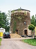 More pictures |
Mutzschen windmill | Mutzschen An der Rolle 4 (card) |
2nd half of the 19th century (windmill) | Tower Dutchman; of importance in terms of technology and local history |
08974275
|
 More pictures |
Water station | Mutzschen Berggasse 37 (map) |
Mid-1930s (elevated water tank) | Plastered construction with natural stone integration, of importance in terms of technology and local history |
08974325
|
 More pictures |
Saxon post mile pillars (totality) | Mutzschen (map) |
marked 1723 (post distance column) | Post mileage column; Copy of a distance column, important in terms of traffic history |
08974246
|
 More pictures |
Mutzschen station | Mutzschener Bahnhofstrasse 73 (map) |
1895 (train station) | Former station on the Mügeln – Neichen railway line, with ancillary building; Station building of a disused narrow-gauge railway line, historically significant station with echoes of the Swiss style |
08974276
|
| Counting stone | Nauberg (map) |
13./15. Century (counting stone) | medieval stone for taking tithes on payday, of cultural and historical importance |
08974566
|
|
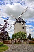 More pictures |
Nauberger Dutch mill | (Map) | 1911 (mill) | Tower Dutchman, with annex and technical equipment; The location of a windmill was documented cartographically as early as 1800, which is of importance in terms of local history and technology |
08974571
|
| Lack of laundry (in the adjacent building) | Nerchau (map) |
around 1920 (lack of laundry) | of significance in terms of technology history |
08973678
|
|
 More pictures |
Nerchau train station; Railway line Glauchau - Wurzen (Muldentalbahn) | (Map) | 1908 (train station) | Station building with adjoining railway underpass; Three-part plastered building with clinker brick structures, formerly part of the Muldentalbahn Glauchau – Wurzen, of significance in terms of traffic history |
08973523
|
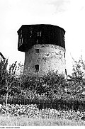 More pictures |
Nerchau windmill | (Map) | 2nd half of the 19th century (mill) | Tower Dutchman; Landscaping windmill, of local historical importance |
08973671
|
| Residential building (Zur Ponicke 2), barn, side building (Zur Ponicke 4), another side building and entrance to a four-sided courtyard, plus a workshop building (Staupitzstraße 4) with warehouse, additional entrance and manual pump | Ostrau (map) |
marked 1854 (residential building); marked 1909 (workshop); marked 1798 (barn) | Residential building, stately plastered building with twin windows in the gable, as a former blacksmith's shop (later agricultural machinery construction) and woodworking workshop of local and architectural importance |
08974806
|
|
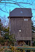 More pictures |
Prositz windmill | (Map) | inscribed 1804 (Müllerwohnhaus); 1811 (mill) | Post mill (No. 18a) and residential house (No. 18), side building and enclosure of a mill property; of importance in terms of local history and technology |
08974299
|
| Pit flora | Ragewitz (map) |
1902 (mining facility) | Shaft building with two adjoining buildings (machine houses) and enclosure; rare evidence of lignite mining in civil engineering in the Leipziger Land, of technical and regional importance |
08974557
|
|
| Paddle mill | Paddle (card) |
1550 first mentioned (mill); in the core 18th century (mill); 1st half of the 19th century (outbuilding) | Former mill and outbuildings with artistic furnishings (former home and studio of Horst Skorupa); Half-timbered watermill, studio house of the artist and ceramist Horst Skorupa (1941–2004), of local and architectural importance as well as artistic and scientific importance |
08974438
|
|
 |
Transformer tower | Paddle (card) |
around 1915 (transformer station) | Pagoda type, in regional history as evidence of electrification and of importance in terms of technology |
08974439
|
| Schaddel railway keeper's house; Railway line Glauchau - Wurzen (Muldentalbahn) | Paddle (card) |
around 1876 (railway keeper's house) | Railway keeper's house with ancillary building; Belonging to the Glauchau – Wurzen railway line (Muldentalbahn), type construction of a 3rd class gatekeeper house with the adjoining building, erected in 1866, one of the last remaining gatekeeper houses on the line, of significance in terms of building history and traffic history |
08974440
|
|
| Waystone | Paddle (card) |
19th century (road stone) | Porphyry without inscription, important in terms of traffic history |
08974441
|
|
 More pictures |
Roitzscher Paltrockmühle | Schkortitz (map) |
around 1900 (mill) | Paltrock windmill (with technical equipment); Mill in Wurzen OT Roitzsch (Nemter Weg) demolished in 2009, reconstruction at the new location (Grimma, OT Schkortitz) completed in 2013, of significance in terms of technology history |
09255779
|
| Residential house with forge (including forge equipment and vaulted cellar) | Schkortitz (map) |
around 1820 (forge) | Middle-floor house with forge, scientific and documentary value, rarity value, of local and technological interest |
08966562
|
|
| Railway line Glauchau - Wurzen (Muldentalbahn) | Schmorditz (map) |
1875–1877 (railway bridge) | Railway bridge over the Thielbach; Bridge on the Glauchau – Wurzen railway line (Muldentalbahn), arched bridge, of historical importance |
08973674
|
|
| Transformer station and adjacent two overhead line masts | Schmorditz (map) |
around 1915 (transformer station) | Evidence of electrification, pagoda-shaped transformer houses typical of the region, steel truss masts, probably more recent, of importance in terms of supply history and technology history |
08973522
|
|
| Neumühle | Zeunitz (map) |
marked 1813 (mill) | Mill and side building; stately plastered building with segmented arched portals, of importance in terms of local history and technology |
08974581 |
Groitzsch, city
| image | designation | location | Dating | description | ID |
|---|---|---|---|---|---|
| Saxon post mile pillars (totality) | (Map) | marked 1722 (quarter milestone) | Post mileage column; Copy of a quarter milestone (partly original), offset, of importance in terms of traffic and regional history |
09258330
|
|
| Berndorfer Mill | (Map) | around 1737 (mill); 1773 Dendro (side building) | Mill building, two side buildings, barn and mill ditch of a mill property, with mill technology; Well-preserved mill system with special details that go back to the 16th century, partly half-timbered, partly solid construction, in the northern side building remarkable room decoration in rococo style, of architectural, local, cultural and technical history of importance |
09258357
|
|
 |
Transformer station | around 1925 (transformer station) | Pagoda type, testimony to the development of the energy supply in the region, of technical significance |
09304765
|
|
 |
Marienbrücke | (Map) | 1879 (road bridge) | Road bridge over the Schwennigke; Two-arched stone bridge over the Schwennigke on the old Groitzsch – Pegau connection road, significance in terms of transport history |
09305052
|
| Platform roofing | (Map) | around 1900 (platform roofing) | Wooden construction, the last remaining part of the historic platform structures of the Groitzsch train station, of significance in terms of local history and traffic history, the station building demolished around 2008 |
09257994
|
|
| Town mill | (Map) | designated 1928 (Mühle); marked 1805 (residential house) | Residential house (Mühlstraße 32) with mill extension (An der Schnauder 14) as well as outbuildings of a mill property; Clearly preserved mill building from various construction phases, upper floor half-timbered house, outbuildings also in half-timbered, no technical equipment preserved, of local and technical significance |
09257966
|
|
| Shoe factory "Meischke & Sons", later "Saxonia" | (Map) | 1868, later redesigned (factory) | Former shoe factory building, today residential building (two addresses: Markt 10a and Graf-Wiprecht-Straße 3), on the corner of Graf-Wiprecht-Straße; simply structured plastered facade, Wilhelminian style factory building of architectural, technological and urban significance |
09257877
|
|
| Town mill | (Map) | designated 1928 (Mühle); marked 1805 (residential house) | Residential house (Mühlstraße 32) with mill extension (An der Schnauder 14) as well as outbuildings of a mill property; Clearly preserved mill building from various construction phases, upper floor half-timbered house, outbuildings also in half-timbered, no technical equipment preserved, of local and technical significance |
09257966
|
|
| Old brewery | (Map) | 1886 (brewery); 1886 (tenement house) | Former brewery; Formerly residential and brewhouse, plastered facade in neo-renaissance forms, plastered and stone structures, box bay windows, some windows with leaded glazing, characterizing the cityscape, of importance in terms of local history and building history |
09257934
|
|
 More pictures |
Water tower | (Map) | marked 1903–1904 (water tower) | Water tower; Standing frame and housing of the high-level water tank made of steel framework, structurally interesting engineering work from the turn of the century, executed by Aug. Klönne (Dortmund), urban landmark, of technical and urban significance, as an open high-rise water tank of the Barkhausen type made of steel framework, unique in Saxony |
09257809
|
| Großstolpen watermill | (Map) | 1820 (mill) | Residential house and mill building of a water mill; Residential house with half-timbered upper floor, mill plastered building, converted for residential purposes, originally clinker brick structure, of local and technological importance |
09256061
|
|
 |
Transformer station | (Map) | around 1925 (transformer station) | Pagoda type, well-preserved example from a group of similar structures, historical evidence of electrification, of significance in terms of technology history |
09258018 |
Großpösna
| image | designation | location | Dating | description | ID |
|---|---|---|---|---|---|
| Oberholz stop; Leipzig – Geithain railway line | (Map) | 1887 (waiting hall) | Großpösna-Oberholz railway stop; Railway line Leipzig – Geithain, km 16, 20, originally preserved station building with waiting hall, of significance in terms of railway history |
09259900
|
|
| Transformer tower | (Map) | after 1900 (transformer station) | Elaborately designed yellow clinker brick building, of technical significance |
09305924
|
|
 More pictures |
Mining Technology Park | (Map) | 1985 (bucket wheel excavator); 1986 (tape release device) | Show system of the lignite mining of the Espenhain and Zwenkau opencast mines consisting of bucket wheel excavator Bg. 1547, belt drop device (stacker), electricity house, two driver's cabs of the Zwenkau overburden conveyor bridge, an empty track from signal box 24 to signal box 6, two electric motors, a railway trailer, dispatcher tower, belt system, apron clearing ; Last evidence of the machine technology and infrastructure systems of the historic lignite mine in the southern area of Leipzig, includes the districts of Gruna (Flst. 1/6) and Sestewitz (Flst. 1/7), of significance in terms of technology and mining history |
09305972
|
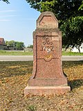 |
Saxon post mile pillars (totality) | (Map) | marked 1722 (quarter milestone) | Post mileage column; Probably a copy of a quarter mile stone, Poststrasse Dresden – Waldheim – Colditz – Grimma – Leipzig of regional and transport historical importance |
09259461
|
 |
Seifertshain windmill | (Map) | 1748 (mill) | Paltrock windmill; 1945 rebuilt post mill, of technical history and landscape design significance |
09259451 |
Kitzscher, city
| image | designation | location | Dating | description | ID |
|---|---|---|---|---|---|
 More pictures |
Trages heap | (Map) | 1938–1939 (construction of the dump) | Dump; After the Thierbach power plant was blown up, one of the last testimonies of the Espenhain open-cast lignite mining operation, due to its size with a landscape-defining effect, used between 1938/39 and 1990 as a dump for overburden as well as subsequently for ashes from the ashes of the Thierbach power plant, significant in mining history, rarity |
09306324 |
Kohren-Sahlis, city
| image | designation | location | Dating | description | ID |
|---|---|---|---|---|---|
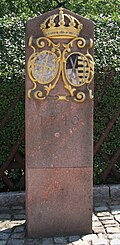 More pictures |
Electoral Saxon road stone | (Map) | marked 1740 (copy from 1977) | Waystone; Copy, porphyrtuff pillar with gold-plated electoral coat of arms, of importance in terms of traffic history |
08971434
|
| Terpitz quarry | (Map) | 19./20. Century (quarry); 2nd half of the 20th century (technical equipment) | Quarry with production building and technical equipment; Porphyry quarry with stone sorting system, of local and regional historical importance due to the extraction of porphyry, due to the existing technical equipment, the system also acquires rarity and importance in terms of technical history |
08971902
|
|
| Castle mill | (Map) | inscribed 1759 (mill) | Mill building and side building of a mill property; Former watermill, formerly part of Gnandstein Castle, of local history |
08970787
|
|
 More pictures |
Totality of the Royal Saxon Triangulation ("European degree measurement in the Kingdom of Saxony"); Station 119 Sahlis | (Map) | 1875 (triangulation column) | Triangulation column, 2nd order station; significant testimony to the geodesy of the 19th century, significant in terms of surveying history |
08971477
|
 |
Hole mill | (Map) | 1827 (part of the mill) | Miller's house, barn and two side buildings of a mill property; Former watermill belonging to the Syhra manor, preserved without technology, ensemble in half-timbered construction, of architectural and local significance |
08971429
|
 More pictures |
Mittelmühle Kohren | (Map) | inscribed 1837 (mill) | Mill; Watermill, later an inn, stately building with half-timbered upper floor, door portal with straight roofing and original door leaf from the time of construction, of architectural and local significance |
08971394
|
| Mill | (Map) | 1817 (mill) | Former watermill of the property at the Schmiedeteich, quarry stone building with porphyry tufa walls, access via arched bridge, porphyry tufa plaque via door, originally with inscription, of local history |
08971409
|
|
| Hainmühle | (Map) | designated 1829 (Mühle); marked 1766 (Müllerwohnhaus) | Mill and house of a mill estate; both buildings with half-timbered upper floor, residential building with original door from around 1820, of architectural and local significance |
09256442
|
|
 More pictures |
Lindigtmühle | (Map) | around 1800 (grain mill); around 1925 (mill technology); around 1900 (shotgun) | Mill building (with technical equipment) and miller's house; Picturesque mill property outside of the village next to the linden forest, simple mill building with overshot waterwheel and mill technology, residential building with protruding upper arbor, half-timbered structure on the upper floor and half-hipped roof, inside a reconstructed oven, important in terms of construction, local history and technology |
09256814
|
| Waystone | 19th century (road stone) | Signpost for Narsdorf – Rochlitz, artificial stone, partially destroyed, inscription, of significance in terms of traffic history |
08971462
|
||
| Drinking water system with technical equipment, well, underground pump house, a weir, an elevated tank and the supply lines in the village | (Map) | 1909–1912 (waterworks) | Drinking water supply for the Terpitz locality, the only known cooperative drinking water supply system in the state of Saxony, has been in operation unchanged for almost 100 years, still provides sufficient drinking water of good quality under today's purity regulations, of importance in terms of technology and local history |
09256886
|
|
| Road bridge over the Ratte (Obergräfenhainer-Rathendorfer Bach) | 19th century (road bridge) | Brick quarry stone arch bridge, of architectural significance |
08971467
|
||
| Former mill | (Map) | marked 1757 (mill) | Today a residential building, with Wilder Mann figures in the half-timbered structure and round-arched porphyry tuff gate, ancient half-timbered construction, of architectural significance |
08971464
|
|
| Mill and associated barn of the mill property | (Map) | 1883 (mill) | former grinding and cutting mill, mill building with half-timbered upper floor, street gable slated (ornamental gable), half-timbered barn, of architectural and local significance |
08971469 |
Lossatal
| image | designation | location | Dating | description | ID |
|---|---|---|---|---|---|
 |
Royal Saxon milestones (totality); Milestone | (Map) | 2nd half of the 19th century (milestone); around 1900 (kilometer stone) | Milestone; Half mile stone, road between Falkenhain and Schildau, kilometer 13, 826, reworked into a kilometer stone, significance in terms of traffic history |
08972660
|
 |
Falkenhain steam dairy and soft cheese dairy; Feinkäserei Zimmermann | (Map) | around 1910 (dairy); 1970 (boiler and machine house); around 1910 (warehouse) | Factory building (dairy) with boiler house, chimney, courtyard pavement as well as stable and warehouse; Plastered buildings with brick structure, technical monument, of local importance |
08972620
|
 |
Waystone | Frauwalde (map) |
19th century (road stone) | Sandstone stele, inscriptions, significance in terms of traffic history |
08972662
|
 |
Wurzen – Eilenburg railway line | Großzschepa Am Klärwerk 1 (next to) (map) |
between 1919 and 1927 (railway bridge) | Railway bridge; Significant in terms of traffic and building history |
08971481
|
 |
Big mill | Heyda Mühlengasse 4 (map) |
1882 according to information (mill) | Mill with technical equipment and mill ditch; Formerly part of the Heyda manor, watermill in a landscape-defining location with local historical significance |
08972647
|
 |
Loss bridge; Wurzen – Eilenburg railway line | Kleinzschepa (map) |
between 1919 and 1927 (railway bridge) | Railway bridge with wing walls; 40 meter long reinforced concrete bridge over the Lossa lowland, because of its construction and design of rarity as well as of importance in terms of traffic and building history |
08971480
|
 |
Wurzen – Eilenburg railway line | Kleinzschepa Am Bahnhof 11 (next to) (map) |
between 1919 and 1927 (railway bridge) | Railway bridge; of importance in terms of traffic history |
08971478
|
 |
Old brick factory | Kühnitzsch Körlitzer Strasse 9 (map) |
19th century (brickworks) | Restored remnants of a former kiln, of technical historical importance |
08972692
|
 More pictures |
Kühnitzsch post mill | Kühnitzsch Mühlenweg 6 (map) |
1812 (mill); 1812 (flour mill) | Post mill with historical mill technology; Largely original, fully functional mill with technical equipment, restored, standing on a walled stand, of technical historical importance |
08972693
|
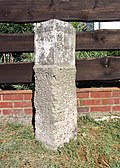 |
Waystone | Kühnitzsch Zum Buchholz 12 (in front) (map) |
19th century (road stone) | Sandstone stele, inscriptions in the unit of hours of travel, significant in terms of traffic history |
08972696
|
 |
Wurzen – Eilenburg railway line | Lüptitz (map) |
between 1919 and 1927 (railway bridge) | Railway bridge; of importance in terms of traffic history |
08971507
|
 |
Wurzen – Eilenburg railway line | Lüptitz (map) |
between 1919 and 1927 (railway bridge) | Railway bridge; of importance in terms of traffic history |
08971506
|
 More pictures |
Holländermühle Meltewitz | Börlner Strasse 22 (map) |
1st half of the 19th century (mill) | Tower Dutchman; Squat, conical windmill, without technical equipment, north of the old location Knatewitz, typical mill construction of the region, of landscape design importance |
08972683
|
 |
Road bridge over the Lossa | Müglenz Birkenweg - (map) |
16th century (road bridge) | stone arch bridge, technical and local significance |
08971495
|
 |
Brewery of the manor | Müglenz Müglenzer Dorfstraße 3 (at) (map) |
19th century (brewery) | Solid construction, plastered ground floor, brick facade upstairs, as part of the former manor of local and cultural significance |
08971494
|
 |
Waystone | Thammenhain (map) |
19th century (road stone) | square floor plan, inscriptions and directional arrows, significance in terms of traffic history |
08972658
|
| Waystone | Thammenhain | 19th century (road stone) | square floor plan, inscriptions, directional arrow, significance in terms of traffic history |
08972652
|
|
| Waystone | Thammenhain | 19th century (road stone) | traffic history significance |
08972651
|
|
 |
Waystone | Thammenhain (map) |
19th century (road stone) | Sandstone stele, inscriptions with directional arrows, significance for traffic history |
08972650
|
 More pictures |
Holländermühle Voigtshain | (Map) | 1888 (weather vane) | Tower Dutchman with technical equipment; The last of the former four windmills in the area around Voigtshain, a location that shapes the landscape at the entrance to Voigtshain, is of local and technological importance |
08972631 |
Makers
| image | designation | location | Dating | description | ID |
|---|---|---|---|---|---|
 More pictures |
Waystone | Dögnitz Dögnitz 1 (opposite) (map) |
19th century (road stone) | Sandstone, inscription unusually designed, important in terms of traffic history |
08973033
|
| Waystone | Lübschütz (map) |
19th century, today a copy (road stone) | Copy, inscriptions, of historical importance |
08973002
|
|
 |
Alternative lead office of the head of the district administration for state security | Lübschütz (map) |
1968–1972 (bunker) | Bunker system; With ventilation nozzles, equipment, warehouse with dog run, three screens, residential building with garage, three bungalows, social building, dog kennel, slab path, workshop building, shower, garage opposite the main entrance in the warehouse, fencing of the site with concrete pillars and chain link fence, iron gates, two electricity pylons with overland line and transformer station as well as two distribution boxes of the energy industry on the fence next to the entrance to the house of the former property manager, the only surviving historical record for the planning intentions of the state security apparatus in Saxony, of scientific importance |
08973005
|
 |
Transformer tower | Lübschütz (map) |
1st third of the 20th century (transformer station) | in elaborate design, evidence of electrification, of importance in terms of supply and technology |
08973001
|
 More pictures |
Railway monument; Leipzig-Dresden Railway | Machern Polenzer Straße - (map) |
around 1840 (LDE stones); 1986 (plaque) | Memorial stone flanked by two LDE stones (marker stones of the Leipzig-Dresden Railway Company); Memorial stone for the beginning of the earthworks for the first German long-distance railway line Leipzig – Dresden near Machern in 1836, next to it two marker stones of the Leipzig-Dresden Railway Company, of railway and local historical importance |
08972986
|
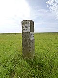 |
Waystone | Plagwitz (map) |
19th century (road stone) | Sandstone, inscriptions, significance in terms of traffic history |
08972999
|
 |
Transformer station | Püchau (map) |
around 1915 (transformer station) | Rare, conical design, evidence of electrification, of importance in terms of supply and technology |
08973035
|
 |
Waystone | Plagwitz (map) |
19th century, renewed (road stone) | Sandstone, inscriptions, of historical importance |
08972997
|
 More pictures |
Tube bridge; aqueduct | (Map) | 1912 (aqueduct) | Aqueduct over the hollow; Plant of the Canitz waterworks for pipelines over the Mulde to the water supply of Leipzig, (see also the Thallwitz municipality northeastern part of the Canitz bridge, Obj. 08972261), of local and technological importance |
09305762
|
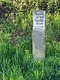 More pictures |
Waystone | Püchau (map) |
19th century, font renewed (Wegestein) | Sandstone, inscription, significance in terms of traffic history |
08973010
|
| Arch bridge with inscription plaque | Püchau Hauptstrasse - (map) |
marked 1655 (bridge) | A road bridge with significant traffic history and an old pavement an important ensemble for the townscape |
08973025
|
|
 More pictures |
Sachsenmühle; Holländermühle Püchau | Püchau (map) |
inscribed 1888 (mill) | Mühlgut with tower dutchman and barn; Mill in an island location that shapes the landscape, of local and technological importance |
08973008
|
| Petersbrücke; Church bridge | Püchau (map) |
marked 1564 (bridge) | Arch bridge; between church and castle, a bridge that defines the street scene and is of local historical importance |
08973012 |
Markkleeberg, city
| image | designation | location | Dating | description | ID |
|---|---|---|---|---|---|
 More pictures |
Gaschwitz train station | (Map) | 1914 (train station, Hauptstrasse 312); 1870s (old station, old crossing 1); around 1914 (platform hall) | Station with reception building (Hauptstrasse 312, with station restaurant), old station building (Alte Überfahrt 1), three platform roofs with paving, signal box (at the underpass); Architecturally remarkable plastered building in the reform style around 1910, first station of the secondary railway in Saxony Gaschwitz – Plagwitz – Lindenau from 1877 to 1879, significance in terms of local history, architectural history, regional history, traffic history and urban development |
09256740
|
| Glazing and joinery company Karl Mahn (formerly) | (Map) | 1931–1932, essentially older (workshop) | Factory building; Typical construction of a small industrial or commercial enterprise, attractive design in the forms of the time around 1930, importance in terms of local history and building history |
09256714
|
|
| Gaschwitz train station | (Map) | 1914 (train station, Hauptstrasse 312); 1870s (old station, old crossing 1); around 1914 (platform hall) | Station with reception building (Hauptstrasse 312, with station restaurant), old station building (Alte Überfahrt 1), three platform roofs with paving, signal box (at the underpass); Architecturally remarkable plastered building in the reform style around 1910, first station of the secondary railway in Saxony Gaschwitz – Plagwitz – Lindenau from 1877 to 1879, significance in terms of local history, architectural history, regional history, traffic history and urban development |
09256740
|
|
| Batschke Floßgraben; Elsterfloßgraben (aggregate) | (Map) | 1608–1610 (raft ditch) | Material population component of the material population Elsterfloßgraben: Floßgraben (see also population list, obj. 09304747); Artificially created raft ditch adapted to the shape of the landscape with a starting section (so-called Batschke) on the Markkleeberger or Zwenkau area, in the Connewitzer Holz (southern Auewald) flowing into the Pleiße, of regional and technological significance |
09305752
|
|
| Elsterfloßgraben (aggregate) | (Map) | around 1915 (bridge); around 1600 (Floßgraben) | Individual monument of the population Elsterfloßgraben: Bridge (at Mehringstraße 8) - (see population list, Obj. 09304747); the combination of artificially created ditches and natural water courses makes the Elsterfloßgraben an important testimony to the hydraulic engineering of the 17th century with a high regional historical value |
09256645
|
|
| Mining Technology Park | 1986 (tape release device); 1985 (bucket wheel excavator) | Show system of the lignite mining of the Espenhain and Zwenkau opencast mines consisting of bucket wheel excavator Bg. 1547, belt drop device (stacker), electricity house, two driver's cabs of the Zwenkau overburden conveyor bridge, an empty track from signal box 24 to signal box 6, two electric motors, a railway trailer, dispatcher tower, belt system, apron clearing ; Last evidence of the machine technology and infrastructure facilities of the historic lignite mine in the southern area of Leipzig, the object also extends into the municipality of Großpösna, Güldengossa district (object no. 09305972), of significance in terms of technology and mining history |
09305976
|
||
 More pictures |
Royal Saxon milestones (totality) | (Map) | 1858 (milestone) | Milestone; Whole milestone, marks the former post road Leipzig – Rötha – Borna; of importance in terms of traffic history |
09256635
|
| Milestone | (Map) | 1875 (kilometer stone) | Route marking stone, typical design in sandstone with a rounded top, significant in terms of traffic history |
09256641
|
|
 More pictures |
Markkleeberg station | (Map) | 1889 opening of the railway line (station); 1904 (reception building) | Station building of a passenger station; Route Leipzig-Plagwitz-Hof, plaster clinker building in Art Nouveau forms, significance in terms of local history, traffic history and building history |
09256140
|
 More pictures |
Water tower | (Map) | 1904 (water tower) | Water tower; today residential house, plastered brick building with lantern and curved hood, significance in terms of technology, architectural and urban development |
09256468 |
Markranstädt, city
| image | designation | location | Dating | description | ID |
|---|---|---|---|---|---|
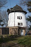 More pictures |
Windmill Göhrenz | (Map) | 2nd half of the 19th century (mill) | Tower Dutchman; today residential building, local historical significance |
09257380
|
 More pictures |
Göhrenz-Albersdorf station; Railway line Leipzig - Plagwitz - Pörsten | (Map) | 1897 (train station) | Reception building and toilet block of a train station; , today residential building, reception building on the Leipzig-Plagwitz-Pörsten railway line, brick building from the Wilhelminian style with a crooked hip roof, of local and historical importance |
09257373
|
| Kulkwitz thermal power station (formerly) | (Map) | around 1960 (control center) | Control room of a former power plant; Plastered construction with clinker brick structures, of technical and regional significance |
09305283
|
|
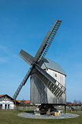 |
Post mill Lindennaundorf | (Map) | 1848 (mill) | Post mill with technical equipment; Implemented in 2009/10 by Mühlenweg on Priesteblicher Straße, significance in terms of local history and technology |
09256771
|
 More pictures |
Markranstädt railway station; Railway line Leipzig – Großkorbetha – Erfurt | (Map) | 1856 (passenger station); 1856 (reception building) | Reception building with house platform (with three house numbers) and platform roofing of the station; Entrance building inside high-quality lead-glazed windows and original staircase, importance for traffic and local history |
09257763
|
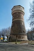 More pictures |
Water tower | (Map) | 1895 (water tower) | Water tower; Clinker brick construction, testimony to the history of technology for the water supply around 1900, also of significance in terms of building typology |
09257621
|
| Machine works Dr. Gaspary & Co. (formerly) | (Map) | designated 1905–1906 (administration building); around 1910 (factory hall) | Administration building, attached factory gate, gatekeeper building, fence and factory hall of a factory; Administration building cement brick facade with cast stone, gable side with large curved gable, very representative building, factory hall with interesting construction, architectural and local historical significance |
09257758
|
|
| Markranstädter Automobilfabrik (former); MAF | (Map) | Founded in 1908 (factory) | Factory building (with several house numbers, farm road 2a and Ziegelstraße 12/14); Testimony to the small-scale automobile production in Saxony, significance in terms of local history and industrial history |
08966350
|
|
| Elsterfloßgraben (aggregate) | (Map) | 1501–1700 (raft ditch) | Material population component of the material population Elsterfloßgraben: Floßgraben section Markranstädt (see population list, Obj. 09304747); Belonging to the Elster rafting system, the combination of artificially created ditches and natural water courses makes the Elster raft ditch an important testimony to the hydraulic engineering of the 17th century with a high regional historical value |
09305751
|
|
 More pictures |
Schkölen-Räpitz stop; Railway line Leipzig-Plagwitz-Pörsten | (Map) | 1897 (train station) | Breakpoint; today a residential house, brick building from the Wilhelminian style with a crooked hip roof, of local historical importance |
09304385
|
 |
Seebenisch stop (formerly); Kulkwitz-Süd stop; Railway line Leipzig-Plagwitz-Pörsten | (Map) | 1915 (train station) | Breakpoint; Railway line Leipzig-Plagwitz-Pörsten, today residential building, simple plastered building with cornice and hipped roof, significance for the local history |
09257363 |
Narsdorf
| image | designation | location | Dating | description | ID |
|---|---|---|---|---|---|
 More pictures |
Narsdorf train station | (Map) | around 1872 (passenger station); around 1930 (equipment) | Reception building, signal box; Inselbahnhof, inaugurated in 1872, important station for goods traffic away from the Mulde valley, of local history, counter hall with ceramic furnishings around 1930 |
08971189
|
| Cutting mill (former) | (Map) | 18th J. (Mühle); around 1910 (saw gate); 18th century (residential house) | Former mill, now a residential building with technical equipment; Known as a cutting mill from the 18th century, full gate from around 1910, with a half-timbered upper floor, of importance in terms of technology and local history |
08971258
|
|
| Dammteichmühle (formerly) | (Map) | marked 1718 (mill) | Former mill (now a residential building) with an extension; with half-timbered upper floor, of architectural and local significance |
08971262
|
|
| Bridge on the dam pond | (Map) | 19th century (road bridge) | Double arch bridge made of quarry stone over the Dammteich tributary, historically important |
08971263 |
Naunhof, city
| image | designation | location | Dating | description | ID |
|---|---|---|---|---|---|
| Distribution tower and measuring container of the Fuchshain water management delivery station | (Map) | around 1890 (distribution tower) | technical historical significance |
09300982
|
|
 More pictures |
Fuchshain post mill | (Map) | 1781 (mill) | Post mill; Part of a former mill estate, consisting of a water mill and a windmill, of importance in terms of technology history, shaping the landscape |
08965938
|
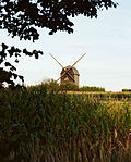 More pictures |
Fuchshainer Paltrockmühle | (Map) | 1927 conversions, older in the core (mill) | Paltrock windmill, house and side building of a mill estate; Formative of the landscape, technical and local historical significance |
08965937
|
| Former water house, today residential building, with enclosure | (Map) | around 1930 (water house) | Plastered building with clinker brick structure and slated tent roof, location that defines the street scene, significance in terms of technology history |
08966016
|
|
 |
Castle mill | (Map) | in the core 17th century (miller's house); around 1800 (side building); 17th century (gatehouse) | Residential house, side building, stable building, barn and courtyard paving of a former mill estate; Closed courtyard with valuable old buildings, half-timbered buildings, the only building in the village with an upper arbor (on the side building) and seat niche portal (on the house), valuable wood paneling in the mill house with paintings (Greek mythology), architectural and local historical importance |
08965790
|
 |
Water tower | (Map) | 1910 (water tower) | Water tower and underground water reservoir; originally designed as a half-timbered construction with a water tank in concrete, later statically strengthened by a brick tower shaft, unique of its kind, strongly characterizing the street space, underground water reservoir probably also in concrete, significance for the history of technology |
08965806
|
| Naunhof I waterworks; Leipzig waterworks east (former) | (Map) | 1886–1887 (waterworks) | Waterworks, foreman house and outbuildings; Brick and quarry stone buildings, was considered the most modern of its kind in Europe when it was built, a technical-historical monument of the Wilhelminian era, still serves to supply the city of Leipzig with water today, carries water through a high-pressure line into the reservoir system 15 km away in the waterworks in Probstheida, regional and of importance in terms of supply history |
08973225
|
|
 |
Naunhof II waterworks; Leipzig Waterworks West (formerly) | (Map) | 1896 (waterworks) | Waterworks with machine house, foreman house and garage; Brick buildings, technological historical monument of the Wilhelminian era, of local significance |
08973226 |
Neukieritzsch
| image | designation | location | Dating | description | ID |
|---|---|---|---|---|---|
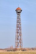 More pictures |
Water tower briquette factory Deutzen | (Map) | 1925 (water tower) | Water tower of a former briquette factory; Highly visible, landscape-defining water tower (spherical tank), iron construction by the Dortmund company August Klönne, which has now become rare, the last surviving industrial water tower of this construction in Saxony, of national technical significance |
09256692
|
 More pictures |
Water tower | (Map) | 1955 (water tower) | Water tower; old location in Röthigen, red clinker brick building with pilaster strips, interesting building type, of importance in terms of supply and technology |
08970103
|
| Mühlgut Zöpen | (Map) | in the core 1760 according to information (mill); marked 1870 (gate) | Residential house, mill wing, stable building, barn and gate system (archway and two gates) of a mill property; old location Zöpen, residential building with simple plastered facade and crooked hip roof, closed preserved complex of local historical importance |
08970504
|
|
| Lippendorf power plant | (Map) | around 1935 (vocational school); around 1930 (archive building); 1978 (mural) | Buildings and parts of the building of the former Lippendorf power station: facade of the former vocational school (northern section of Werkstrasse), former archive building (Werkstrasse, across from Busplatz), laboratory building on Industriestrasse; Buildings mostly in clinker brick construction, echoes of the modern style, power plant construction from the 1920s and 1960s, the last protected evidence of lignite power generation from the GDR era in the southern area of Leipzig, no production buildings from this period survived, regional and economic significance |
08970094
|
|
| Transformer tower | (Map) | 1920s (transformer station) | Possibly built around 1925 as a type building, plastered facade with tower top in half-timbered, of importance in terms of supply history as well as technical and architectural history |
08970603
|
|
 More pictures |
Lobstädt railway station | (Map) | 1914 (train station) | Reception building of the Lobstädt train station; in the reform style of the time around 1910, interesting in terms of building history, significant in terms of traffic history |
08970628
|
 More pictures |
Neukieritzsch station | (Map) | 1867 (train station) | Reception building; Neukieritzsch station, railway lines Leipzig – Hof (Saxon-Bavarian railway), Neukieritzsch – Chemnitz as well as the former railway line Neukieritzsch – Pegau, plastered construction with plaster and natural stone elements, of architectural and railway historical importance |
08970560 |
Otterwisch
| image | designation | location | Dating | description | ID |
|---|---|---|---|---|---|
 More pictures |
Milestone | (Map) | around 1900 (kilometer stone) | Route marker no. 6 on the Pomßen – Bad Lausick road, typical sandstone design with a rounded top, significant in terms of traffic history |
08965768 |
| Transformer tower | (Map) | around 1920 (transformer station) | pagoda-shaped station of importance in terms of technology and site development |
08965755 |
|
| Two milestones | (Map) | around 1900 (kilometer stone) | Route marking stones on the Pomßen – Bad Lausick road, typical sandstone design with a rounded top, significant in terms of traffic history |
08965764 |
|
| Milestone | (Map) | around 1900 (kilometer stone) | Route marker no. 4 on the Pomßen – Bad Lausick road, typical sandstone design with a rounded top, significant in terms of traffic history |
08965767 |
|
| Transformer tower | (Map) | around 1920 (transformer station) | technical monument of electrification of the region |
08965770 |
Parthen stone
| image | designation | location | Dating | description | ID |
|---|---|---|---|---|---|
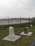 More pictures |
Milestone | around 1900 (kilometer stone) | Route marker no. 18 of the former 22 stones on the Leipzig – Grimma road, typical sandstone design with a rounded top, of importance for the history of traffic |
08965851 |
|
 |
Großsteinberg train station | (Map) | 1880 (reception building); 1940 (signal box) | Reception building (Bahnhofstrasse 1) and signal box (Grethener Strasse 20 (next to)) on the Borsdorf – Coswig railway line; Reception building typical historicism building, of importance in terms of building history and traffic history |
08965839 |
| Transformer tower | (Map) | around 1920 (transformer station) | Evidence of regional electrification, with technical equipment, of importance in terms of supply and technology |
08965829 |
|
 More pictures |
Paltrockmühle Staudnitz | (Map) | 1947 (mill) | Paltrock windmill with technical equipment; old location Staudnitz, of local and technological importance |
08965830 |
 More pictures |
Milestone | (Map) | 19th century (milestone) | Route marker no. 14 of the former 22 stones on the Leipzig – Grimma road, typical sandstone design with a rounded top, of significance for the history of traffic |
08965878 |
| Two milestones | around 1900 (kilometer stone) | Route marker stones no. 16 and 17 of the former 22 stones on the Leipzig – Grimma road, typical sandstone design with a rounded top, significant in terms of traffic history |
08965852 |
||
| Waystone | (Map) | 1st half of the 20th century (Wegestein) | Granite, inscriptions, of historical importance |
08965866 |
|
| Memory construction of a mill | (Map) | Early 20th century (Speicher) | old location Kleinpomßen, granary of the water mill, boarded half-timbered building, local and architectural significance |
08965861 |
|
 More pictures |
Milestone | around 1900 (kilometer stone) | Route marker no. 15 of the former 22 stones on the Leipzig – Grimma road, typical design in sandstone with a rounded top, further kilometer information, of significance in terms of traffic history |
08965875 |
|
| Milestone | 19th century (milestone) | Route marker no. 1 on the Pomßen – Bad Lausick road, typical sandstone design with a rounded top, significant in terms of traffic history |
08966017 |
||
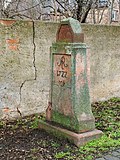 More pictures |
Saxon post mile pillars (totality) | (Map) | marked 1722 (quarter milestone) | Post mileage column; Quarter milestone, marking stone of the Poststrasse from Leipzig to Grimma, importance for traffic history |
08965873 |
 More pictures |
Milestone | around 1900 (kilometer stone) | Route marking stone, starting stone no. 0 of the Pomßen – Bad Lausick road, typical sandstone design with a rounded top, significant in terms of traffic history |
08965876 |
Pegau, city
| image | designation | location | Dating | description | ID |
|---|---|---|---|---|---|
| Bridge LXXII; Elsterfloßgraben (aggregate) | (Map) | 1608–1610 (bridge) | Individual monument of the population Elsterfloßgraben: Bridge LXXII (see population list, Obj. 09304747); the combination of artificially created ditches and natural water courses makes the Elsterfloßgraben an important testimony to the hydraulic engineering of the 17th century with a high regional historical value |
09304748
|
|
| Eisdorf watermill | (Map) | 1851 (mill) | Mill building (with water wheel) and Mühlgraben (Elsterfloßgraben); of significance in terms of technology history |
08970709
|
|
| Elsterfloßgraben (aggregate) | (Map) | 16./17. Century (raft ditch) | Elsterfloßgraben as a whole, with the following totality components: Branch at Pegau to Profener Elstermühlgraben (so-called small raft ditch, see totality component -Obj. 09257111) and individual sections in Zwenkau (so-called Batschke-Floßgraben, see so-called Batschke-Floßgraben, so-called Batschke-Floßgraben , see population component -object. 0305752), Leipzig (so-called Batschke-Floßgraben, population list -obj. 09296651), Markranstädt (Elsterfloßgraben, population list -obj. 09305751) still with the following individual monuments: Mittelbrücke (see individual bridge monument document, object 3048) LXXII (see individual monument document, obj. 09304748), bridge LXVIII (see individual monument document, obj. 09304839), bridge LXV (see individual monument document, obj. 09304747) and bridge LXIV (see individual monument document, obj. 09305200) as well as Elsterwehr in Zwenkau (see individual monument document) Obj. 09299655) and Markkleebe rg (bridge, see individual monument list -obj. 09256645); the combination of artificially created ditches and natural water courses makes the Elsterfloßgraben an important testimony to the hydraulic engineering of the 17th century with a high regional historical value |
09304747
|
|
| Bridge LXVIII; Elsterfloßgraben (aggregate) | (Map) | 1608–1610 (bridge) | Individual monument of the population Elsterfloßgraben: Bridge LXVIII (see population list, Obj. 09304747); the combination of artificially created ditches and natural water courses makes the Elsterfloßgraben an important testimony to the hydraulic engineering of the 17th century with a high regional historical value |
09304839
|
|
| Red bridge | (Map) | marked 1586, later reshaped (road bridge) | Road bridge over the Rote Graben; Two-arched bridge in natural stone and brick masonry, partly renewed in concrete, spans the Rote Graben on the old Groitzsch-Pegau connecting road at the confluence with the Schwennigke, significant in terms of transport history |
09305053
|
|
| Flood bridge | (Map) | marked 1904 (road bridge) | Road bridge over a flood canal; Five-arched road bridge, well-preserved bridge structure from the turn of the century, of significance in terms of traffic history |
09258373
|
|
| Schwennigke Bridge | (Map) | 1799 (road bridge) | Road bridge over the Schwennigke; Well-preserved, two-arched sandstone arch bridge from the 18th century, of significance in terms of traffic history |
09258372
|
|
| Small raft ditch; Elsterfloßgraben (aggregate) | (Map) | 1608–1610 (raft ditch) | Material entity component of the entity Elsterfloßgraben: Floßgraben (see entity entity list, Obj. 09304747); the definition of the route as the shortest and most economically effective connection between Stöntzsch (a village west of Pegau that was demolished because of the Profen opencast mine) and Leipzig, the combination of artificially created ditches and natural water courses make the Elsterfloßgraben an important testimony to the hydraulic engineering of the 17th century high regional historical value |
09257111
|
|
| Pegau waterworks | (Map) | 1906–1907 (waterworks); 1906/07 (engine) | Waterworks with technical equipment, stationary engine and bridge crane as well as civil servants' residence; Evidence of the urban water supply with remains of technical equipment, of importance in terms of supply history and local history |
09257309
|
|
 |
Niederoder Untermühle (formerly); Felt factory (later) | (Map) | around 1890 (manufacturer's villa); around 1860 (mill); marked 1888 (portal) | Factory owner's villa (with two house numbers, No. 2/4) with a fence around the garden as well as a former mill building with turbine house and remnants of the technical equipment (without address) and portal of a factory building (No. 1), in the rear area of the extensive factory site a chimney (behind No. 10); Well-preserved example of a historic industrial plant from the 19th century (former mill building), of importance in terms of building history, technology history and local history |
09257747
|
 More pictures |
Brickyard Erbs | (Map) | 1908–1910 (brickworks) | Brickwork building (with elongated Hoffmann ring furnace and chimney), drying shed, press house, workshop building, track system and technical equipment of a brickyard; From 1911 until production was discontinued in 1978, a purely family business, hardly any modern technology, therefore preserved the early form of industrial brick production, of local, economic and technological importance |
09302347
|
| Obermühle | (Map) | denotes 1804 (mill); End of the 18th century (residential building) | Mill on the Kleine Elster (Profener Elstermühlgraben), consisting of a residential building (address: Flur am Stadtbad 2) with stable building and two sheds, also ancillary building (address: Eulauer Straße 5/7), mill building and free-standing chimney, courtyard paving; Residential house a plastered building with a mansard roof, stable building a clinker building, ancillary building in half-timbered construction, mill building plastered solid construction, important monument of early industrialization with all important ancillary buildings, continuity of the location: from water to steam power, of local and technical significance |
09257474
|
|
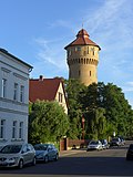 More pictures |
Water tower | (Map) | marked 1906 (water tower) | Water tower; Clinker brick building with a hooded roof, an important building for the city's supply chain with a character that shapes the cityscape |
09257437
|
 More pictures |
Saxon post mile pillars (totality) | (Map) | marked 1723 (post distance column) | Post mileage column; Copy of a distance column, important in terms of traffic history |
09257556
|
| Elster Bridge | (Map) | around 1850 (road bridge) | Arch bridge over the Kleine Elster (Profener Elstermühlgraben); important part of the townscape, of importance in terms of local history and traffic |
09257331
|
|
| Bridge LXV; Elsterfloßgraben (aggregate) | (Map) | 1608–1610 (bridge) | Individual monument of the totality Elsterfloßgraben: Bridge LXV (see population list, Obj. 09304747); the combination of artificially created ditches and natural water courses makes the Elsterfloßgraben an important testimony to the hydraulic engineering of the 17th century with a high regional historical value |
09304838
|
|
| Bridge LXIV; Elsterfloßgraben (aggregate) | (Map) | 1608–1610 (bridge) | Individual monument of the population Elsterfloßgraben: Bridge LXIV (see population list, Obj. 09304747); The combination of artificially created ditches and natural water courses makes the Elsterfloßgraben an important testimony to the hydraulic engineering of the 17th century with a high regional historical value |
09305200
|
|
| Middle bridge; Elsterfloßgraben (aggregate) | (Map) | 16./17. Century (raft ditch); 16./17. Century (bridge) | Individual monument of the population Elsterfloßgraben: bridge (see population list, Obj. 09304747); the combination of artificially created ditches and natural water courses makes the Elsterfloßgraben an important testimony to the hydraulic engineering of the 17th century, with a high level of regional and technical history |
09304844
|
|
 More pictures |
Sender Wiederau (totality) | (Map) | 1930s to 1960s (transmitter) | Totality of transmitter Wiederau, with the individual monuments: transmitter house (with two transmitters and cooling system), attached to the former administration building, machine house (with two ship diesels), attached transformer house, culture house with workshop building, antenna tuning house I, television transmitter building and tubular mast antenna and air raid shelter (see list of individual features -Obj. 08966045, same address) as well as further technical facilities (including foundations of various antenna bracing, antenna tuning house II, water treatment house, fan house and further transmitter building) as a whole; Of importance in terms of technology history, rarity |
09304710 |
Regis-Breitingen, city
| image | designation | location | Dating | description | ID |
|---|---|---|---|---|---|
| Transformer station | (Map) | around 1925 (transformer station) | Plastered building with clinker brick structures and a gable roof, interestingly designed functional building from the 1920s, evidence of the electrification of the place, of importance in terms of technology and supply history |
09259986
|
|
| Transformer station | (Map) | around 1930 (transformer station) | old village location Breitingen, plastered building with half-timbered elements, example of landscaped design of functional buildings from the 1920s / 1930s, evidence of regional electrification, of importance in terms of technology and supply history |
09259365
|
|
| Schwelwerk II; VEB central workshop Regis | (Map) | 1936–1938 (Schwelwerk); 1936–1938 (factory halls); 1936–1938 (administration); 1936–1938 (kitchen) | Factory, former smoldering factory, consisting of culture house (formerly laboratory), carpentry, laboratory, transformer station, administration building, main store, workshop 1 and kitchen building; Clinker-brick buildings with pilaster strips and flat saddle and hip roofs, factory buildings largely preserved in their original state in the factual classicist style of the 1st half of the 20th century, of local, regional, architectural and technological significance |
08970107 |
Rötha, city
| image | designation | location | Dating | description | ID |
|---|---|---|---|---|---|
| Espenhain station | (Map) | 1913 (reception building) | Reception building of Espenhain train station; Plastered building with boarded-up upper floor, richly structured structure in the local style, built in 1913, used as a passenger and freight station until 1995, of significance in terms of railway and architectural history |
09259597
|
|
| Espenhain power station; Espenhain lignite refining plant | (Map) | 1938–1940 (administration building); 1938–1940 (control room) | Administration building (address: Leipziger Straße 34) and control room (address: Stromstraße 6) of the former large power plant and later Espenhain lignite refining plant; Clinker buildings, echoes of the modern style, structural evidence of an important factory with a briquette factory, heavy-duty plant and power plant, largely preserved in the original, built in the run-up to the Second World War especially for the production of fuels, of technical, architectural and local significance |
09258387
|
|
| Waystone | (Map) | 19th century (road stone) | square floor plan, signposts to Mölbis made of porphyry tufa, significant in terms of traffic history |
09259724
|
|
 More pictures |
Water tower | (Map) | 1913 (water tower) | Water tower; yellow clinker building, significance in terms of technology history, defining the cityscape |
09259103
|
| Transformer house | (Map) | around 1925 (transformer station) | Plastered facade, well-preserved transformer house typical of the region from the 1920s, significance in terms of technology history |
09259093
|
|
 More pictures |
Royal Saxon milestones (totality) | (Map) | marked 1859 (milestone) | Milestone; Whole milestone, significant in terms of traffic history |
09259351
|
| Castle mill | (Map) | 18th century (miller's house) | Mill property, consisting of miller's house, mill building and rear mill ditch with weir system; Müller's house is baroque in its core, its significance in terms of local history, building history and technology history |
09259389
|
|
| Großkelterei Rötha | (Map) | 1910 (wine press) | Factory building, later administration, with staff room; in the reform style of the period around 1910, in the attic largely preserved in its original form from the Nazi era, with local, regional and socio-historical significance |
09259392
|
|
| Pump plant of the former Espenhain plant | (Map) | around 1940 (pump house) | Pump works of the former Espenhain waterworks; Clinker brick building, today a residential building, of importance in terms of technology and economic history |
09259368 |
|
 More pictures |
Trages heap | (Map) | 1938–1939 (stockpile) | Dump; After the Thierbach power plant was blown up, one of the last testimonies of the Espenhain open-cast lignite mining operation, due to its size with a landscape-defining effect, used between 1938/39 and 1990 as a dump for overburden as well as subsequently for ashes from the ashes of the Thierbach power plant, significant in mining history, rarity |
09306325 |
Thallwitz
| image | designation | location | Dating | description | ID |
|---|---|---|---|---|---|
 |
Water tower | (Map) | around 1910 (water tower) | Water tower; old location Collmen, lower part of the tower in clinker construction, technical monument, of local importance |
08972467
|
 |
Canitz hydropower plant | (Map) | around 1925 (hydroelectric power station) | Hydropower plant with boundary walls and control room as well as power plant canal; one of two preserved run-of-river power plants in the Mulde catchment area, evidence of the electrification of the Leipzig region in the 1920s, large, cubic plastered building with a landscape-shaping effect, of importance in terms of supply history |
08972256
|
 More pictures |
Canitz Dutch Mill | (Map) | marked 1876 (mill) | Tower Dutchman; Windmill without technical equipment, of local historical importance, due to its exposed location in the middle of the agricultural areas outside of Canitz also an element that shapes the landscape |
08972263
|
 More pictures |
Canitz waterworks | (Map) | 1907–1912 (waterworks); 1909–1910 (boiler and machine house) | Waterworks of the Leipzig operating network consisting of a pump house, boiler and machine house, coal bunker, filter building, former administration building, machine master house, lock tower, collection well, wall fence and avenue (garden monument); In operation since 1912, technical and architectural monument from around 1910, waterworks with the largest supply for the region and city of Leipzig, therefore also of regional historical importance |
08972262
|
 More pictures |
Tube bridge; aqueduct | (Map) | 1912 (aqueduct) | Aqueduct over the hollow; Operating system of the Canitz waterworks for pipelines over the Mulde to the water supply of Leipzig, (see also the municipality of Machern, southwestern part of the Püchau bridge, Obj. 09305762), of local and technical significance |
08972261
|
| Kollau waterworks | (Map) | 1937–1943 according to information (waterworks) | Waterworks with well house, control room; Concrete clinker building in the modern style, part of the Canitz waterworks, of technical and regional significance |
08972461
|
|
 |
Waystone | (Map) | 19th century (road stone) | partly copy, sandstone, inscriptions, significance in terms of traffic history |
08972443
|
| Road bridge over the Herrenteich | (Map) | Mid 19th century (road bridge) | Arch bridge on four arches, significance in terms of traffic history |
08972442
|
|
| Under mill | (Map) | around 1790 according to information (mill); Mid 19th century (mill); 1911, last water law (flood channel) | Mill building (with mill technology) and Lossalauf (formerly Mühlgraben) with weir and inlet of the flood channel; Saw and grinding mill, simple plastered building with a crooked roof, mill technology preserved, rifle weir partly in wooden construction, inlet with quarry stone border, of technical and local historical importance |
08972444
|
|
| Storage building | (Map) | 17th century, later modified (agricultural warehouse) | Typical, multi-storey, stately, multi-axis granary, plastered building with small windows and large gates, with a gable roof, formerly part of the Thallwitz manor, significance for local and architectural history |
08966258
|
|
| Old brick factory with lack of laundry in the extension | (Map) | 19th century (brickworks) | of importance in terms of local history and technology |
08972597
|
|
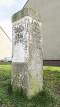 |
Waystone | (Map) | 3rd third of the 19th century (Wegestein) | Kilometers and arrows indicating the direction, from 1870, of importance for the history of traffic |
08972264 |
Trebsen / Mulde, city
| image | designation | location | Dating | description | ID |
|---|---|---|---|---|---|
| Railway bridge over the Mutzschener Wasser | (Map) | around 1875 (railway bridge) | belonging to the Glauchau-Wurzen route (Muldentalbahn); Arched bridge made of granite rubble masonry over the Mutzschener Wasser, significant in terms of traffic history |
08966103
|
|
 |
Milestone | (Map) | around 1900 (kilometer stone) | of importance in terms of traffic history |
08966191
|
| Milestone | around 1900 (kilometer stone) | of importance in terms of traffic history |
08966190
|
||
| Milestone | (Map) | around 1900 (kilometer stone) | of importance in terms of traffic history |
08966195
|
|
| Wiede & Sons paper mill (formerly) | (Map) | 1892–1893, later expanded (factory); 1921 (administration building); 1916 (pulp preparation); 1962 (caustic regeneration); around 1920 (gatehouse) | Paper mill with pulp processing (house no.14), lye regeneration (house no.19), transformer station (house no.65), car workshop (house no.70), coppersmith (house no.74), administration building (house no.78 and 79 ), Workshop and administration (house no. 80), administration building (house no. 80a) with dining room extension, courtyard paving as well as storage, consumption and porter (house no. 82 and 97, formerly factory fire station); old location of Pauschwitz, impressive overall complex with highlighted historical and urban significance, relevance to the history of technology, influenced the development of the area (see neighboring villa buildings, infant home etc.) |
08966363
|
|
 More pictures |
Trebsen / Mulde train station | (Map) | 1911 (reception building); 1966 (hand lever pump) | Former train station with reception building, attached goods shed, scales, ancillary building and manual pump with well shaft; An ensemble of train station buildings that has been preserved in a closed manner, a typical example of a train station building in the local style, evidence of traffic history for the development of the area |
08966193 |
Wurzen, city
| image | designation | location | Dating | description | ID |
|---|---|---|---|---|---|
 |
Waystone | Burkartshain (map) |
19th century (road stone) | Sandstone stele, inscriptions with directional arrows, of importance in terms of traffic history |
08973706
|
 |
Royal Saxon milestones (totality) | Burkartshain (map) |
19th century (milestone, copy from 1987) | Milestone; later a kilometer stone, a copy from 1987, of significance in terms of traffic history |
08973896
|
 |
Waystone | Dehnitz (map) |
1st half of the 19th century (Wegestein) | Stone signpost made of sandstone, important in terms of traffic history |
09255302
|
 |
Waterworks I Wurzen | Dehnitz Am Wasserwerk 7 (map) |
1892–1893 (waterworks) | Waterworks (with technical equipment, well, emergency power generator and bridge crane) and fencing; Brick construction, of importance in terms of local history and supply history |
09305864
|
 More pictures |
Dehnitz windmill | Dehnitz Osterblumenweg 15 (map) |
1876 (mill) | Tower Dutchman with attached farm building; Windmill tower stump made of quarry stone masonry, without wooden structure, of local and economic importance |
09255790
|
 |
Leipzig-Dresden Railway | (Map) | 1838 (railway bridge) | Railway bridge; Arched bridge on the Leipzig – Dresden route over Bundesstraße 6, the oldest railway bridge still in operation in Germany, as a civil engineering structure for the first German long-distance railway from Leipzig to Dresden of great importance in terms of railway history and building history |
08973722
|
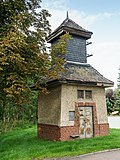 |
Transformer station | Kühren Brunnenweg - (map) |
around 1910 (transformer station) | of importance in terms of technology and local history |
08973690
|
 |
Rittergut Mühlbach (material entity) | (Map) | around 1810/1817 and later (manor); 1811–1815 (sugar factory) | Material collection of the Mühlbach manor, with the following individual monuments: mansion (No. 30), manor barn and two farm buildings (No. 32 and No. 34) with a former distillery (part No. 34) - (see also list of individual monuments -obj. 08973698), still with following parts of the whole: farmyard (including farm building no. 28) and the remains of the former estate park; of local and architectural importance, former distillery one of the first sugar factories in Saxony |
09302791
|
 |
Rittergut Mühlbach (material entity) | (Map) | Mid 19th century (farm building); around 1810/1817 (manor house); 1810–1811 (distillery); 1st half of the 19th century (chimney) | Individual features of the Mühlbach manor property: manor house (No. 30), manor barn and two farm buildings (No. 32 and No. 34) with a former distillery (part No. 34) - (see also material list -obj. 09302791); Of local and architectural importance, former distillery one of the first sugar factories in Saxony, of industrial history |
08973698
|
 |
Manor Obernitzschka (entity) | (Map) | 1704 (castle ruins); End of the 18th century (farmyard); Early 20th century (farmyard) | Subject aggregate of the manor Obernitzschka, with the following individual monuments: castle ruins, church, churchyard wall and tomb, farm building, enclosure and gate system to the farm yard of a manor and dam (see also list of monuments - obj. 08973679, obj. 08973694 and obj. 08973695), also manor garden and manor park ( Garden monument), furthermore with the following parts: churchyard, farmyard with paving; Of architectural and site historical importance, location on the Mulde that characterizes the townscape |
09302792
|
 |
Railway bridge on the Glauchau-Wurzen route (Muldentalbahn) | Oelschütz Wurzener Strasse (map) |
1875–1877 (railway bridge) | Arched bridge, important in terms of traffic history |
08973691
|
 |
Transformer station | Sachsendorf Poststrasse - (map) |
around 1930 (transformer station) | technological historical monument |
08973685
|
 |
Wurzener Mühlgraben | (Map) | around 1000 (Mühlgraben) | Mill moat; Former eastern arm of the Mulde, supply ditch used since around 1000 for the production facilities in the Wurzen urban area, of local, technical and supply historical significance |
09306289
|
 |
Cardboard box factory Zimmermann & Breiter (formerly) | Wurzen Albert-Kuntz-Strasse 26a (map) |
marked 1903 (factory building) | Factory building (old town 9–13) in formerly closed development, with courtyard buildings (Albert-Kuntz-Straße 26a); Main building in Art Nouveau forms, with slightly protruding side elevations, clinker brick facade with architectural structure in plaster; Significant building and local history |
09259346
|
 |
Wurzener carpet factory Schütz; Carpet factory Juel (formerly) | Wurzen Albert-Kuntz-Strasse 48 (map) |
1912 (factory building); 1920–1922 (factory building); 1927 (residential building); 1559 (part of the building) | Carpet factory with two production buildings (Alte Nischwitzer Straße 5 and Straße des Friedens 36a), administration building (address: Alte Nischwitzer Straße 7) and another building, bridge over the Mühlgraben and the garden of the manufacturer's villa with enclosure (garden monument, address: Alte Nischwitzer Straße 3), in the garden seating niche portal; Production building (address: Alte Nischwitzer Straße 5) a plastered building in steel frame construction or reinforced concrete construction around 1925, production building (address: Straße des Friedens 36a) single-storey elongated structure with Cyclops masonry, older building next to it, residential building / administration building (address: Alte Nischwitzer Straße 7) in Reform style of the time around 1910 based on a design by Leipzig architect Max Fricke, villa garden with enclosure, grotto and cloverleaf-shaped water basin, terraces as well as space and structure-forming planting, interesting industrial architecture with a character that shapes the townscape and history, partly including older buildings |
09255068
|
 More pictures |
Wurzen train station; Railway lines Leipzig – Dresden; Glauchau – Wurzen (Muldentalbahn) | Wurzen Am Bahnhof 3 (map) |
1888–1889 (train station); 1839 (reception building); 1895 (platform) | Railway station with reception building, house platform (platform 1) with cast-iron columns and platform roofing, single-stem platform roofing (platforms 2 and 3) with wooden roof and wooden columns, cast-iron columns with composite capital on platform 6, existing small paving in the platform areas; Interesting station facility on the Leipzig – Dresden and Glauchau – Wurzen railway lines (Muldentalbahn) of importance in terms of traffic history, representative Wilhelminian style reception building as a five-part structure, consisting of one and two-storey building parts, with a simple, neo-renaissance-like design of the plastered facade, pilasters, arched windows and arched portal |
09255742
|
 More pictures |
Wurzener Kunstmühlenwerke; Krietsch Works (formerly) | (Map) | 1917–1924 (mill) | Industrial mill consisting of a wheat mill, rye mill, gatehouse, gate pillar, mill ditch and parapet of the former Mühlgraben bridge; Architecturally, locally, economically, technologically and artistically of importance, important factory of the food industry in the reform and Heimat style of the period after 1910, design by Leipzig architect Max Fricke, location near the Mulde that characterizes the townscape |
09255723
|
 |
Transformer station | Wurzen Badergraben 1 (next to) (map) |
around 1925 (transformer station) | of significance in terms of technology history |
09255220
|
 |
Saxon bronze goods factory (formerly) | Wurzen Badergraben 16 (map) |
around 1880/1890 (tenement house) | Tenement houses (two parts of the house) in closed development as well as the former production building of a factory in the courtyard, side wing and warehouse in the courtyard on Albert-Kuntz-Strasse; Significant for Wurzen in terms of industrial history, production of lamps for many important German and foreign buildings (Reichstag building in Berlin, National Theaters in Krakow and Oslo and many more), also of importance in terms of local history, architectural history and urban planning |
09255060
|
 |
Wurzener Kartonagenfabrik Paul Kraner (formerly) | Wurzen Carl-Magirius-Strasse 4 (map) |
around 1890 (factory building) | Cardboard box factory with outbuilding; Factory building with a central projection, clinker brick buildings from the Wilhelminian era, in connection with the factory owner's villa (Carl-Magirius-Straße 6), of importance in terms of building history, local history and technology history |
09255750
|
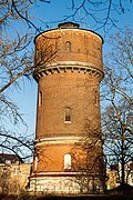 |
Water tower | Wurzen Clara-Zetkin-Platz 8 (map) |
marked 1893 (water tower); around 1890 (workshop) | Water tower with shed (workshop building); In operation from 1894 to 1992, part of the extensive water supply system in Wurzens, striking clinker brick building, of importance in terms of technology and the history of the town |
09255767
|
 |
JD Weickert felt factory | Wurzen Crostigall 55; 57 (card) |
around 1890 (factory building); 1883–1884 (manufacturer's villa) | Factory (No. 55) with technical equipment consisting of several parts of the building and the associated manufacturer's villa (No. 57); Multi-storey factory building with subsequent extensions (clinker brick facade, multi-part vertical rectangular windows, add-ons in skeleton construction with clinker facing), manufacturer's villa with neo-renaissance elements, architecturally sophisticated building complex of regional industrial and urban significance, founded as a factory for optical instruments, owner: August Moritz Weickert (1801-1878) (1801-1878) , hereinafter dealt with for tools and iron goods, from 1847 together with Friedrich Wilhelm Patzschke (master hat maker, subsequently son Carl Wilhelm Patzschke) Manufacture of the first felt made in Germany for use as hammer head felt (Pianoforte felt), development into a multi-award-winning company in felt production , 1861 relocation to the Mühlgraben, still producing today |
09255682
|
 |
Heckmann Armaturenfabrik (formerly) | Wurzen Dehnitzer Weg 16 (map) |
around 1885 (residential building) | Residential and office building with a factory building at the rear; Wilhelminian-style administration building of a small company of local historical importance |
09259792
|
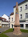 More pictures |
Saxon post mile pillars (totality) | (Map) | marked 1724 (post distance column) | Post mileage column; Copy of a distance column, of importance in terms of traffic and regional history |
09255270
|
 |
Klinkhardt foundry | Wurzen Dresdener Strasse 34a (map) |
1872 (machine factory formerly Söhlmann, now Klinkhardt); 1877 (foundry); 1877 (administration building); 1872–1877 (mechanical engineering industrial plant part); marked 1890 (administration and residential building) | Factory site consisting of several production buildings, a boiler shop (No. 34a) and an office and residential building (No. 34) on the street as well as remains of the paving of the courtyard; Small-scale, early mechanical engineering factory and foundry for agricultural machinery built in front of the city gates of Wurzens, essentially preserved in its original form, the residential building a clinker-brick building with corner bay windows and beautiful portals, earliest construction built around 1867 and still equipped with original rafters and doors, renovated in 1997 , the other buildings of remarkable architectural design and regional industrial-historical interest |
09255294
|
 |
Transformer station | Wurzen Dresdener Strasse 36 (next to) (map) |
around 1910 (transformer station) | Elaborately designed transformer station, rich facade design, probably used as a power station for the Richard Klinkhardt machine factory, of significance in terms of technology history |
09255308
|
 |
Krietsch memory | Wurzen Dresdener Strasse 38 (map) |
denotes 1912 (memory); 19th century (office building) | Grain silo with loading ramp in the courtyard area and office building on the street; Significant testimony to the large-scale mill industry, block-like storage building with towering staircase and silo tower, high-quality storage building with the character of an "industrial cathedral" towering over the city silhouette, a high-quality storage building with the character of an "industrial cathedral", the office building a building that characterizes the street scene, defining the townscape and of significance in terms of technology history |
09255296
|
 |
Storage building with attached silo part | Wurzen Dresdener Strasse 54a (map) |
1925 (memory) | Architecturally interesting granary with a defining effect on the townscape (architect: Max Fricke), three-storey block with bulk floors and 12 high-rise silo containers, a particularly successful example of a combination of emphasized practicality and high-quality architectural implementation in industrial construction, characterizing the townscape and of importance in terms of technology history |
09255312
|
 |
Klinkhardt foundry | (Map) | marked 1900 (foundry) | Former casting hall of a foundry; A three-aisled factory hall with an elevated central nave, brick building with a beautifully designed facade, of regional industrial-historical interest (see also Klinkhardt foundry Dresdener Straße 34 / 34a) |
09256076
|
 |
Heinrich August Schmidt KG, special factory for transport systems | Wurzen Liststrasse 17 (map) |
1902 (factory building); 1890 (factory building) | Factory ensemble consisting of two production buildings, administration building and chimney; Construction of transport systems for lignite mining, of architectural and technical historical importance, locally important industrial building in brick construction of architecturally interesting and, due to its direct location on the Leipzig-Dresden railway line, of formative effect |
09257226
|
 |
Tonneborn | Wurzen Torgauer Strasse - (map) |
around 1450 (fountain) | Dry stone barrel over a spring; historical source of drinking water in the city, of importance in terms of supply history |
09255802 |
Zwenkau, city
| image | designation | location | Dating | description | ID |
|---|---|---|---|---|---|
| Waterworks, consisting of a residential building and a company building | (Map) | 1905 (waterworks) | Plastered buildings with gable roofs and clinker brick structures, largely in their original condition, significance in terms of local history and technology history |
09257972
|
|
| Transformer house | (Map) | 1912 (transformer station) | Tower-like construction, significance in terms of regional and technological history |
09258314
|
|
| Magpie weir; Batschke Floßgraben; Elsterfloßgraben (aggregate) | (Map) | 1860 (weir); 1608–1610 (raft ditch) | Individual monument of the totality of the Elsterfloßgraben: weir system to seal off the White Elster (oxbow lake) and an upstream icebreaker at the Batschke-Floßgraben branch (see population list, Obj. 09304747); Belonging to the Elster rafting system, the combination of artificially created ditches and natural water courses make the Elsterfloßgraben an important testimony to the art of hydraulic engineering in the 17th century, with a high level of regional and technical history |
09299655
|
|
 More pictures |
Zwenkau train station | (Map) | 1874 (passenger station) | Station reception building; today residential house, plastered building in historicist forms, significance in terms of local development and building history |
09258814
|
| Gasworks | 1904–1905 (gas works) | Gasworks; Late historical industrial building in clinker brick architecture, significance in terms of local history, building history and technology history |
09258816
|
||
| Batschke Floßgraben; Elsterfloßgraben (aggregate) | (Map) | 1608-1610 (raft ditch) | Material population component of the material population Elsterfloßgraben: Floßgraben (see also population list, obj. 09304747); Artificially created raft ditch adapted to the shape of the landscape with a starting section (so-called Batschke) on the Markkleeberger or Zwenkau area, in the Connewitzer Holz (southern Auewald) flowing into the Pleiße, of regional and technological significance |
09305755
|
|
| Enke shoe factory | (Map) | 1892/93 (residential building) | Residential building; Clinker brick building, once the residential building of the owner of the former Enke shoe factory, significance in terms of local development and architectural history |
09256093
|
|
 |
Zwenkau mill | (Map) | 1881 (mill); 1916 (turbine); 19th century, the system probably older | Residential house, gate system, outbuildings, courtyard paving and turbine of the former mill as well as part of the mill ditch; Richly decorated miller's house in renaissance forms, outbuildings simple plastered building, turbine from 1915 in the former grinding house (this is not a monument), significance in terms of local history, architectural history, economic history and technological history |
09259741
|
 More pictures |
Water tower | (Map) | 1904 (water tower) | Water tower; Clinker brick construction in late historical forms, significance in terms of technology history and urban development |
09259175
|
| Zwenkau lignite works | (Map) | 1891 (residential house) | Residential building; Formerly an office building, significance in terms of local and industrial history |
09258815 |
Remarks
- ↑ The list may not correspond to the current status of the official list of monuments. This can be viewed by the responsible authorities. Therefore, the presence or absence of a structure or ensemble on this list does not guarantee that it is or is not a registered monument at the present time. The State Office for the Preservation of Monuments in Saxony provides binding information .
swell
Commons : Cultural monuments in the district of Leipzig - Collection of images, videos and audio files