List of technical monuments in the district of North Saxony
The list of technical monuments in the district of North Saxony contains the technical monuments in the district of North Saxony .
This list is a partial list of the list of cultural monuments in Saxony .
Legend
- Image: shows a picture of the cultural monument and, if applicable, a link to further photos of the cultural monument in the Wikimedia Commons media archive
- Designation: Name, designation or the type of cultural monument
-
Location: If available, street name and house number of the cultural monument; The list is basically sorted according to this address. The map link leads to various map displays and gives the coordinates of the cultural monument.
- Map view to set coordinates. In this map view, cultural monuments are shown without coordinates with a red marker and can be placed on the map. Cultural monuments without a picture are marked with a blue marker, cultural monuments with a picture are marked with a green marker.
- Dating: indicates the year of completion or the date of the first mention or the period of construction
- Description: structural and historical details of the cultural monument, preferably the monument properties
-
ID: is awarded by the State Office for the Preservation of Monuments in Saxony. It clearly identifies the cultural monument. The link leads to a PDF document from the State Office for the Preservation of Monuments in Saxony, which summarizes the information on the monument, contains a map sketch and often a detailed description. For former cultural monuments sometimes no ID is given, if one is given, this is the former ID. The corresponding link leads to an empty document at the state office. The following icon can also be found in the ID column
 ; this leads to information on this cultural monument at Wikidata .
Arzberg
| image | designation | location | Dating | description | ID |
|---|---|---|---|---|---|
 More pictures |
Beckersche mill | Arzberg (map) |
around 1800 (mill) | Post mill; defining the appearance of the town and of significance in terms of the history of technology |
08966453 |
 |
Transformer station |
Arzberg (map) |
around 1900 (transformer station) | Concise clinker building, of importance in terms of technology and supply |
08967048 |
 More pictures |
Wendrich's mill | Arzberg (map) |
around 1800 (mill) | Post mill; Of importance in terms of local and technological history and landscape-shaping character |
08966454 |
| Forge with technical equipment |
Blumberg (map) |
1905, in operation until 1992 (forge) | A building that shapes the street scene, is of importance in terms of local history and technology |
08967059 |
|
 |
Waystone |
Kötten (map) |
around 1900 (Wegestein) | traffic history significance |
08967066 |
 |
Waystone |
Nichtewitz (card) |
around 1900 (Wegestein) | traffic history significance |
08967074 |
 More pictures |
Waystone |
Packisch (card) |
around 1900 (Wegestein) | of traffic-historical importance |
08967060 |
 More pictures |
Waystone |
Pülswerda (map) |
around 1900 (Wegestein) | traffic history significance |
08967055 |
 More pictures |
Windmill Stehla |
Stehla (card) |
marked 1876 (mill) | Tower Dutchman; of significance in terms of technology history |
08966439 |
 More pictures |
Transformer station | Stehla Dorfstraße 3 (opposite) (map) |
around 1925 (transformer station) | Technology and supply history of importance |
08967069 |
 More pictures |
Waystone | Stehla (card) |
around 1900 (Wegestein) | of importance in terms of traffic history |
08967068 |
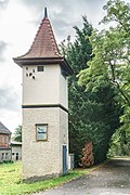 More pictures |
Transformer station |
Tauschwitz Am Dorfplatz (map) |
around 1905 (transformer station) | of significance in terms of technology history |
08967079 |
Bad Düben, city
| image | designation | location | Dating | description | ID |
|---|---|---|---|---|---|
| Transformer station |
Bad Düben (map) |
around 1925/1930 (transformer station) | technology and supply history significance |
08974055 |
|
 More pictures |
Official cutter; Town mill | Bad Düben (map) |
Early 18th century (flour mill); marked 1965 (grinding machine); 1989, parts older (plansifter); 1954 (peeling machine); 1940 (roller mill) | Residential mill building with extension, weir system and mill technology; The only still commercially operated watermill in the town and the surrounding area, remarkable is the completely preserved technology, of importance in terms of building history, local history and technology history |
08973973 |
 More pictures |
Bad Düben train station | Bad Düben (map) |
around 1895 (station building); around 1895 (water tower); around 1930 (signal box) | Reception building (with signal box) and water tower of a train station; Reception building typical of the region, clinker brick construction, of importance in terms of building history, railway history and technology history |
08973892 |
 More pictures |
Gauge house | Bad Düben (map) |
1893 (level house) | Octagonal clinker brick building with tent roof, important in terms of building history and technology |
08973886 |
 More pictures |
Bergschiffmühle Bad Düben | Bad Düben (map) |
1748 (mill) | Ship mill; the only preserved ship mill in the region, of significance in terms of building history and technology |
08973901 |
 More pictures |
Obermühle | Bad Düben (map) |
around 1800 (grain mill) | Mill building with technology, miller's house, reconstructed water wheel and mill ditch; one of the oldest mill locations in Bad Dübens as well as one of the oldest water mills in the region, of significance in terms of building history, local history and technology history |
08973967 |
 More pictures |
Post mill Sommerfeld |
Tiefensee (map) |
1847 (flour mill); 1927 (agricultural storage); 1927 (barn) | Mill property with post mill and motor mill (former storage) with mill technology and barn; of technical historical importance with a landscape-defining effect |
08973346 |
Beilrode
| image | designation | location | Dating | description | ID |
|---|---|---|---|---|---|
 |
Waystone |
Beilrode (map) |
Late 19th century (Wegestein) | traffic history significance |
09286370 |
 |
Waystone | Beilrode (map) |
Late 19th century (Wegestein) | of importance in terms of traffic history |
09286369 |
 |
Waystone | Beilrode (map) |
around 1900 (Wegestein) | traffic history significance |
09286623 |
 More pictures |
Beilrode train station | Beilrode (map) |
before 1900 (reception building); before 1900 (goods handling); before 1900 (Speicher) | Railway station with reception building, goods shed to the west, toilet building and shed to the east and storage building to the north-west on the Halle-Torgau-Guben railway line; Railway line completed in 1872, station building in the arched style, of importance in terms of railway and local history |
09286613 |
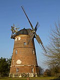 More pictures |
Beilrode windmill | Beilrode (map) |
1874 (mill) | Turmholländer including the existing mill technology; Unplastered brick building on a natural stone base, wind power shut down in 1935, probably the highest tower Dutchman in Saxony, of importance in terms of building history, technology history and shaping the townscape |
09286919 |
 |
Waystone |
Döbrichau (map) |
around 1900 (Wegestein) | traffic history significance |
09285946 |
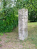 |
Waystone | Döbrichau (map) |
around 1900 (Wegestein) | of importance in terms of traffic history |
09285947 |
 |
Brick kiln |
Großtreben (map) |
around 1865 (brick kiln) | According to the latest research by Thomas Linsener, Torgau, the ring kiln is the oldest of the Hoffmann design preserved in Germany. It was created shortly after 1860, is of importance in terms of technology history and is a rarity |
09286311 |
 More pictures |
Rosenfeld windmill |
Rosenfeld Teichstrasse 21 (map) |
marked 1836 (mill) | Post mill (ruin, currently stored); technical historical significance |
08967097 |
 |
Transformer station | Rosenfeld Teichstrasse 38 (opposite) (map) |
around 1920 (transformer station) | Type construction, importance in the history of supply and technology |
08985796 |
Belgern-Schildau, city
| image | designation | location | Dating | description | ID |
|---|---|---|---|---|---|
 |
Saxon-Prussian boundary stone: Pilar No. 10 (left Elbe) as well as 53 runner stones (see also material document - Obj. 09305644) | Bockwitz (map) |
after 1828 | In terms of surveying and regional history, it is important as a contemporary document of the historical demarcation between Saxony and Prussia after the Congress of Vienna in 1815
After Napoleon's reign ended, the borders of Europe were redefined at the Congress of Vienna from September 18, 1814 to June 9, 1815. Saxony, which fought alongside Napoleon and was therefore among the defeated, had to cede almost two thirds of its territory by decision of the victorious powers. Almost all of these areas were assigned to Prussia and became part of the Prussian province of Saxony. The new border ran - beginning in Wittig on the Witka River (now Poland) across the Upper Lusatia, met the Elbe at Strehla, continued west to Schkeuditz and finally ended south of Leipzig at today's border with Saxony-Anhalt. Even today it can be traced back to the division of the church provinces between Saxony and Brandenburg. The first marking of the newly created border line was made in 1815 by means of wooden stakes erected in pairs. The distances between the boundary signs were not uniform, but referred to local conditions such as ditches, rivers or roads and varied between 200 and 4,350 meters. From 1828 the wooden border posts were gradually replaced by much more solid border stones, the design of which goes back to Prussian designs and which are known as pilare (Spanish for "column"). A total of four types of boundary stones can be distinguished. They are numbered from east to west, with the counting starting anew on the Elbe (right Elbe boundary stones number 1 - 212, left Elbe number 1 - 74). East of the Elbe, the stones between number 1 and number 82 are initially designed as a pair of granite blocks, between which a runner stone marks the exact boundary. From number 82 to 148, truncated pyramids stand directly on the border line. Then the forms alternate unsystematically between slender sandstone steles and truncated pyramids with plinths. Several volunteer local researchers have brought together essential findings on the course of the former Saxon-Prussian border. The property of the Saxon-Prussian boundary stones as a monument results from their historical significance; they are reminiscent of a decisive event for Saxony's history. The public interest in preservation is based on the great attention that individual people, groups and communities pay to these stone testimonies of history. In the meantime, several publications have appeared, more extensive documentation is available and signs have even been put up on at least one section of the former border. (LfD / 2014) |
08972655 |
 More pictures |
Belgern train station |
Belgians (map) |
1914–1916 (reception building) | Reception building and goods handling; The reception building is now used as a residential building and is of importance in terms of architectural and local history |
09286114 |
 More pictures |
Saxon post mile pillars (totality) | Belgians (map) |
1730 (post distance column) | Post mileage column; Copy of a distance column, of importance in terms of local history and traffic history |
09286126 |
 |
Under mill | Belgians (map) |
1st half of the 19th century (mill) | Under mill; Important in terms of building history and local history Note: After the lower mill was demolished, a new building was built on the property around 2014. On the embedded photo from May 17, 2009 the lower mill can be seen above, in the middle of the picture (below the half-timbered house). |
09229359 |
 More pictures |
Water tower | Belgians (map) |
Weather vane marked 1914 (water tower) | Water tower; technical system of the Belgern waterworks, in the reform style of the time around 1910, characterizing the townscape and of importance in terms of technology |
09286146 |
 More pictures |
Waystone |
Döbeltitz (map) |
around 1900 (Wegestein) | Sandstone stele with a flat, pyramidal end and inscription, of significance in terms of traffic history |
09301459 |
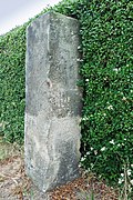 |
Waystone | Döbeltitz (map) |
around 1900 (Wegestein) | Square sandstone stele with carved inscription and directional arrows, of importance in terms of traffic history |
09286628 |
 More pictures |
Kobershainer windmill |
Kobershain (map) |
18th century (mill) | Post mill; Windmill visible from afar, significance in terms of the history of technology, also of relevance to the townscape |
09286272 |
 |
Transformer station |
Probsthain (map) |
around 1920 (transformer station) | typical tower type, supply and technical history of importance |
08966495 |
 More pictures |
Probsthainer windmill | Probsthain (map) |
Mid 19th century (mill) | Post mill; defining the appearance of the town and of significance in terms of the history of technology |
08967101 |
 |
Forest mill Kurzwalde |
Schildau (map) |
marked 1776 (mill) | Mill building with mill technical equipment, barn and fencing; Quarry stone barn, as a former monastery mill of the Sitzenroda monastery of local historical importance |
09286921 |
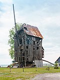 More pictures |
Döbler'sche mill | Schildau (map) |
1732 (grist mill) | Post mill; Testimony to rural supply, one of the oldest windmills in the North Saxony region, built in 1732, rebuilt several times, of significance in terms of local history, technology history and supply history |
09286184 |
 More pictures |
Fuse factory (formerly) | Schildau (map) |
1854 (factory) | Fuse factory; technical historical significance |
08967388 |
 |
Waystone | Schildau (map) |
around 1850 (Wegestein) | Sandstone stele, flat, pyramid-like end, distinctive inscriptions, plus directional signs, important in terms of local and transport history |
09303406 |
 |
Waystone | Schildau (map) |
2nd half of the 19th century (Wegestein) | Sandstone stele, distinctive inscriptions, plus directional signs, significant in terms of local and traffic history |
09303412 |
 More pictures |
Waystone |
Seydewitz (map) |
2nd half of the 19th century (Wegestein) | Sandstone stele on a square ground plan, slightly pyramidal end, carved inscription, of importance for the history of transport |
09286625 |
 More pictures |
Transformer station |
Sitzenroda (map) |
around 1910 (transformer station) | A particularly high-quality example in terms of design, of importance in terms of building history and technology history |
09286067 |
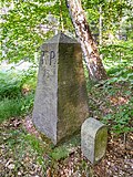 |
Saxon-Prussian boundary stones (totality); Pilar No. 13 (left Elbe); Saxon-Prussian boundary stone: Pilar No. 13 (left Elbe) as well as 30 runner stones (see also general document - Obj. 09305644) | Sitzenroda | after 1828 (boundary stone) | In terms of surveying and regional history, it is important as a contemporary document of the historical demarcation between Saxony and Prussia after the Congress of Vienna in 1815 |
08972284 |
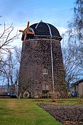 More pictures |
Sitzenroda windmill | Sitzenroda (map) |
1877 (mill) | Tower Dutchman; Today the residential building, the grinder removed, the tower converted into a residential building, significant in terms of both architectural and local history |
09286195 |
Cavertitz
| image | designation | location | Dating | description | ID |
|---|---|---|---|---|---|
 |
Transformer station |
Outside (map) |
around 1915 (transformer station) | As the first transformer house in Außenigs, it was of importance in terms of local history, supply history and technology history |
08972565 |
 |
Waystone |
Cavertitz (map) |
around 1850 (Wegestein) | of importance in terms of traffic history |
08972540 |
 |
Round arch bridge | Cavertitz (map) |
1st half of the 20th century (road bridge) | high-quality bridge construction, largely preserved in its original form, of significance in terms of building history and traffic history |
08972536 |
 |
Waystone | Cavertitz (map) |
Mid 19th century (Wegestein) | of importance in terms of traffic history |
08972542 |
 |
Arch bridge |
Klingenhain (map) |
19th century (bridge) | characterizes the earlier course of the old mill ditch, historically important |
08973376 |
 |
Road bridge | Klingenhain (map) |
around 1845 (road bridge) | Three-arched arched bridge over the Dahle, well-preserved and rare evidence of traffic engineering with an impact on the landscape and the image of the village, of architectural significance |
08972433 |
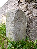 |
Waystone | Klingenhain (map) |
2nd half of the 19th century (Wegestein) | of importance in terms of traffic history |
08972432 |
 More pictures |
Obermühle | Klingenhain (map) |
around 1840 (mill) | Residential mill house and side building of a former mill property; Characteristic of the street due to its location at the entrance to the village, of importance in terms of building history and local history |
08972434 |
 |
Harzbeckermühle | Klingenhain (map) |
inscribed 1906 (in the gable of the residential wing); marked 1921 (cowshed) | Residential mill building with mill technology, side building and courtyard paving of a mill property; Mill ensemble, largely preserved in its original state, of architectural, local and technical historical importance |
08972428 |
 More pictures |
Flour mill |
Lampertswalde (map) |
marked 1833, in the core probably older (Müllerwohnhaus); marked 1919 (flour mill) | Residential house, flour mill, sawmill and courtyard paving of a mill estate; as a former water mill with a late baroque miller's house, largely preserved in its original form, of architectural, local and technical historical importance |
08972579 |
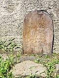 |
Waystone | Lampertswalde (map) |
2nd half of the 19th century (Wegestein) | of traffic-historical importance |
08972586 |
 |
Inn with equipment, barn and stone path | Lampertswalde (map) |
Beginning 19th century (inn); 1918 (catering equipment); 2nd half of the 18th century (barn); Mid 19th century (Wegestein) | Plastered building with a dining room from 1918 that has largely been preserved in its original form, of importance in terms of building history, local history and the appearance of the street, road stone with importance for the history of traffic |
08972589 |
 More pictures |
Niedermühle; Dörfchenmühle | Lampertswalde (map) |
marked 1822 and later (Mühle); 2nd half of the 19th century (barn); Mid 19th century (side building) | Mill with equipment, side building and barn as well as mill wheel, mill ditch and courtyard pavement; Largely original, stately mill system of architectural, local and technical historical importance |
08972588 |
 More pictures |
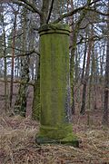
Totality of Royal Saxon Triangulation ("European degree measurement in the Kingdom of Saxony"); Station 106 Olganitz |
Olganitz (map) |
marked 1873 (triangulation column) | Triangulation column; Second order station, significant testimony to geodesy of the 19th century, of significance in terms of surveying history |
09286950 |
 |
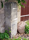
Waystone |
Schona (map) |
Mid 19th century (Wegestein) | of importance in terms of traffic history |
08972590 |
 |
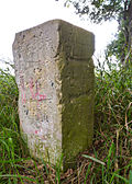
Waystone | Schona (map) |
19th century (road stone) | of importance in terms of traffic history |
08972592 |
 |
Waystone |
Treptitz (map) |
around 1900 (Wegestein) | high sandstone stele as part of a garden fence, signposts in the direction of Dahlen and Belgern, important in terms of traffic history |
08973411 |
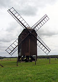 More pictures |
Zeuckritz post mill |
Zeuckritz (map) |
1864 (mill) | Post mill with technical equipment; Mill with equipment from 1864, partly renewed, of technical historical importance and extraordinarily important for the landscape |
08972440 |
Dahlen, city
| image | designation | location | Dating | description | ID |
|---|---|---|---|---|---|
 More pictures |
Börln Castle and Manor (aggregate) |
Börln (map) |
1732 (mill) | Individual monument of the entity of the castle and manor of Börln: former water mill (see also entity 08972371, same address); Today residential house, stately, regionally typical half-timbered building as part of the manor and the historical townscape, of importance in terms of building history, local history and the townscape |
08972370 |
 More pictures |
Holländermühle Börln | Börln (map) |
1869 (mill) | Tower Dutchman; Landscaping mill construction, of importance in terms of building history, technology history and local history |
08972361 |
 |
Signpost |
Bortewitz (map) |
2nd half of the 19th century (signpost) | with mileage, of importance in terms of traffic history |
08972360 |
 More pictures |
Lion Brewery |
Dahlen (map) |
1884 (brewery); around 1884 (factory owner's house) | Brewery building and factory owner's residence of a former brewery; as the former Dahlens brewery of local historical importance |
08972373 |
 |
Residential house with enclosure and transformer station | Dahlen (map) |
around 1935 (residential building); around 1935 (transformer station) | Most of the original preserved system with architectural quality, as evidence of the early power supply of local historical importance |
08972289 |
 |
storage hall | Dahlen (map) |
around 1965 (warehouse) | Due to the internal supporting structure (steel girders) and narrow profiles, the filigree effect of the fully glazed, flat facade, thus a high-quality technical monument of the GDR era, formerly part of the agricultural engineering district, of importance in terms of building history and technology history |
08972402 |
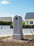 More pictures |
Royal Saxon milestones (totality) | Dahlen (map) |
1859-1865 (milestone) | Milestone; Station stone, start and end point of the postal routes Oschatz and Wurzen or Torgau and Wermsdorf, of importance in terms of traffic history |
08972287 |
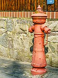 |
hydrant | Dahlen (map) |
around 1900 (hydrant) | Early evidence of the public (extinguishing) water supply of Dahlen, of local importance |
08972389 |
 More pictures |
Storage building | Dahlen (map) |
around 1920 (Speicher) | A largely original building with architectural standards, as a former granary, a relic of the early commercial use of the station area, of architectural and local significance |
08972401 |
 More pictures |
Dahlen railway station | Dahlen (map) |
1881 (reception building) | Railway station with reception building with an intermediate building to the toilet block and railway master's house with an annex to the north; Railway station on the first railway line Leipzig – Dresden from 1838, important freight station in the Dahlen region, significance in terms of transport and local history, passenger station converted around 1880–1900 |
08972436 |
 More pictures |
Residential mill building (No. 6) and side building (No. 8) a mill property | Dahlen (map) |
around 1865 (mill) | Most of the originally preserved complex near the castle, as a former mill of architectural and technical significance |
08972386 |
 |
Residential and locksmith's workshop building in open development and enclosure | Dahlen (map) |
around 1902 (residential and workshop building) | as a former locksmith's shop, largely original evidence of industrialization in Dahlen |
08972375 |
 |
Stream passage under the railway (bridge) |
Großböhla (map) |
2nd half of the 19th century (railway bridge) | For the most part originally preserved, beautiful, time-typical bridge construction as a brook passage, of architectural significance |
08973728 |
 |
Railway bridge | Großböhla (map) |
2nd half of the 19th century (railway bridge) | A beautiful bridge construction typical of the time, largely preserved in its original state, of significance in terms of architectural history |
08973727 |
 |
Passage of the mill ditch under the railway | Großböhla (map) |
2nd half of the 19th century (railway bridge) | A beautiful bridge construction typical of the time, largely preserved in its original state, of significance in terms of architectural history |
08973726 |
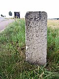 |
Waystone | Großböhla (map) |
19th century (road stone) | Sandstone stele with inscription, signpost of importance for the history of transport |
08972306 |
 |
Gatekeeper house | Großböhla (map) |
around 1860 (railway keeper's house) | Type construction on the Wurzen-Oschatz route, largely original building with importance for the history of the railway and transport |
08972298 |
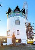 More pictures |
Vorsdorfmühle | Großböhla (map) |
19th century (mill); 1970s (mill) | Mill stump with extension from the 1970s; Landscaping importance, architecturally successful expansion for residential purposes |
08972311 |
 More pictures |
Schmannewitz post mill |
Schmannewitz (map) |
1839 (reconstruction) | Post mill with technical equipment; one of the few largely original objects of its kind, evidence of a centuries-old milling tradition on site, landmark visible from afar, significant in terms of technology history and landscape design |
08972317 |
| Equipment of a forge | Schmannewitz (map) |
19th century and 20th century (equipment in a forge) | Rare craft and technical history evidence. (The forge's equipment is no longer available after the property was sold 20170720). |
08973573 |
|
| Royal Saxon milestones (totality) |
Black cat (card) |
Mid 19th century (milestone) | Milestone; of importance for the history of traffic Note: The milestone has disappeared for at least 3 years |
08972353 |
Delitzsch, city
| image | designation | location | Dating | description | ID |
|---|---|---|---|---|---|
 More pictures |
Prussian milestone |
Benndorf (map) |
around 1820 (milestone) | Milestone; Whole-mile sandstone obelisk, important in terms of traffic history |
08971747
|
 |
Prussian milestone | Benndorf (map) |
around 1820 (milestone) | Milestone; Quarter milestone (so-called Little Bell), of significance in terms of traffic history |
08971746
|
| Transformer station |
Brodau (map) |
around 1920 (transformer station) | Clinker brick building with a gable roof, in the Swiss style, of technical and local significance |
08972090
|
|
 |
Water tower |
Delitzsch (map) |
1903 (water tower) | Water tower; Construction of yellow and red clinker bricks with a simple plaster structure, of importance in terms of technology and supply, characterizing the cityscape |
08971740
|
 More pictures |
Upper Delitzsch station | Delitzsch (map) |
1871 (reception building) | Station building; Wilhelminian-style clinker brick building with two towers, attractively structured monument to the history of transport |
08971744
|
 |
Delitzsch waterworks | Delitzsch (map) |
around 1900 (waterworks); 1920s and earlier (technology) | Waterworks, part of the building pump house (with Junkers diesel engine, pumps, indoor crane with trolley, gas lantern lighting); of importance in terms of technology and local history |
09259828
|
| Railway building (location: corner of Beerendorfer Straße) and Bahn-Schmiede (location: corner of Dübener Straße) | Delitzsch (map) |
End of the 19th century (forge); Early 20th century (railway operations facility) | Local monuments of the history of transport |
08972073
|
|
 |
Roller mill | Delitzsch (map) |
1874 (factory owner's villa); 2nd half of the 19th century (mill); marked 1906 (outbuilding) | Factory owner's villa (No. 26) and factory building of the roller mill (No. 24b), including the head building of an outbuilding (No. 24d) between the railway line and the roller mill; Stately Wilhelminian-style factory ensemble with a richly structured factory owner's villa and the first factory building in the city of Delitzsch, significant in terms of technology, construction and urban history |
08971742
|
| Naundorf mill | Delitzsch (map) |
18th century (mill) | Residential house and outbuildings of a mill property; Former water mill, partly in half-timbered construction, of technical, local and cultural significance |
08971831
|
|
 More pictures |
Saxon post mile pillars (totality) | Delitzsch (map) |
1730-1731, marked 1730 (post distance column) | Post mileage column; Copy of a distance column, important in terms of traffic history |
08971609
|
| Old shoemaking | Delitzsch (map) |
around 1800 (residential building) | Residential house in closed development (with cobbler workshop); Environment-shaping component of the small-scale old town development, plastered eaves building with a steep pitched roof, portico on the courtyard side, old shoemaker's shop, of architectural significance |
08971735
|
|
 More pictures |
Post mill Same |
Same (card) |
1753 (mill) | Post mill (with mill technology); of importance in terms of the history of technology and the impact on the townscape |
08972218 |
Doberschütz
| image | designation | location | Dating | description | ID |
|---|---|---|---|---|---|
 More pictures |
Waystone |
Bunitz (map) |
2nd half of the 19th century (Wegestein) | of importance in terms of traffic history |
08972516 |
| Waystone |
Doberschütz (map) |
19th century (road stone) | of importance in terms of traffic history |
08972483 |
|
 More pictures |
Transformer station | Doberschütz (map) |
around 1920 (transformer station) | of local, technical and supply historical importance |
08972481 |
 |
Waystone |
Mölbitz (map) |
19th century (road stone) | Corner location road to Strelln and Schöna, of importance for the history of traffic |
08972514 |
 More pictures |
Friedemann windmill |
Paschwitz (map) |
1883 (mill) | Tower Dutchman; Very well-preserved, windy tower Dutchman in the region, important in terms of technology and local history |
08972484 |
 More pictures |
Transformer station |
Sprotta (map) |
around 1925 (transformer station) | defining the street space and of importance in the history of supply and technology |
08972506 |
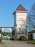 |
Transformer station |
Sprotta settlement (map) |
around 1920 (transformer station) | Belonging to Gut Heideck, of importance in terms of technology and local history |
08973165 |
 More pictures |
Winkelmühle |
Winkelmühle (map) |
2nd half of the 19th century (mill) | Mill with mill ditch and chimney; Street-defining building with local and technical historical significance |
08972522 |
Dommitzsch, city
| image | designation | location | Dating | description | ID |
|---|---|---|---|---|---|
 More pictures |
Dommitzsch station |
Dommitzsch (map) |
1890-1892 (reception building) | Reception building with goods handling and side building; Significant evidence of the history of transport in terms of local history, as well as largely original, period-typical station building with a high-quality clinker brick facade, of importance in terms of building and railway history |
09286860 |
| German pottery factory; Dommitzsch ceramics factory | Dommitzsch (map) |
1909–1910 (factory building) | Factory building with forge and technology; Apart from the Meißen porcelain factory in Dommitzsch with fully preserved furnishings, it is probably the only one of its kind in Saxony with a rarity value, and also significant in terms of industrial history |
09303275 |
|
 |
Wörblitz station |
Wörblitz (map) |
around 1900 (reception building) | Station building of a train station; Today used as a residential building, characteristic clinker brick building from the late 19th century, of architectural and railway history |
09286418 |
Dreheide
| image | designation | location | Dating | description | ID |
|---|---|---|---|---|---|
 More pictures |
Großwig post mill; Huebner's mill |
Großwig (map) |
1845–1847 rebuilding (mill); marked 1823 (fountain) | Post mill with mill technology, plus fountain; With full equipment, this is a rare example of wind-powered milling, especially since the beginning of the 18th century, important in terms of technology history, and also important as a landmark in terms of landscape design |
09286399 |
Eilenburg, city
| image | designation | location | Dating | description | ID |
|---|---|---|---|---|---|
 More pictures |
Eilenburger celluloid factory (formerly); later Eilenburger Chemiewerke (ECW) |
Eilenburg Ziegelstrasse 2 (map) |
around 1915 and later (part of the factory); 1915–1916 (water tower) | Factory with administration building (address: Ziegelstraße 2), coal tower (hose tower) with gate system, extension (social building) and water tower (address: Am Wasserturm 1); The site-defining facility of technical and architectural significance |
08973374 |
 More pictures |
Eilenburg station | Eilenburg (map) |
1870–1871 (reception building); 1870/1871 (water tower west); End of the 19th century (water tower east); End of the 19th century (signal box EO); 1925/1930 (EW signal box) | Railway station with reception building (address: Bahnhofstraße 21), furthermore with two water towers (Wasserturm West, address: Sydowstraße 6), two signal boxes and two bridgeheads on the railway site; important evidence of the development of traffic in the city, preserved in the ensemble, in the high-quality architecture of historicism, of architectural and technological significance |
08973253 |
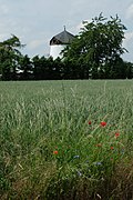 More pictures |
Becher's windmill | Eilenburg (map) |
designated 1863 (Mühle); around 1930 (enclosure) | Tower Dutchman with enclosure; Structures typical of the locality and landscape, of technical historical importance |
08973429 |
| Former substation with residential building extension | Eilenburg (map) |
1920 and later (substation) | with largely original building fabric, of architectural, technological and local significance |
08973431 |
|
 More pictures |
Saxon post mile pillars (totality) | Eilenburg Leipziger Strasse 28 (near) (map) |
marked 1724 copy (post distance column) | Post mileage column; Copy of a distance column, important in terms of traffic history |
09304915 |
 More pictures |
Eilenburg observatory | Eilenburg (map) |
1964–1965 (observatory); 1964-1965 (planetarium); 1974 (bust) | Observatory and planetarium (with equipment), Juri Gagarin bust and complex with memorial stone; as one of the rare structures of the 1960s in an architecturally and artistically high quality design of architectural significance, bust of local history |
08973417 |
 More pictures |
Storage in semi-open development | Eilenburg (map) |
Late 19th century (warehouse) | Part of the old mill, of local, technical and architectural significance |
08973229 |
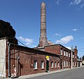 More pictures |
Joinery | Eilenburg (map) |
around 1895 (joinery) | Factory hall and chimney; beautiful example of industrialization with high-quality clinker brick facade and distinctive chimney, of local historical importance |
08973237 |
 More pictures |
Substation | Eilenburg (map) |
1920s (substation) | Thanks to the original structure of the facade, a structurally appealing building, singular position in the place, characterizing the street space, of significance in terms of the history of technology |
08973364 |
| gasometer | Eilenburg (map) |
Late 19th century (gas works) | technical historical significance |
08973732 |
|
 More pictures |
Eilenburg station | Eilenburg Sydowstrasse 6 (map) |
1870–1871 (reception building); 1870/1871 (water tower west); End of the 19th century (water tower east); End of the 19th century (signal box EO); 1925/1930 (EW signal box) | Railway station with reception building (address: Bahnhofstraße 21), furthermore with two water towers (Wasserturm West, address: Sydowstraße 6), two signal boxes and two bridgeheads on the railway site; important evidence of the development of traffic in the city, preserved in the ensemble, in the high-quality architecture of historicism, of architectural and technological significance |
08973253 |
 More pictures |
Eilenburger celluloid factory (formerly); later Eilenburger Chemiewerke (ECW) | Eilenburg Am Wasserturm 1 (map) |
around 1915 and later (part of the factory); 1915–1916 (water tower) | Factory with administration building (address: Ziegelstraße 2), coal tower (hose tower) with gate system, extension (social building) and water tower (address: Am Wasserturm 1); The site-defining facility of technical and architectural significance |
08973374 |
| Transformer station |
Kospa (map) |
around 1920 (transformer station) | of technical and supply historical importance |
08973470 |
|
| Transformer station |
Pressing (card) |
around 1920 (transformer station) | Strikingly located building, of technical historical importance |
08973244 |
|
 More pictures |
Transformer station with technical equipment |
Wedelwitz (map) |
around 1915 (transformer station) | Testimony to the electrification of the place, of importance in terms of technology and supply history |
08973414 |
 More pictures |
Wedelwitz waterworks | Wedelwitz (map) |
around 1910 (waterworks); around 1910 (transformer station) | Residential building, transformer station and workshop building of a waterworks; Brick buildings, in a scenic location, of technical and architectural significance |
08973413 |
| Transformer station |
Zschettgau (map) |
around 1920 (transformer station) | of technological historical importance |
08973467 |
Elsnig
| image | designation | location | Dating | description | ID |
|---|---|---|---|---|---|
| Elsnig train station |
Elsnig (map) |
around 1900 (reception building) | Reception building, goods handling and toilets at Elsnig train station; clinker buildings typical of the time with flat gable roofs, built-on goods handling with upstream loading ramp, of importance for the history of the railway and the local area |
09286438
|
|
 |
Post mill Neiden |
Envy (card) |
19th century (mill) | Post mill; defining the appearance of the town and of significance in terms of the history of technology |
09286331 |
Jesewitz
| image | designation | location | Dating | description | ID |
|---|---|---|---|---|---|
 More pictures |
Jesewitz train station | Jesewitz train station, Bahnhofstrasse 1; 3 (card) |
last third of the 19th century (reception building) | Station building and outbuilding of a train station; Reception building with brick facade, evidence of the traffic development and connection of the place, of architectural and traffic historical importance |
08974925 |
 More pictures |
Eckard-Mühle Gallen |
Gallen Zur Mühle 1 (map) |
1924 (mill) | Paltrock windmill; converted post mill; Windmill with partially preserved technology, of importance in terms of technology history and landscape |
08965656 |
 More pictures |
Water station (with stairs and gate entrance) |
Gotha (map) |
around 1930 (elevated water tank) | one of the last preserved water station houses of significant importance for the landscape |
08965821 |
 More pictures |
Old distillery; Gotha manor | Gotha Lindenstrasse 18 (map) |
marked 1870 (distillery); 1st half of the 19th century (manor barn); probably 1930s (chimney) | Former distillery of a manor, with annex and chimney, as well as barn and mill ditch; At the site of the former mill belonging to the manor from the early days, a striking brick building, of industrial and local significance |
09257001 |
| Transformer station |
Groitzsch Zum Seeblick (map) |
around 1925 (transformer station) | rare slim design, of local historical and local significance |
08974935 |
|
 More pictures |
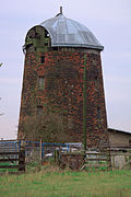
Liemehna windmill |
Liemehna Zschettgauer Strasse (map) |
around 1880 (mill) | Tower Dutchman with technical equipment; of technological history and landscape-shaping importance |
08965652 |
| Waystone |
Pehritzsch Hauptstrasse 27 (opposite) (map) |
19th century (road stone) | Sandstone pillar with inscription, of local and historical importance |
08965609 |
|
| Transformer station | Pehritzsch Mühlweg 2 (next to) (map) |
around 1925 (transformer station) | High, slim type of construction typical of the region, evidence of electrification, of technical and supply historical importance |
08974921 |
|
 More pictures |
Post mill Weltewitz Bockwindmuehle.jpg |
Weltewitz (map) |
2nd half of the 18th century (mill) | Remainder of a post mill; severely ruinous windmill, typical regional, landscape-defining structure, of architectural and technical historical importance |
08965639 |
| Transformer station | Weltewitz Wöllmener Straße 11 (opposite) (map) |
around 1925 (transformer station) | Evidence of electrification, of technical and supply historical importance and in a prominent location, defining the street scene |
08974924 |
|
 |
Transformer station |
Wölpern to the village square (map) |
after 1920 (transformer station) | In a central location that defines the townscape, a tall, slender structure with a swinging pyramid roof, evidence of electrification, of significance in terms of technology and supply history |
08965661 |
Krostitz
| image | designation | location | Dating | description | ID |
|---|---|---|---|---|---|
 More pictures |
Waystone |
Beuden (map) |
marked 1843 (Wegestein) | of importance in terms of traffic history |
09305695 |
 More pictures |
Krensitz station |
Krensitz (map) |
around 1890 (reception building) | Reception building with attached goods shed and toilet block of a train station; Brick buildings, of local and technical historical importance |
08965610 |
| Transformer station | Krensitz (map) |
around 1920 (transformer station) | Testimony to electrification, tall, upwardly tapering structures, extraordinary appearance, of importance in terms of local history and character, as well as technology and supply history |
08965606 |
|
 More pictures |
Krostitzer brewery |
Krostitz (map) |
around 1900 (administration building) | Administration building of a brewery; old location of Kleinkrostitz, industrial architecture typical of the time, significant in terms of building history, local history and technology history |
08965581 |
 More pictures |
Krostitzer Malzwerk; Krostitzer brewery | Krostitz (map) |
around 1900 (factory building) | Kiln building, two barley buildings and the former barn building (today a beverage market) of a brewery; Typical brick buildings of the time, of local history, technical history and landscape-defining importance |
08965582 |
| Transformer station |
Kupsal (map) |
around 1920 (transformer station) | High, slim design typical of the region, evidence of electrification, characterizing the landscape, of importance in terms of technology and supply history |
08965616 |
|
 More pictures |
Kupsal windmill | Kupsal (map) |
marked 1883 (mill) | Tower Dutchman with technical equipment; Mill with renewed rods, partially preserved technical equipment, rare polygonal design, of importance for the local history, the landscape and the history of technology |
08965615 |
Lousy
| image | designation | location | Dating | description | ID |
|---|---|---|---|---|---|
 More pictures |
Fiehn post mill |
Authausen Görschlitzer Strasse 7 (map) |
1846 (flour mill) | Post mill; striking example of a characteristic post mill, of technical historical importance, shaping the landscape |
08974065 |
 More pictures |
Post mill Ludwig | Authausen Görschlitzer Strasse 8 (map) |
marked on the house tree 1713 (grain mill) | Post mill with mill technology; striking example of a characteristic post mill, significant in terms of technology history, has a rarity value with its comparatively complete equipment, and also characterizes the landscape |
08974066 |
 |
Waterworks with porter's house and enclosure |
Durchwehna (card) |
1955/1958 (waterworks) | High-quality, unique example of excellent architectural design of a technical utility building from the post-war period, of importance in terms of building history and technology history |
08972845 |
| Railway bridge | Durchwehna (card) |
Early 20th century (railway bridge) | Arched bridge, of importance in terms of railway history and technology |
08974163 |
|
 |
Waystone | Durchwehna Friedrichshütte (map) |
19th century (road stone) | distinctive corner location at the exit to Kossa, significant in terms of traffic history |
08974166 |
| Bad luck in Friedrichshütte | Durchwehna (card) |
1696 and later (Pechhütte) | Bad luck with a pitch pile and an adjoining fire shelter, three coal piles, a distillation building and a ruinous fire shelter; Rare, coherent technical monument as a good example of the production-related development of bad luck of technical and local historical importance, at the same time singular importance due to the beehive-shaped coal piles |
08974164 |
|
 |
Water tower |
Kossa Authausener Strasse (map) |
around 1870 (water tower) | Water tower; Clinker brick building with corner pilasters and tent roof, of importance in terms of building history and technology and supply history |
08974075 |
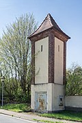 |
Transformer station | Kossa Authausener Strasse (map) |
around 1920/1925 (transformer station) | Slim, tall construction typical of the region, plastered construction with clinker strips with a tent roof, evidence of electrification, of importance in terms of building history, technology and supply |
08974074 |
 More pictures |
NVA alternate command post in Söllichau; Military Museum Kossa (whole) | Kossa Dahlenberger Strasse 1 (map) |
1976–1979 (military construction) | All items NVA alternate command post with the following individual monuments: six bunkers, functional building, fence, surface antenna, covered positions, path network and all original equipment (see individual monument at the same address - Obj. 09256885); The only system of this type preserved with all equipment and technology, historically and technologically significant |
09304741 |
 More pictures |
NVA alternate command post in Söllichau; Military Museum Kossa (whole) | Kossa Dahlenberger Strasse 1 (map) |
1976–1979 (military construction) | Individual features of the aggregate NVA alternate command post: six bunkers, functional buildings, fencing, surface antenna, covered positions, network of paths and all original equipment (see also aggregate 09304741); The only system of this type preserved with all equipment and technology, historically and technologically significant |
09256885 |
| Pitch pile | Kossa (map) |
1922 (Pechhütte) | one of the last examples of a pitch pile with technical historical significance |
08974071 |
|
 |
Transformer station |
Lousy (card) |
around 1925 (transformer station) | High and slim design typical of the region, evidence of electrification, importance in the history of supply and technology |
08974088 |
 |
Residential house (No. 9a) and mill (No. 4a, 5) with technical equipment |
Pressel Authausener Strasse 4a; 5; 9a (card) |
1937 (mill); around 1820 (residential building) | Mill in largely original structure in a street-defining location, of importance in terms of building history and technology |
08974174 |
Liebschützberg
| image | designation | location | Dating | description | ID |
|---|---|---|---|---|---|
| Waystone |
Bornitz (map) |
19th century (road stone) | on the outskirts, significant in terms of traffic history |
08967021 |
|
 More pictures |
Water pressure tank and pumping station | Bornitz Wadewitzer Strasse 8 (map) |
around 1900 (water pressure tank and pumping station) | Technical-historical significance, characterizing the street scene, singular position |
08974741 |
 More pictures |
Clanzschwitzer windmill |
Clanzschwitz Mill 1 (map) |
around 1850 (mill) | Post mill; Significant in terms of building history, technology history and shaping the townscape |
08974890 |
 More pictures |
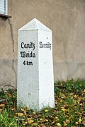
Waystone |
Ganzig (before Oschatzer Weg 30) (map) |
19th century (road stone) | at the north-eastern exit towards Bornitz, important in terms of traffic history |
08967039 |
 More pictures |
Transformer station |
Leckwitz Riesaer Strasse (map) |
around 1925 (transformer station) | Testimony to electrification, of importance in terms of technology history and shaping the streetscape |
08974700 |
 |
Mill dwelling house |
Leisnitz Müllergasse 8 (map) |
1846/1847 (mill) | Former watermill, half-timbered structure largely preserved in its appearance, of importance in terms of architectural, local and technical history |
08974748 |
 More pictures |
Post mill Liebschütz |
Liebschütz (card) |
1828 (mill) | Post mill; It is important in terms of building history, technology history and the landscape, and in connection with the Old Salt Road it is also of particular importance in terms of local history |
08974750 |
 More pictures |
Totality of Royal Saxon Triangulation ("European degree measurement in the Kingdom of Saxony"); Station 105 Dürrenberg | Liebschütz (card) |
marked 1868 (triangulation column) | Triangulation stone, 2nd order station; significant testimony to the geodesy of the 19th century, significant in terms of surveying history |
08974753 |
 More pictures |
Waystone |
Sahlassan Strehlaer Straße 15 (opposite) (map) |
19th century (road stone) | Sandstone pillar with inscription, meaning of transport history |
08974728 |
 |
Mill building with technical equipment |
Schönnewitz An der Döllnitz 14 (Map) |
inscribed 1887 (mill) | Former watermill, stately plastered building in a location that shapes the street scene, of importance in terms of building history, local history and technology history |
08974739 |
| Waystone |
Terpitz (map) |
19th century (road stone) | on the outskirts towards Schönnewitz, important in terms of traffic history |
08967040 |
|
 More pictures |
Arch bridge over Luppa |
Wellerswalde Handwerkergasse 9a (near) (map) |
marked 1841 (road bridge) | historically important |
08974710 |
 More pictures |
Arch bridge over the Luppa | Wellerswalde Neue Strasse (map) |
around 1800 and later (road bridge) | a technical monument of architectural and street-defining importance |
08974707 |
 More pictures |
Zaußwitz windmill |
Zaußwitz Am Laaser Weg 1a (map) |
1799 (mill) | Tower Dutchman; Mill construction, largely preserved in its original state, of importance in terms of architectural history, landscape design and technical history |
08974891 |
 More pictures |
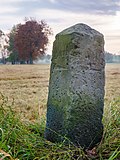
Waystone | Zaußwitz Canitzer Strasse (map) |
Mid 19th century (Wegestein) | of importance in terms of traffic history |
08974893 |
Löbnitz
| image | designation | location | Dating | description | ID |
|---|---|---|---|---|---|
 More pictures |
Post mill Döbler Löbnitz |
Löbnitz (map) |
around 1760 (mill) | Post mill; technical historical significance |
08972030 |
| Waystone | Löbnitz (map) |
marked 1841 (Wegestein) | Sandstone stele with inscription, of importance in terms of traffic history |
08972070 |
|
 More pictures |
Werbeliner post mill |
Reibitz (map) |
1844 (mill) | Post mill with technical equipment; Built in Werbelin in 1844, dismantled in 1991 (due to lignite mining), rebuilt in 1994, of significance in terms of technology history |
08972016 |
| Reibitz water mill | Reibitz (map) |
Late 19th century (mill) | Three mill buildings with technical equipment; Former watermill with partially preserved mill technology, of significance in terms of technology history |
08972071 |
|
 More pictures |
Roitzschjora windmill |
Roitzschjora (map) |
1835-1836 (mill) | Remains of a post mill; A type of mill that has become rare, of regional and technological significance. Note: The mill was no longer there when we visited it in March 2017. |
08972017 |
Mockrehna
| image | designation | location | Dating | description | ID |
|---|---|---|---|---|---|
| Waystone |
Audenhain (map) |
19th century (road stone) | Sandstone stele with inscription, of importance in terms of traffic history |
08966388
|
|
| Mill building with mill technology and ditch, side building, barn (without extension), stable and coach house | Audenhain (map) |
around 1800 (mill) | Last watermill in the village still preserved with equipment, of importance in terms of building history, local history and technology history |
08966389
|
|
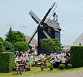 More pictures |
Paltrockmühle Audenhain | Audenhain (map) |
1751 (mill) | Paltrock windmill; The only functioning windable mill type in the region around Torgau, a landmark of the place visible from afar, rare example of a Paltrock mill with winged cross and compass rose, of importance in terms of building history, technology history and landscape design |
08966384
|
| Waystone |
Graefendorf (map) |
around 1900 (Wegestein) | Granite stele with inscription, of importance in terms of traffic history |
08966468
|
|
| Waystone |
Langenreichenbach (map) |
around 1900 (Wegestein) | Sandstone stele with inscription, meaning of transport history |
08966519
|
|
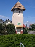 |
Transformer station | Langenreichenbach (map) |
around 1910 (transformer station) | Evidence of electrification, defining the townscape, of importance in terms of supply and technology |
08966474
|
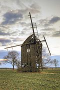 |
Drubig post mill | Langenreichenbach (map) |
19th century (mill) | Post mill; Ruinous building with preserved mill technology, of local history, technical history and landscape design significance |
08966476
|
 |
Mill Rudolph Kretschmar | Langenreichenbach (map) |
around 1900 (mill); Mid 20th century (mill technology) | Mill building with mill technology and living area on an angled floor plan; Watermill, of importance in terms of technology and local history |
08966521
|
 |
Mockrehna train station |
Mockrehna (map) |
1872 Opening of the railway line (passenger station) | Station with reception building, toilet building, shed, goods shed, pavement, Kastanienallee and platform as well as two switchman houses (one on Schildauer Straße), located on the Eilenburg – Falkenberg section of the Halle (Saale) - Cottbus railway line; Entrance building designed in the arched style of architectural importance, corner location to Schildauer Strasse (pavement), as an ensemble well-preserved technical monument of the history of transport |
08966511
|
 |
Windmill Richter | Mockrehna (map) |
1883 start of construction, marked W. Richter 1883 (weather vane) | Tower Dutchman; Of importance in terms of technology, local history and the appearance of the town |
08966515
|
 |
Waystone | Schona (map) |
19th century (road stone) | Sandstone stele with inscription, meaning of transport history |
08966497
|
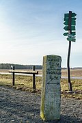 |
Waystone |
Wildenhain (map) |
19th century (road stone) | Sandstone pillar with an inscription, important in terms of traffic history |
08966523
|
 |
Motor mill Wildenhain | Wildenhain (map) |
Built in 1907 (as a steam mill) | Motor mill with mill technology; Of great importance in terms of mill technology, forms an ensemble with the adjacent sawmill, both operated by the same steam engine |
08966462
|
| Knöfel sawmill | Wildenhain (map) |
1901 (sawmill founded) | Sawmill with old sawmill technology; Originally a steam sawmill, of great importance in terms of the history of technology, forms an ensemble with an adjacent grinding mill, both of which are operated by the same steam engine |
08966461
|
|
 |
Waystone |
Wildschütz (card) |
around 1900 (Wegestein) | Porphyry stele with chiseled inscription, of importance in terms of traffic history |
08966493
|
| Scales house | Wildschütz (card) |
Mid 20th century (weighing house) | Testimony to the rural economy of the last century, of importance in terms of technology and local history |
08966484
|
|
| Transformer station | Wildschütz (card) |
around 1900 (transformer station) | Evidence of electrification, defining the townscape, of importance in terms of technology and supply |
08966494 |
Mügeln, city
| image | designation | location | Dating | description | ID |
|---|---|---|---|---|---|
| Waystone |
Berntitz (map) |
19th century (road stone) | Sandstone pillars with inscriptions, of importance in terms of traffic history |
08965736 |
|
 |
Gut Oberhof and Landscape Park Kranichau (aggregate) |
Gaudlitz (map) |
marked 1860 (manor house); marked 1817 (stable house); 1st half of the 19th century, with Kumthalle (farm building); End of the 19th century (elevated water tank) | Individual features of the Oberhof estate and the Kranichau landscape park: northern manor house (no.7), southern residential stable house (no.1) and southwestern farm building with Kumthalle (no.3), gate entrance, gate and remains of the enclosure as well as flood tank with pump room including technical equipment in the Park (see also aggregate 08974840, same address); Former manor, which was converted into a country estate by the Leipzig industrialist Colditz, largely originally preserved complex with architecturally sophisticated mansion, impressive residential stable with half-timbered upper floor and crooked hip roof, farm building with originally preserved Kumthalle and representative gates, of architectural and local importance |
08974835 |
 |
Quartzite quarry glosses; Feldbahnschauanlage |
Glosses (map) |
around 1935 (Loren); 1953-1954 (locomotives); 1956-1958 (Brecher); 1960 (engine shed) | Quartzite quarry with light rail system consisting of a locomotive shed, loading crane with trolleys, storage building, two bridges, loading system, two switches, double crossing switch, two locomotives and lorries as well as a backhoe and a crusher; Quarry in operation since the beginning of the 20th century, since 1995 used as a light railroad display system for tourism, rare, completely preserved ensemble at the place of activity, important in terms of economic and technical history as well as landscape design |
08974841 |
 More pictures |
Mügeln train station (near Oschatz); Railway line Oschatz - Mügeln - Döbeln; Döllnitzbahn (totality); Railway line Mügeln - Neichen |
Mügeln (map) |
1884 (reception building) | Individual monument of the Döllnitzbahn as a whole: station building of a train station (see also as a whole 09305783); old station of the narrow-gauge railway "Wilder Robert", singular position, important in terms of railway and technology history |
08965720 |
 |
Döllnitzbahn (aggregate) | Mügeln (map) |
1884–1885 (railway line) | Sub-entity component of the entity Döllnitzbahn, with the following individual monument: Entrance building of a train station (see also individual monument 08965720), with the following entity part: route of the narrow-gauge railway (see also entity entity 09305782, Oschatz, OT Oschatz, Bahnhofsplatz 1); old station of the narrow-gauge railway "Wilder Robert", singular position, important in terms of railway and technology history |
09305783 |
 |
Royal Saxon Milestones (aggregate): Milestone | Mügeln (map) |
around 1840 (milestone) | Milestone; traffic-historical importance |
08965692 |
 |
Royal Saxon Milestones (aggregate): Milestone | Mügeln (map) |
2nd half of the 19th century (milestone <Royal Saxon>) | Milestone; later road stone, sandstone pillars, inscriptions illegible, significant in terms of traffic history |
08965732 |
| Arch bridge over the Döllnitz | Mügeln (map) |
marked 1934 (road bridge) | Significant in terms of traffic history and the appearance of the town |
08965716 |
|
 More pictures |
Saxon postal mile pillars (totality): Post mile pillar | Mügeln (map) |
marked 1726 (post distance column) | Post mileage column; Copy of a distance column, important in terms of traffic history |
08965704 |
| Royal Saxon Milestones (aggregate): Milestone | Mügeln (map) |
2nd half of the 19th century (milestone) | Milestone; Half milestone, significance in terms of traffic history |
08966424 |
|
| Döllnitzbahn (aggregate) |
Niedergoseln (map) |
1884–1885 (railway line) | Sub-entity component of the entity Döllnitzbahn, with the following individual monument: Entrance building of a train station (see also individual monuments list Obj. 08965720), with the following entity part: route of the narrow-gauge railway (see also entity entity 09305782, Oschatz, OT Oschatz, Bahnhofsplatz 1); old station of the narrow-gauge railway "Wilder Robert", singular position, important in terms of railway and technology history |
09305783 |
|
| Arch bridge |
Paschkowitz (map) |
19th century (bridge) | Technical monument largely preserved in its original form, of importance in terms of building history and landscape design |
08972420 |
|
 More pictures |
Hesselmühle |
Querbitzsch (map) |
marked 1895, older in the core (Mühle) | Turmholländer with outbuilding; very well-preserved windmill, of importance in terms of building history, landscape design and technology history |
08974862 |
| Döllnitzbahn (aggregate) |
Schweta (map) |
1884–1885 (railway line) | Sub-entity component of the entity Döllnitzbahn with the following entity entity: route of the narrow-gauge railway (see also entity entity 09305782, Oschatz, OT Oschatz, Bahnhofsplatz 1); important in terms of railway history and technology history |
09305792 |
|
| Transformer station | Schweta (map) |
marked 1912 (transformer station) | Testimony to electrification, a monument in the history of utilities and technology |
08965630 |
|
| Schweta Mill | Schweta (map) |
around 1850 (mill) | Residential mill building with mill technology, built-on storage facility and side building; characteristic grinding mill of its time with largely complete milling equipment, main building highlighted in terms of design, of significance in terms of building history, local history and technology history |
08965623 |
|
| Obermühle Sornzig | Angry | 18th century (mill) | Residential building, side building and gatehouse of a mill estate; all buildings in half-timbered construction, the most originally preserved mill of Sornzig, of architectural, local and technological history |
08974880 |
|
| Mittelmühle Sornzig | Sornzig (map) |
marked 1734 (mill) | Residential building with angled extension; former watermill, in the core from 1734, of architectural, local and technical history of importance |
08974882 |
|
| Waystone |
Zschannewitz (map) |
Mid 19th century (Wegestein) | on the field path between Döhlen, Schrebitz and Sömnitz, technical monument of importance for the landscape and traffic |
08965679 |
Naundorf
| image | designation | location | Dating | description | ID |
|---|---|---|---|---|---|
| Casabra windmill |
Casabra (map) |
inscribed 1891 (mill) | Tower Dutchman; Mill construction, largely preserved in its original state, of importance in terms of architectural history, landscape design and technical history |
08973399
|
|
| Totality of Royal Saxon Triangulation ("European degree measurement in the Kingdom of Saxony"); Station 104 Hohenwussen |
Hohenwussen (map) |
marked 1868 (triangulation column) | Triangulation column 2nd order station; of significance in terms of technology history |
09305756
|
|
| Water tower | Hohenwussen (map) |
1966 (water tower) | Water tower; Technical monument, convincing in terms of design through material and shape, shaping the landscape |
08972782
|
|
| Döllnitzbahn (aggregate) |
Naundorf (map) |
1884–1885 (railway line) | Sub-entity component of the entity Döllnitzbahn with the following entity entity: route of the narrow-gauge railway (see also entity entity 09305782, Oschatz, OT Oschatz, Bahnhofsplatz 1); important in terms of railway history and technology history |
09305791
|
|
| Old Forge | Naundorf (map) |
According to information 1879 (technical equipment) | Equipment of a forge; Rare evidence of a rural craft business, of significance in terms of technology history |
08972778
|
|
| Wrought |
Stennschütz (card) |
marked 1811 and later (smithy) | important evidence of the old development of Stennschütz, as a former smithy of local and craft historical importance |
08972776 |
Oschatz, city
| image | designation | location | Dating | description | ID |
|---|---|---|---|---|---|
| Road bridge over a mill moat |
Leuben (map) |
around 1893 and later (road bridge) | Due to its largely preserved original condition, it is a beautiful building with traffic-related significance |
08973597
|
|
| Mill building (with technical equipment), attached miller's house, mill ditch, courtyard paving and enclosure of a milled property | Leuben (map) |
marked 1893 (Müllerwohnhaus) | Due to its original function, the watermill on the Döllnitz is of local historical importance |
08973596
|
|
 |
Waystone | Leuben Naundorfer Straße 018 (opposite) (map) |
Mid 19th century (Wegestein) | at a crossroads, of historical importance
Path stone: sandstone pillars, directions: Limbach, Naundorf, Saalhausen |
08973595
|
 More pictures |
Döllnitz Viaduct; Leipzig-Dresden Railway |
Oschatz (map) |
1838 (railway bridge) | Railway bridge; One of the oldest railway bridges in Germany, as a remnant of a civil engineering structure of the Leipzig-Dresden Railway of great importance in terms of railway history and building history |
08973839
|
 More pictures |
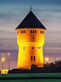
Water tower | Oschatz, Am Wasserturm 81 (next to) (map) |
marked 1911 (water tower) | Water tower; Technical monument, as a testimony to the early public water supply, of importance in terms of local history and the landscape |
08972757
|
 |
Oschatz stop; Oschatz – Mügeln – Döbeln railway line; Döllnitzbahn (aggregate) | Oschatz Bahnhofsplatz 1 (map) |
around 1885 (waiting hall) | Individual features of the Döllnitzbahn entity: Stop of the narrow-gauge railway, including platform roofing at Oschatz station, locomotive shed and two railway bridges over the Döllnitz (in the Brückenstraße and Am Brühl area) - (see also entity 09305782); Object of importance in terms of traffic and technology history |
08973794
|
 |
Döllnitzbahn (aggregate) | Oschatz (map) |
1884–1885 (railway line) | Döllnitzbahn as a whole, with the following individual monuments: stop of the narrow-gauge railway, including platform roofing at Oschatz station, locomotive shed and two railway bridges over the Döllnitz in the Brückenstraße and Am Brühl area (see also individual monument 08973794, Bahnhofsplatz 1), as well as Oschelden Süd station (see also individual monument 08973791, Freiherrvom-Stein-Promenade 1) and the Körnerstraße stop (see also the individual monument 08973795, Theodor-Körner-Straße), furthermore with the following general part: the narrow-gauge railway line from Oschatz Süd station to the west end of Oschatz station (with a retaining wall in the Döllnitz area Dresdener Straße), and the cross-community part of the narrow-gauge railway in Mügeln, OT Mügeln (see also entity component 09305783, Mügeln, OT Mügeln, Bahnhofstraße 2); Object of importance in terms of traffic and technology history |
09305782
|
 More pictures |
Oschatz train station | Oschatz Bahnhofsplatz 2 (map) |
1880 (reception building); around 1900 (signal box); End of the 19th century (railway keeper's house); 1920 (crane) | Station with reception building, exit to the pedestrian tunnel, ancillary building (next to the reception building), reloading facility with gantry crane, signal box as well as a station keeper's house with ancillary building; as a historical station facility on the first long-distance line Leipzig – Dresden and the still operating Döllnitzbahn of local and historical importance |
08973796
|
 More pictures |
Road bridge over the Döllnitz | Oschatz Breite Strasse (map) |
around 1600 (keystone); 1st half of the 20th century (road bridge) | Round arch bridge with old keystone, keystone in second use to mark an old bridge location, evidence of traffic history |
08972716
|
 |
Oschatz south station; Oschatz – Mügeln – Döbeln railway line; Döllnitzbahn (aggregate) | Oschatz Freiherr-vom-Stein-Promenade 1 (map) |
around 1885, later redesigned (passenger station) | Individual monument of the Döllnitzbahn as a whole: station of the narrow-gauge railway (see also as a whole 09305782); as a narrow-gauge station of importance in terms of railway and local history |
08973791
|
 |
Obermühle | Oschatz, Hospitalstrasse 16 (map) |
around 1842, later reshaped (mill) | Mill building (with technical equipment) in semi-open development and in a corner; as an old town mill at a mill location of local historical importance that can be traced back to the Middle Ages |
08972740
|
 More pictures |
Two storage buildings | Oschatz Hubertusburger Strasse 8 (map) |
1934 (memory) | architecturally sophisticated building, characterizing the townscape due to its location on the railway line, of significance in terms of technology history |
08973840
|
 More pictures |
Municipal electricity company | Oschatz Lichtstrasse 1 (map) |
1909 (power station); around 1935 (first outbuilding); around 1955 (second annex) | Power station with two outbuildings; as the first power station in Oschatz of local and technological importance |
08973804
|
 More pictures |
Felt factory Ambrosius Marthaus (former) | Oschatz Lichtstrasse 3 (map) |
1912, according to information (factory building); around 1935 (block house) | Former textile factory with wool processing hall, boiler house with chimney and log cabin with bunker and swimming pool; Architecturally high-quality buildings, bunkers from the 1930s, evidence of National Socialist company policy and war provisions, old felt factory of industrial and local historical importance |
08973801
|
 |
Transformer station | Oschatz Schlachthofstraße 2 (near) (map) |
around 1915 (transformer station) | as an early transformer house, it is a testament to the history of technology |
08973803
|
 |
Niedermühle | Oschatz Schmorlstrasse 4 (map) |
designated 1870 (Mühle); 1912 (mill technology); 1950 according to information (mill technology) | Mill building (with technical equipment); as a mill with equipment at an old mill location of local and technical historical importance |
08973495
|
 More pictures |
Körnerstraße stop; Oschatz – Mügeln – Döbeln railway line; Döllnitzbahn (aggregate) | Oschatz Theodor-Körner-Strasse (map) |
around 1930 (waiting hall) | Individual monument of the Döllnitzbahn as a whole: stopping point of a narrow-gauge railway (see also as a whole 09305782); as a well-preserved stopping point of the narrow-gauge railway of local and historical importance |
08973795
|
 |
Mill (with extension) |
Schmorkau Strasse des Friedens 11 (map) |
marked 1806 (mill) | The building has largely been preserved in its original form, and due to its cubature it has a defining effect on the street scene, and due to its original function as a water mill, it is of local historical importance |
08973504
|
 |
Waystone |
Zöschau Salbitzer Straße 23 (near) (map) |
marked 1849 (Wegestein) | Significant in terms of traffic history |
08973517 |
Rackwitz
| image | designation | location | Dating | description | ID |
|---|---|---|---|---|---|
| Waystone |
Kreuma (map) |
19th century (road stone) | Sandstone stele with inscription, of importance in terms of traffic history |
08972783
|
|
| Rackwitz flour mill |
Rackwitz (map) |
End of the 19th century (mill); marked 1928 (mill) | Mill (with historical technology) and barn of a mill property; of technical historical importance as a well-preserved example of industrialized mill technology with almost complete equipment |
08972826
|
|
| Zschortau train station |
Zschortau (map) |
around 1870 (reception building) | Entrance building with attached goods shed of a train station; Clinker brick construction, significance in terms of traffic and local history |
08972836 |
Schkeuditz, city
| image | designation | location | Dating | description | ID |
|---|---|---|---|---|---|
 |
Zschampert passage; Elster-Saale-Canal (entity) |
Dölzig (map) |
1934 (canal) | Individual monument belonging to the Elster-Saale Canal as a whole (section Schkeuditz, city, Dölzig district): Zschampert passage between Burghausen and Dölzig (see also entity 09303057, Dölzig district); Technical monument |
09259327
|
 |
Elster-Saale-Canal (entity) | Dölzig (map) |
from 1933 (canal) | Material component of the material entirety Elster-Saale Canal (section Schkeuditz, City, OT Dölzig) with the following individual monuments: Zschampert passage between Burghausen and Dölzig (see individual monument 09259327, without address), road underpass of the Elster-Saale Canal (see individual monument 09259267, Am Canal), street underpass of the Elster-Saale Canal (see individual monument 09259268, Auenstraße) and road bridge over the Elster-Saale Canal (see individual monument 09259328, Äußere Gundorfer Straße) (see also material group 09259222, Leipzig, Stadt, OT Burghausen-Rückmarsdorf, without address); Technical monument |
09303057
|
 |
Elster-Saale-Canal (entity) | Dölzig (map) |
1935 (road tunnel) | Individual monument belonging to the Elster-Saale Canal as a whole (section Schkeuditz, City, Dölzig district): underpass of the Elster-Saale Canal (see also entity 09303057, Dölzig district); technical monument |
09259267
|
 |
Dutch Mill Inn | Dölzig (map) |
18th century (inn) | Inn (temporarily also customs house) with hall extension and four millstones in front of the inn; Stately plastered building with a mansard roof, customs station between the kingdoms of Saxony and Prussia from 1815 to 1834, of regional historical importance |
09259242
|
 |
Elster-Saale-Canal (entity) | Dölzig (map) |
around 1935 (road tunnel) | Individual monument belonging to the Elster-Saale Canal as a whole (section Schkeuditz, City, Dölzig district): underpass of the Elster-Saale Canal (see also entity 09303057, Dölzig district); technical monument |
09259268
|
 |
Ochsenwegbrücke; Elster-Saale-Canal (entity) | Dölzig (map) |
1936-1937 (road bridge) | Individual monument of the Elster-Saale Canal as a whole (section Schkeuditz, City, Dölzig district): road bridge over the Elster-Saale Canal (see also entity 09303057, Dölzig district); of importance in terms of traffic history |
09259328
|
 |
Post mill Dölzig | Dölzig (map) |
19th century (mill) | Post mill, now a residential building; of technological historical importance |
09259266
|
 |
Mühlgut Panthey |
Freiroda (map) |
19th century (miller's house); around 1900 (side building); marked 1924 (barn) | Residential house, two side buildings, barn, two gates and courtyard paving of a mill property (four-sided courtyard); Partly plastered buildings, partly brick buildings, in the typical regional construction (post mill on the property demolished in 2005), significance in terms of building history and local history |
08972926
|
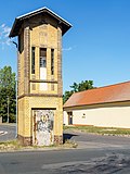 |
Transformer tower | Freiroda (map) |
after 1920 (transformer station) | Elaborately designed brick building, in a prominent location, of technical historical importance |
08972931
|
 |
Berndorfsche post mill | Freiroda (map) |
1820 (mill) | Post mill; important part of the landscape that was once rich in windmills, with rare, complete interior fittings, technical and historical significance |
08972936
|
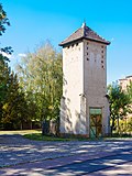 |
Transformer tower |
Glesien (map) |
after 1920 (transformer station) | in a corner location that shapes the street scene, of technical and historical importance |
08972972
|
 |
Waystone |
Kleinliebenau (map) |
19th century (road stone) | of importance in terms of traffic history |
09259336
|
 |
AERO-Park Kursdorf; Ilyushin-IL 18 airplane |
Kursdorf (map) |
1960 (airplane) | Ilyushin-IL 18 W aircraft; Repainted in 2010, technical monument |
09256726
|
 |
Leipzig / Halle Airport; beacon | Kursdorf (map) |
1939 (aviation) | Airport beacon; one of three previously hydraulically retractable beacons, a rarity, a unique document in German aviation history, of significance in terms of technology history |
08985864
|
| Provincial-Irren-Anstalt Altscherbitz (formerly) (entity) |
Schkeuditz (map) |
1894 (water treatment plant) | Individual monument of the aggregate of the former Provinzial-Irren-Anstalt Altscherbitz: water treatment plant (see aggregate 08966026); In terms of technology and local history of importance, formerly drinking water supply (today service water supply) for the former provincial insane asylum Altscherbitz |
09257267
|
|
 |
Altscherbitz Mill | Schkeuditz (map) |
around 1880/1900 (mill) | Mill system, consisting of miller's house, mill building, turbine house, storage building, silo, stable building and gate entrance; old location Altscherbitz, partly brick facades, partly plastered buildings, of local and technological importance |
08966029
|
 |
Schkeuditz water tower | Schkeuditz (map) |
marked 1909 (water tower) | Water tower with enclosure; A technical monument that characterizes the town, also interesting from an art-historical point of view, testimony to the development of the town |
09258683
|
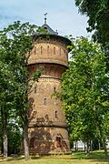 |
Provincial-Irren-Anstalt Altscherbitz (formerly) (entity) | Schkeuditz (map) |
1876-1912 (sanatorium); 1912 (institutional church); around 1885 (water tower); 1868–1888 (drainage) | Individual features of the aggregate of the former provincial insane asylum in Altscherbitz: Dormitories, administration building, pharmacy, ambulance, asylum church, water tower and former official residence (doctor and institution administrator) of the Kaiser Wilhelm Augusta Foundation of the former provincial insane asylum Altscherbitz and drainage system on the Institution premises (see aggregate 08966026); Significant in terms of building history, medical history, local history and technology history, today Saxon Hospital Altscherbitz, predominantly Wilhelminian-style clinker buildings, surface drainage to dry the area of the former provincial insane asylum Altscherbitz |
08966021
|
| Provincial-Irren-Anstalt Altscherbitz (formerly) (entity) | Schkeuditz (map) |
1886 (ring furnace) | Individual monument of the totality of the former Provincial-Irren-Anstalt Altscherbitz: former ring kiln of the brickworks belonging to the Irren-Anstalt Altscherbitz (see totality 08966026); Technical monument and of local history |
09257269
|
|
| Old office building | Schkeuditz (map) |
16th century in the core (police); after 1815 (wheel winch) | Former office building in a corner, today a police building, with a wheel winch in the building; Plastered construction, buildings of local historical importance in an important urban area, wheel winches of technical historical importance |
09258294
|
|
 |
Transformer tower |
Wolteritz (map) |
around 1920 (transformer station) | striking building of technical historical importance |
08972954 |
Schönwölkau
| image | designation | location | Dating | description | ID |
|---|---|---|---|---|---|
| Badrina watermill |
Badrina (map) |
around 1790 (mill) | Mill; Watermill later converted into a bakery, wood-burning oven preserved, upper floor half-timbered, of technical and local significance |
08974665
|
|
| Old Forge | Badrina (map) |
2nd half of the 18th century, older in the core (forge) | Residential house and attached workshop building of a forge; Single-storey earth building, ancillary building with half-timbered upper floor, of local and technical historical importance |
08974666
|
|
| Transformer tower |
Brinnis (map) |
around 1910 (transformer station) | Evidence of regional electrification, technical, local and supply historical importance |
08974639
|
|
 |
Post mill Hohenroda |
Hohenroda (map) |
1790 (mill) | Remains of a post mill; Components and technical equipment of the original mill (first mentioned in 1790) on the mill site (a replica of the original windmill from 1996/1997, without re-use of the original substance), of technical historical importance |
08974676
|
 |
Waystone |
Lindenhayn (map) |
2nd half of the 19th century (Wegestein) | of historical importance |
08974611
|
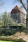 More pictures |
Lindenhayn post mill | Lindenhayn Dübener Strasse 2 (map) |
marked 1741 (mill) | Post mill (without newer attachments); of architectural and technical historical importance |
08974620
|
 More pictures |
Gruppachmühle Mocherwitz |
Mocherwitz mill (map) |
1823 (mill) | Post mill; of importance in terms of local history, the history of technology and the local image |
08974667
|
| Mill, house and barn of a mill estate |
Wölkau (map) |
marked 1948, older in the core (Mühle) | old location Kleinwölkau, of local and economic importance |
08974609
|
|
| Road bridge over the leash | Wölkau (map) |
marked 1932 (road bridge) | old location Großwölkau, small reinforced concrete bridge, of historical importance |
08974595 |
Taucha, city
| image | designation | location | Dating | description | ID |
|---|---|---|---|---|---|
 |
Central German Motor Works (MIMO) |
Graßdorf (map) |
after 1935 (administration building) | Administration building of a factory; Typical clinker brick building from the 1930s, of architectural and local importance |
09305651
|
 |
Transformer station |
Graßdorf (map) |
around 1910 (transformer station) | Testimony to regional electrification, its importance in terms of technology and supply history |
09255991
|
 More pictures |
Merkwitz post mill |
Merkwitz (map) |
End of the 19th century (mill); marked 1940 (memory) | Post mill (Alte Salzstrasse 1a) and storage facility (An der Mühle Merkwitz 35) of a mill property; defining the appearance of the town and of significance in terms of the history of technology |
09257070
|
 |
Mill Plösitz |
Plösitz (map) |
around 1905 (Müllerwohnhaus) | House of a mill estate; historic plastered facade, typical miller's house in a prominent location at the entrance to the town, significance in terms of building history |
09257108
|
 |
Old Mill |
Seegeritz Hauptstrasse 12 (map) |
19th century (residential house) | House of a mill estate; of local historical importance |
08970577
|
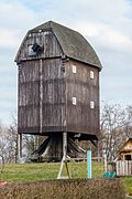 More pictures |
Landmann's post mill |
Taucha (map) |
1831 (mill) | Post mill; The mill that characterizes the town (in operation until 1960), its significance in terms of local history and technology |
09257049
|
 More pictures |
Taucha train station |
Taucha Bahnhofstrasse 1 (map) |
1874 (reception building) | Station building and goods handling building of a train station; Reception building, clinker brick construction typical of the region, of importance in terms of building history, local development history, railway history and technology history |
09305344
|
 |
Beka pump plant |
Tauchagerichtsweg 10 (map) |
around 1920 (part of the factory); around 1920 (gatehouse) | Factory halls with administration building, chimney and porter's house of a pumping station; Industrial architecture preserved intact, sophisticated and high-quality clinker brick facade, significance in terms of building history and technology history |
09257046
|
 |
Power station |
Taucha Graßdorfer Strasse 11 (map) |
marked 1898 (E-Werk) | Administration building with workshop, fence and gate system of a former power station; typical industrial architecture from the turn of the century around 1900, carefully structured clinker brick building, significance in terms of building history and technology history |
09256987
|
 |
Steinwegsmühle; Merry's Mill |
Taucha (map) |
early 19th century (miller's house) | Residential house (with a rear annex), three outbuildings and courtyard gate of a mill property; as a former urban watermill of local historical importance, the entire system has a character that defines the local image, a technical historical monument |
09256925
|
 |
Cable distributor of the Deutsche Reichspost |
Taucha market 2 (map) |
around 1913 (cable distributor) | Junction boxes for telephone connections; Cable distributor similar to the Leipzig types, metal housing, of significance in terms of technology history, rarity and documentation value |
08971848
|
 |
Street lamp and traffic island with pavement |
Taucha Portitzer Strasse (map) |
around 1960 (street lamp) | Well-structured street furniture from the 1950s, of importance in terms of technology history, impact on the townscape |
09259824 |
Torgau, city
| image | designation | location | Dating | description |
ID
|
|---|---|---|---|---|---|
 |
Path pillar |
Beckwitz (map) |
18th century or 19th century (road stone) | Shaft with flat, arched end, inscriptions and direction indicators; of importance in terms of traffic history |
09286259
|
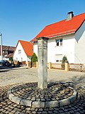 |
Waystone |
Loßwig (map) |
Mid 19th century (Wegestein) | high shaft with cover plate, inscriptions and direction indicator, important in terms of traffic history |
08967240
|
 |
Waystone |
Mehderitzsch (map) |
1st half of the 19th century (Wegestein) | Shaft with a flat, pyramid-shaped cover, inscriptions and directional signs, important in terms of traffic history |
08967105
|
 |
Waterworks | Mehderitzsch Hauptstraße 27 (map) |
1903 (waterworks) | Waterworks, consisting of a machine house and storage building; striking, historicizing clinker-plastered buildings, of importance in terms of building history, as well as significance in terms of the history of technology |
09229238
|
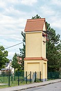 |
Transformer house |
Melpitz Windmüllerstrasse 29 (map) |
Early 20th century (transformer station) | on a square floor plan with a gable roof and cornice cover, plastered, of relevance to the history of construction and technology |
09287231
|
 |
Staupitz windmill |
Staupitz (map) |
marked 1807 (mill) | Post mill; Feet and mill house, of importance in terms of local history and technology |
08967102
|
 |
Bridgeheads made of ashlar masonry |
Torgau (map) |
2nd half of the 19th century (railway bridge) | partially supplemented with brick masonry, the former steel truss bridge with curved upper chord supports has meanwhile been dismantled and replaced, a testament to the history of construction and transport |
09286704
|
 |
Water tower | Torgau Am Wasserturm 1 (map) |
1903 (water system) | Water tower, pump house and administration building; Water-technical system from 1903, also of special architectural quality (especially the water tower, which is visible from afar, highlighted with colored bricks and ornaments) |
09286499
|
 |
Stand weir | Torgau Dahlener Strasse (map) |
1674 (weir); 1st half of the 19th century (railing) | Bottom outlet or pond stand of the large pond, system made of wall with sandstone blocks, stairs as well as weir and railing; The large pond with its facilities is one of the oldest monuments in the history of production in the Saxon region (see Dahlener Strasse, Großer Teich) and is of importance in terms of technology history |
09286700
|
 More pictures |
Landes-Haupt-fortress (formerly); Lock lunette I | Torgau Dahlener Strasse (map) |
1831–1833 (fortifications) | Flooding system made of sandstone walls with a bead-like cover; Preserved work of the historic city fortifications from the Prussian garrison period, of military and local significance |
09287038
|
 |
Road bridge over the Black Ditch | Torgau Dahlener Strasse (map) |
17./18. Century (road bridge) | Arch bridge made of quarry stone and ashlar masonry, as an original bridge structure from the 17th / 18th centuries. Century significant, possibly part of the large pond, which is one of the oldest monuments in the history of production in the Saxon area (see Dahlener Straße, Großer Teich), of architectural and technological history |
09286701
|
 More pictures |
Big pond | Torgau Dahlener Strasse (map) |
1483–1484 (pond) | Construction of the pond including dam structure and avenue; as an artificially created fish breeding pond in the late Middle Ages (at times it was also used for agriculture) of particular economic and historical importance (see also Dahlener Strasse, Ständer-Wehr and Bogenbrücke as well as tournament square path, two-arch bridge) |
09287207
|
 More pictures |
Landes-Haupt-fortress (formerly); Lock lunette II (formerly) | Torgau, Prager Strasse / Friedrich-Naumann-Strasse (map) |
1831–1833 (fortifications) | Flooding system made of sandstone wall with a bead-like cover; Preserved work of the historic city fortifications from the Prussian garrison period, of military historical importance |
09286677
|
 |
Torgau port railway | Torgau (near) Dr.-Külz-Ufer 18 (map) |
around 1898 (railway bridge) | Railway bridge; Steel truss bridge of the Torgau port railway over the Schwarzen Graben, of importance in terms of railway history and building history as well as defining the townscape |
09305319
|
 |
Bridge head or abutment with arch, pillar and water level indicator of the old road bridge | Torgau (map) |
1811 (road bridge) | of high symbolic and memorable value for encounter on the Elbe (1945), historically significant, also as part of the historical fortifications from the time of the Napoleonic Wars, of military-historical significance |
09287005
|
 |
Building of the former electricity utility | Torgau Elbstraße 19 (map) |
last quarter of the 19th century (bridge keeper's house) | Clinker brick, in its place stood the bridge writer's apartment, an important measure maker, of local historical importance |
09286999
|
 |
Elbe magazine | Torgau Elbstraße 21 (map) |
1782–1784 (memory) | Storage building; unique baroque functional building, also important for military and local history as well as of importance for the townscape |
09287014
|
 |
Salzhof | Torgau (map) |
marked 1766 (residential building) | Administrator's house and salt store; striking baroque buildings of architectural and artistic value, also of importance for local history and economic history (monument to trade and warehouse management) |
09286990
|
 |
Storage building | Torgau Güterbahnhofstrasse 7 (map) |
around 1910 (Speicher) | with clinker brick architecture made of pilaster strips, segmented arched windows, tooth-cut frieze and gothic gables, evidence of economic history in connection with the supply of Torgau, as an example of a successfully designed functional building of early objectivity of architectural historical value, also important for the townscape |
09286983
|
 |
Storage building at the train station | Torgau Güterbahnhofstrasse 11 (map) |
1902 (memory) | Composition of a massive storage wing with pilaster strips, triangular gable and three tower structures as well as a side silo, one of the most striking storage buildings of the early objectivity in Saxony and thus of architectural historical value (special style-historical value) and singular importance (rarity), also economic-historical testimony in connection with the supply of Torgau 1900, also important as a landmark for the townscape |
09286982
|
 |
Storage building | Torgau Güterbahnhofstrasse 11a (map) |
around 1910 (Speicher) | Elongated, with clinker brick architecture made of pilaster strips, segmented arched windows and tooth-cut frieze, evidence of economic history in connection with the supply of Torgau at the beginning of the 20th century, as well as a structural document of the industrial architecture after 1900 |
09286981
|
 |
Water tower | Torgau Güterbahnhofstrasse 12a (map) |
Late 19th century (water tower) | Water tower; Located in the station area, high-quality design, with a different-colored clinker brick facade, blind arch structure and timber-framed top, functional building with architectural and historical significance, important for the townscape, and also important as a technical monument |
09286984
|
 |
Remains of a lime kiln | Torgau (opposite) Hafenschlößchen 1 (map) |
around 1820 (lime kiln) | of importance in terms of industrial and local history |
09287050
|
 |
Jam factory Leue & Weise; later steel foundry; later the stoneware factory Villeroy & Boch | Torgau (map) |
after 1900 (factory building) | Factory building; With a designed yellow clinker facade, side tower extension visible from afar, building that looks like the townscape and characterizes the townscape, also testimony to the industrial architecture around 1900 and thus of architectural historical value |
09286988
|
 |
Torgau gas works | Torgau (map) |
around 1900 (gasworks) | Four gas works buildings with clinker facades; Partly richly structured (gable, serrated frieze, arched or segmented arched windows, pilaster strips, attachments, etc.), monument of industrial architecture, also of local historical value |
09286985
|
 |
Earthenware factory Villeroy & Boch | Torgau (map) |
Late 19th century (factory) | Factory building; with turrets and battlements shaped like a castle, high-quality example of castle architecture in industrial construction at the end of the 19th century, of architectural historical value, also important for the townscape (harbor view) |
09286987
|
 |
Landes-Haupt-fortress (formerly); Batardeau at the upper harbor gate | Torgau (map) |
1829 (Batardeau) | Elongated dam with sandstone wall and conical structure; Water-technical system of the historical fortification of Torgau from the 1st half of the 19th century, one of the few systems of this type, of military and local historical importance |
09287051
|
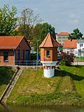 More pictures |
Level system with lath and writing level, massive houses with writing level accentuated by a hexagonal floor plan, tent roof, brickwork and decorative elements | Torgau Loßwiger Weg 25 (map) |
1897 (level house) | Significant historical evidence of the first systematic and scientifically based water level measurement, of technical historical value, rarity value, important for local history and appearance (view of the port) |
09287048
|
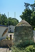 |
Landes-Haupt-fortress (formerly); Batardeau at the lower harbor gate | Torgau Pestalozziweg (map) |
after 1811 (or 1829) | Elongated dam with sandstone wall and conical structure; Water-technical system of the historical fortification of Torgau from the 1st half of the 19th century, one of the few examples of this kind, of military and local significance |
09286973
|
 |
Torgau slaughterhouse (formerly) | Torgau Pestalozziweg 13 (map) |
around 1900 (slaughterhouse) | Slaughterhouse with production building, including boiler house and forge, as well as administration building and one-storey outbuilding; A high-quality ensemble with clinker and clinker-plaster facades, particularly noteworthy is the arcade facade of the production building, of local and architectural value (evidence of industrial architecture around 1900) |
09287035
|
 |
Workshop building | Torgau Schlachthofstrasse (map) |
around 1910 (workshop) | as a design highlighted functional building of the early objectivity (especially with geometric Art Nouveau elements) of architectural historical and architectural value |
09287031
|
 |
Former lime kiln, now a residential building | Torgau Schlachthofstrasse 1b (map) |
18./19. Century (lime kiln) | of significance in terms of technology history |
09287030
|
 |
Landes-Haupt-fortress (formerly); Hauptwerk (formerly) | Torgau Str. Der Jugend 12c (map) |
1811-1813 (fortification); 2nd half of the 19th century (villa) | Villa with enclosure; Vault in the basement part of Bastion III or the curtain wall between Bastion III and IV, still preserved section of the historical fortification from the time of the Napoleonic Wars, also with a so-called aqueduct gate at the rear, of urban and military significance |
09287201
|
 |
Flood barrier | Torgau (map) |
1676 (road bridge) | Two-arched sandstone bridge as the remainder of the flood weir, the embedded sandstone coat of arms was originally dated 1676 and is of importance in terms of building history and technology |
09286702
|
 |
Locomotive shed with turntable | Torgau Warschauer Strasse (map) |
1910 (engine shed) | Originally preserved clinker brick building with a quarter-circle floor plan with a striking forge and lower extension, together with the turntable monument of transport history, near the Hochstraße |
09286525
|
 More pictures |
Landes-Haupt-fortress (formerly); Lock lunette III (former) | Torgau Wolffersdorffstrasse (map) |
1831–1833 (fortifications) | Flooding system made of sandstone wall with a bead-like cover; Preserved work of the historical city fortifications from the Prussian garrison period, of military historical importance |
09286676
|
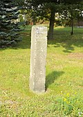 |
Waystone | Welsau | around 1900 (Wegestein) | of historical importance |
09286569 |
Trossin
| image | designation | location | Dating | description | ID |
|---|---|---|---|---|---|
| Dahlenberg village mill |
Dahlenberg (map) |
19th century (mill); 19th century (flour mill); 19th century (cutting mill); Early 19th century (miller's house) | Residential house, mill building with mill technology (grinding mill) and wood cutting mill with saw gate of a mill estate and mill ditch; Former watermill, mentioned as a mill location as early as 1534, of importance in terms of building history, local history and technology history |
09285936
|
|
| Miller's house |
Falkenberg (map) |
Early 19th century (miller's house) | Corresponding windmill demolished in 1925 (later grinding mill), as a clay building of architectural and local significance |
09285941
|
|
| Waystone | Roitzsch (map) |
19th century (road stone) | Of importance in terms of traffic and local history |
09285939
|
|
| Waystone | Roitzsch (map) |
19th century (road stone) | Of importance in terms of traffic and local history |
09305274
|
|
| Furthmühle; Pond mill |
Trossin (card) |
1796 (on the ruins of the mill that burned down in 1755); 1st half of the 20th century (mill technology); 1930 (roller mill) | Mill building with built-on residential part including the existing mill and water technology system, turbine house and bridge over the mill ditch and millstones; Essentially original and important mill complex, of importance in terms of building history, local history and technology history |
09286922
|
|
| Brewmaster House | Trossin (card) |
marked 1700 (social building) | Braumeisterhaus; Single-storey plastered building with a gabled central projection, of importance in terms of building history and local history |
09286274 |
Wermsdorf
| image | designation | location | Dating | description | ID |
|---|---|---|---|---|---|
 More pictures |
Sand mill |
Calbitz Zur Sandmühle 35 (Map) |
1924 and later (mill technology) | Mill equipment; Almost completely preserved technical equipment of a mill, technical history and craft history importance |
08974121
|
 More pictures |
Totality of Royal Saxon Triangulation ("European degree measurement in the Kingdom of Saxony"); Station 18 Collm; Albert Tower |
Collm (map) |
marked 1854 (observation tower); designated 1865 (triangulation column); marked 1865 (triangulation column) | Albert Tower with triangulation column 1st order station; high-quality neo-Romanesque observation tower of regional historical significance, triangulation point of significance in terms of surveying history |
08974020
|
 |
Geophysical Observatory Collm of the University of Leipzig | Collm Bayreuther Weg 1 (map) |
1932 (observatory) | Observatory with original furniture, magnet station with three variometers, absolute house, earthquake station with Wiechert seismograph and Benioff seismometer, garage (measuring house), wooden building behind the observatory and gate post; Architecturally high-quality facility with largely preserved interior fittings in the Bauhaus-Modern style, with historical instruments of great technical significance |
08974147
|
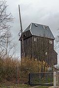 |
Windmill Collm | Collm Oberweg (map) |
19th century (mill) | Post mill; Of importance in terms of technology history and the appearance of the town |
08974019
|
| Round arch bridge over the Döllnitz |
Liptitz (map) |
marked 1858 (road bridge) | Elaborately designed bridge, beautiful historical testimony of its kind, of architectural significance |
08974005
|
|
| Round arch bridge over the Döllnitz | Liptitz (map) |
around 1880 (road bridge) | Bridge construction with an impact on the townscape, of importance in terms of building history and technology |
08974159
|
|
 More pictures |
Luppa post mill |
Luppa (card) |
1st half of the 19th century (mill) | Post mill; Of importance in terms of technology and local history, shaping the townscape |
08974107
|
| Mahlis stop (formerly) |
Mahlis (map) |
around 1900 (train station) | Mahlis train station; as a former train stop of local historical importance |
08974004
|
|
| Mahlis village cooperative | Mahlis (map) |
around 1925 (mill) | Storage building with mill and courtyard pavement; Plant with local, economic and technical historical significance |
08973993
|
|
| Road bridge |
Malkwitz (map) |
around 1935 (road bridge) | Technical monument in a simple, high-quality design language, of importance in terms of building history |
08974132
|
|
 |
Saxon post mile pillars (totality) |
Wermsdorf Alte Poststrasse (map) |
marked 1724 (half-mile column) | Post mileage column; Half-mile column, important in terms of traffic history |
08974237
|
 More pictures |
Water house | Wermsdorf old hunting lodge (map) |
1885 (water supply and sewage system) | Water house; due to its former function a technical monument with local historical significance |
08974221
|
 |
Royal Saxon milestones (totality) | Wermsdorf old hunting lodge (map) |
2nd half of the 19th century (milestone); 2nd half of the 19th century (milestone) | Milestone; Ganzmeilenstein, on the Poststrasse to Wurzen, technical monument and evidence of traffic history |
08974219
|
 |
Former station of the small train | Wermsdorf Grimmaer Strasse 29 (map) |
1888 (passenger station) | historical and traffic-historical significance, echoes of the Swiss style |
08967028
|
| Hubertusburg Palace (entity) | Wermsdorf (map) |
before 1826 (ceramic industry) | Individual monument belonging to the Hubertusburg Castle: farm building with drying floors (see also 08970574); Structurally, historically and scientifically of importance, dry building of the former stoneware factory on the castle grounds, later part of the hospital, part of the Hubertusburg castle complex |
08973759
|
|
 |
Hubertusburg Castle (material entirety); Water tower | Wermsdorf Hubertusburg 58 (map) |
around 1900 (water tower) | Individual monument belonging to the Hubertusburg Castle: Water Tower (see also 08970574); Structurally, historically and scientifically of importance, clinker brick building from the Gründerzeit, hospital component, part of the whole of the Hubertusburg palace complex |
08973760
|
| Hubertusburg Palace (entity) | Wermsdorf (map) |
around 1900 (boiler house) | Individual monument belonging to the Hubertusburg Castle: boiler house and electrical station (see also 08970574); Structurally, regionally, technologically and scientifically of importance, more recent Wilhelminian expansion buildings (hospital use) as part of the Hubertusburg castle complex |
08973753
|
|
| 13 street lights | Wermsdorf (map) |
around 1915 (city lighting) | Rare technical monument, as part of the first public lighting in Reckwitz of local historical importance |
08974243 |
Wiedemar
| image | designation | location | Dating | description | ID |
|---|---|---|---|---|---|
| Saxon post mile pillars (totality) |
Grebehna (map) |
marked 1722 (quarter milestone) | Post mileage column; Quarter milestone, offset, significant in terms of traffic history |
08972603
|
|
| Saxon post mile pillars (totality) | Grebehna (map) |
marked 1722 (half-mile column) | Post mileage column; Remainder of a half-mile column, significant in terms of traffic history |
09304874
|
|
| Klitschmar train station |
Klitschmar (map) |
1872 (reception building) | Reception building (no. 8) of a train station, with an attached goods shed, ancillary building and adjoining railway house (no. 6) as well as toilets; Reception building in a rare half-timbered construction, brick building residential building, historical testimony to the development of traffic engineering in the place of excellent design quality with largely original structure |
08972795
|
|
| Transformer tower | Klitschmar (map) |
around 1920 (transformer station) | Testimony to electrification, a building with a significant history of supply and technology in a prominent location |
08972794
|
|
| Transformer tower |
Kölsa (map) |
1920s (transformer station) | exceptionally high structure, evidence of regional electrification, importance in the history of supply and technology and in shaping the townscape |
08972806
|
|
| Transformer tower |
Kyhna (map) |
around 1920 (transformer station) | Testimony to electrification, of significance in terms of supply and technology |
09305699
|
|
| Kyhna windmill | Kyhna (map) |
marked 1825 (mill) | Paltrock windmill (with technical equipment), former post windmill; In 2004/2005 it was converted from a post mill to a Paltrock windmill, making it the youngest of its kind in Germany, with a technical and historical significance |
08972057
|
|
| Post mill Peterwitz |
Peterwitz (map) |
around 1890 (mill) | Post mill; Typical example of the former mill landscape in northern Saxony, with significance in terms of technology history and a landscape-defining effect |
08972786
|
|
| Transformer tower |
Zaasch (map) |
around 1910 (transformer station) | Rare design for the region, brick construction, evidence of regional electrification, of importance in terms of supply and technology |
09305700
|
|
| Schkeuditz post mill |
Zwochau (map) |
1806-1807 (mill) | Post mill; Relocated to Zwochau in 2008 (relocated from Schkeuditz, old location: Kursdorfer Straße, behind No. 5, district Schkeuditz, Flstk. 111, Corridor 3), large parts of the historical construction preserved during the implementation, of technical significance |
09258684 |
Zschepplin
| image | designation | location | Dating | description | ID |
|---|---|---|---|---|---|
| Waystone |
Glaucha (map) |
marked 1866 (Wegestein) | of importance in terms of traffic history |
08974348 |
|
 More pictures |
Post mill »Wolkwitz« Niederglaucha | Glaucha (map) |
1749 (mill) | Post mill; Typical regional windmill in largely original condition, still in operation, of importance in terms of building history, landscaping and local history |
08973985 |
| Forge with equipment |
Hohenprießnitz (map) |
Mid 19th century (forge) | Worth preserving due to the central location and the importance of the history of technology, largely original structure |
08974394 |
|
| Transformer tower | Hohenprießnitz (map) |
around 1925 (transformer station) | Testimony to electrification, importance in the history of supply and technology, location that shapes the street scene |
08974391 |
|
| Transformer tower |
Krippehna (map) |
around 1920 (transformer station) | Testimony to regional electrification, of importance in the history of supply and technology |
08974337 |
|
| Old dairy (former) | Krippehna (map) |
Late 19th century (dairy) | Dairy; in a central location on the village square, of architectural and local significance |
08974338 |
|
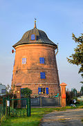 More pictures |
Naundorf windmill | Naundorf (map) |
around 1885 (mill) | Tower Dutchman with partially preserved mill technology; Today residential house, in its original condition, typical and beautiful example of the later mill architecture, of architectural, local history and landscape-defining importance |
08974369 |
| Kämmereiforst station | Naundorf (map) |
1872 (reception building); 1888 (goods handling); around 1900 (farm building); 1st half of the 20th century (signal box Kf); 1st half of the 20th century (signal box Ko) | Reception building, goods shed, farm building, two signal boxes and barriers as well as the residential building of the Kämmereiforst station; Railway line Halle (Saale) –Eilenburg – Cottbus, clinker building ensemble, existing equipment in the reception building and signal box for the operation of the barrier system, of technical, architectural and railway historical importance |
08974346 |
|
 |
Waystone |
Noitzsch (map) |
2nd half of the 19th century (Wegestein) | Sandstone, important in terms of traffic history |
08974314 |
| Saxon post mile pillars (totality) | Noitzsch (map) |
marked 1722 (quarter milestone) | Post mileage column; Quarter milestone, important in terms of traffic history |
08974344 |
|
 More pictures |
Waystone | Noitzsch (map) |
1st half of the 19th century (Wegestein) | of importance in terms of traffic history |
08974345 |
| Transformer tower |
Rödgen (map) |
around 1920/1925 (transformer station) | Evidence of regional electrification, importance in the history of supply and technology |
08974365 |
|
| Bicycle workshop with equipment |
Zschepplin (map) |
1913 and later (workshop) | original example with singular and technical-historical significance |
08974380 |
|
| Transformer tower | Zschepplin (map) |
around 1930 (transformer station) | technical historical significance |
08974378 |
|
 More pictures |
Zschepplin motor mill | Zschepplin (map) |
around 1840 (mill) | Motor mill; converted post mill, significance in terms of the history of technology |
08974377 |
Remarks
- ↑ The list may not correspond to the current status of the official list of monuments. This can be viewed by the responsible authorities. Therefore, the presence or absence of a structure or ensemble on this list does not guarantee that it is or is not a registered monument at the present time. The State Office for the Preservation of Monuments in Saxony provides binding information .
swell
- List of monuments of the state of Saxony
- Answer to the big question of the AfD parliamentary group of 23 August 2016; Appendix to the Big Question Drs. 6/5471