Loulan
| Uighur name | |
|---|---|
| Arabic-Persian (Kona Yeziⱪ) : | كروران قەدىمكى شەهىرى |
| Latin (Yengi Yeziⱪ) : | Kroran ⱪədimki xəⱨiri |
| Cyrillic ( Soviet Union ): | Кроран қәдимки шәһири |
| Chinese name | |
| Abbreviation : | 楼兰 故城 |
| Traditional characters : | 樓蘭 故城 |
| Transcription in Pinyin : | Lóulán gùchéng |
| Wade-Giles transcription : | Lou-lan ku-ch'eng |

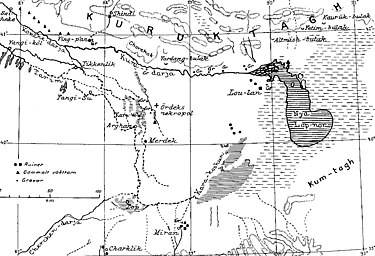
Loulan is an archaeological dig site in the Lop Nor desert in Xinjiang , China . In ancient times , Loulan was an oasis town on the northwestern shore of Lake Lop Nor , seat of a kingdom and later a Chinese garrison town. The city was on the middle route of the Silk Road and was the last oasis before the desert.
Loulan (other names: Lao-lan, Leou-lan, Glu-lan , Kharosthi : Kroraimna, Kroraina, Raurata, Rooran ) is located in Qakilik district (若羌 县), about 230 km northeast of the seat of the district government, the Ruoqiang community (若羌 鎮). The county belongs to the Mongolian Autonomous District of Bayingolin in the Xinjiang Autonomous Region.
history
In northwest China, around 200 BC, A period of high temperatures and heavy rainfall, which was replaced by a period of prolonged drought and drought until the 5th century. From 200 BC The rivers that carried their water to Lop Nor became broad rivers that desalinated the salt water of Lake Lop Nor, carried it over the shores of the lake and created large wetlands that could be used for agriculture.
The climate change therefore led from 200 BC. BC to founding cities in Loulan, Miran , Haitou, Yingpan, Merdek and Qakilik (= Ruoqiang). Among these cities, Loulan and her Kingdom of Shanshan played a dominant role due to its location on the Middle Silk Road , until the royal family was ousted by the Chinese Empire, which now controlled the Silk Road itself and secured it against attacks by the Xiongnu with signal towers along the Great Wall of China . It was the job of the residents of Loulan to provide water and provisions for travelers on the Silk Road.
Loulan, which lay on a river and experienced an economic boom as an outpost for the Chinese, was abandoned around 330, along with other settlements on the Kum-darja, due to the lack of water. The cause was the beginning of the climate change, which led to the fact that the rivers and river oases dried up and that from now on there was no fresh water in Loulan; earlier it was assumed that the frequent earthquakes here steered the Tarim in a different direction. The Middle Silk Road north of Lake Lop Nor was now impassable, and the population in the Lop Nor desert was rapidly declining.
The city of Loulan was first established in 176 BC. Mentioned in a letter from the Xiongnu ruler Mao-tun Chanyu to the Chinese emperor Wendi. A report from the year 126 BC BC about Loulan comes from the Chinese diplomat Zhang Qian , who lived between 139 and 123 BC. BC explored the Silk Road on behalf of the Chinese Emperor Wudi . He reported of a town of about 14,000 inhabitants and wrote: “The areas of Loulan and Gushi have a walled city and walled suburbs; they are on the salt marsh. "
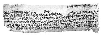
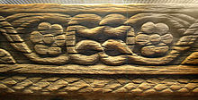
On March 28, 1900, the Swedish explorer Sven Hedin reached Loulan. He discovered the ruins of the 340 × 310 m wall-enclosed former royal city and later Chinese garrison city of Loulan with the brick building of the Chinese military commander, a signal tower of the Great Wall of China on the Silk Road called by Sven Hedin Stupa and 19 residential houses made of poplar wood. In early March 1901, during archaeological excavations, he found a wooden wheel that came from a horse-drawn cart (called "Arabas"), and 276 written documents from 252 to 310 made of wood, paper and silk, which provided information about the history of the city of Loulan.
In 1994 Christoph Baumer found a large former orchard about 5 km south of the city of Loulan. He writes: “In front of us are more than 20 long rows of withered fruit trees, which must have come from the 4th century AD. It is probably apricot trees. "
Great Wall of China and Silk Road
The Middle Silk Road ran from Dunhuang via Yumenguan on a not yet exactly clarified route through the Lop Nor Desert and the encrusted lake basin north of Lake Lop Nor via the fortresses "LJ", "Tuken" and "LE" to "Loulan" ("LA “= Loulan station) and from Loulan on the north bank of the then southerly Kum Darya and the Konqi via Yingpan along ten signal towers to Korla . This middle section of the Silk Road was built around 120 BC. BC up to the year 330 mainly used in winter because water supplies could be transported in the form of ice blocks during frost. An alternative was the northern silk road from the 2nd century onwards. It avoided the dreaded Lop Nor desert by heading north-west to Turfan from Dunhuang. In Kashgar it united with the southern Silk Road.
Since the Han dynasty (202 BC – 220 AD), signal towers (= watchtowers) have provided orientation and safety for travelers on the Middle Silk Road. Ruins of signal towers of the Great Wall of China that accompanied the Silk Road were found in the Lop Nor desert in the following locations: in Miran ; 45 km south of Loulan (name of the fortress: "LK"); 20 km northeast of Merdek at the "Schmalen Fluss"; on the north and north-west edge of Lake Lop Nor (names of the fortresses: "LJ", "Tuken", "LF", "LE", "LA" = Loulan); in Yingpan and from there to the west on the northern bank of the Kum Darya and the Konqi at close distances to Korla and "Charchi". After the Lop Nor lake dried up, the southern silk road was used from 330; it led from Dunhuang south of Lake Lop Nor via Miran to Qakilik ; Marco Polo used this route .
There was also a road from Miran to Loulan that connected the Middle and South Silk Roads. The fortress "LK" with the settlements "LL", "LM" and "LR" to the west of it stood on this road 45 km south of Loulan. To the north of "LK" this road ran through an area with yardangs .
Another road possibly led from Miran or Ruoqiang (= Qakilik ) via the Merdek fortress and the "Narrow River" past the signal tower there to the "Middle Silk Road" on the Kum Darya River.
Expeditions to Loulan

The following expeditions led to Loulan:
- 1900-1901 Sven Hedin
- 1905-1906 Ellsworth Huntington
- 1906–1907 Sir Aurel Stein
- 1908–1909 Zuichō Tachibana , Eizaburō Nomura ( Kōzui Ōtani's 2nd expedition to Central Asia)
- 1910–1911 Zuichō Tachibana (Kōzui Ōtani's 3rd expedition to Central Asia)
- 1914 Sir Aurel Stein
- 1928–1935 Sino-Swedish expedition , led by Sven Hedin:
- 1928 Folke Bergman , Erik Norin, Henning Haslund-Christensen
- 1930 Huang Wenbi
- 1930–1931 Nils Hörner, Parker C. Chen
- 1934–1935 Sven Hedin, Parker C. Chen, Huang Wenbi, Folke Bergman
- 1979–1981 Research Groups at the Chinese Academy of Sciences
- 1996 John Hare with Chinese scientists
literature
- Sven A. Hedin: Scientific Results of a Journey in Central Asia 1899–1902. 6 volumes of text + 2 volumes of maps, Stockholm 1904–1997.
- Ellsworth Huntington: The Pulse of Asia. Boston / New York 1907.
- August Conrady: The Chinese manuscripts - and other small finds of Sven Hedins in Lou-lan. General Staff litografiska anstalt, Stockholm 1920.
- Sir Aurel Stein: Serindia: detailed report of explorations in Central Asia and westernmost China. Oxford 1921 (text material is contained in volume 1 ; graphic material is contained in volume 4 ; maps are contained in volume 5 ).
- Sir Aurel Stein: Innermost Asia: Detailed Report of Explorations in Central Asia, Kan-Su and Eastern Iran. Volume 1. Oxford, 1928 (maps are contained in Volume 4 ).
- Herrmann, Albert: Lou-lan - China, India and Rome in the light of the excavations at Lobnor. With a foreword by Sven Hedin. Brockhaus, Leipzig 1931, 1st edition.
- Folke Bergman: Lou-Lan Wood-Carvings and Small Finds Discovered by Sven Hedin. In: Bulletin of the Museum of Far Eastern Antiquities. No. 7, 1935, pp. 71-144.
- Folke Bergman: Archaeological Researches in Sinkiang. Especially the Lop-Nor region. In: Reports: Publication. No. 7, Stockholm 1939 (English, the basic work on the archaeological finds in Loulan and the surrounding area with important maps).
- Kuan-wu Lin: Western spirit in the eastern body ?: "Medea" in the intercultural theater of China and Taiwan. On the universalization of Greek antiquity Transcript, Bielefeld 2010, ISBN 3-837-61350-X (About the "Loulan Princess" as Medea)
- Vivi Sylwan: Woolen textiles of the Lou-lan people. Stockholm 1941.
- Vivi Sylwan: Investigation of silk from Edsengol and Lop-nor and a survey of wool and vegetable materials. Stockholm 1949.
- Herbert Wotte: Course towards unexplored. Brockhaus, Leipzig 1967.
- Helmut Uhlig: The Silk Road. Ancient world culture between China and Rome. Lübbe, Bergisch Gladbach 1986, ISBN 3-7857-0446-1 .
- John Hare : On the trail of the last wild camels. An expedition to forbidden China. Foreword by Jane Goodall. Frederking & Thaler, Munich 2002. Description of the 1996 expedition to Loulan: Pages 160 to 188. Description of Loulan: Pages 176 to 179, ISBN 3-89405-191-4
- Christoph Baumer: The southern silk road. Islands in the sand sea. Mainz 2002. ISBN 3-8053-2845-1 (with current references).
- Alfried Wieczorek, Christoph Lind (Ed.): Origins of the Silk Road. Sensational new finds from Xinjiang, China. Exhibition catalog of the Reiss-Engelhorn-Museums, Mannheim. Theiss, Stuttgart 2007. ISBN 380622160X (pages 230-244).
- Feng Zhao: Treasures in Silk. An illustrated history of Chinese textiles. ISAT / Costume Squad, Hangzhou 1999, ISBN 962-85691-1-2 .
Web links
Remarks
- ↑ Journal of Geophysical Research, Vol. 109, D02105, doi : 10.1029 / 2003JD003787 , 2004: Evidence for a late Holocene warm and humid climate period and environmental characteristics in the arid zones of northwest China during 2.2 - 1.8 KABP.
- ^ The discovery of the Loulan site
- ↑ Maps and research results on the houses, fortresses, signal towers, streets etc. see: Folke Bergman: Archaeological Researches in Sinkiang. Especially the Lop-Nor region. (Reports: Publication 7), Stockholm 1939.
Coordinates: 40 ° 31 ' N , 89 ° 55' E


