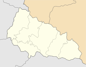
Luh (Rakhiv)
| Luh | ||
| Луг | ||

|
|
|
| Basic data | ||
|---|---|---|
| Oblast : | Zakarpattia Oblast | |
| Rajon : | Rakhiv Raion | |
| Height : | 347 m | |
| Area : | 3.75 km² | |
| Residents : | 1,985 (2004) | |
| Population density : | 529 inhabitants per km² | |
| Postcodes : | 90616 | |
| Area code : | +380 3132 | |
| Geographic location : | 47 ° 58 ' N , 24 ° 3' E | |
| KOATUU : | 2123685501 | |
| Administrative structure : | 1 village | |
| Address: | 9061 с. Луг 107 | |
| Statistical information | ||
|
|
||
Luh ( Ukrainian Луг ; Russian Луг Lug , Slovak Luh , Hungarian Tiszalonka ) is a village in the southeast of the Ukrainian Zakarpattia Oblast with about 2000 inhabitants (2004).

The village, first mentioned in writing in 1439, is located in the historical region of Maramureş in Carpathian Ukraine and is the only town in the district council of the same name in the southwest of the Rajon Rakhiv .
Luh lies at the confluence of the Kossiwska ( Косівська ) in the Tisza , which forms the Romanian- Ukrainian border here. The Romanian village of Lunca la Tisa is located on the opposite bank of the Tisza . The trunk road N 09 runs through Luh and leads in a north-west direction to the neighboring urban-type settlement Velykyj Bychkiv .
The Rajon center of Rakhiv is located about 33 km (by road) northeast and the Uzhhorod oblast center is about 180 km northwest of Luh.
Individual evidence
- ↑ Luh on the official website of the Verkhovna Rada ; accessed on August 11, 2017 (Ukrainian)
- ↑ Cities and Villages of the Ukrainian SSR - Luh on ukrssr.com.ua; accessed on August 11, 2017 (Ukrainian)

