Malinyi (district)
Malinyi District
|
|||
|---|---|---|---|
| Basic data | |||
| Country | Tanzania | ||
| region | Morogoro | ||
| surface | 11,112 km² | ||
| Residents | 114,202 (2012) | ||
| density | 10 inhabitants per km² | ||
| ISO 3166-2 | TZ-16 | ||
Coordinates: 8 ° 52 ′ S , 36 ° 1 ′ E
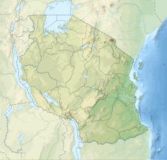
Malinyi is a district of the Morogoro region in Tanzania . It borders on the Ulanga district to the east, the Ruvuma region to the south and south- west, and the Kilombero district to the west and north .
geography
Malinyi has an area of 11,112 square kilometers and a little over 100,000 inhabitants (2012 census) and is very sparsely populated with ten inhabitants per square kilometer. The largest rivers are the Ulanga in the north and the Luwegu in the south, both of which belong to the catchment area of the Rufij River , which flows into the Indian Ocean . The climate in Malinyi is tropical, Aw according to the effective climate classification .
history
The district was created after 2012 by dividing the Ulanga district.
Administrative division
Malinyi is divided into 10 parishes (wards) with 33 villages.
population
Around sixty percent of the population is illiterate.
Facilities and services
- Education: 35 primary schools and 14 secondary schools are available for the education of young people.
- Health: The district has a hospital, health center and thirteen pharmacies. The hospital is run by the Evangelical Church .
- Water: In 2019, 53 percent of the population was provided with safe and clean water.
Economy and Infrastructure
Malinyi is one of the poorest districts in Tanzania, the per capita income is less than 300 euros per year. The majority of the population lives from small farms.
The main road connection is the unpaved national road T16 from Ifakara in the north to Songea in the south.
politics
In MalinyiIm, a District Council is elected every 5 years. Fadhili Liguguda holds the chairmanship (as of 2020).
Attractions
- Kilombero Game Reserve: The district has a share in the game reserve of the Kilombero River . The reserve is home to large numbers of buffalo, elephants, zebras, crocodiles and the colobus monkey.
Web links
Individual evidence
- ^ A b c d Ed Wilson, Robert McInnes, Damas Patrick Mbaga and Paul Ouedraogo: Kilombero Valley. (PDF) April 2017, pp. 16-18 , accessed on May 4, 2020 .
- ↑ Maps for the World, Map 500k - xc37-1. Russian Army Maps, accessed May 4, 2020 (Russian).
- ↑ Search results - Climate-Data.org. Retrieved May 4, 2020 .
- ^ Tanzania Regional Profiles, 04 Morogoro Regional Profiles. (PDF) The United Republic of Tanzania, 2016, p. 16 , accessed on May 4, 2020 .
- ↑ a b Mwanzo | Home. Malinyi District Council, accessed May 4, 2020 .
- ↑ a b A partnership to tackle women and mothers with pregnancy related diabetes in Tanzania. (PDF) ESTHER Switzerland, July 2019, p. 20 , accessed on May 4, 2020 .
- ↑ Statistics. Retrieved May 4, 2020 (Swahili).
- ^ A partnership to tackle women and mothers with pregnancy related diabetes in Tanzania. (PDF) ESTHER Switzerland, July 2019, p. 6 , accessed on May 4, 2020 .
- ↑ Lugala Hospital. Retrieved May 4, 2020 .
- ↑ Maji | Malinyi District Council. Retrieved May 4, 2020 (Swahili).
- ^ Tanzania Trunk Road Network. Retrieved May 4, 2020 .
- ^ Trunk Roads Network. Retrieved May 4, 2020 .
- ↑ Siegfried Schröder and Elke Kuhne: Elections in Tanzania 2015. (PDF) Rosa-Luxemburg-Stiftung, November 9, 2015, p. 3 , accessed on May 4, 2020 .
- ↑ Kilombero Game Controlled Area Tanzania | Canoeing Safari at Kilombero River. Retrieved May 4, 2020 (American English).

