Manapouri
| Manapouri | ||
| Geographical location | ||
|
|
||
| Coordinates | 45 ° 34 ′ S , 167 ° 37 ′ E | |
| Region ISO | NZ-STL | |
| Country |
|
|
| region | Southland | |
| District | Southland District | |
| Ward | Te Anau Ward | |
| Residents | 228 (2013) | |
| height | 200 m | |
| Post Code | 9643 | |
| Telephone code | +64 (0) 3 | |
| UN / LOCODE | NZ MNP | |
| website | www.manapouri.nz.com | |
| Photography of the place | ||
 Manapouri |
||
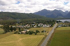
Manapouri is a village in the Southland District of the Southland regionon the South Island of New Zealand .
Origin of name
The place got its name from the lake of the same name on which it is located. Manapouri can be derived from two terms, either from manawapouri , which means "sorrowful heart", or from manawapopore , which can be translated as "beating heart".
geography
Manapouri is located around 19 km southwest of Te Anau at the southeast end of Lake Manapouri . Directly south of the village is the outflow of Lake Manapouri over the Waiau River
population
In the 2013 census, the town had 228 inhabitants, 25.5% less than in the 2006 census.
Infrastructure
Road traffic
Manapouri can be reached via Te Anau on the New Zealand State Highway 95 , which is part of the Southern Scenic Route, which is popular among tourists . About the outgoing east Manapouri Road , the site receives the following from Te Anau to the east towards Mossburn leading New Zealand State Highway 97 .
Hydroelectric power plant
In the 1960s, was the power station Manapouri the largest underground power station in the country at Lake Manapouri built, which is mostly underground. Despite considerable protests across the country, this project was pushed ahead, but an artificial increase in the water level of the lake was not realized because of the protest actions. The Manapouri power plant was only able to use its full capacity in 2002 , as another underground tunnel had to be blasted into the rock.
tourism
Manapouri is an important starting point for hikes in the Fiordland National Park , the largest national park in the country. The west of the Lake Manapouri located Doubtful Sound is another tourist attraction of the area, which is made available by combined ship and boat tours traveler.
literature
- Helga Neubauer: Manapouri . In: The New Zealand Book . 1st edition. NZ Visitor Publications , Nelson 2003, ISBN 1-877339-00-8 , pp. 890-892 .
Individual evidence
- ↑ a b 2013 Census QuickStats about a place : Manapouri . Statistics New Zealand , accessed August 4, 2017 .
- ↑ a b Helga Neubauer: Manapouri . In: The New Zealand Book . 2003, p. 892 .
- ↑ a b Topo250 maps . Land Information New Zealand , accessed August 4, 2017 .
- ↑ Manapōuri hydro station . Meridian Energy , accessed August 4, 2017 .
