Manasarovar
|
Manasarovar Mapam Yumco, Mapam Yum Co |
||
|---|---|---|

|
||
| Satellite image with the lakes Manasarovar (right), Rakshastal (left) and the Kailash in the background. (NASA World Wind) | ||
| Geographical location | Circle Purang in the administrative district of Ngari in Tibet ( China ) | |
| Drain | temporarily to the Rakshastal | |
| Data | ||
| Coordinates | 30 ° 40 ′ N , 81 ° 28 ′ E | |
|
|
||
| Altitude above sea level | 4586 m | |
| surface | 412 km² | |
| length | 27.7 km | |
| width | 21.7 km | |
| Maximum depth | 77 m | |
|
particularities |
temporary outflow |
|

|
||
| View from the Chiu Monastery to Lake Manasarovar. (2006) | ||
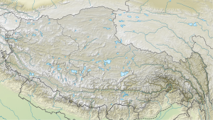
The lake Manasarovar ( Tibetan མ་ ཕམ་ གཡུ་ མཚོ Wylie ma-pham g.yu-mtsho Mapam Yumco ; Sanskrit मानस सरोवर Manasa Sarovara ; Chinese 瑪旁雍錯 / 玛旁雍错 ), located in the county Purang , administrative region Ngari on the " roof of the world " in the southwest of the Tibet Autonomous Region in the People's Republic of China .
geography
Manasarovar, located between the Transhimalaya (in the north) and Himalaya (in the south) mountain ranges , is one of the highest freshwater lakes in the world with a height of 4586 meters above sea level. It has an average water surface of 412 km² and is up to 77 meters deep. The lake is located on a plateau, which is framed by the striking mountains Kailash ( 6714 m ) and Gurla Mandhata ( 7728 m ). It is separated from the Rakshastal Lake to the west by a narrow ridge . When the water level is high when the snow melts , water can flow through a channel called Ganga Chhu into the Rakshastal, which is about 15 m below.
Four large rivers have their source in the immediate vicinity of the lake:
- Satluj in the west, with sufficient water in the Rakshastal and with high tide via the connecting Wadi Ganga Chu in Manasarovar,
- Indus in the north,
- Brahmaputra (Yarlung Zangbo) in the east and
- Karnali in the south.
Names
In Tibetan the lake is called Mapham Yutsho ( Tib . : ma pham g.yu mtsho); the name means "invincible turquoise lake". The Chinese name Mǎpáng Yōngcuò玛旁雍错 (also: Mǎfǎ Mùcuò玛法 木 错) is borrowed from Tibetan. Other Tibetan names for the lake are Tshochen Mapham Yutsho , Tsho Mapham , Tsho Rinpoche and Pema Lhatsho ("divine lotus lake"). "Manasarovar" is Sanskrit , composed of manas (= "spirit") and sarovar (= "lake"); another Sanskrit name is Anavatapta .
The lake is called “invincible” or “unsurpassed” because only its water should have the “eight properties of perfect water”: cool, sweet, light, soft, clear, pure, neither stomach nor throat irritating. It is also called “forever cool” because the water god ( naga ) Anavatapta ( Pali : Anotatta , Tibetan: Mazhoiba; “who never heats up”) is said to live here. The name “divine lotus lake” goes back to a comparison of its water surface with an open lotus blossom.
Religious meaning
The Manasarovar is a sanctuary of the Hindus and the Buddhists and thus also an important destination for pilgrims. It is one of the three sacred lakes in Tibet. According to Hindu mythology , the lake was invented by the god Brahma ("manas"). In the Hindu epic Ramayana it says:
Along the lake shore there used to be the gompas (monasteries) Chiu (built on a rock), Cherkip, Langpona, Bönri, Seralung, Yerngo, Trügo and Gossul (also built on a rock), corresponding to the eight spokes of the Buddhist wheel of life , five of which still exist. The circular route on the traditional pilgrimage route measures 103 km (Manasarovar Parikrama), for which the pilgrims need between two and four days.
While in mysticism the attributes light, positive and masculine are associated with the Manasarovar, in the western neighbor Raksastal these are the attributes dark, negative and feminine. Since the two lakes are also viewed by the Tibetans as the bridegroom and bride, it is considered auspicious when the connecting channel Ganga Chu carries water.
Others
The lake is the namesake of the Bollywood film Wiedersehen am See Manasarovar , Anup Kurian (2004).
Manasarovar ("Ocean of Thoughts") is also the title of a collection of 205 of a total of 350 short stories by the Indian writer Premchand (1880–1936).
literature
- Paolo Gondoni, Map Kailas 1: 250.000, Route from West Nepal to Tibet, Simikot - Purang - Manasarovar - Kailas , Nepa Maps for extreme and soft trekking
- Andreas Gruschke : Manasarovar (Mapam Tso), in: The holy places of the Tibetans. Myths and legends from Kailash to Shambhala . Diederichs Verlag, Munich 1997, pp. 115-118, 130f. ISBN 3-424-01377-3
- John Snelling, The Sacred Mountain; Travelers and Pilgrims at Mount Kailas in Western Tibet and The Great Universal Symbol of The Sacred Mountain ; Revised and Enlarged Edition including: Kailas-Manasarovar Travelers' Guide; East-West Publications, London and The Hague 1990, ISBN 0-85692-173-4
Web links
- The Manasarovar Lake and the Kailash (Georg Temme: Genius Loci )
- Photos and map of Lake Manasarovar and Kailash
Individual evidence
- ↑ Geologic Map of the Mt. Kailas-Gurla Mandhata Area, southwest Tibet (PDF; 821 kB) easd.geosc.uh.edu.
- ↑ Altitude information: see Paolo Gondoni, Kailas map, and Google Earth
- ↑ See John Snelling, pp. 61 f.
- ↑ See John Snelling, pp. 66 f.

