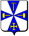
Mancieulles
| Mancieulles | ||
|---|---|---|

|
|
|
| local community | Val de Briey | |
| region | Grand Est | |
| Department | Meurthe-et-Moselle | |
| Arrondissement | Briey | |
| Coordinates | 49 ° 17 ' N , 5 ° 54' E | |
| Post Code | 54790 | |
| Former INSEE code | 54342 | |
| Incorporation | January 1, 2017 | |
| status | Commune déléguée | |
| Website | http://www.mairie-mancieulles.fr/ | |
 City Hall ( Mairie ) of Mancieulles |
||
Mancieulles is a village and a commune déléguée in the French commune Val de Briey with 1,880 inhabitants (as of January 1, 2017) in the Meurthe-et-Moselle department in the Grand Est region (until 2015 Lorraine ). The inhabitants of Mancieulles are called Mancieullois .
The municipality of Mancieulles merged with Mance and Briey to form the new municipality of Val de Briey on January 1st, 2017 . The municipality was part of the Briey arrondissement and the canton of Briey and a member municipality in the Pays de Briey municipality .
location
Mancieulles is about 18 kilometers west-southwest of Thionville in the valley of the River Woigot .
The municipality of Mancieulles was surrounded by the neighboring municipalities of Tucquegnieux in the north, Bettainvillers in the north and northeast, Mance in the south and east and Anoux in the south and west.
Population development
| year | 1962 | 1968 | 1975 | 1982 | 1990 | 1999 | 2006 | 2012 |
| Residents | 2,660 | 2,369 | 2,107 | 1,549 | 1,474 | 1,419 | 1,546 | 1,792 |
| Source: Cassini and INSEE | ||||||||
Attractions
- Saint-Siméon church from the 12th century, alterations from the 18th and 20th centuries
- Old Notre-Dame chapel in Saint-Pierremont
- Calvaire
Personalities
- Serge Masnaghetti (* 1934), football player

