Marion Heights
| Marion Heights | ||
|---|---|---|
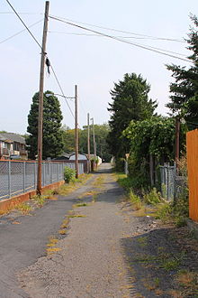
 Marion Heights Fire Company guard |
||
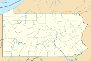
| Location in Pennsylvania | ||
|
|
||
| Basic data | ||
| Foundation : | 1906 (incorporated) | |
| State : | United States | |
| State : | Pennsylvania | |
| County : | Northumberland County | |
| Coordinates : | 40 ° 48 ′ N , 76 ° 28 ′ W | |
| Time zone : | Eastern ( UTC − 5 / −4 ) | |
| Residents : | 735 (as of: 2000) | |
| Population density : | 1,470 inhabitants per km 2 | |
| Area : | 0.5 km 2 (approx. 0 mi 2 ) of which 0.5 km 2 (approx. 0 mi 2 ) is land |
|
| Height : | 432 m | |
| Postal code : | 17832 | |
| Area code : | +1 570 | |
| FIPS : | 42-47480 | |
| GNIS ID : | 1180412 | |
| Mayor : | Michael David Woytowich | |
Marion Heights is a borough in Northumberland County , Pennsylvania , United States . At the time of the 2010 United States Census , Marion Heights had 611 residents.
geography
Marion Heights geographic coordinates are 40 ° 48 ′ N , 76 ° 28 ′ W (40.804745, −76.464013). The borough is located in the northwest of Northumberland County on the southern flank of a foothill of Big Mountain and borders directly on Kulpmont . According to the United States Census Bureau , the borough has an area of 0.5 km 2 , all of which is land.
Marion Heights' road network is at right angles, but not facing north. The north-south streets are, from east to west, Rosenthal, Morington, Woodland, Belgrade, Brunswick, Russell and Margarton Streets, with Russell Street dividing the east-west streets into east and west . From north to south, these are Park Avenue, North, Coal, Melrose, Fern, Warsaw, Mine, Clermond, and Oak Streets. All parcels are north and south on a street, with the exception of the parcels on West Clermond Street because Oak Street ends west on Russell Street and the parcels on the north side of Park Avenue.
The area south of Oak Street is vacant. It is an earlier opencast mining area. The area around the cemetery also belongs to the district of Marion Heights.
administration
Marion Heights is governed by an elected council and mayor. In 2014, the incumbent was Michael David Woytowich.
Demographics
| Population development | |||
|---|---|---|---|
| Census | Residents | ± in% | |
| 1910 | 1362 | - | |
| 1920 | 1874 | 37.6% | |
| 1930 | 2001 | 6.8% | |
| 1940 | 2068 | 3.3% | |
| 1950 | 1551 | -25% | |
| 1960 | 1132 | -27% | |
| 1970 | 958 | -15.4% | |
| 1980 | 921 | -3.9% | |
| 1990 | 837 | -9.1% | |
| 2000 | 735 | -12.2% | |
| 2010 | 611 | -16.9% | |
| 2015 estimate | 605 | -1 % | |
| Sources: | |||
At the time of the United States Census 2000, Marion Heights lived in 735 people. The population density was 1,493.6 people per km 2 . There were 375 housing units at an average of 762.0 per km 2 . The Marion Heights population was 99.32% White , 0% Black or African American , 0.14% Native American , 0% Asian , 0% Pacific Islander , 0% said they were racial , and 0.54% named two or more races. 0.41% of the population declared to be Hispanic or Latinos of any race.
The residents of Marion Heights' distributed to 314 households out of which 24.5% were living in children under 18 years of age. 48.7% of households were married, 13.7% had a female head of the household without a husband and 32.2% were not families. 29.9% of households were made up of individuals and someone lived in 15.6% of all households aged 65 years or older. The average household size was 2.34 and the average family size was 2.89 people.
The population was divided into 19.2% minors, 6.5% 18–24 year olds, 26.9% 25–44 year olds, 26.0% 45–64 year olds and 21.4% aged 65 and over or more. The median age was 43 years. For every 100 women there were 92.4 men. For every 100 women over 18, there were 88.6 men.
The median household income in Marion Heights was 29,107 US dollars and the median family income reached the amount of 37,500 US dollars. The median income for men was $ 31,029 compared to $ 21,250 for women. The per capita income was $ 15,772. 5.9% of the population and 5.3% of families had an income below the poverty line , including 2.7% of minors and 11.0% of those aged 65 and over.
supporting documents
- ↑ Annual Estimates of the Resident Population for Incorporated Places: April 1, 2010 to July 1, 2015 ( English ) Retrieved October 25, 2016.
- ^ Census of Population and Housing ( English ) US Census Bureau. Retrieved December 11, 2013.
- ↑ American FactFinder ( English ) United States Census Bureau . Retrieved January 31, 2008.
- ↑ Incorporated Places and Minor Civil Divisions Datasets: Subcounty Resident Population Estimates: April 1, 2010 to July 1, 2012 ( English ) In: Population Estimates . US Census Bureau. Retrieved December 11, 2013.

