Marquesas Keys
| Marquesas Keys | ||
|---|---|---|
| Marquesas Keys satellite image | ||
| Waters | Gulf of Mexico | |
| archipelago | Florida Keys | |
| Geographical location | 24 ° 34 ′ N , 82 ° 7 ′ W | |
|
|
||
| Number of islands | 10 | |
| Main island | Entrance Key | |
| Land area | 6.75 km² | |
| Lagoon area | 29.37 km² | |
| Residents | uninhabited | |
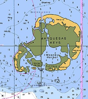
| Marquesas Keys Nautical Map | ||
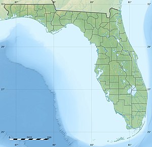
The Marquesas Keys are an uninhabited group of islands belonging to Florida in the Gulf of Mexico . The archipelago belongs to the Florida Keys and is located at the western end about 30 km west of Key West . They are separated from the other Keys by the Boca Grande Channel . Only the Dry Tortugas are isolated further west. Administratively, the Marquesas Keys represent an "unincorporated area" of Monroe County .
The Marquesas Keys consist of ten islands with a land area of 6.58 km² and inland lakes of 0.17 km². The central lagoon , called Mooney Harbor , has an area of 29.37 km². The islands are densely overgrown with mangroves .
The archipelago served as a military training target until the 1980s, but is now a protected area as part of the Key West National Wildlife Refuge . It is also a popular destination for divers and sport fishermen.
Web links
Individual evidence
- ↑ Marquesas Keys: Blocks 3042 and 3043, Census Tract 9725, Monroe County, Florida United States Census Bureau (Engl.)


