Meganisi
|
Meganisi municipality Δήμος Μεγανησίου (Μεγανήσι) |
||
|---|---|---|
|
|
||
| Basic data | ||
| State : |
|
|
| Region : | Ionian islands | |
| Regional District : | Lefkada | |
| Geographic coordinates : | 38 ° 40 ′ N , 20 ° 47 ′ E | |
| Area : | 22.356 km² | |
| Residents : | 1,041 (2011) | |
| Population density : | 46.6 inhabitants / km² | |
| Seat: | Katomeri | |
| LAU-1 code no .: | 3602 | |
| Districts : | 1 municipality | |
| Local self-government : | 3 local communities | |
| Website: | www.meganisi.gr | |
| Location in the Ionian Islands region | ||
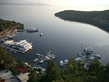
Meganisi ( Greek Μεγανήσι ( n. Sg. ) 'Big island') is a Greek island in the Ionian Sea , which belongs to the Tilevoides archipelago and with them to the Ionian Islands . At the same time, together with Skorpios and some uninhabited islets, it forms an independent municipality ( Greek δήμος , Dimos ) within the Lefkada regional district of the Ionian Islands .
geography
The 20.1 km² large island of Meganisi is separated from the much larger neighboring island of Lefkada in the west by a strait that is only 800 meters wide . The distance to mainland Greece in the east is about 9 kilometers.
Meganisi has an irregular shape, roughly reminiscent of a "C". It consists of a main part in the north and a long headland stretching about 6.5 km to the south-east and only a few hundred meters narrow. The length is eleven kilometers, the maximum width in the north (in west-east direction) six kilometers. The forested island is rather hilly and reaches a height of 297 m in the west south of Spartochori with the mountain range ( Μέγας Μπίρνος Mégas Bírnos ). The two ports of Vathy and Spartochori as well as the main town Katomeri in the interior of the island are located in the north of the island.
Name and location of the individual islands
The municipality of Meganisi includes the surrounding islands of Kythros and Petalou in the south, Skorpios , Skorpidi , Tsokari and Sparti, and Thilia in the west .
| Surname | Greek name | Archipelago | height | location |
|---|---|---|---|---|
| Sparti | Σπάρτη ( f. Sg. ) |
Tilevoides : Pringiponisia |
55 m | 38 ° 42 ′ 50 " N , 20 ° 44 ′ 29" E |
| Tsokari | Τσοκάρη ( f. Sg. ) |
Tilevoides : Pringiponisia |
38 ° 41 ′ 35 " N , 20 ° 44 ′ 9" E | |
| Scorpidi | Σκορπίδι ( n. Sg. ) |
Tilevoides : Pringiponisia |
38 ° 42 ′ 2 " N , 20 ° 44 ′ 38" E | |
| Scorpios | Σκορπιός ( n. Sg. ) |
Tilevoides : Pringiponisia |
81 m | 38 ° 41 ′ 31 " N , 20 ° 44 ′ 40" E |
| Thilia | Θηλιά ( f. Sg. ) | Tilevoides | 35 m | 38 ° 39 '27 " N , 20 ° 43' 59" E |
| Meganisi | Μεγανήσι ( n. Sg. ) | Tilevoides | 297 m | 38 ° 38 ′ 35 " N , 20 ° 45 ′ 12" E |
| Alafonisi | Αλαφονήσι ( n. Sg. ) | Tilevoides | 38 ° 40 ′ 30 " N , 20 ° 48 ′ 8" E | |
| Petalou | Πεταλού ( n. Sg. ) | Tilevoides | 38 ° 35 ′ 33 " N , 20 ° 46 ′ 13" E | |
| Kythros | Κυθρός ( m. Sg. ) | Tilevoides | 106 m | 38 ° 36 '7 " N , 20 ° 47' 55" E |
Administrative division
The municipality Meganisi was formed in 1990 from the union of the three rural municipalities Katomeri, Spartochori and Vathy, the administrative seat is Katomeri.
| Local community (Τοπική Κοινότητα) | Greek name | code | Area (km²) | Residents 1991 | 2001 residents | Residents 2011 | Villages and settlements |
|---|---|---|---|---|---|---|---|
| Katomeri | Τοπική Κοινότητα Κατωμερίου | 36020001 | 8,429 | 523 | 492 | 455 | Katomeri |
| Vathy | Τοπική Κοινότητα Βαθέως | 36020002 | 1.425 | 211 | 145 | 203 | Vathy |
| Spartochori | Τοπική Κοινότητα Σπαρτοχωρίου | 36020003 | 12.502 | 512 | 455 | 383 | Spartochori, Skorpios , Sparti |
| total | 3602 | 22.356 | 1246 | 1092 | 1041 | ||
Economy and Transport
Agriculture plays an increasingly minor role on Meganisi. There are olive groves, fruit and vegetable cultivation and cattle breeding. Fishing is also steadily declining due to overfishing in the surrounding waters. Tourism, on the other hand, is becoming increasingly important.
The nearest airport is in Preveza on the mainland. The two ports are usually approached several times a day by ferries from Nydri on Lefkada. There are bus connections between the island towns and the main beaches.
Individual evidence
- ↑ Results of the 2011 census. ( Memento from June 27, 2015 in the Internet Archive ) ( MS Excel ; 2.6 MB) Greek Statistical Office (ΕΛ.ΣΤΑΤ)
- ↑ Ελληνική Στατιστική Αρχή [ΕΛΣΤΑΤ] (Ed.): Στατιστική Επετηρίδα της Ελλάδος (Statistical Yearbook of Greece) 2009 & 2010 . Piraeus 2011, p. 47 .
- ↑ Greek Law Gazette of April 2nd, 1990 (ΦΕΚ A48 / April 2nd, 1990), p. 502. PDF Online (Greek)


