Mionne
|
Mionne Mionnaz / Mionna |
||
|
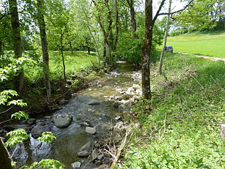
The Mionne at Moulin de Villard in the municipality of Saint-Martin |
||
| Data | ||
| Water code | CH : 3171 | |
| location | Canton of Friborg , Canton of Vaud ; Switzerland | |
| River system | Rhine | |
| Drain over | Broye → Zihl Canal → Aare → Rhine → North Sea | |
| Headwaters | in the Haute-Veveyse near La Verrerie near the edge of the Alps 46 ° 36 ′ 31 ″ N , 6 ° 55 ′ 10 ″ E |
|
| Source height | 887 m above sea level M. | |
| muzzle | south of Oron-la-Ville in the Broye coordinates: 46 ° 33 ′ 19 " N , 6 ° 49 ′ 20" E ; CH1903: 552738 / 156 189 46 ° 33 '19 " N , 6 ° 49' 20" O |
|
| Mouth height | 617 m above sea level M. | |
| Height difference | 270 m | |
| Bottom slope | 21 ‰ | |
| length | 12.7 km | |
| Catchment area | 18.2 km² | |
| Discharge A Eo : 18.2 km² at the mouth |
MQ Mq |
410 l / s 22.5 l / (s km²) |
The Mionne , also called Mionna and Mionnaz in the local dialect of the Patois , is an approximately 13 km long right tributary of the Broye in the Swiss cantons of Friborg and Vaud . It drains a section of the higher plateau and belongs to the catchment area of the Rhine . The brook was first mentioned in 1344 as Miona ; from 1521 the name Myonaz has been handed down.
geography
course
The headwaters of the Mionne are located at about 890 m above sea level. M. in the Haute-Veveyse in the municipality of La Verrerie in the canton of Friborg, near the edge of the Alps. The Mionne flows to the southwest and at Grattavache takes on the La Vaux side stream from the right , which rises in the La Mosse d'en Bas nature reserve near Le Crêt . In a wide valley basin, the Mionne runs with only a very slight gradient in small meanders further to the southwest through the molasse heights in the Alpine foothills.
Below the village of Saint-Martin , the stream crosses into the canton of Vaud. Here the Mionne deepens into the surroundings with a notch valley and overcomes a height difference of almost 100 m on a 2 km route in the area of the Bois de l'Erberey on the eastern edge of the Haute-Broye. At Palézieux it reaches the wide valley of the upper Broye and flows south of Oron-la-Ville at 620 m above sea level. M. in the Broye.
Catchment area
The catchment area of the Mionne is 18.2 km² and consists of 17.1% wooded area , 82.6% agricultural area and 0.3% settlement area .

Tributaries
- Ruisseau de Lavau ( right )
- Ruisseau du Chevillard ( right )
- Ruisseau de la Saubetta ( right )
- Ruisseau de la Sauba ( right )
- Ruisseau de l'Enfer ( right )
character
The course of the Mionne creek is largely preserved in its natural or near-natural state. Even in the open valley sections, it is usually accompanied by a narrow forest border. The Mionne is characterized by a pluvial runoff regime . Their hydropower was previously used in various places for the operation of mills (Moulin de Villard near Saint-Martin) and sawmills.
Web links
Individual evidence
- ↑ a b c d Geoserver of the Swiss Federal Administration ( information )
- ↑ a b Modeled mean annual discharge. In: Topographical catchment areas of Swiss waters: area outlets. Retrieved October 29, 2015 .
