Mita line
| Mita line | |
|---|---|
| Route length: | 26.5 km |
| Gauge : | 1067 mm ( cape track ) |
| Power system : | 1500 = |
| Top speed: | 75 km / h |
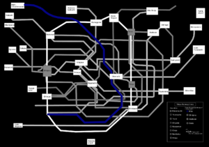
The Mita Line ( Japanese 三 田 線 , Mita-sen ) is a metro line in Tokyo , Japan that opened on December 27, 1968 and is managed by the Toei Subway . It appears in blue on cards ![]() ; the stations have the letter I followed by a number. In planning, the line has the number 6.
; the stations have the letter I followed by a number. In planning, the line has the number 6.
The Mita Line trains run together with the Tōkyū Meguro Line from Meguro .
Data
- Length: 26.5 km
- Track width: 1067 mm
- Number of stations: 27
- Passenger number (2014): 600,570
Train stations
| No. | railway station | Japanese | Transfer options | Borough |
|---|---|---|---|---|
| I-01 | Meguro | 目 黒 | JR East : Yamanote Line , Tokyo Metro : Namboku Line (N-01), Tōkyū Meguro Line | Shinagawa |
| I-02 | Shirokanedai | 白金 台 | Tokyo Metro: Namboku Line (N-02) | Minato |
| I-03 | Shirokane-Takanawa | 白金 高 輪 | Tokyo Metro: Namboku Line (N-03) | |
| I-04 | Mita | 三 田 | Toei : Asakusa Line (A-08) | |
| I-05 | Shibakōen | 芝 公園 | ||
| I-06 | Onarimon | 御 成 門 | ||
| I-07 | Uchisaiwaichō | 内 幸 町 | Chiyoda | |
| I-08 | Hibiya | 日 比 谷 | Tōkyō Metro: Chiyoda Line (C-09), Hibiya Line (H-07) | |
| I-09 | Ōtemachi | 大 手 町 | Tōkyō Metro: Chiyoda Line (C-11), Marunouchi Line (M-18), Tōzai Line (T-09), Hanzōmon Line (Z-08) | |
| I-10 | Jimbocho | 神 保 町 | Tōkyō Metro: Hanzōmon Line (Z-07), Toei: Shinjuku Line (S-06) | |
| I-11 | Suidōbashi | 水 道橋 | JR East: Chūō-Sōbu Line | Bunkyō |
| I-12 | Kasuga | 春日 | Tōkyō Metro: Marunouchi Line (M-22), Namboku Line (N-11), Toei: Ōedo Line (E-07) | |
| I-13 | Hakusan | 白山 | ||
| I-14 | Sengoku | 千石 | ||
| I-15 | Sugamo | 巣 鴨 | JR East: Yamanote Line | Toshima |
| I-16 | Nishi-Sugamo | 西 巣 鴨 | ||
| I-17 | Shin-Itabashi | 新 板橋 | Itabashi | |
| I-18 | Itabashi-Kuyakushōmae | 板橋 区 役 所 前 | ||
| I-19 | Itabashihonchō | 板橋 本 町 | ||
| I-20 | Motohasunuma | 本 蓮 沼 | ||
| I-21 | Shimurasakaue | 志 村 坂 上 | ||
| I-22 | Shimura3chome | 志 村 三 丁目 | ||
| I-23 | Hasune | 蓮 根 | ||
| I-24 | Nishidai | 西 台 | ||
| I-25 | Takashimadaira | 高 島 平 | ||
| I-26 | Shin-Takashimadaira | 新 高 島 平 | ||
| I-27 | Nishi-Takashimadaira | 西 高 島 平 |
Web links
Commons : Toei Mita Line - collection of images, videos and audio files
Individual evidence
- ↑ 都 営 地下 鉄 . Bureau of Transportation. Tokyo Metropolitan Government, accessed December 11, 2016 (Japanese).
- ↑ 都 営 三 田 線 (西 高 島 平 ~ 目 黒) 駅 名 一 覧 . (No longer available online.) Gurunavi Inc, April 1, 2016, archived from the original on December 11, 2016 ; Retrieved December 11, 2016 (Japanese). Info: The archive link was inserted automatically and has not yet been checked. Please check the original and archive link according to the instructions and then remove this notice.
