Mitzpe Ramon
| Mitzpe Ramon | ||
|---|---|---|

|
||
| Basic data | ||
| hebrew : | מצפה רמון | |
| State : |
|
|
| District : | south | |
| Founded : | 1951 | |
| Coordinates : | 30 ° 37 ' N , 34 ° 48' E | |
| Height : | 714 m | |
| Area : | 62.875 km² | |
| Residents : | 5221 (as of 2018) | |
| Population density : | 83 inhabitants per km² | |
| Community code : | 0099 | |
| Time zone : | UTC + 2 | |
| Postal code : | 80600 | |
| Website : | ||
|
|
||

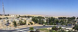
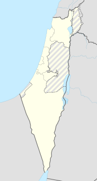
Mitzpe Ramon (also Mizpe Ramon , Hebrew מצפה רמון) is a small Israeli town in the central Negev desert, about 80 kilometers south of Beer Sheva .
History and today's city
Like many other Israeli development cities, Mitzpe Ramon emerged after the establishment of the Israeli state. First a camp for the construction workers on the road to Eilat was set up in 1953 , later the city emerged from it. It was planned as an urban center in the central Negev and, among other things, should serve the purpose of extracting natural resources in the area. Before the construction of the trunk road through the Arava Valley in 1966, the only road to Eilat at that time led through Mitzpe Ramon and contributed to the growth of the settlement; in the meantime, however, this road is only of secondary importance.
Due to its remoteness, the place could not develop into an important central place. For a long time the population stagnated between 4,000 and 5,000. At the end of 2005 it was around 4,500, at the end of 2006 around 4,300. Only in the 2010s did the population gradually increase. Mitzpe Ramon had 5221 inhabitants in 2018.
Due to its location in the desert, Mitzpe Ramon has a dry, but also comparatively cool climate due to the altitude of just under 900 m . Rain rarely falls, so the natural vegetation is so sparse that it is no longer even sufficient for extensive grazing of the area by nomads .
economy
An important economic factor (besides industry) is the Israeli army , which operates a number of military facilities in Mitzpe Ramon. Tourism also has a certain importance : the city is located on the edge of the Makesh Ramon , the largest erosion crater in the Negev. Mitzpe Ramon has an information center about the crater and viewpoints, and the town is also the starting point for excursions into the crater. Mitzpe Ramon is part and access point of the Israel National Trail , Israel's longest long-distance hiking trail. A little north of the city are the Nabataean ruined city of Avdat and the kibbutz Sede Boker , where the Israeli state founder David Ben-Gurion had a house.
Web links
Individual evidence
- ↑ אוכלוסייה ביישובים 2018 (population of the settlements 2018). (XLSX; 0.13 MB) Israel Central Bureau of Statistics , August 25, 2019, accessed May 11, 2020 .
- ↑ אוכלוסייה ביישובים 2018 (population of the settlements 2018). (XLSX; 0.13 MB) Israel Central Bureau of Statistics , August 25, 2019, accessed May 11, 2020 .
- ^ Christian Seebauer: Israel Trail with a Heart. SCM Hänssler Verlag, 2016, ISBN 978-3-7751-5706-3
