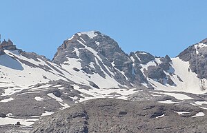
Monte Casale (Fanes Group)
| Monte Casale | ||
|---|---|---|
|
Monte Casale |
||
| height | 2898 m slm | |
| location | South of the Fanes | |
| Mountains | Fanes Group ( Dolomites ) | |
| Dominance | 0.23 km → Monte Cavallo | |
| Notch height | 40 m ↓ Forcella Casale | |
| Coordinates | 46 ° 33 '50 " N , 12 ° 1' 40" E | |
|
|
||
The Monte Casale is a 2898 m slm high mountain in the Fanes group on the border between the province of South Tyrol and the province of Belluno . It is the middle summit of the group of three Monte Castello - Monte Casale - Monte Cavallo . The South Tyrolean parts of the mountain are part of the Fanes-Sennes-Braies Nature Park .
rise
From the Lavarelahütte or the Faneshütte, head south over the Limojoch past the Limosee to reach the Große Fanesalm . Further south on path no.17, which is also part of the Dolomites high path no.1 , the path continues between the Furcia Rossa peaks on the left and the Cime Ciampestrin on the right through the Valun Blanch to the Friedensbivak ( 2760 m slm ) , which was built directly under the protection of the steep rock walls of Monte Castello . From here we continue, past the former trenches, along the ridge to the summit.
Alternatively, the summit can also be reached from the south via the Val Travenanzes on the southeast side of which the Tofana massif rises . First through the valley you reach path no. 17 which leads up to the Casalescharte ( Forcella Casale or Forcella de Cians ). From here you can reach the summit after a short ascent.
Literature and maps
- Compass hiking maps (1: 50,000), sheet 57, ISBN 978-3-85026-675-8 .


