Monte Confinale
| Monte Confinale | ||
|---|---|---|
|
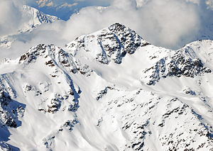
Monte Confinale seen from the Königspitze. Left Cima della Manzina |
||
| height | 3370 m slm | |
| location | Sondrio Province , Italy | |
| Mountains | Ortler Alps | |
| Coordinates | 46 ° 26 '59 " N , 10 ° 30' 40" E | |
|
|
||
| First ascent | July 30, 1864 by Francis Fox Tuckett and Edward N. Buxton, led by Christian Michel and Franz Biner | |
| Normal way | Southeast ridge from Val dei Forni from | |
|
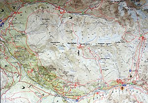
Map of the confinale ridge |
||
The Monte Confinale is a 3370 meter high mountain in the Confinalekamm , a mountain range in the Ortler Alps , a mountain range in the southern central Alps , which branches off to the southwest from the Ortler main ridge . It is located in the Italian province of Sondrio . The mountain sends out pronounced ridges to the north, east, south-east and south-west. The ridge runs here, at its highest and most westerly elevation, in an east-west direction. Although Monte Confinale is easy to climb and offers a good view of the central Ortler Alps, it is not often climbed. It is a worthwhile destination for ski tourers in late winter. According to unclear sources, it was first climbed in the early 1860s by a German tourist with the guide Janiger from Martell . The first precisely documented ascent then took place on July 30, 1864 by the English alpinists Francis Fox Tuckett and Edward N. Buxton with the Swiss mountain guides Christian Michel from Grindelwald and Franz Biner from Zermatt .
Surroundings
Two glaciers meet at Monte Confinale, the Vedretta del Fora in the northwest and the Vedretta del Confinale in the southwest . Adjacent mountains in the course of the Confinalekamm are the one kilometer away Cima della Manzina with an altitude of 3318 meters and in the further course the three Cime dei Forni ( Cima del Forno Occidentale , 3227 m, -Central , 3240 m and -Orientale with 3247 m) . To the north the terrain slopes down into the Val Zebrù , to the west into the Valle del Confinale , a side valley of the upper Valtellina , and to the south into the Val Furva and Valle dei Forni . The next significant settlement is the winter sports resort of Santa Caterina Valfurva, about four kilometers south as the crow flies . Like the surrounding area, the mountain is part of the Stilfserjoch National Park .
Base and ascent
The way of the English and their leaders in 1864 led from Santa Caterina in the south in a northerly direction through the Val del Pasquale up to the snowfields below the Confinale southeast ridge . After an ascent time of four and three quarters of an hour, they reached the summit via this ridge, on which one then spent three hours.
Today's normal route , the easiest ascent, leads from the Rifugio Stella Alpina inn at an altitude of 2061 meters on the road in Val dei Forni , a good four kilometers east of Santa Caterina, in a northerly direction through the Valle della Manzina up to the Lago della Manzina at an altitude of 2929 meters. Then the route continues over firn fields to a saddle between the Monte Confinale and the Cima della Manzina and then over the partially rocky, firn-covered southeast ridge to the summit. According to the literature, the walking time is around 4 to 5 hours. Climbing is also possible over the other ridges of Monte Confinale. The north ridge , which was first climbed in 1913 by Aldo Bonacossa and Carl Prochownik , is one kilometer long and inclines up to 30 ° in the short firn sections .
Literature and map
- Peter Holl: Alpenvereinsführer Ortleralpen , 9th edition, Munich 2003, ISBN 3-7633-1313-3
- The Alpine Journal, Volume II , London 1864
- Communications of the OeAV , Volume III, Vienna 1865
- Eduard Richter (editor): The development of the Eastern Alps, Volume II , publishing house of the German and Austrian Alpine Association, Berlin, 1894
- Casa Editrice Tabacco , Tavagnacco: Carta topografica 1: 25,000, sheet 08, Ortles-Cevedale / Ortler area


