Mota (Vanuatu)
| Mota | ||
|---|---|---|
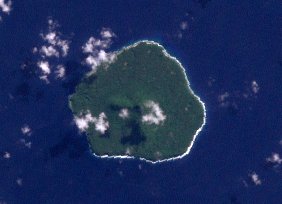
| Satellite image of the island | ||
| Waters | Coral sea | |
| Archipelago | Banks Islands | |
| Geographical location | 13 ° 50 '40 " S , 167 ° 41' 25" O | |
|
|
||
| length | 5 km | |
| width | 4.5 km | |
| surface | 9.5 km² | |
| Highest elevation | Mount Tawe 411 m |
|
| Residents | 683 (2009) 72 inhabitants / km² |
|
| main place | Veverao | |
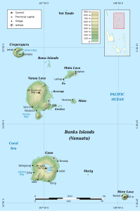
| Map of the Banks Islands with Mota in the middle | ||
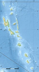
Mota , formerly Sugarloaf Island , is a volcanic island in the center of the Banks Islands in the north of the Pacific island state of Vanuatu . Administratively, the island, like all the Banks Islands, belongs to the province of Torba .
geography
Mota is 18 km south of Mota Lava and 12 km east of Vanua Lava , the largest island in the archipelago . The slightly oval island has a length of 5 km and an area of 9.5 km². It is formed by an extinct, basaltic volcano , which in Mount Tawe reaches a height of 411 m above sea level. The island is surrounded by a fringing reef and its steep coast makes it difficult to land by boat.
Mota has 683 inhabitants; The main town is Veverao on the northwest coast of the island. The population speaks Mota , a Melanesian language from the Oceanic language group that is only spoken on this island.
Individual evidence
- ↑ a b UNEP Islands Directory (English)
- ^ National Geospatial-Intelligence Agency: Sailing Directions (enroute), Pub. 126, Pacific Ocean (English; PDF; 5.1 MB) (accessed December 23, 2010)
- ↑ National Census of Population and Housing 2009 (English; PDF) (accessed December 23, 2010)
- ↑ Linguistic Map of the Banks Islands (accessed December 23, 2010)


