Mount Timpanogos
| Mount Timpanogos | ||
|---|---|---|
|
Mount Timpanogos from the Utah Valley |
||
| height | 3582 m | |
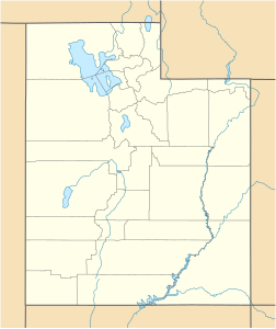
| location | Utah , USA | |
| Mountains | Wasatch chain | |
| Notch height | 1606 m | |
| Coordinates | 40 ° 23 '27 " N , 111 ° 38' 45" W | |
|
|
||
| rock | Limestone and dolomite | |
| Age of the rock | approx. 300 million years | |
| First ascent | Unknown | |
The Mount Timpanogos is 3582 meters above sea level is the second highest mountain of the Wasatch Range of Utah . It is located in the Uinta National Forest, which is now part of the Wasatch-Cache National Forest. In the north flank of the mountain is a stalactite cave system , which is designated as Timpanogos Cave National Monument .
The mountain looms over the Utah Valley , including Provo , Orem , Pleasant Grove , American Fork , Lindon, and others. The protruding part of the approx. 300 million year old mountain consists entirely of limestone and dolomite from the Pennsylvanian period. Avalanches and heavy snowfall in autumn and winter are characteristic of this region of the Wasatch range.
The word Timpanogos comes from the Ute Indians , who have lived in the surrounding valleys since 1400 AD. The name means stone (tumpi) and water mouth or canyon (panogos).
Mountain hike
Mount Timpanogos is one of Utah's most popular mountain hiking destinations and is visited year round. In winter, however, advanced knowledge of alpinism is required. Snow undercutting in spring often presents dangerous conditions. Although the mountain tour there and back takes around 23 km (around 8 hours) and an ascent of around 1500 m, Timpanogos is one of the most visited peaks in the Rocky Mountains . There are two main hiking trails that lead to the top: One starts from the 2106 m high car park in Aspen Grove ; the other way starts from the Timpooneke campsite (2185 m) in the American Fork Canyon . Both variants are approximately the same length and run through montane, subalpine and alpine vegetation levels. Characteristic for the paths are waterfalls, pines, slopes and ridges as well as mountain goats and a small lake, the Emerald Lake at 3164 m. A short detour leads the hiker past an aviator memorial. There are other routes, but these require appropriate knowledge of alpinism.
The Timpanogos Cave National Monument can be reached via a dead-end road from the American Fork Canyon. The sanctuary administration offers guided excursions into the caves.
Web links
- Mount Timpanogos on Peakbagger.com (English)
Individual evidence
- ↑ FAQ Database. nps.gov, accessed June 28, 2009 .
- ↑ Mount Timpanogos Wilderness Uinta-Wasatch-Cache National Forest, Utah Database. sangres.com, accessed June 28, 2009 .

