Utah Valley
| Utah Valley | ||
|---|---|---|
|
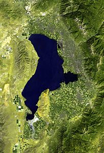
Satellite image of the Utah Valley, 2006 |
||
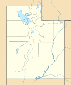
| location | Utah (USA) | |
| Waters | Utah Lake | |
| Mountains | Wasatch Mountains | |
| Geographical location | 40 ° 13 '57 " N , 111 ° 45' 29" W | |
|
|
||
| height | 1378 to 1579 m | |
The Utah Valley is a region in Utah County in the US state of Utah around Utah Lake . The valley with around 5200 km² at an altitude between 1378 and 1579 m lies west of the Wasatch Mountains and is one of the outermost valleys of the geological Basin and Range province, immediately below the Rocky Mountains . In the south and west, the valley is delimited by clumps that belong to the Horst-und-Graben structure of the Basin and Range region; in the north, the Traverse Mountains (also known as the Traverse Range ) protrude from the Wasatch range to the west and border so the Utah Valley from the adjoining Salt Lake Valley to the north .
Utah Lake is in the Utah Valley. It drains over the Jordan River through the breakthrough valley Jordan Narrows between the Traverse Range and the western eyrie into the Salt Lake Valley and the Great Salt Lake . This has no drain, which makes the Utah Valley part of the Great Basin . Like the entire Basin and Range province, the valley was only formed around six million years ago through expansion fractures in the earth's crust , which created the parallel eyrie and ditch structures. At the end of the last ice age, the Utah Valley was part of prehistoric Lake Bonneville , which peaked around 16,000 years ago and reached Provo around 14,000 years ago after the catastrophic Bonneville Flood . All of today's lakes in the eastern Great Basin, including Utah Lake, are remnants of that lake.
history
Originally, the Utah Valley was the home of the eponymous Ute Indians. The Dominguez Escalante expedition of two Franciscan fathers brought the first whites into the valley in 1775/76. The Rocky Mountain Fur Company's fur hunters and traders became the first white men to stay in the area in the 1820s. Mormon pioneers arrived as settlers in 1850, working to develop the valley for agriculture on behalf of the Church of Jesus Christ of Latter-day Saints (Mormons). Because of the water supply, they settled almost exclusively on the eastern shore of the lake. In the vicinity of the bank they mainly planted orchards, the higher parts were used for growing grain, partly with and partly without irrigation. In the north of the valley there was also large-scale cultivation of sugar beet.
The Provo Canyon of the Provo River was very suitable for generating hydropower , so that as early as 1898 a hydropower plant was built to supply mines in Mercur in the mountains west of the lake. Due to increasing consumption, it was supplemented in 1904 by a second, much larger power plant further below on the Provo River.
There was no industry until the Second World War. After the United States entered the war in 1942/43, a steelworks was built on the lakeshore north of Orem, which used the coal and ore deposits in the region. It was temporarily closed in the 1980s and closed completely in 2001, and its systems were sold to China in 2004 and transported away.
Utah Valley today
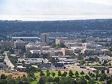
The east shore of Utah Lake is now a continuous agglomeration of settlements. The largest is Provo , named after the fur hunter Etienne Provost . Other notable towns are Orem , Pleasant Grove and American Fork . Together they form the Provo Orem- metropolitan region ( Provo-Orem metropolitan area ). Utah valley lie with the Brigham Young University in Provo and Utah Valley University in Orem, the two largest universities in Utah. The Eyring Research Institute , founded in Provo in 1972, was important for the region's development into a high-tech location. In cooperation with the universities, the institute promoted the development of communication and production technology. From it Novell and the Word Perfect Corporation emerged.
Agriculture only takes place in the south of the valley. The orchards and fields in the corridor between Provo and Lehi have been turned into suburbs.
Individual evidence
- ↑ a b Utah Valley in the Geographic Names Information System of the United States Geological Survey
- ^ Jordan Narrows in the United States Geological Survey's Geographic Names Information System
- ↑ The story is largely based on Roger Roper: Utah County . In: Utah Historical Encyclopedia
- ↑ Sagebrush Archeology, Inc: Olmstead Hydroelectric Plant (PDF; 45 kB). On: WaterHistory.org
- ^ Dave Anderton: Judge approves sale of Geneva Steel land . In: Deseret Morning News , November 23, 2005


