Utah County
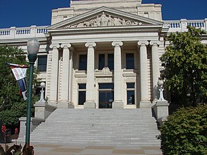
 Utah County Courthouse |
|
| administration | |
|---|---|
| US state : | Utah |
| Administrative headquarters : | Provo |
| Foundation : | 1852 |
| Demographics | |
| Residents : | 516,564 (2010) |
| Population density : | 99.8 inhabitants / km 2 |
| geography | |
| Total area : | 5545 km² |
| Water surface : | 369 km² |
| map | |
| Website : www.co.utah.ut.us | |
Utah County is a county in the state of Utah in the United States . The county seat and largest city is Provo .
geography
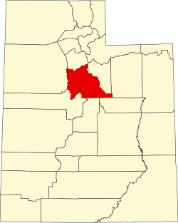
Utah County lies in the transition of the Rocky Mountains in the east to the geological province of the Basin and Range in the west and has an area of 5545 square kilometers (2145 mi²), of which only 369 square kilometers of Uth Lake are the proportion of water. It is bordered by counties in a clockwise direction: Wasatch County , Carbon County , Duchesne County , Sanpete County , Juab County , Tooele County, and Salt Lake County . The average height in the County is 1,310 m to 1,432 m . The area of the county is largely identical to the Utah Valley , the valley of the Utah Lakes below the Wasatch Mountains , on whose main ridge the eastern border of the county runs. However, the county continues in the southeast into the mountains and includes in particular the valley of Soldier Creek , which is almost unpopulated, but is a major traffic route with US Highway 6 . In the south, the county boundary is initially straight and in the south-west takes up the hilly structures of the clumps that characterize the basin-and-range region of the Great Basin . In the west the border also runs on the eyrie, in the north the Oquirrh Mountains and the foothills of the Wasatch range , known as the Traverse Range , border the valley and valley. Not only all traffic routes run between them in a north-south direction, but also the Jordan River , which is the outflow from Utah Lake into the Salt Lake Valley and the Great Salt Lake .
history
Utah County was founded in 1852. It was named after the Spanish name Yuta for the Ute Indians .
Demographic data
| Population development | |||
|---|---|---|---|
| Census | Residents | ± in% | |
| 1850 | 2026 | - | |
| 1860 | 8248 | 307.1% | |
| 1870 | 12.203 | 48% | |
| 1880 | 17,973 | 47.3% | |
| 1890 | 23,768 | 32.2% | |
| 1900 | 32,456 | 36.6% | |
| 1910 | 37,942 | 16.9% | |
| 1920 | 40,792 | 7.5% | |
| 1930 | 49.021 | 20.2% | |
| 1940 | 57,382 | 17.1% | |
| 1950 | 81,912 | 42.7% | |
| 1960 | 106.991 | 30.6% | |
| 1970 | 137,776 | 28.8% | |
| 1980 | 218.106 | 58.3% | |
| 1990 | 263,590 | 20.9% | |
| 2000 | 368,540 | 39.8% | |
| 2010 | 516,564 | 40.2% | |
| Before 1900
1900-1990 2000 |
|||

After the census in 2000 three hundred sixty-eight thousand five hundred thirty-six people lived in Utah County. There were 99,937 households and 80,749 families. The population density was 71 people per square kilometer. The racial the population was composed of 92.36% White, 0.30% African American, 0.60% Native American, 1.06% Asian, 0.58% Pacific Islander, and 3.25% other races Groups; 1.85% were from two or more races. Hispanic or Latino of any race was 7.00% of the population.
Of the 99,937 households, 48.30% had children and young people under the age of 18 living with them. 69.80% were married couples living together, 8.00% were a single mother. 19.20% were not families. 11.20% are single households and 4.70% have someone who is 65 years of age or older. The average household size was 3.59 and the average family size was 3.86 people.
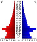
For the entire county, the population was composed of 34.10% residents under the age of 18, 21.00% between 18 and 24 years old, 25.90% between 25 and 44 years old, 12.70% between 45 and 64 years old 6.40% were 65 years of age or over. The median age was 23 years. For every 100 females there were 98.30 males, and for every 100 females aged 18 and over there were 94.50 males.
The median income for a household in the 45,833 USD , and the median income for a family was 50,196 USD. Males had a median income of $ 37,878 versus $ 22,656 for females. The per capita income was $ 15,557. 12.00% of the population and 6.80% of families are below the poverty line. 8.40% of them were under 18 years of age and 4.80% were 65 years of age or older.
cities and communes
- Alpine
- American fork
- Aspen Grove
- Benjamin
- Birdseye
- bunker
- Canyon Glen
- Caryhurst
- Castilla
- Cedar Fort
- Cedar Hills
- Christmas City
- Colton
- Curtis
- dividend
- Draper
- Eagle Mountain
- Edgemont
- Elk Ridge
- Fairfield
- Geneva
- Genola
- Gilluly
- Gomex
- Goshen
- Hardy
- Highland
- Homansville
- Ironton
- Keigley
- Kyune
- Lake Shore
- Lakeview
- Lant
- Lehi
- Leland
- Lewis
- Lincoln
- Lindon
- Mapleton
- Mill fork
- Moark Junction
- Mosida
- Mutual Dell
- Well
- Olmstead
- Orem
- Orem station
- Palmyra
- Payson
- Pines
- Pleasant Grove
- Pleasant view
- Provo
- Rio
- Salem
- Santaquin
- Saratoga Springs
- Sky view
- Snow
- Spanish fork
- Spring Lake
- Springdell
- Springville
- Sun Dance
- Sutro
- Thistle
- Three forks
- Townsend
- Tucker
- Vineyard
- Vivian Park
- West Mountain
- West portal
- Wicks
- Wildwood
- Wing
- Woodland Hills
Individual evidence
- ^ Utah County in the Geographic Names Information System of the United States Geological Survey . Retrieved February 22, 2011
- ^ US Census Bureau _ Census of Population and Housing . Retrieved February 28, 2011
- ↑ Extract from Census.gov . Retrieved February 28, 2011
- ↑ Excerpt from factfinder.census.gov.Retrieved February 28, 2011
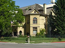
- ^ Extract from the National Register of Historic Places . Retrieved March 13, 2011
Web links
- Virtual tour of Utah County (English)
Coordinates: 40 ° 7 ′ N , 111 ° 40 ′ W


