Mouswald
| Mouswald | ||
|---|---|---|
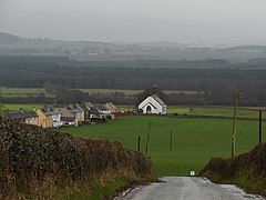
| View over Mouswald | ||
| Coordinates | 55 ° 2 ′ N , 3 ° 28 ′ W | |
|
|
||
| administration | ||
| Post town | DUMFRIES | |
| ZIP code section | DG1 | |
| prefix | 01387 | |
| Part of the country | Scotland | |
| Council area | Dumfries and Galloway | |
| British Parliament | Dumfriesshire, Clydesdale and Tweeddale | |
| Scottish Parliament | Dumfriesshire | |
Mouswald is a town in the Scottish Council Area Dumfries and Galloway . It is located about ten kilometers southeast of central Dumfries and twelve kilometers northwest of Annan in the Nithsdale region in the traditional county of Dumfriesshire . The Mouswald Burn , a headwaters of Lochar Water , borders Mouswald in the south.
The name of the village is derived from Mosswald , which means "forest on the moor". It points to the location of the village in a formerly wooded region a short distance northeast of the Lochar Moss moor .
history
Mouswald already had a school in the 18th century. In the 1880s it offered space for 135 students. It continued as a primary school until July 2016 and was then closed. A tower windmill also dates from the 18th century and is now a listed building both as a Category B building and as a Scheduled Monument . It was used to grind oats.
Mouswald Parish Church was opened in Mouswald around 1816 . In 1929 the building was extensively redesigned. Just like the associated rectory built in 1830, the church is now a listed building. From a former church building of the Free Church of Scotland the listed rectory still exists. The clergyman Henry Duncan , who opened Scotland's first savings bank in the neighboring parish of Ruthwell in 1810 (see Ruthwell Museum ), was given the Henry Duncan Monument in Mouswald around 1846.
In the course of the 1961 census survey, 51 inhabitants were counted in the small village of Mouswald.
traffic
While the B724 touches Mouswald in the west, an approximately one kilometer long road connects the town in the east to the nationally important trunk road A75 ( Stranraer - Gretna Green ). With the stations of Racks and Ruthwell , the Glasgow and South Western Railway opened two stations within a few kilometers of Mouswald in the middle of the 19th century. Both have since been abandoned.
Individual evidence
- ↑ a b Entry in the Gazetteer for Scotland
- ^ A b c Mouswald in: FH Groome: Ordnance Gazetteer of Scotland: A Survey of Scottish Topography, Statistical, Biographical and Historical , Grange Publishing, Edinburgh, 1885.
- ^ Information from the Council of Dumfries and Galloway ( Memento of March 26, 2016 in the Internet Archive )
- ↑ Mouswald Primary earmarked for closure in July
- ↑ Listed Building - Entry . In: Historic Scotland .
- ↑ Scheduled Monument - Entry . In: Historic Scotland .
- ↑ Listed Building - Entry . In: Historic Scotland .
- ↑ Listed Building - Entry . In: Historic Scotland .
- ↑ Listed Building - Entry . In: Historic Scotland .
- ↑ Listed Building - Entry . In: Historic Scotland .
- ^ Information in the Gazetteer for Scotland

