Mozerov
| Mozerov | ||||
|---|---|---|---|---|
|
||||
| Basic data | ||||
| State : |
|
|||
| Region : | Kraj Vysočina | |||
| District : | Havlíčkův Brod | |||
| Municipality : | Věž | |||
| Geographic location : | 49 ° 35 ' N , 15 ° 27' E | |||
| Height: | 582 m nm | |||
| Residents : | 11 (2011) | |||
| Postal code : | 580 01 | |||
| License plate : | J | |||
| traffic | ||||
| Street: | Věž - Mozerov | |||
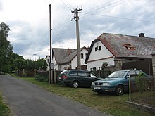
Mozerov (German Moserow ) is a district of the municipality Věž in the Czech Republic. It is located seven kilometers northeast of the city center of Humpolec and belongs to the Okres Havlíčkův Brod .
geography
Mozerov is located in the headwaters of the creek Veselský potok on the northeastern slope of the Worlow ridge in the Křemešnická vrchovina ( Křemešník-Bergland ). To the northeast rises the Kalvárie (615 m nm), in the southeast of the Lejchovec (588 m nm), to the southwest of the Orlík ( Worlow , 678 m nm) and in the west of the Kopec (655 m nm). The Orlovské lesy ( Worlow Forest ) stretch to the west of the village , where the Křivoláčský potok rises. In the southwest is the Veselsko game reserve.
Neighboring towns are Loskoty, Na Pelhřimáku and Bratroňov in the north, Kojkovičky and Čekánov in the Northeast, Jedouchov the east, Svitálka, Květinov and Věž the southeast, Veselsko , Skala and Leština in the south, Čejov in the southwest, Budíkov and Orlovy the west and Kejžlice , Nový Dvůr and Blatov in the northwest.
history
Mozerov was probably created around 1730 by the owner of the Věž estate, Franz Josef Moser, in the corridors of the Veselsko farm, to which the residents were required to use robots. According to the Chronicle of Věž, Mozerov initially consisted of six houses. Mozorow was first mentioned in a document in 1787. At that time there were 8 houses in the village.
In 1840 the village of Moserow or Mozerow in the Caslauer Kreis consisted of 11 houses in which 88 people lived. On the other side were the manorial Meierhof Weselsko with a sheep farm and a brandy distillery as well as the forester's house Weselsko. The parish was Skala . The main source of income was agriculture. Until the mid-19th century was Moserow the Good WIEZ servants.
After the abolition of patrimonial Mozerov formed from 1849 a district of the municipality Věž in the judicial district Deutschbrod . From 1868 the place belonged to the district Deutschbrod . In 1869 Mozerov had 58 inhabitants and consisted of 12 houses. After the construction of the new elementary school in Věž, the children from Mozerov were retrained from Skála to Věž in 1884. At the end of the 19th century the district was called Mozerov-Veselsko . In 1900 there were 64 people living in Mozerov, in 1910 there were 50. The village bell was requisitioned in 1917 as war metal. In 1930 Mozerov had 55 inhabitants and consisted of 10 houses. On June 1, 1934, František Plíhal's farm (No. 9) - one of the last timbered farms in the village - burned down completely; since Mozerov did not have its own fire brigade, the Jedouchov brigade was deployed. During the German occupation the village was assigned to the Gumpolds district in 1940 , after the end of the Second World War it came back to Okres Havlíčkův Brod. The road from Věž to Mozerov was only converted into a road in 1956. In the 1960s, investigations were carried out on the suitability of the source area near Mozerov for the drinking water supply of Věž; then a water reservoir and water pipes to the retirement home in Věž Castle and to the JZD Věž were created. In 1963 Mozerov was connected to the electricity network. In the 2001 census, 3 people lived in the 7 houses in the village. The former farms are now mainly used for private recreation.
Local division
The one-layer Veselsko ( Weselsko ) belongs to Mozerov .
The Mozerov district is part of the Věž cadastral district.
Attractions
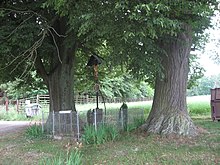
- Cross at the junction to Veselsko
- Cast iron cross on the western slope of the Kalvárie, erected in 1875 together with a stone staircase by the Pytlík family from Jedouchov as a thank you for being spared by the devil. In front of the farmer Jaroslav Pytlík, while working in the fields on the top of the hill, a dust devil with cones, needles and a live hare had risen; he believed the vortex to be the appearance of the devil. On the summit of the Kalvárie there used to be a 50 m high wooden lookout tower, but in the 1960s it was demolished due to decay.
- Veselsko mouflon enclosure
literature
- Historický lexikon obcí České republiky 1869–2005 , part 1, p. 560
Web links
Individual evidence
- ↑ Jaroslaus Schaller : Topography of the Kingdom of Bohemia. Sixth part. Czaslauer Kreis Prague and Vienna 1787, p. 152
- ^ Johann Gottfried Sommer : The Kingdom of Bohemia; Represented statistically and topographically. Volume 11: Caslauer Kreis. Ehrlich, Prague 1843, p. 195.
- ↑ http://www.uir.cz/casti-obce/409626/Mozerov


