Myhija
| Myhija | ||
| Мигія | ||

|
|
|
| Basic data | ||
|---|---|---|
| Oblast : | Mykolaiv Oblast | |
| Rajon : | Pervomaysk Raion | |
| Height : | 71 m | |
| Area : | 10 km² | |
| Residents : | 2,099 (2001) | |
| Population density : | 210 inhabitants per km² | |
| Postcodes : | 55223 | |
| Area code : | +380 5161 | |
| Geographic location : | 48 ° 2 ' N , 30 ° 57' E | |
| KOATUU : | 4825485101 | |
| Administrative structure : | 9 villages, 2 settlements | |
| Address: | вул. Первомайська буд. 50 55223 с. Мигія |
|
| Website : | City council website | |
| Statistical information | ||
|
|
||
Myhija ( Ukrainian Мигія ; Russian Мигия Migija ) is a village on the left bank of the Southern Bug in the northwest of the Ukrainian Mykolaiv Oblast with about 2100 inhabitants (2001).
The area around the tourist village is called Little Switzerland due to its picturesque landscapes and the variety of flora and fauna and is reminiscent of the banks of the Rhine and the large rocks of the Crimea and the Caucasus.
Geographical location
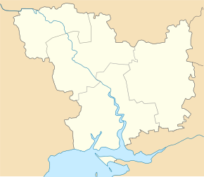
The village is located in the Rayon Pervomaisk at an altitude of 71 m 6 km east of Rajonzentrum Pervomaisk and about 150 km northwest of the Oblastzentrum Mykolajiw . The M 24 trunk road (formerly R -06) runs through the village from Blahowischenske to Mykolaiv. The Orlyk ( Орлик ) train station on the Borschtschi – Kharkiv railway line is near the village .
history
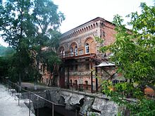
The village, founded by the Zaporozhian Cossacks at the beginning of the 18th century , was later a Hajdamak camp and in 1765 became a Russian military border fortification. In 1859 the village had 1025 inhabitants. At the beginning of the 20th century a watermill was built on the bank of the Bug, which produced 2000 poods of flour annually. In June 1889 a meteorite, later named after the village, fell from the sky near Myhija .
local community
Myhija is the administrative center of the same name, founded on June 30, 2019 243.03 km² land community to which even the villages Hajiwske ( Гаївське ) Kuriptschyne ( Куріпчине ) Romanova Balka ( Романова Балка ) Heniwka ( Генівка ), Lviv ( Львів ), Sokolivka ( Соколівка ), Sofijiwka ( Софіївка ) and Bohoslowka ( Богословка ) as well as the settlements Ivaniwka ( Іванівка ) and Bandurka ( Бандурка ) belong.
Attractions
Near the village are the Myhija rapids ( Мигійські пороги ) on the southern Bug, named after the village at the beginning of the 18th century , the natural monument Radon Lake ( Радоновое озеро ), a flooded granite quarry with a depth of more than 40 m that of the underground Radon sources are fed, as well as the Buskyj Hard National Park ( Національний природний парк «Бузький Гард» ).
Web links
Individual evidence
- ↑ Local website on the official website of the Verkhovna Rada ; accessed on October 28, 2019 (Ukrainian)
- ^ History of the village on the official website of the rural community; accessed on October 28, 2019 (Ukrainian)
- ^ Local history of Myhija in the history of the cities and villages of the Ukrainian SSR ; accessed on October 28, 2019 (Ukrainian)
- ↑ Meteorite Collection of the Russian Academy of Sciences ; accessed on October 28, 2019 (Russian)
- ↑ website of the rural community to gov.ua ; accessed on October 28, 2019 (Ukrainian)
- ^ Rural United Territorial Community Myhija on decentralization.gov.ua ; accessed on October 28, 2019 (Ukrainian)
- ↑ Little-known resorts in Ukraine: Myhija - "Little Switzerland" in Mykolaiv Oblast on ua.news ; accessed on October 28, 2019 (Russian)
- ↑ Radon Lake on doroga.ua ; accessed on October 28, 2019 (Ukrainian)


