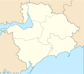
Mykolaivka (Berdyansk)
| Mykolaivka | ||
| Миколаївка | ||

|
|
|
| Basic data | ||
|---|---|---|
| Oblast : | Zaporizhia Oblast | |
| Rajon : | Berdyansk Raion | |
| Height : | 63 m | |
| Area : | 6.678 km² | |
| Residents : | 1,370 (2001) | |
| Population density : | 205 inhabitants per km² | |
| Postcodes : | 71135 | |
| Area code : | +380 6153 | |
| Geographic location : | 47 ° 1 ' N , 36 ° 51' E | |
| KOATUU : | 2320683501 | |
| Administrative structure : | 1 village | |
| Address: | вул. Миру 177 А 71130 c. Берестове |
|
| Website : | Rural community website | |
| Statistical information | ||
|
|
||
Mykolaivka ( Ukrainian Миколаївка ; Russian Николаевка Nikolajewka ) is a village in the south of the Ukrainian Oblast of Zaporizhia with about 1,300 inhabitants (2001) and an area of 6.678 km².
The first settlers of the village, founded in 1803 (another source mentions 1812 as the year of foundation), were state farmers from the Poltava and Chernigov provinces .
Since August 2015, Mykolaivka has been part of the rural municipality of Berestowe ( Берестівська громада ) in the east of Berdyansk district and until then was the administrative center of a district council .
Mykolaivka is located at an altitude of 63 m on the right bank of the Berda , a 130 km long tributary of the Sea of Azov , 15 km south of the Berestove community center , 32 km north of the Berdyansk district center and 58 km west of the city of Mariupol . The Zaporizhia Oblast Center is located about 180 km northwest of Mykolaivka. Territorial road T – 08–19 runs west of the village .
Web links
- Website of the former municipal council on rada.info (Ukrainian)
Individual evidence
- ↑ a b website of the village on the website of the Verkhovna Rada , accessed on September 13, 2019 (Ukrainian)
- ^ Local history Mykolaivka in the history of the cities and villages of the Ukrainian SSR ; accessed on September 13, 2019 (Ukrainian)
- ↑ Landgemeinde Berestowe on gromada.info ; accessed on September 13, 2019 (Ukrainian)

