Nashville (Michigan)
| Nashville | ||
|---|---|---|
 View of the Nashville Dam on the Thornapple River in Nashville |
||
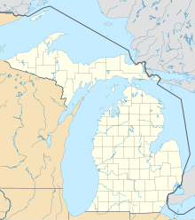
| Location in Michigan | ||
|
|
||
| Basic data | ||
| Foundation : | 1865 | |
| State : | United States | |
| State : | Michigan | |
| County : | Barry County | |
| Coordinates : | 42 ° 36 ′ N , 85 ° 5 ′ W | |
| Time zone : | Eastern ( UTC − 5 / −4 ) | |
| Residents : | 1,684 (as of: 2000) | |
| Population density : | 311.9 inhabitants per km 2 | |
| Area : | 5.7 km 2 (approx. 2 mi 2 ) of which 5.4 km 2 (approx. 2 mi 2 ) is land |
|
| Height : | 250 m | |
| Postal code : | 49073 | |
| Area code : | +1 517 | |
| FIPS : | 26-56680 | |
| GNIS ID : | 0633223 | |
Nashville is a town in Barry County in the US state of Michigan. According to the 2000 census, it had a population of 1,684 on an area of 5.7 km². The population density is 312 per km².
geography
According to the United States Census Bureau , the village has a total area of 5.7 km 2 , of which 5.4 km 2 are land and 0.3 km 2 are water.
Demographics
According to the 2000 census, 1,648 people live in 647 households and 447 families in the village. The population density was 309.6 people per km 2 . There were children under the age of 18 living in 36.6% of households and 50.5% were married couples. 24.7% of the households were led by singles and in 10% people over 65 years lived alone. The average household size was 2.60 and the average family size was 3.12 members.
29% of the population were under 18 years of age, 9.1% between 18 and 24 years of age, 29.2% between 25 and 44, 19.2% between 45 and 64 and 13.4% were 65 and older. For every 100 female residents there were 89.6 males and for every 100 women aged 18 and over there were 87.9 males.
The median household income was $ 32,857 and the median family income was $ 36,250. The per capita income was $ 14147. Approximately 10.6% of the population lives below the poverty line.
Early history
The origins of Nashville lie on, which was acquired by John R. Pettibone on February 15, 1836. The land was part of Barry and later until February 16, 1842, part of the Hastings Ward. It then became Section 36 of the newly established Castleton Ward. Robert B. Gregg owned the land until 1865. This parceled out the land in 127 lots on the south side of the Thornapple River. The land survey was carried out by Joshuas Martin and certified on October 2, 1865. The first lot was sold to Enos Kuhlman. The development plan had been expanded seven times by 1875 .
The brothers Henry and Solomon Feighner from Ohio acquired 320 acres from Horace Butler and other properties on the west side of the Thornapple River, including the Hanchet sawmill.
By 1870, Griffith and Grant built a granary on the new Grand River Valley division of the Michigan Central Railroad .
1874 was the granary of Ainsworth and Brooks bought and 3 years later, a steam-powered was mill installed. The mill was operated under a patent from Holler and known as the Nashville Roller Mill.
In 1866, the chief engineer of the Grand River Valley Railroad began looking for a new route from Jackson to Grand Rapids . Garadaus Nash suggested using his name. Without a dissenting vote, the Nashville Ward was baptized. On March 26, 1869, Governor Henry Baldwin signed law admitting the parish of Nashville.
Around 1920 Nashville was the stopover and overnight stop between Jackson and Grand Rapids. The trains, which at that time only ran during the day, each took one day to get to the two cities.
Individual evidence
- ↑ See EO Wagner's 1880 article "Castleton" in "History of Allegan and Barry counties, Michigan".
- ↑ Village of Nashville History ( Memento of the original from August 23, 2011 in the Internet Archive ) Info: The archive link was automatically inserted and not yet checked. Please check the original and archive link according to the instructions and then remove this notice.
